Pico Volcano
Updated: May 21, 2024 17:12 GMT -
stratovolcano, lavadome 2351 m
Azores (Portugal), 38.47°N / -28.4°W
Current status: normal or dormant (1 out of 5)
Azores (Portugal), 38.47°N / -28.4°W
Current status: normal or dormant (1 out of 5)
A prominent 2351-m-high stratovolcano occupying the eastern end of Pico Island is the highest volcano in the Azores.
[smaller] [larger]
Pico volcano eruptions: 1718 A.D.
Latest nearby earthquakes
| Time | Mag. / Depth | Distance / Location | |||
| May 19, 10:10 am (Azores) | 2.2 5 km | 29 km (18 mi) to the NE | Info | ||
| Tuesday, May 14, 2024 GMT (1 quake) | |||||
| May 14, 03:47 pm (Azores) | 2.1 0.1 km | 11 km (7.1 mi) to the W | Info | ||
Background
Pico is superimposed on an older linear volcano with numerous flank cones that forms most of the 48-km-long island. The conical, dominantly basaltic Pico volcano is capped by a 500-m-wide summit crater that is overtopped by a small steep-sided cone. Historical eruptions have been restricted to the flanks of Pico volcano and to the SE-trending rift zone, which is dotted by pyroclastic cones. An eruption during 1562-64 from the SE rift zone produced lava flows that reached the northern coast. An eruption from a nearby vent issued lava flows that traveled into the sea on the southern side of the island. A flank eruption from Pico in 1718 fed lava flows that reached both coasts.-----------------------
Source: Smithsonian GVP
Pico Volcano Photos

Lava flow and panoramic view from Pico del Teide, Teneriffa Isl., Canaries (Photo: WNomad)
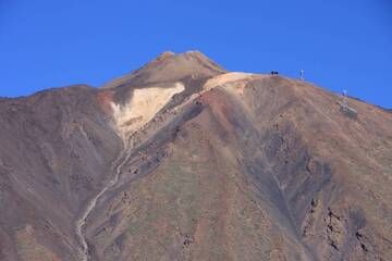
Peak of Pico del Teide, Teneriffa Isl., Canaries (Photo: WNomad)
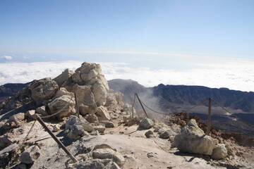
Peak of Pico del Teide, south view, Teneriffa Isl., Canarys (Photo: WNomad)
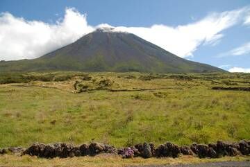
Pico volcano, Pico Island, Açores Archipel (2007) (Photo: Hugues)
Latest satellite images