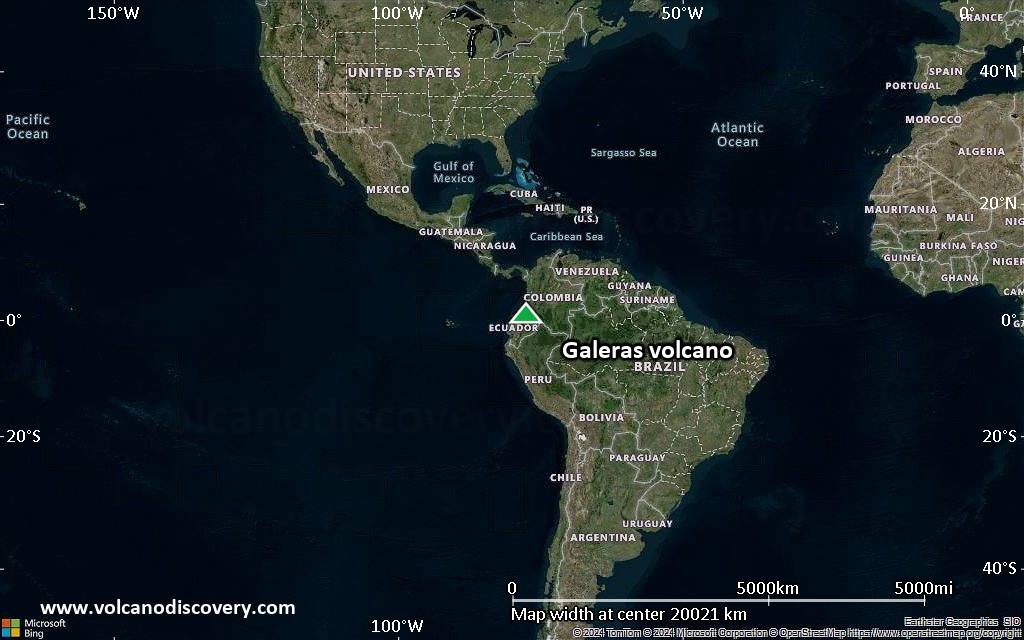
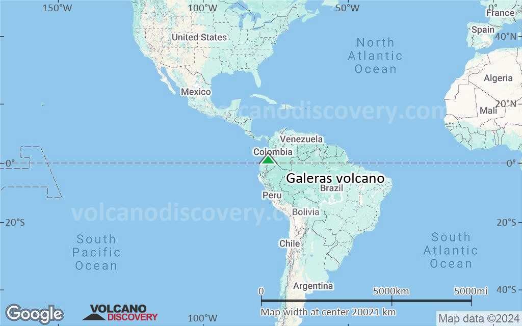
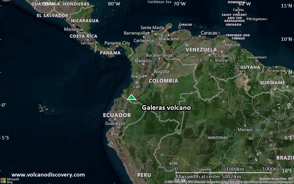
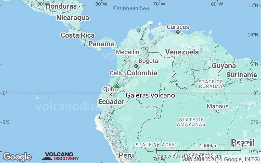
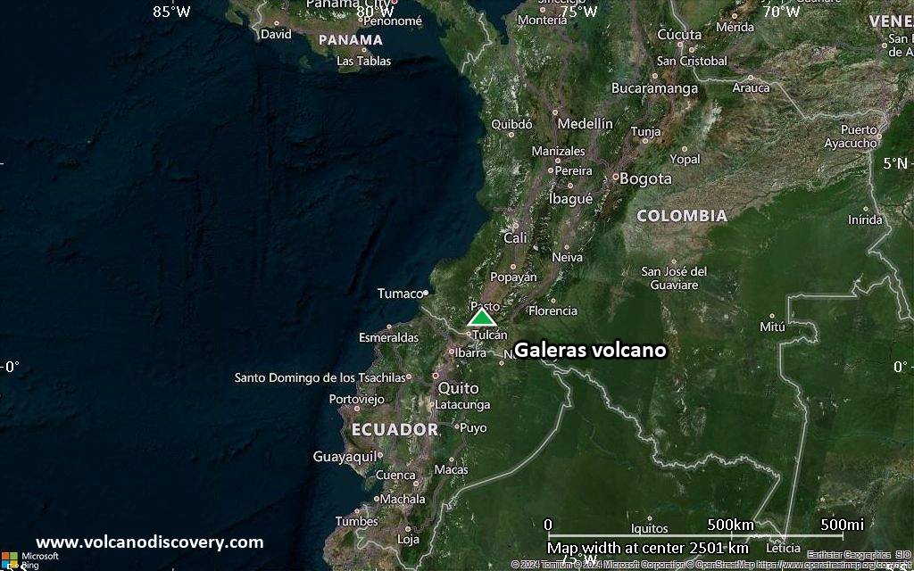
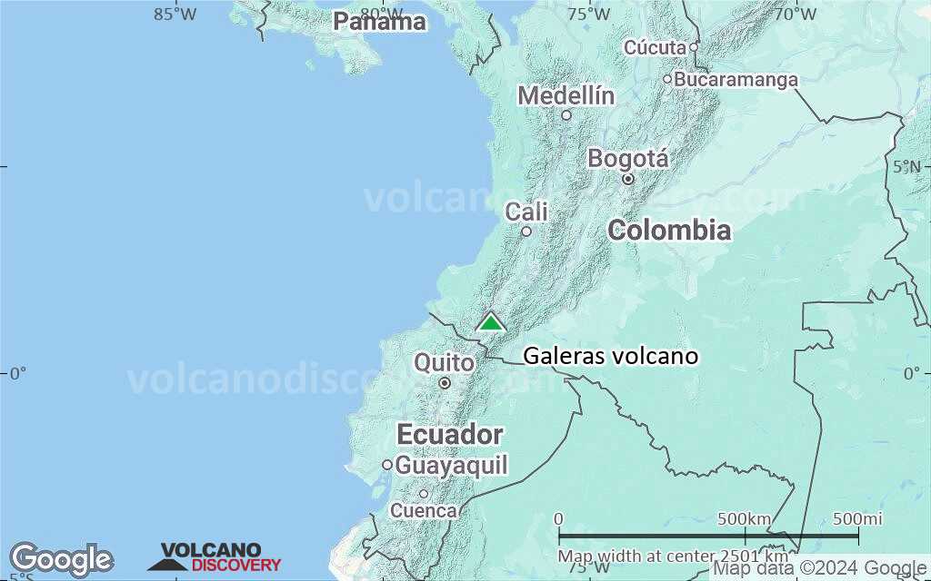
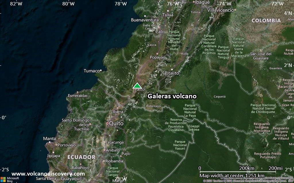
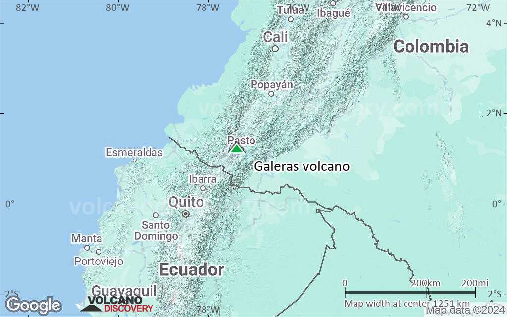
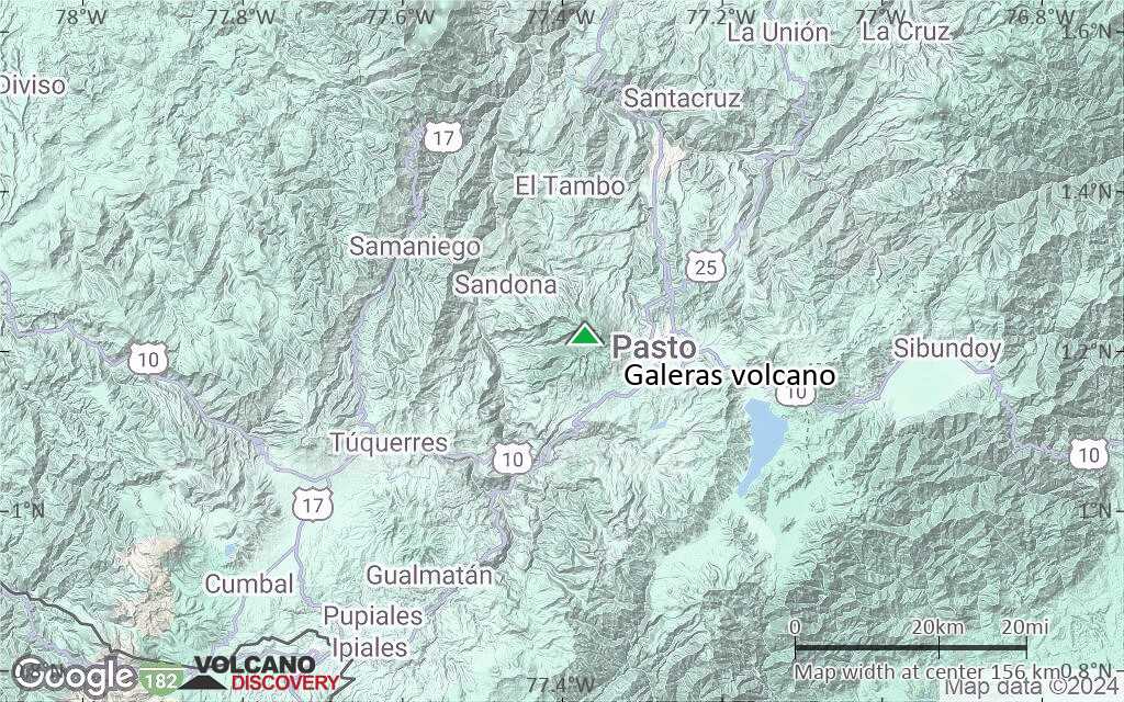
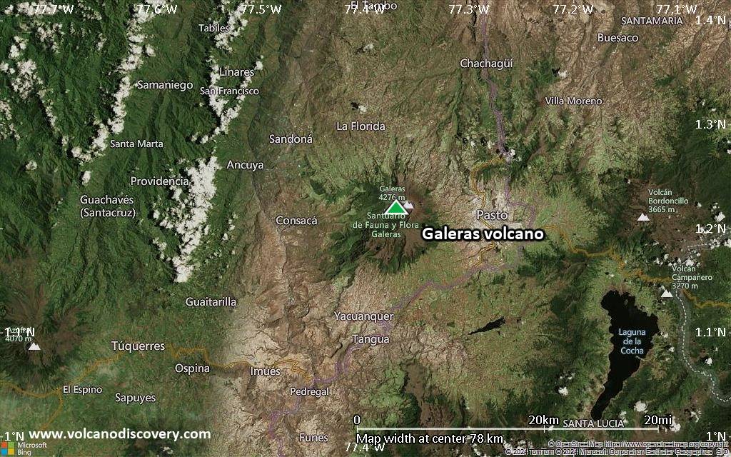
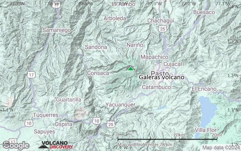
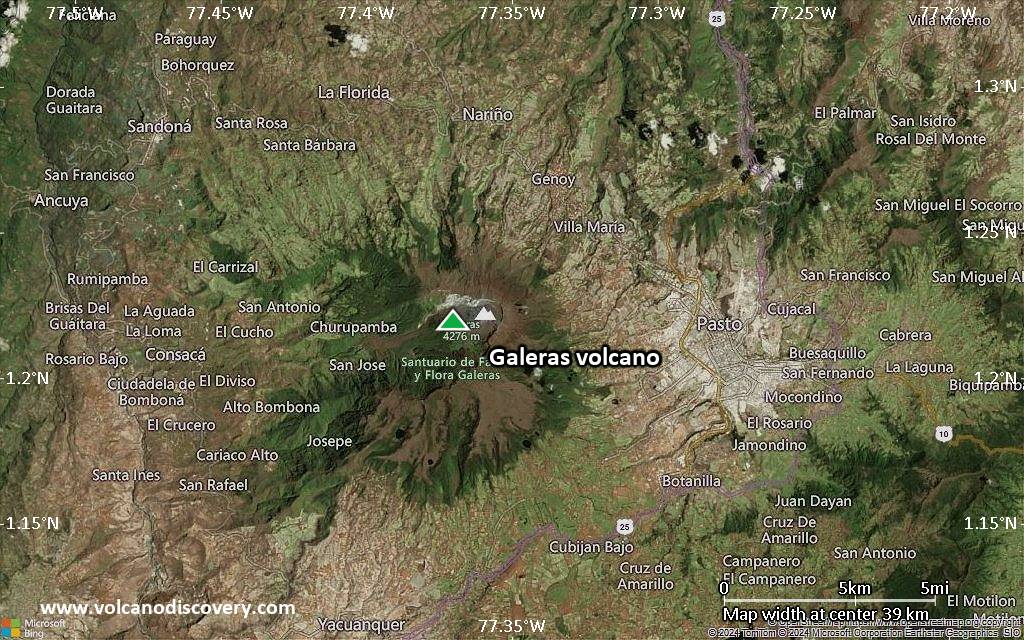
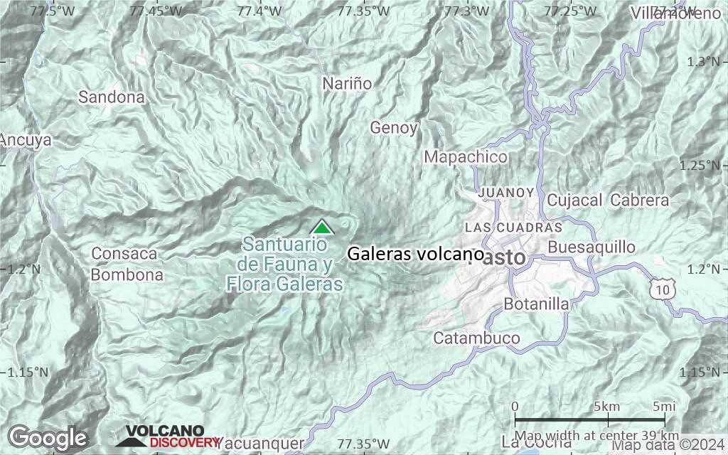
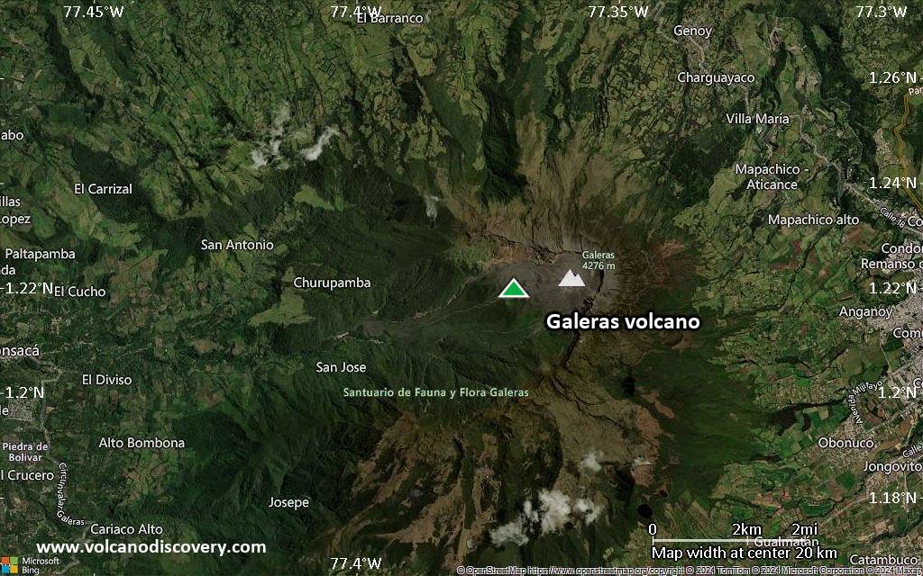
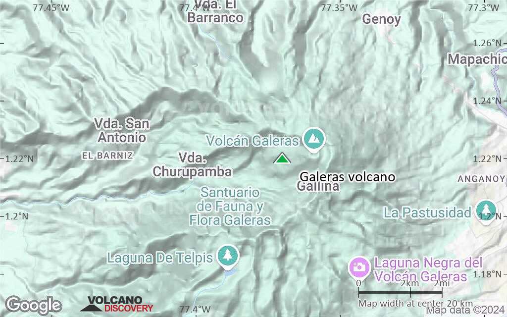
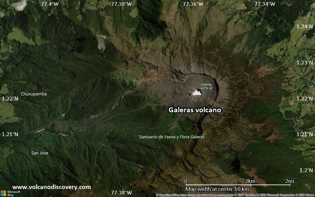
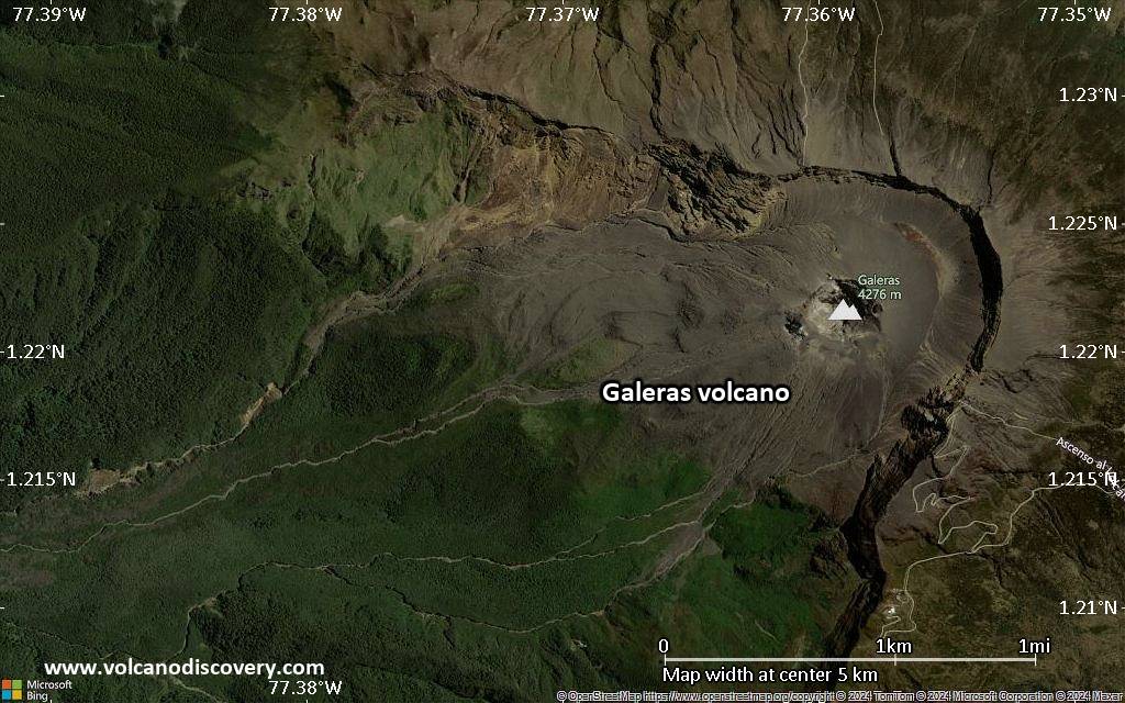
| RSS | EN | DE | EL | ES | FR | IT | RU

Galeras Volcán

Updated: 24 nov. 2025 09:46 GMT -
complex stratovolcano
Colombia, 1.22°N / -77.37°W
Summit height: 4276 m / 14,029 ft
Current status: normal or dormant (1 out of 5)
Last update: 10 dic 2021

Galeras is one of Colombia's most active volcanoes. In an eruption in 1993, it killed a group of scientists and tourists who had been inside its crater when it erupted.

[smaller] [larger]
Typical eruption style: explosive
Erupciones del volcán Galeras: 1535, 1580, 1616, 1641-43, 1670-1736, 1754-56, 1796-1801, 1823, 1828-34, 1834, 1836(?), 1865-70, 1889, 1891, 1923, 1924-27, 1930, 1932, 1933(?), 1936, 1947, 1950, 1973(?), 1974-83, Feb-May 1989, Jan 1990 - July 1992, Jan-June 1993, Mar-May 2000, June 2002, July 2004 - Feb 2005, Nov 2005 - July2006, Oct 2007 - Jan 2008, Oct 2008 - 2010

Latest nearby earthquakes

Fecha y horaMag / Prof.Distancia / Ubicación

Background

Galeras is one of Colombia's most frequently active volcanoes. The dominantly andesitic volcano has been active for more than 1 million years, and two major caldera collapse eruptions took place during the past 100,000 years. Several collapse events have produced debris avalanches that swept to the west and left a large horseshoe-shaped caldera inside which the modern cone has been constructed.
Major explosive eruptions in the past thousands of years have produced widespread tephra deposits and pyroclastic flows that swept all but the southern flanks. A central cone slightly lower than the caldera rim has been the site of numerous small-to-moderate historical eruptions since the time of the Spanish conquistadors.

The fatal eruption in 1993
Galeras became active again in 1988 after 10 years of dormancy. It became infamous when it erupted on 14 January 1993, killing six volcanologists and three tourists who were inside the crater when it exploded. The group was part of an scientific conference excursion and their final decision to enter the crater, pushed forth by team leader Stanley Williams (who miracoulously survived), was and still is highly debated: the fatal decision was made despite the observation of a significantly increased number of particular earthquakes (tornillos), which had preceded previous eruptions and also started to occur in the days before the eruption.

Erupciones volcánicas significativas: Galeras volcano

In the past 10,000 years, Galeras has had at least 36 confirmed volcanic eruptions, out of which 30 are documented by historical records, while the others can be inferred from geological evidence.
Additionally, there are 6 uncertain or discredited eruptions from Galeras volcano.
The table below lists all known eruptions (date in bold face) of Galeras volcano since around 1900. Updates on the most recent volcanic activity of Galeras can be found on the news page of Galeras volcano.
FechaNotaVEIFallecidosDaños
2012 may 13 - 2014 ene 30 ±1 d.Summit crater
Obs. históricas/documentos
2
desconocido
?? 2011 mar 31 - abr 1
Erupción incierta
Obs. históricas/documentos
?
desconocido
2010 ago 25Central cone
Obs. históricas/documentos
1
desconocido
2008 oct 21 ? - 2010 ene 2 ?
Obs. históricas/documentos
3
desconocido
2007 oct 4 - 2008 ene 17
Obs. históricas/documentos
3?
desconocido
2005 nov 24 - 2006 jul 12
Obs. históricas/documentos
2
desconocido
2004 jul 16 - 2005 feb 7 ?El Pinta vent
Obs. históricas/documentos
3
desconocido
2002 jun 7El Pinta vent
Obs. históricas/documentos
1?
desconocido
2000 mar 21 - may 18
Obs. históricas/documentos
1
desconocido
1993 ene 14 - jun 7Summit crater, west, SW, & south rims
Obs. históricas/documentos
2
desconocido
1993 ene 14
(erupción 1993 ene 14 - jun 7)
Obs. históricas/documentos
29
desconocido
Información
1990 ene 7 - 1992 jul 16
Obs. históricas/documentos
2
desconocido
1989 feb 19 - may 9El Pinta vent
Obs. históricas/documentos
2
desconocido
1974 jul 2 ±182 d. - 1983 jul 2 ±182 d.
Obs. históricas/documentos
1?
desconocido
?? 1973 may 16 ±15 d.
Erupción incierta
2
desconocido
1950 ene 12 - sep 5
Obs. históricas/documentos
2
desconocido
?? 1947 jul 15
Erupción incierta
2?
desconocido
1936 feb 9 - ago 27 ?
Obs. históricas/documentos
2
desconocido
?? 1933
Erupción incierta
?
desconocido
1932 oct 10
Obs. históricas/documentos
2
desconocido
?? 1930 abr 17
Erupción incierta
?
desconocido
1924 oct - 1927
Obs. históricas/documentos
3
desconocido
1923 dic 8
Obs. históricas/documentos
2
desconocido
Remark:
Our list of volcanic eruptions closely follows the database of eruptions of the Smithsonian's Global Volcanism Project (GVP), the internationally most recognized data source for volcanic eruptions, but also includes significant eruptive episodes or related volcano events. "Volcanic eruptions" are usually to be understood as sequences of individual eruptive episodes that can follow each other, or even overlap (if several vents are involved), and can last many years, decades or even longer. For example, the current activity of Stromboli volcano is understood as a single eruption that has been ongoing since 1934.
Fuentes: NOAA National Centers for Environmental Information (NCEI), Global Significant Volcanic Eruptions Database. doi:10.7289/V5TD9V7K | Global Volcanism Project / Smithsonian Institution

Galeras Volcano FAQ

+When was the last eruption of Galeras volcano?

+How often does Galeras volcano erupt?

+How active is Galeras volcano at present?

+When was the largest eruption of Galeras volcano?

Últimas imágenes satelitales

Galeras imagen satelital sat1Galeras imagen satelital sat2

Galeras Volcán Mapas

Below is a selection of maps showing the location and surroundings of the volcano at various resolutions based on aerial-imagery / terrain maps. Feel free to use them for non-commercial purposes on your blog or website as long as you credit them with a link back to this page (click to copy it).
Satellite/aerial-type map of Galeras volcano (world scale)
Terrain-type map of Galeras volcano (world scale)
Satellite/aerial-type map of Galeras volcano (region scale large)
Terrain-type map of Galeras volcano (region scale large)
Satellite/aerial-type map of Galeras volcano (region scale medium)
Terrain-type map of Galeras volcano (region scale medium)
Satellite/aerial-type map of Galeras volcano (region scale small)
Terrain-type map of Galeras volcano (region scale small)
Satellite/aerial-type map of Galeras volcano (local scale large)
Terrain-type map of Galeras volcano (local scale large)
Satellite/aerial-type map of Galeras volcano (local scale medium)
Terrain-type map of Galeras volcano (local scale medium)
Satellite/aerial-type map of Galeras volcano (local scale small)
Terrain-type map of Galeras volcano (local scale small)
Satellite/aerial-type map of Galeras volcano (scale of 10s of km)
Terrain-type map of Galeras volcano (scale of 10s of km)
Satellite/aerial-type map of Galeras volcano (scale of 20-40 km)
Terrain-type map of Galeras volcano (scale of 20-40 km)
Satellite/aerial-type map of Galeras volcano (scale of approx. 10-20 km)
Terrain-type map of Galeras volcano (scale of approx. 10-20 km)
Satellite/aerial-type map of Galeras volcano (scale of 5-10 km)
Satellite/aerial-type map of Galeras volcano (scale of few kilometers)
Volcanoes & Earthquakes - new app for Android
Guaranteed tours
2-10 may 2026: From Stromboli to Etna - Sicily and Eolian Islands (Italy)
= spaces available   = guaranteed   = few spaces left   = booked out

M4.5 earthquake near Galeras volcano kills 2 people

Thursday, Jun 14, 2018 | 7 years ago
Small ash emission observed from the Pasto Volcano Observatory on 17 December 2012 (INGEOMINAS)
Two moderate earthquakes occurred near Galeras, Colombia's most active volcano, at a depth of ca 30 km. According to the Colombian Geological Service, the first quake occurred at 4:35 a.m. local time …

En esta página:

Try our free app!
Volcanoes & Earthquakes - new app for Android
Android | iOS version

More on VolcanoDiscovery

Why is there advertising on this site?

¡Apóyanos – Ayúdanos a mejorar nuestros servicios!

Nos encanta trabajar para traerte los datos más recientes sobre volcanes y terremotos de todo el mundo, solo para ti. Sin embargo, mantener nuestro sitio web y nuestras aplicaciones gratuitas requiere mucho tiempo, esfuerzo y recursos.
Tu apoyo nos permite ampliar la capacidad de nuestro hardware y software, así como fortalecer a nuestro equipo editorial. Nuestra misión es ofrecer actualizaciones continuas en tiempo real siempre que ocurra un terremoto o una erupción volcánica — ¡y tus donaciones lo hacen posible! Cada contribución, grande o pequeña, es profundamente apreciada. Si encuentras útil la información que ofrecemos y deseas ayudarnos a integrar nuevas funciones, crear contenido atractivo y mejorar nuestra tecnología, por favor considera hacer una donación:

Usa PayPal:

Funciones planeadas:

Gracias a tus donaciones anteriores, recientemente hemos añadido:
Descarga la app Volcanes & Terremotos para ser de los primeros en recibir alertas rápidas en línea sobre terremotos y volcanes:
Android | iOS
¡Gracias por formar parte de nuestra misión!
Sources: VolcanoDiscovery / VolcanoAdventures and other sources as noted.
Use of material: Most text and images on our websites are owned by us. Re-use is generally not permitted without authorization. Contact us for licensing rights.
Volcanoes & Earthquakes
VolcanoDiscovery Home
Volcanes | Sismos | Fotos | News | | Shop | App
Adventure & Study Travel
Tours to Volcanoes and Volcanic Areas: walking tours, photo tours, study tours
Tours & Dates | FAQ | About us
Get our newsletter!
Company info
Contact | Legal info | Terms & conditions
Follow us
Follow us on facebook Follow us on Instagram Follow us on Bluesky Follow us on Twitter Visit our Youtube channel
EN | DE | EL | ES | FR | IT | RU
VolcanoDiscovery GmbH, Germany, Reg. nr.: HRB 103744, EU Tax Id: DE 297 465 123 owned and created by
Dr. Tom Pfeiffer, volcanologist, volcano photographer, tour organizer member of
IAVCEI
IAVCEI
Vulkanologische Gesellschaft
Volcanological Society
Ecotourism Greece
Ecotourism Greece
RUV insurance
Insured by R+V
VolcanoDiscovery © 2004- All Rights Reserved | Privacy - Cookie Settings