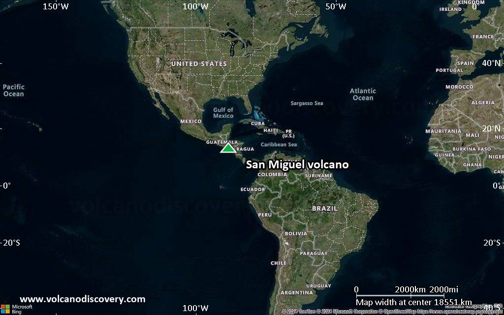
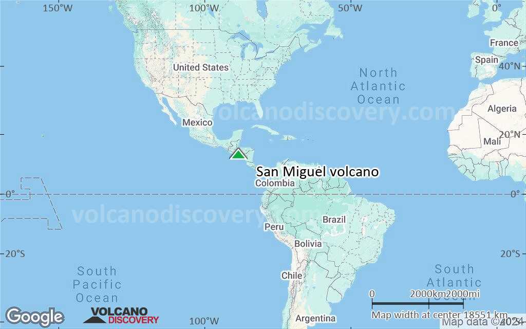
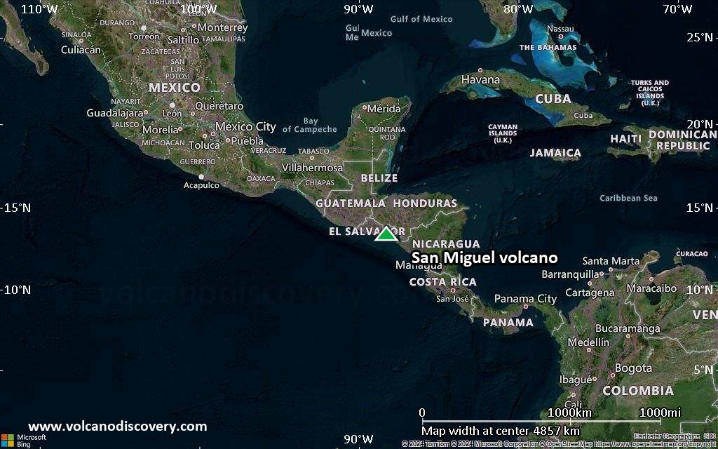
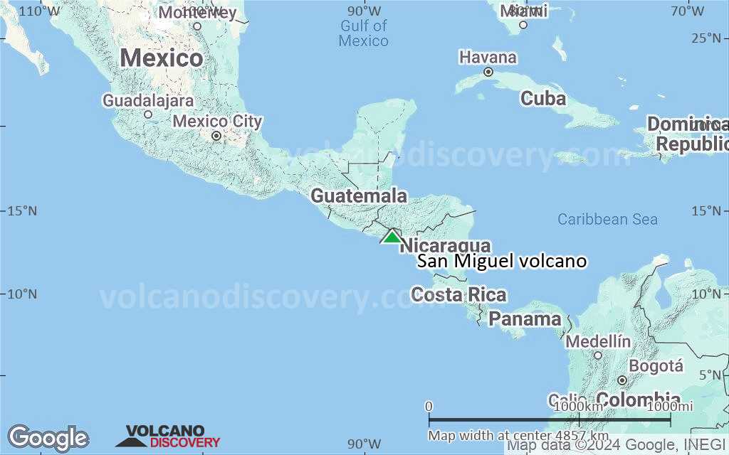
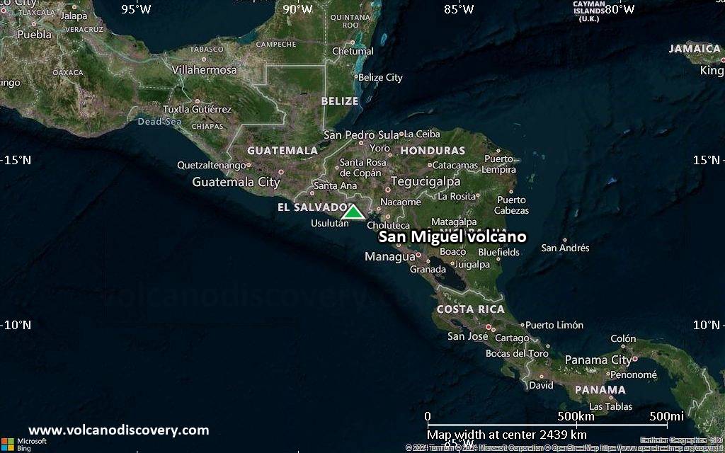
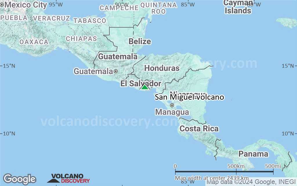
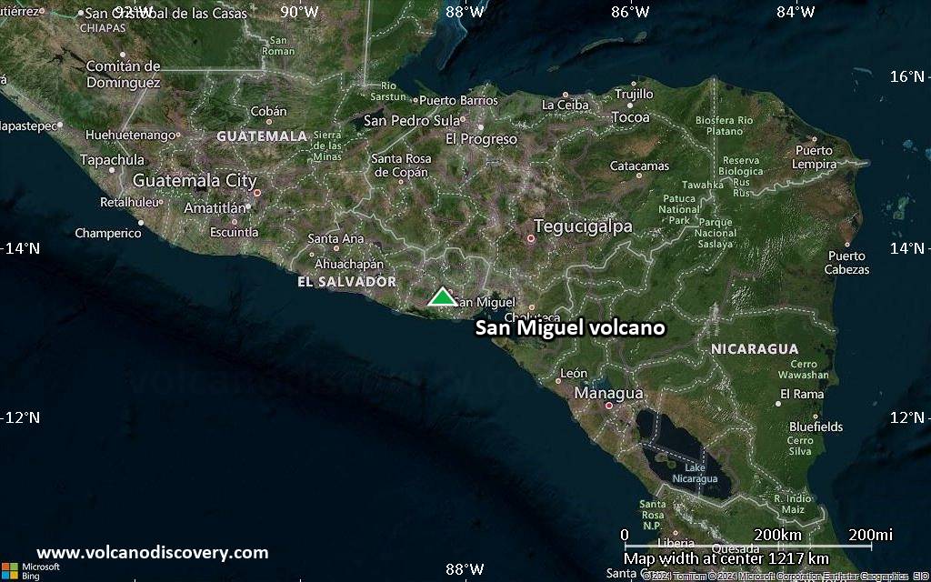
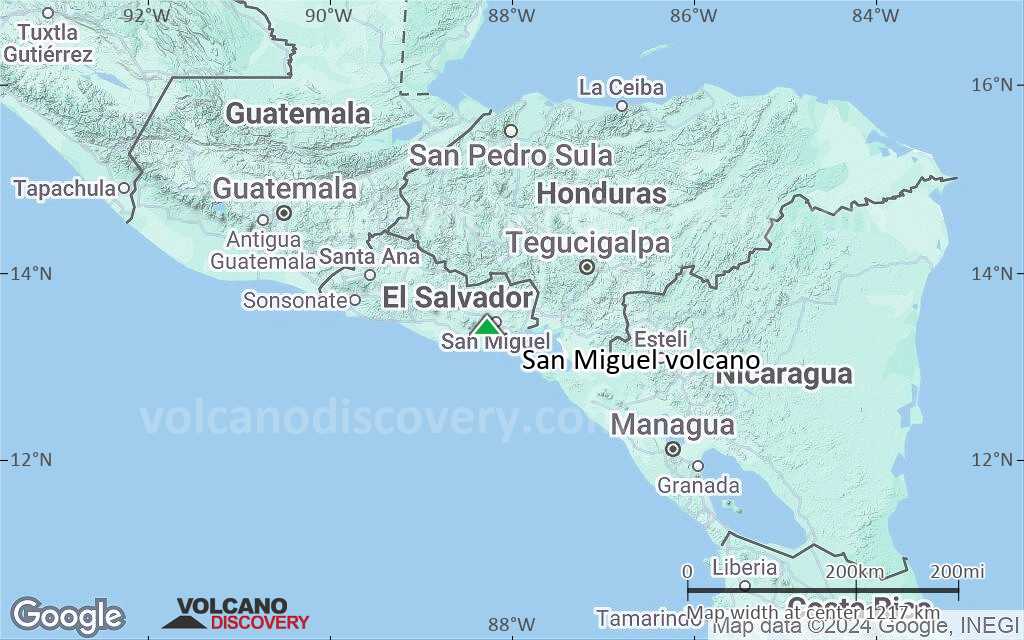
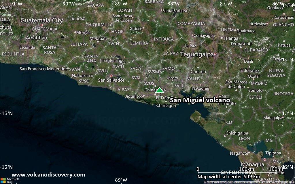
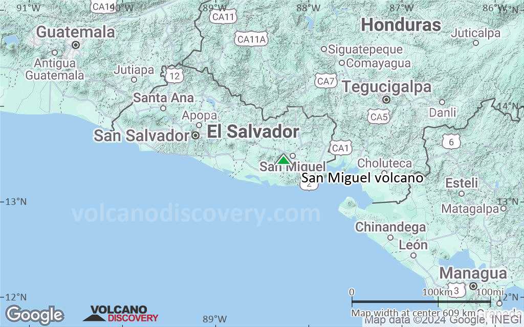
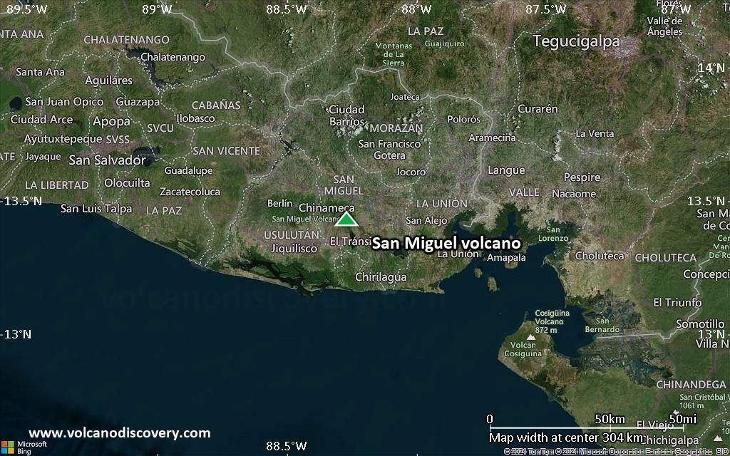
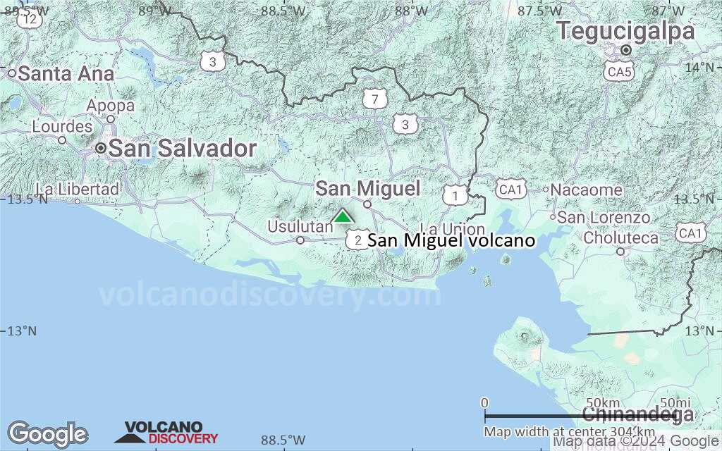
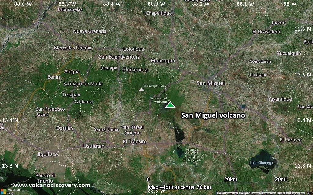
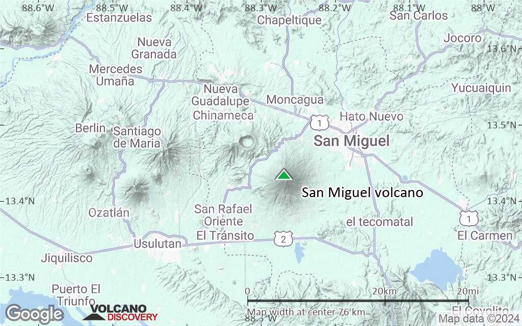
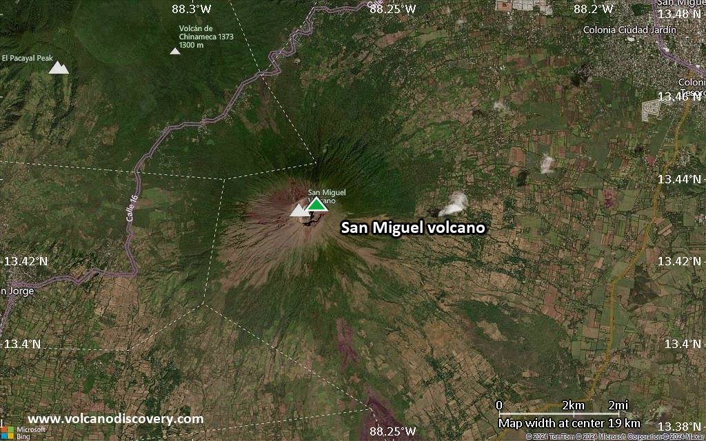
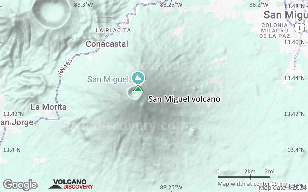
| RSS | EN | DE | EL | ES | FR | IT | RU

San Miguel Volcán

Updated: 23 jul. 2025 19:32 GMT -
stratovolcano
El Salvador, 13.43°N / -88.27°W
Summit height: 2130 m / 6,988 ft
Current status: normal or dormant (1 out of 5)
Last update: 14 oct 2023 (Smithsonian / USGS Weekly Volcanic Activity Report)

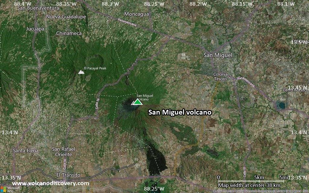
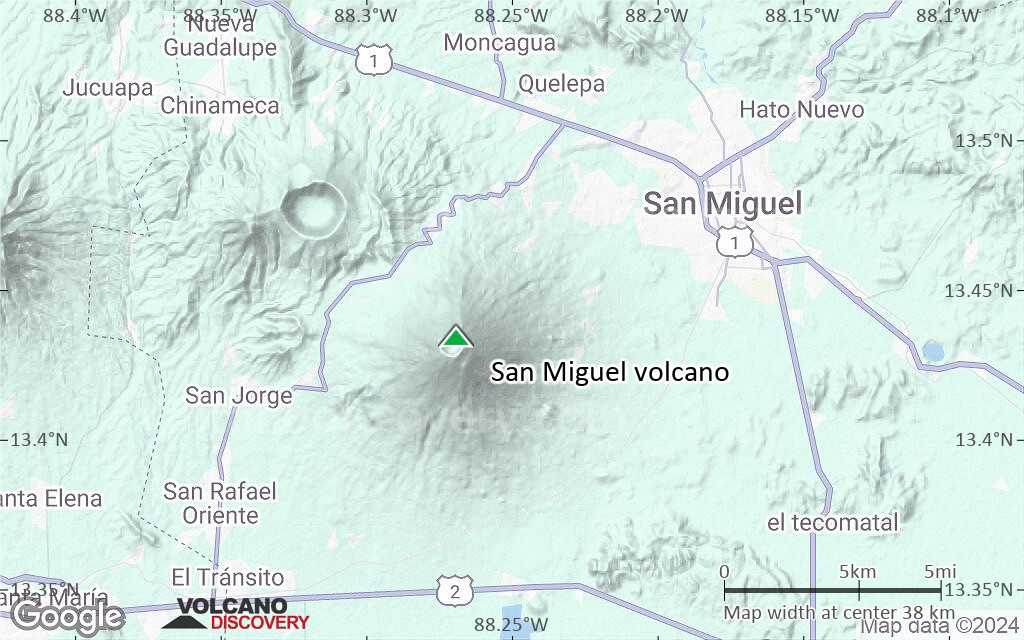
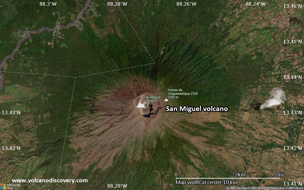
San Miguel volcano (also known locally as Chaparrastique) in eastern El Salvador is a symmetrical stratovolcano and one of the most active volcanoes of the country. It rises majestically from near sea level to 2130 m elevation and forms a prominent land mark.
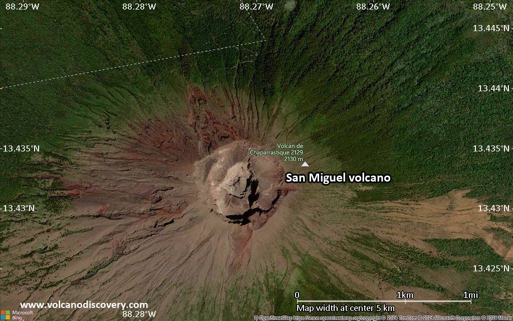
The volcano's summit lacks vegetation due to frequent eruptions, but its flanks are largely covered with coffee plantations.
San Miguel has a broad, deep crater complex, which has frequently changed morphology during historic eruptions recorded since the early 16th century.

[smaller] [larger]
Typical eruption style: small to moderate phreatic and phreatomagmatic summit explosions
Erupciones del volcán San Miguel: 2015, 2014, 2013, 2002, 1997, 1995, 1985-86, 1976-77, 1970, 1967, 1966 (Jul), 1966 (Feb), 1964, 1954, 1939, 1936(?), 1931, 1930, 1929, 1919-20, 1890-91, 1884, 1882, 1867-68, 1862, 1857, 1855, 1854(?), 1844-48, 1819, 1811(?), 1798(?), 1787, 1769, 1762, 1699, 1510 ± 5 years

Latest nearby earthquakes

Fecha y horaMag / Prof.Distancia / Ubicación
15 jul 15:25 (GMT -6)
2.5

220 km
22 km al suroeste 8 km Al Sureste De Usulután, El Salvador Más
viernes, 11 julio 2025 GMT (1 sismo)
11 jul 06:13 (Tiempo Universal)
2.1

4 km
28 km al este 18 km Al Norte De Intipucá, El Salvador Más
jueves, 10 julio 2025 GMT (1 sismo)
10 jul 10:53 (El Salvador)
3.0

2 km
29 km al oeste 7 km Al Sur De Vista Hermosa, El Salvador 1 reportMás

Background

Radial fissures on the flanks of the basaltic-andesitic San Miguel volcano have fed a series of historical lava flows, including several erupted during the 17th-19th centuries that reached beyond the base of the volcano on the north, NE, and SE sides.
The SE-flank lava flows are the largest and form broad, sparsely vegetated lava fields crossed by highways and a railroad skirting the base of the volcano.
The location of flank vents has migrated higher on the edifice during historical time, and the most recent activity has consisted of minor ash eruptions from the summit crater.
(Source: GVP)

Erupciones volcánicas significativas: San Miguel volcano

In the past 10,000 years, San Miguel has had at least 41 confirmed eruptions, all documented by historical records or observations. Additionally, there are 4 uncertain or discredited eruptions from San Miguel volcano.
The table below lists all known eruptions (date in bold face) of San Miguel volcano since around 1900. Updates on the most recent volcanic activity of San Miguel can be found on the news page of San Miguel volcano.
FechaNotaVEIFallecidosDaños
2022 nov 15 - 2023 may 27
Obs. históricas/documentos
2
desconocido
2020 feb 22
Obs. históricas/documentos
1
desconocido
2018 ene 14 - mar 4 ±4 d.Summit crater
Obs. históricas/documentos
1
desconocido
2017 ene 7Summit crater
Obs. históricas/documentos
1
desconocido
2016 jun 18Summit crater
Obs. históricas/documentos
1
desconocido
2016 ene 12 - ene 18Summit crater
Obs. históricas/documentos
1
desconocido
2015 ago 13Summit crater
Obs. históricas/documentos
1
desconocido
2015 ene 26 - abr 11Summit crater
Obs. históricas/documentos
1
desconocido
2013 dic 29 - 2014 jul 28Summit Crater
Obs. históricas/documentos
3
desconocido
2002 ene 16
Obs. históricas/documentos
1
desconocido
1997 dic 31
Obs. históricas/documentos
1
desconocido
1995 ene 12 - abr 19
Obs. históricas/documentos
1
desconocido
1985 nov 16 ±15 d. - 1986 feb 16 ±15 d.
Obs. históricas/documentos
1
desconocido
1976 dic 2 - 1977 mar 1
Obs. históricas/documentos
1
desconocido
1970 mar 30 - abr 5
Obs. históricas/documentos
1
desconocido
1967 ene 5
Obs. históricas/documentos
2
desconocido
1966 jul 16 ±15 d.
Obs. históricas/documentos
2
desconocido
1966 feb 22
Obs. históricas/documentos
2
desconocido
1965 jun 14Summit crater
Obs. históricas/documentos
2
desconocido
1964 oct 23 - nov 16 ±15 d.
Obs. históricas/documentos
2
desconocido
1954 oct 21
Obs. históricas/documentos
2
desconocido
1939 may - jul
Obs. históricas/documentos
2
desconocido
?? 1936 ?
Erupción incierta
2
desconocido
1931 mar - jun
Obs. históricas/documentos
2
desconocido
1930 ene 26 ±5 d.
Obs. históricas/documentos
2
desconocido
1929 ago
Obs. históricas/documentos
2
desconocido
1920 ago 14 - 1925
Obs. históricas/documentos
2
desconocido
1919 dic 10 - 1920 ene
Obs. históricas/documentos
2
desconocido
Remark:
Our list of volcanic eruptions closely follows the database of eruptions of the Smithsonian's Global Volcanism Project (GVP), the internationally most recognized data source for volcanic eruptions, but also includes significant eruptive episodes or related volcano events. "Volcanic eruptions" are usually to be understood as sequences of individual eruptive episodes that can follow each other, or even overlap (if several vents are involved), and can last many years, decades or even longer. For example, the current activity of Stromboli volcano is understood as a single eruption that has been ongoing since 1934.
Fuentes: NOAA National Centers for Environmental Information (NCEI), Global Significant Volcanic Eruptions Database. doi:10.7289/V5TD9V7K | Global Volcanism Project / Smithsonian Institution

Erupciones del volcán San Miguel


2002-2006 unrest and seismic activity
Following the small eruption in January 2002, San Miguel volcano remained restless for over 4 years, with periods of increased seismic activity, landslides inside the crater, increased fumarole activity, and lahars triggered by heavy rains. The volcano was on alert several times, but no eruption occurred in this period. ...más info

2002 eruption
On 16 January, gas and steam emissions with some ash were observed at San Miguel, reaching a few 100 meters above the summit crater

2000-2001 lahars
A large lahar occurred on 26 August 2000 and damaged houses and a highway north of the volcano. On 6 September 2001, another lahar damaged a highway.

1997 eruption
A small eruption occurred on 31 December 1997 and produced minor ashfall.

1995 eruption
A small eruption occurred on 23 March 1995. ...más info

1976-77 eruption
After 6 years of dormancy, San Miguel started erupting on 2 December 1976. The eruption built a new spatter cone in the central crater and continued until 12 December. It paused for 56 days and resumed on 28 February the following year and ended on 1 March.

1970 eruption
An eruption of San Miguel volcano started on 30 March 1970 and lasted until 4 April. It consisted of small ash emissions, sometimes accompanied by loud explosions.
The first ash eruption could be heard 4 km away and produced an ash plume rising 400 m above the crater. Light ashfall occurred at up to 10 km distance.

San Miguel Volcano FAQ

+When was the last eruption of San Miguel volcano?

+How often does San Miguel volcano erupt?

+How active is San Miguel volcano at present?

+When was the largest eruption of San Miguel volcano?

Últimas imágenes satelitales

SanMiguel imagen satelital sat1SanMiguel imagen satelital sat2

San Miguel Volcán Mapas

Below is a selection of maps showing the location and surroundings of the volcano at various resolutions based on aerial-imagery / terrain maps. Feel free to use them for non-commercial purposes on your blog or website as long as you credit them with a link back to this page (click to copy it).
Satellite/aerial-type map of San Miguel volcano (world scale)
Terrain-type map of San Miguel volcano (world scale)
Satellite/aerial-type map of San Miguel volcano (region scale large)
Terrain-type map of San Miguel volcano (region scale large)
Satellite/aerial-type map of San Miguel volcano (region scale medium)
Terrain-type map of San Miguel volcano (region scale medium)
Satellite/aerial-type map of San Miguel volcano (region scale small)
Terrain-type map of San Miguel volcano (region scale small)
Satellite/aerial-type map of San Miguel volcano (local scale large)
Terrain-type map of San Miguel volcano (local scale large)
Satellite/aerial-type map of San Miguel volcano (local scale medium)
Terrain-type map of San Miguel volcano (local scale medium)
Satellite/aerial-type map of San Miguel volcano (local scale small)
Terrain-type map of San Miguel volcano (local scale small)
Satellite/aerial-type map of San Miguel volcano (scale of 10s of km)
Terrain-type map of San Miguel volcano (scale of 10s of km)
Satellite/aerial-type map of San Miguel volcano (scale of 20-40 km)
Terrain-type map of San Miguel volcano (scale of 20-40 km)
Satellite/aerial-type map of San Miguel volcano (scale of approx. 10-20 km)
Terrain-type map of San Miguel volcano (scale of approx. 10-20 km)
Satellite/aerial-type map of San Miguel volcano (scale of 5-10 km)
Satellite/aerial-type map of San Miguel volcano (scale of few kilometers)
Volcanoes & Earthquakes - new app for Android
Guaranteed tours
1-17 ago 2025: Volcanoes and Spices - Halmahera N-Sulawesi (Indonesia)
1-14 oct 2025: Desert, salt and volcanoes - Danakil desert (Ethiopia)
4-12 oct 2025: From Stromboli to Etna - Sicily and Eolian Islands (Italy)
6-21 oct 2025: From Krakatau to Bali - Java (Indonesia)
3-19 nov 2025: Volcanoes and Spices - Halmahera N-Sulawesi (Indonesia)
9-19 nov 2025: Guatemala Volcano Special - Guatemala
= spaces available   = guaranteed   = few spaces left   = booked out
mié, 31 may 2023, 14:00

San Miguel volcano (Eastern El Salvador) - Smithsonian / USGS Weekly Volcanic Activity Report for 24 May-30 May 2023 (Continuing Activity)

MARN reported that seismicity at San Miguel was detected on 23 May and remained elevated. At 1647 on 27 May an explosion generated a gas-and-ash plume that rose 700 m; seismicity decreased afterwards. Sulfur dioxide emissions were as high as 400 tons per day that same day based on measurements from an instrument located on the W flank, and then decreased to 268 and below 100 tons per day on 28 and 29 May, respectively. ... Leer todo
lun, 29 may 2023, 05:35

San Miguel volcano (El Salvador): near-constant eruptions continue

The explosion from San Miguel volcano on 27 May (image: Ministerio de Medio Ambiente)
The explosive eruption at the volcano continues at roughly regular intervals. ... Leer todo

En esta página:

Try our free app!
Volcanoes & Earthquakes - new app for Android
Android | iOS version

More on VolcanoDiscovery

Why is there advertising on this site?

Support us - Help us upgrade our services!

We truly love working to bring you the latest volcano and earthquake data from around the world. Maintaining our website and our free apps does require, however, considerable time and resources.
We need financing to increase hard- and software capacity as well as support our editor team. We're aiming to achieve uninterrupted service wherever an earthquake or volcano eruption unfolds, and your donations can make it happen! Every donation will be highly appreciated. If you find the information useful and would like to support our team in integrating further features, write great content, and in upgrading our soft- and hardware, please make a donation (PayPal).

Planned features:Thanks to your past donations, these features have been added recently:
Download and Upgrade the Volcanoes & Earthquakes app to get one of the fastest seismic and volcano alerts online:
Android | IOS
Thank you!
Sources: VolcanoDiscovery / VolcanoAdventures and other sources as noted.
Use of material: Most text and images on our websites are owned by us. Re-use is generally not permitted without authorization. Contact us for licensing rights.
Volcanoes & Earthquakes
VolcanoDiscovery Home
Volcanes | Sismos | Fotos | News | | Shop | App
Adventure & Study Travel
Tours to Volcanoes and Volcanic Areas: walking tours, photo tours, study tours
Tours & Dates | FAQ | About us
Get our newsletter!
Company info
Contact | Legal info | Terms & conditions
Follow us
Follow us on facebook Follow us on Instagram Follow us on Bluesky Follow us on Twitter Visit our Youtube channel
EN | DE | EL | ES | FR | IT | RU
VolcanoDiscovery GmbH, Germany, Reg. nr.: HRB 103744, EU Tax Id: DE 297 465 123 owned and created by
Dr. Tom Pfeiffer, volcanologist, volcano photographer, tour organizer member of
IAVCEI
IAVCEI
Vulkanologische Gesellschaft
Volcanological Society
Ecotourism Greece
Ecotourism Greece
RUV insurance
Insured by R+V
VolcanoDiscovery © 2004- All Rights Reserved | Privacy - Cookie Settings