Furnas Volcano
Updated: May 6, 2024 02:13 GMT -
stratovolcano 805 m
Sao Miguel Island, Azores, 37.76°N / -25.33°W
Current status: normal or dormant (1 out of 5)
Sao Miguel Island, Azores, 37.76°N / -25.33°W
Current status: normal or dormant (1 out of 5)
Last update: 12 Mar 2022
Furnas volcano lies at the eastern end of Sao Miguel Island, immediately west of the older Nordeste shield volcano and its Povoaçao caldera.
[smaller] [larger]
Furnas volcano eruptions: 1439 and 1443 and another in 1630
Latest nearby earthquakes
| Time | Mag. / Depth | Distance / Location | |||
Background
Furnas contains at least two calderas, a younger one that is 6-km wide and a larger older one that is less topographically distinct. The eastern wall of the 500-m-deep caldera of Furnas overlaps the western wall of the Povoaçao caldera of Nordeste volcano. Volcanic activity at Furnas dates back about 100,000 years. At least 11 trachytic pumice layers, all erupted during the past 5000 years, post-date the caldera. The most prominent post-caldera feature is the Pico do Gaspar lava dome, east of the Lagoa das Furnas caldera lake. A zone of late-Pleistocene to Holocene basaltic-to-trachytic cinder cones and lava domes is located between Furnas and Agua de Pau volcanoes. Two historical eruptions have occurred at Furnas, one sometime between 1439 and 1443 and the other in 1630. The latter was one of the largest Holocene explosive eruptions in the Azores and caused significant damage and fatalities.--------------
Source: Smithsonian GVP
Furnas Volcano Photos
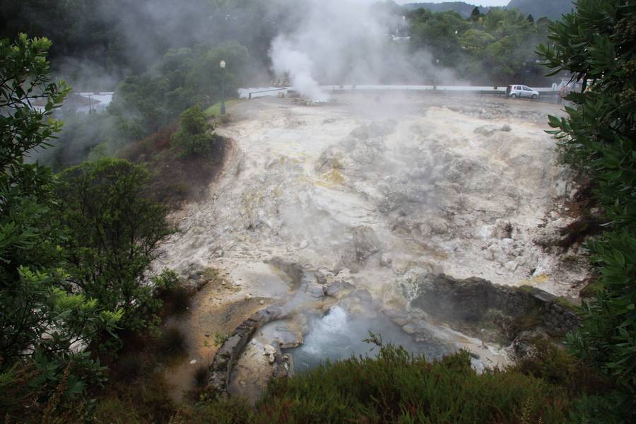
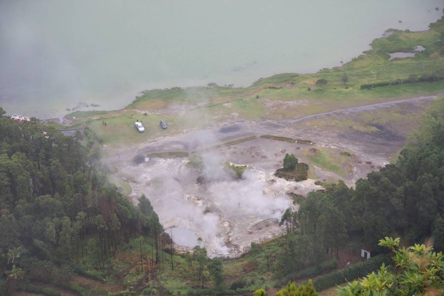
Hot springs and fumarols in the center of Furnas, Sao Miguel Island, Azores (Photo: WNomad)
Hot springs, solfatares and fumarols as “natural kitchen” at the northern bank of Lagoa das Furnas, St. Miguel (Photo: WNomad)
Latest satellite images