


Gaua Volcano
Gaua is one of the most remote and most active volcanoes of the Vanuatu archipel, located on the island with the same name in the West Banks island group atht enorthern end of the archipelago. Its most recent eruption started in Sep 2009 from Mt Garet inside the caldera lake and is ongoing (as of April 2010).
Gaua volcano eruptions: July 1962, 1963, Sep 1965, 1966, Jul 1967, 1968, Sep 1969, May 1971, Oct 1973 - Jan 1974, Jan 1976, April 1977, 1980, July 1981, April 1982, Sep 2009 - ongoing
Latest nearby earthquakes
| Date and Time | Mag / Depth | Distance / Location | |||
|---|---|---|---|---|---|
Background
The roughly 20-km-diameter Gaua Island, also known as Santa Maria, consists of a basaltic-to-andesitic stratovolcano with an 6 x 9 km wide summit caldera. Small parasitic vents near the caldera rim fed Pleistocene lava flows that reached the coast on several sides of the island; several littoral cones were formed where these lava flows reached the sea.Quiet collapse that formed the roughly 700-m-deep caldera was followed by extensive ash eruptions. Construction of the historically active cone of Mount Garat (Gharat) and other small cinder cones in the SW part of the caldera has left a crescent-shaped caldera lake. The symmetrical, flat-topped Mount Garat cone is topped by three pit craters. The onset of eruptive activity from a vent high on the SE flank of Mount Garat in 1962 ended a long period of dormancy. (Source: GVP)
Significant volcanic eruptions: Gaua volcano
| Date | Note | VEI | Deaths | Damage | |
|---|---|---|---|---|---|
| Mt. Garet Historical obs./docs. | 1 | ||||
| Mt. Garet Historical obs./docs. | 1 | ||||
| Mt. Garat Historical obs./docs. | 1 | ||||
| Mt. Garat Historical obs./docs. | 2 | ||||
| Mt. Garat Historical obs./docs. | 2 | ||||
| Mt. Garat Historical obs./docs. | 1? | ||||
| Mt. Garat Historical obs./docs. | 1? | ||||
| Mt. Garat Historical obs./docs. | 2 | ||||
| Mt. Garat Historical obs./docs. | 2 | ||||
| Mt. Garat (upper SE flank) Historical obs./docs. | 2 | ||||
| Mt. Garat (upper SE flank) Historical obs./docs. | 2 | ||||
| Mt. Garat Historical obs./docs. | 2 | ||||
| Mt. Garat (upper SE flank) Historical obs./docs. | 2 | ||||
| Mt. Garat Historical obs./docs. | 2 | ||||
| Mt. Garat Historical obs./docs. | 2 | ||||
| Mt. Garat Historical obs./docs. | 3 | ||||
| Mt. Garat (upper SE flank) Historical obs./docs. | 2 | ||||
| Mt. Garat Historical obs./docs. | 2? | ||||
Gaua Volcano FAQ
+When was the last eruption of Gaua volcano?
The last confirmed eruption of Gaua occurred in 2022.
+How often does Gaua volcano erupt?
There are no known historic eruptions, but evidence from geologic records shows that it has had at least 18 eruptions over the past 10,000 years. This number is likely much higher because many past eruptions might not have left evidence recognizeable today and/or the volcano might not have been studied in too much detail. Using the available data, a very conservative estimate is that Gaua volcano erupts every 556 years.
+How active is Gaua volcano at present?
Gaua volcano is relatively active: Since 1900, it has had 20 eruptions, and been active during 20 years out of 126 as of now. This means, Gaua has been in eruption one in 6.3 years on average. The last eruption was in 2022 and ended 4 years ago.
+When was the largest eruption of Gaua volcano?
The largest eruption of Gaua volcano in historic times occurred in 1965. It ranks as a "vulcanian" eruption with a magnitude 3 on the VEI (Volcanic Explosivity Index) scale.
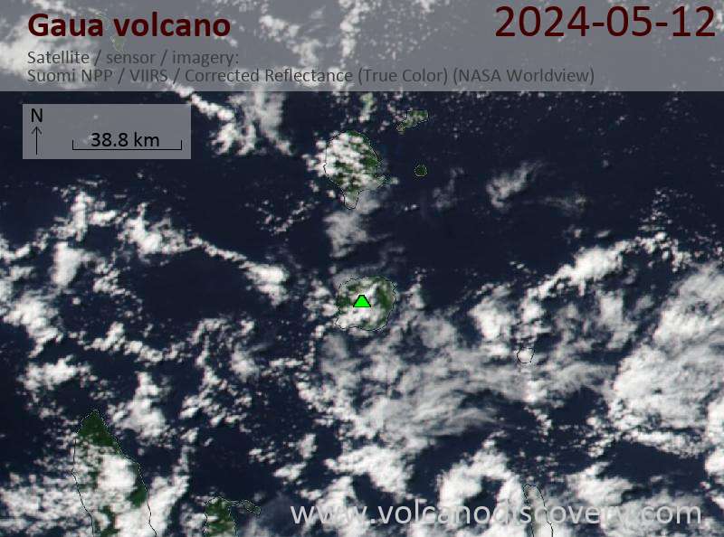
Latest satellite images
Gaua Volcano Maps


