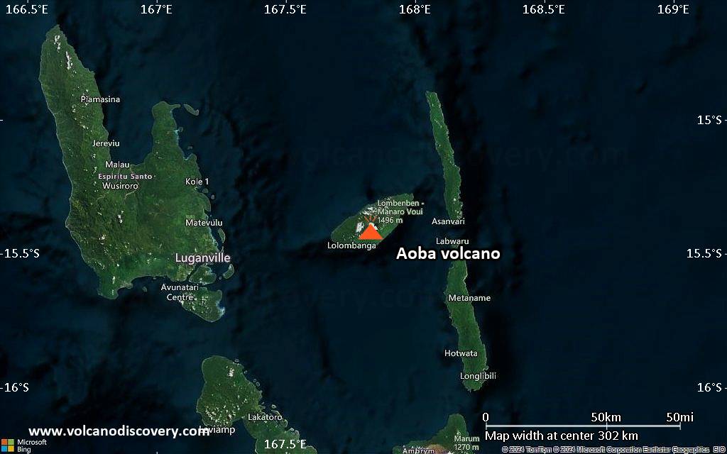
| RSS | EN | DE | EL | ES | FR | IT | RU

Aoba Volcano

Updated: Nov 25, 2025 15:27 GMT -
Shield volcano
Vanuatu, -15.4°S / 167.83°E
Summit height: 1496 m / 4,908 ft
Current status: minor activity or eruption warning (3 out of 5)
Last update: 1 Oct 2025 (Smithsonian / USGS Weekly Volcanic Activity Report)

Aoba, also known as Ambae, is a massive 2500 cu km basaltic shield volcano that is the most voluminous volcano of the New Hebrides archipelago.

[smaller] [larger]
Typical eruption style: unspecified
Aoba volcano eruptions: 2017, 2011, 2005

Latest nearby earthquakes

Date and TimeMag / DepthDistance / Location
Nov 22, 01:23 am (Universal Time)
2?

95 km
8.6 km (5.3 mi) to the W Penama Province, 64 km east of Luganville, Sanma Province, Vanuatu (unconfirmed) Info
Tuesday, November 18, 2025 GMT (1 quake)
Nov 18, 12:23 pm (Efate)
3?

130 km
22 km (14 mi) to the SW Coral Sea, 24 km southwest of Aoba Island, Penama Province, Vanuatu (unconfirmed) Info
Saturday, November 15, 2025 GMT (1 quake)
Nov 16, 02:13 am (Efate)
3?

133 km
26 km (16 mi) to the N Coral Sea, 73 km northeast of Luganville, Sanma Province, Vanuatu (unconfirmed) Info
Friday, November 14, 2025 GMT (1 quake)
Nov 14, 11:41 pm (GMT +11)
2?

0 km
16 km (10.2 mi) to the W Coral Sea, 16 km west of Aoba Island, Penama Province, Vanuatu (unconfirmed) Info

Background

A pronounced NE-SW-trending rift zone dotted with scoria cones gives the 16 x 38 km island an elongated form. A broad pyroclastic cone containing three crater lakes is located at the summit of the Hawaiian-style shield volcano within the youngest of at least two nested calderas, the largest of which is 6 km in diameter. Post-caldera explosive eruptions formed the summit craters of Lake Voui (also spelled Vui) and Lake Manaro Ngoru about 360 years ago. A tuff cone was constructed within Lake Voui about 60 years later. The latest known flank eruption, about 300 years ago, destroyed the population of the Nduindui area near the western coast.
---
Smithsonian / GVP volcano information

Aoba Volcano Photos

Significant volcanic eruptions: Aoba volcano

In the past 10,000 years, Aoba has had at least 11 confirmed volcanic eruptions, out of which 9 are documented by historical records, while the others can be inferred from geological evidence.
Additionally, there are 2 uncertain or discredited eruptions from Aoba volcano.
The table below lists all known eruptions (date in bold face) of Aoba volcano in historic times and during the past 10,000 years. Updates on the most recent volcanic activity of Aoba can be found on the news page of Aoba volcano.
DateNoteVEIDeathsDamage
2024 Jun 29 - Jun 30
Historical obs./docs.
?
2023 Dec 11 - Dec 21
Historical obs./docs.
2
2023 Feb 20 - May 28
Historical obs./docs.
2
2021 Dec 5 - 2022 Aug 15 ±10 d.
Historical obs./docs.
1
2017 Sep 6 - 2018 Oct 30 ?Pyroclastic cone in Lake Voui
Historical obs./docs.
3
2018 Mar 30
(eruption 2017 Sep 6 - 2018 Oct 30 ?)
Historical obs./docs.
34
moderate
Info
2017 Sep 23
(eruption 2017 Sep 6 - 2018 Oct 30 ?)
Historical obs./docs.
0
light
Info
?? 2016 Aug 18 - Aug 19
Uncertain Eruption
?
2011 Jun 4 - Jul 10Lake Manaro
Historical obs./docs.
1
2005 Nov 27 - 2006 Feb 16 ±15 d.Lake Voui
Historical obs./docs.
2
1995 Mar 2 - Mar 3 ?Lake Voui
Historical obs./docs.
2
?? 1915 ±1 y.
Uncertain Eruption
?
1914
(eruptive episode 1914)
Historical obs./docs.
0100
Info
1870
(eruption 1870 ?)
Historical obs./docs.
2100-1,000 (*)
heavy
Info
1870 ?SE side Lake Manaro Lakua; Lake Voui?
Historical obs./docs.
2?
1670 AD
(eruption 1670 ? AD)
Historical obs./docs.
2100-1,000 (*)
Info
1670 ? ADLake Voui and upper west flank2?
1530 ? ADLakes Voui and Manaro Ngoru?
(*) Estimated numbers
Remark:
Our list of volcanic eruptions closely follows the database of eruptions of the Smithsonian's Global Volcanism Project (GVP), the internationally most recognized data source for volcanic eruptions, but also includes significant eruptive episodes or related volcano events. "Volcanic eruptions" are usually to be understood as sequences of individual eruptive episodes that can follow each other, or even overlap (if several vents are involved), and can last many years, decades or even longer. For example, the current activity of Stromboli volcano is understood as a single eruption that has been ongoing since 1934.
Sources: NOAA National Centers for Environmental Information (NCEI), Global Significant Volcanic Eruptions Database. doi:10.7289/V5TD9V7K | Global Volcanism Project / Smithsonian Institution

Aoba Volcano FAQ

+When was the last eruption of Aoba volcano?

+How often does Aoba volcano erupt?

+How active is Aoba volcano at present?

+When was the largest eruption of Aoba volcano?

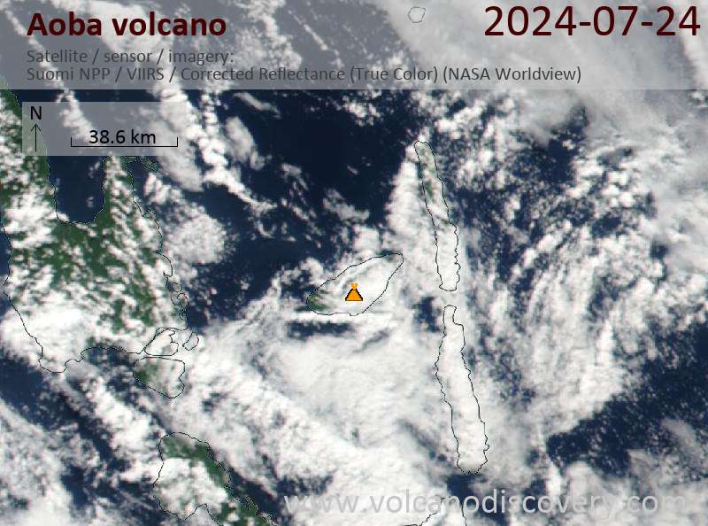
Latest satellite images

aoba satellite image sat1aoba satellite image sat2

Aoba Volcano Maps

Below is a selection of maps showing the location and surroundings of the volcano at various resolutions based on aerial-imagery / terrain maps. Feel free to use them for non-commercial purposes on your blog or website as long as you credit them with a link back to this page (click to copy it).
Satellite/aerial-type map of Aoba volcano (world scale)
Terrain-type map of Aoba volcano (world scale)
Satellite/aerial-type map of Aoba volcano (region scale large)
Terrain-type map of Aoba volcano (region scale large)
Satellite/aerial-type map of Aoba volcano (region scale medium)
Terrain-type map of Aoba volcano (region scale medium)
Satellite/aerial-type map of Aoba volcano (region scale small)
Terrain-type map of Aoba volcano (region scale small)
Satellite/aerial-type map of Aoba volcano (local scale large)
Terrain-type map of Aoba volcano (local scale large)
Satellite/aerial-type map of Aoba volcano (local scale medium)
Terrain-type map of Aoba volcano (local scale medium)
Satellite/aerial-type map of Aoba volcano (local scale small)
Terrain-type map of Aoba volcano (local scale small)
Satellite/aerial-type map of Aoba volcano (scale of 10s of km)
Terrain-type map of Aoba volcano (scale of 10s of km)
Satellite/aerial-type map of Aoba volcano (scale of 20-40 km)
Terrain-type map of Aoba volcano (scale of 20-40 km)
Satellite/aerial-type map of Aoba volcano (scale of approx. 10-20 km)
Terrain-type map of Aoba volcano (scale of approx. 10-20 km)
Satellite/aerial-type map of Aoba volcano (scale of 5-10 km)
Satellite/aerial-type map of Aoba volcano (scale of few kilometers)
Volcanoes & Earthquakes - new app for Android
Guaranteed tours
2-10 May 2026: From Stromboli to Etna - Sicily and Eolian Islands (Italy)
= spaces available   = guaranteed   = few spaces left   = booked out

Ambae volcano (Vanuatu) - Smithsonian / USGS Weekly Volcanic Activity Report for 24 September-30 September 2025 (Continuing Activity)

Wednesday, Oct 1, 2025 | 1 month ago · VN
The Vanuatu Meteorology and Geohazards Department (VMGD) reported ongoing unrest at Ambae during the month of September based on seismic and satellite data, webcam images, and field observations. Sulf…

On this page:

Try our free app!
Volcanoes & Earthquakes - new app for Android
Android | iOS version

More on VolcanoDiscovery

Why is there advertising on this site?

Support Us – Help Us Enhance Our Services!

We’re passionate about delivering the latest volcano and earthquake data from around the globe — just for you. However, maintaining our website and free apps requires significant time, effort, and resources.
Your support helps us expand our hardware and software capabilities and empowers our dedicated editorial team. Our mission is to provide uninterrupted, real-time updates whenever an earthquake strikes or a volcano erupts — and your donations make this possible. Every contribution, big or small, is deeply appreciated. If you find our information valuable and want to help us add new features, create compelling content, and improve our technology, please consider making a donation:

Donate with PayPal:

Planned Features:

Thanks to your past donations, we have recently added:
Download the Volcanoes & Earthquakes app to stay among the first to receive the fastest seismic and volcano alerts online:
Android | iOS
Thank you for being part of our mission!
Sources: VolcanoDiscovery / VolcanoAdventures and other sources as noted.
Use of material: Most text and images on our websites are owned by us. Re-use is generally not permitted without authorization. Contact us for licensing rights.
Volcanoes & Earthquakes
VolcanoDiscovery Home
Volcanoes | Earthquakes | Photos | Volcano News | | Shop | App
Adventure & Study Travel
Tours to Volcanoes and Volcanic Areas: walking tours, photo tours, study tours
Tours & Dates | FAQ | About us
Get our newsletter!
Company info
Contact | Legal info | Terms & conditions
Follow us
Follow us on facebook Follow us on Instagram Follow us on Bluesky Follow us on Twitter Visit our Youtube channel
EN | DE | EL | ES | FR | IT | RU
VolcanoDiscovery GmbH, Germany, Reg. nr.: HRB 103744, EU Tax Id: DE 297 465 123 owned and created by
Dr. Tom Pfeiffer, volcanologist, volcano photographer, tour organizer member of
IAVCEI
IAVCEI
Vulkanologische Gesellschaft
Volcanological Society
Ecotourism Greece
Ecotourism Greece
RUV insurance
Insured by R+V
VolcanoDiscovery © 2004- All Rights Reserved | Privacy - Cookie Settings