| RSS | EN | DE | EL | ES | FR | IT | RU

Dieng Volcano

Updated: Nov 10, 2025 06:32 GMT -
Complex volcano
Central Java (Indonesia), -7.22°S / 109.9°E
Summit height: 2565 m (8415 ft)
Current status: normal or dormant (1 out of 5)
Last update: 1 Oct 2025 (Smithsonian Daily Volcanic Activity Report)

The Dieng volcanic complex forms a 6x14 km large highland plateau in Central Java west of Yogyakarta. It consists of overlapping volcanoes and a large caldera, lava domes, cones, and explosion craters many of which are filled by lakes.
It is known for its varied colorful volcanic scenery and hydrothermal activity, and a sacred area to the Javanese people; some of the oldest Hindu temples of Java are found here, dating back to the 8th century AD.

[smaller] [larger]
Typical eruption style: Explosive, mainly phreatic eruptions, intense geothermal activity
Dieng volcano eruptions: 2017, 2011, 2009, 2005, 1993, 1986, 1981, 1979, 1964, 1956, 1954, 1953, 1952 (?), 1944, 1943, 1939, 1928, 1883-84, 1847, 1826, 1825, 1786, 1776 (?), 1375

Latest nearby earthquakes

Date and TimeMag / DepthDistance / Location
Oct 31, 03:51 pm (Jakarta)
3.2

10 km
10.8 km (6.7 mi) to the N Java, Indonesia Info

Background

The Dieng volcanic complex was formed by at least two overlapping stratovolcanoes, Butak Petarangan and Prahu. The latter was destroyed and truncated by a caldera formation less than 10,000 years ago. About 20 small geologically younger craters, lava domes, cinder cones and explosion craters dot the area. Some of the craters are filled by warm acidic lakes, including: the craters of Bismo, Srojo, Binem, Pangonan, Merdodo, Pagerkandang, Nogosari, Petarangan, Telogo Dringo, Pakuwaja,Kendil, Kunir and Prambanan.
Lava flows cover much of the plateau, but none of them have erupted in historic time. Historic activity at Dieng consited in small phreatic eruptions. Emissiong of toxic volcanic gas has caused fatalities and remains a hazard at several craters. There have been at least 18 historic eruptions and 8, which caused fatalities.

The strong heat flow on the plateau of Dieng creates numerous hydrothermally active areas with boiling mud ponds, fumaroles, warm springs etc. The most interesting hydrothermal areas include Kawah Sikidang, Kawah Sigajah, Kawah Kumbang, Kawah Sibanteng, Kawah Upas,Telogo Terus, Kawah Pagerkandang, Kawah Sipandu, Kawah Siglagah, Kawah Sileri, Telogo Dringo and Condrodimuko.
The intense heat flow of the area makes it a prime target for geothermal prospect.

Significant volcanic eruptions: Dieng volcano

In the past 10,000 years, Dieng has had at least 29 confirmed volcanic eruptions, out of which 25 are documented by historical records, while the others can be inferred from geological evidence.
Additionally, there are 3 uncertain or discredited eruptions from Dieng volcano.
The table below lists all known eruptions (date in bold face) of Dieng volcano since around 1900. Updates on the most recent volcanic activity of Dieng can be found on the news page of Dieng volcano.
DateNoteVEIDeathsDamage
2021 Apr 29
Historical obs./docs.
1
2018 Apr 1Sileri Crater
Historical obs./docs.
1
2017 Apr 30 - Jul 2Sileri Crater
Historical obs./docs.
1
2017 Jul 1
(eruption 2017 Apr 30 - Jul 2)
Historical obs./docs.
08
Info
2009 Sep 27Sileri Crater
Historical obs./docs.
1
2009 Jan 15Sibanteng crater
Historical obs./docs.
1
2003 Jul 16 ±15 d.Sileri Crater
Historical obs./docs.
1?
1996 Dec 31Near Padangsari crater
Historical obs./docs.
1
1993 Jan 23Near Pandawa Lima temples
Historical obs./docs.
1
1992 Mar 18
(eruptive episode 1992 Mar 18)
Historical obs./docs.
01
Info
1986 Aug 6Sileri Crater
Historical obs./docs.
1
1981 Jul 2 ±182 d.Sikidang
Historical obs./docs.
1?
1979 Feb 20Sinila and Sigluduk
Historical obs./docs.
1
1979 Feb 20
Historical obs./docs.
1149
Info
1964 Dec 13Sileri Crater
Historical obs./docs.
1
1964 Dec 13
Historical obs./docs.
1114
Info
1956 Jun 2Sileri Crater
Historical obs./docs.
1
1954 Dec 6Candradimuka area
Historical obs./docs.
0
1953 Mar 24 - Mar 25
Historical obs./docs.
2
?? 1952 Jul 16 ±15 d.
Uncertain Eruption
1?
1944 Dec 4Sileri Crater
Historical obs./docs.
2
1944 Dec 4
(eruption 1944 Dec 4)
Historical obs./docs.
2117
Info
1943 Nov 3Sileri Crater
Historical obs./docs.
1
1939 Oct 13 - Oct 15Butak Petarangan
Historical obs./docs.
1?
1939 Oct 13
(eruption 1939 Oct 13 - Oct 15)
Historical obs./docs.
110
light
Info
1928 May 13Butak Petarangan (Timbang)
Historical obs./docs.
2
1928 May 13
(eruption 1928 May 13)
Historical obs./docs.
240
Info
Remark:
Our list of volcanic eruptions closely follows the database of eruptions of the Smithsonian's Global Volcanism Project (GVP), the internationally most recognized data source for volcanic eruptions, but also includes significant eruptive episodes or related volcano events. "Volcanic eruptions" are usually to be understood as sequences of individual eruptive episodes that can follow each other, or even overlap (if several vents are involved), and can last many years, decades or even longer. For example, the current activity of Stromboli volcano is understood as a single eruption that has been ongoing since 1934.
Sources: NOAA National Centers for Environmental Information (NCEI), Global Significant Volcanic Eruptions Database. doi:10.7289/V5TD9V7K | Global Volcanism Project / Smithsonian Institution

Eruptions of Dieng volcano


September 2009 eruption
One or two phreatic eruptions occured at Sileri crater on 26-27 September. ...more info

January 2009 eruption - landslide and phreatic explosion
A small phreatic eruption occured on 16 Jan 2009 at Sibateng crater. ...more info

1992 gas eruption
A sudden gas emissions ocurred at 16h00 on 18 March 1992. One person was killed by CO2 in a river valles 200 m W of Sikidang Crater, and two people trying to rescue him had to be hospitalized.

1979 eruption - deadly gas emissions
The last eruption at Dieng causing a large number of fatalities happened on 20 February 1979. Large gas emissions (CO2, most likely, or H2S) occured along with at least two phreatic eruptions from Sinila and Sigludung craters. At least 149 people were killed, when they fled the explosions and were cought in the deadly gas cloud. Many hundreds were severely injured.
Around 15,000 people were evacuated from six villages near Sinila. Fish and livestock were killed by the eruption. The eruption had been preceded by at least 3 felt earthquakes.

1964 eruption
An eruption in 1964 caused 114 deaths.

1944 eruption
An explosion occurred from Kawah Sileri crater during the night of 4 Dec 1944. The powerful explosion occured in darkness and showered rocks and boiling mud over parts of the villages Kepakisan, Sekalem, Sidolok, Pagerkandang, Djawera and Kepakisanlor. in complete darkness. Some blocks were thrown up to 1 km distance from the vent. An estimated 117 people people were killed, and more than 200 severely injured by ballistic impact and burns from boiling mud.

1939 eruption
A violent phreatic eruption happened at Dieng volcano on 13th October 1939 near the northern side of the Chinese cementary. Hot mud erupted from a new fissure. Activity ended on 3 November 1939.

1928 eruption
A phreatic explosion in 1928 near Timpang killed about 40 people, one by a falling block.

Eruptions in 1826 and 1827
The eruptions in 1826 and 1827 caused several fatalities.

1786 eruption
Fissures opened in the ground and destroyed the village of Jamping killing 38 people.

Dieng Volcano FAQ

+When was the last eruption of Dieng volcano?

+How often does Dieng volcano erupt?

+How active is Dieng volcano at present?

+When was the largest eruption of Dieng volcano?

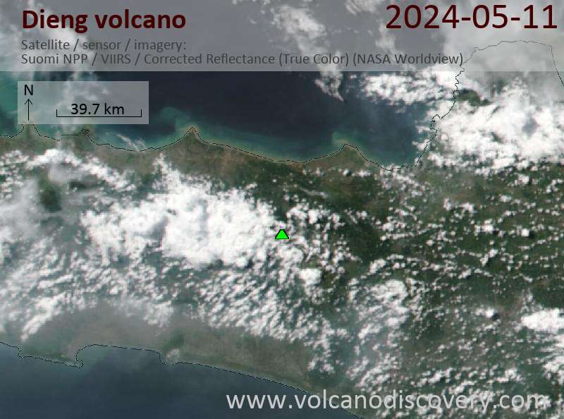
Latest satellite images

Dieng satellite image sat1Dieng satellite image sat2

Dieng Volcano Maps

Below is a selection of maps showing the location and surroundings of the volcano at various resolutions based on aerial-imagery / terrain maps. Feel free to use them for non-commercial purposes on your blog or website as long as you credit them with a link back to this page (click to copy it).
Satellite/aerial-type map of Dieng volcano (world scale)
Terrain-type map of Dieng volcano (world scale)
Satellite/aerial-type map of Dieng volcano (region scale large)
Terrain-type map of Dieng volcano (region scale large)
Satellite/aerial-type map of Dieng volcano (region scale medium)
Terrain-type map of Dieng volcano (region scale medium)
Satellite/aerial-type map of Dieng volcano (region scale small)
Terrain-type map of Dieng volcano (region scale small)
Satellite/aerial-type map of Dieng volcano (local scale large)
Terrain-type map of Dieng volcano (local scale large)
Satellite/aerial-type map of Dieng volcano (local scale medium)
Terrain-type map of Dieng volcano (local scale medium)
Satellite/aerial-type map of Dieng volcano (local scale small)
Terrain-type map of Dieng volcano (local scale small)
Satellite/aerial-type map of Dieng volcano (scale of 10s of km)
Terrain-type map of Dieng volcano (scale of 10s of km)
Satellite/aerial-type map of Dieng volcano (scale of 20-40 km)
Terrain-type map of Dieng volcano (scale of 20-40 km)
Satellite/aerial-type map of Dieng volcano (scale of approx. 10-20 km)
Terrain-type map of Dieng volcano (scale of approx. 10-20 km)
Satellite/aerial-type map of Dieng volcano (scale of 5-10 km)
Satellite/aerial-type map of Dieng volcano (scale of few kilometers)
Volcanoes & Earthquakes - new app for Android
Guaranteed tours
20 Nov - 3 Dec 2025: Desert, salt and volcanoes - Danakil desert (Ethiopia)
2-10 May 2026: From Stromboli to Etna - Sicily and Eolian Islands (Italy)
= spaces available   = guaranteed   = few spaces left   = booked out

Dieng Volcanic Complex Volcano (Indonesia) activity update Sep 30, 2025 - Unrest

Wednesday, Oct 1, 2025 | 1 month ago · VN
The Center for Volcanology and Geological Hazard/Pusat Vulkanologi dan Mitigasi Bencana Geologi (CVGHM/PVMBG) reported that unrest continued at Dieng Volcanic Complex on 30 September 2025 (local). The …

Dieng Volcanic Complex Volcano (Indonesia) activity update Sep 29, 2025 - Unrest

Tuesday, Sep 30, 2025 | 1 month ago · VN
The Center for Volcanology and Geological Hazard/Pusat Vulkanologi dan Mitigasi Bencana Geologi (CVGHM/PVMBG) reported that unrest continued at Dieng Volcanic Complex on 29 September 2025 (local). The …

On this page:

Try our free app!
Volcanoes & Earthquakes - new app for Android
Android | iOS version

More on VolcanoDiscovery

Why is there advertising on this site?

Support Us – Help Us Enhance Our Services!

We’re passionate about delivering the latest volcano and earthquake data from around the globe — just for you. However, maintaining our website and free apps requires significant time, effort, and resources.
Your support helps us expand our hardware and software capabilities and empowers our dedicated editorial team. Our mission is to provide uninterrupted, real-time updates whenever an earthquake strikes or a volcano erupts — and your donations make this possible. Every contribution, big or small, is deeply appreciated. If you find our information valuable and want to help us add new features, create compelling content, and improve our technology, please consider making a donation:

Donate with PayPal:

Planned Features:

Thanks to your past donations, we have recently added:
Download the Volcanoes & Earthquakes app to stay among the first to receive the fastest seismic and volcano alerts online:
Android | iOS
Thank you for being part of our mission!
Sources: VolcanoDiscovery / VolcanoAdventures and other sources as noted.
Use of material: Most text and images on our websites are owned by us. Re-use is generally not permitted without authorization. Contact us for licensing rights.
Volcanoes & Earthquakes
VolcanoDiscovery Home
Volcanoes | Earthquakes | Photos | Volcano News | | Shop | App
Adventure & Study Travel
Tours to Volcanoes and Volcanic Areas: walking tours, photo tours, study tours
Tours & Dates | FAQ | About us
Get our newsletter!
Company info
Contact | Legal info | Terms & conditions
Follow us
Follow us on facebook Follow us on Instagram Follow us on Bluesky Follow us on Twitter Visit our Youtube channel
EN | DE | EL | ES | FR | IT | RU
VolcanoDiscovery GmbH, Germany, Reg. nr.: HRB 103744, EU Tax Id: DE 297 465 123 owned and created by
Dr. Tom Pfeiffer, volcanologist, volcano photographer, tour organizer member of
IAVCEI
IAVCEI
Vulkanologische Gesellschaft
Volcanological Society
Ecotourism Greece
Ecotourism Greece
RUV insurance
Insured by R+V
VolcanoDiscovery © 2004- All Rights Reserved | Privacy - Cookie Settings