| RSS | EN | DE | EL | ES | FR | IT | RU

Gorely Volcán

Updated: 6 mayo 2025 00:03 GMT -
Stratovolcano (caldera)
Southern Kamchatka, 52.55°N / 158.03°E
Summit height: 1829 m (6,001 ft)
Current status: normal or dormant (1 out of 5)
Last update: 9 dic 2021 (degassing)
The eastern central crater of Gorely, often filled with an acid lake.

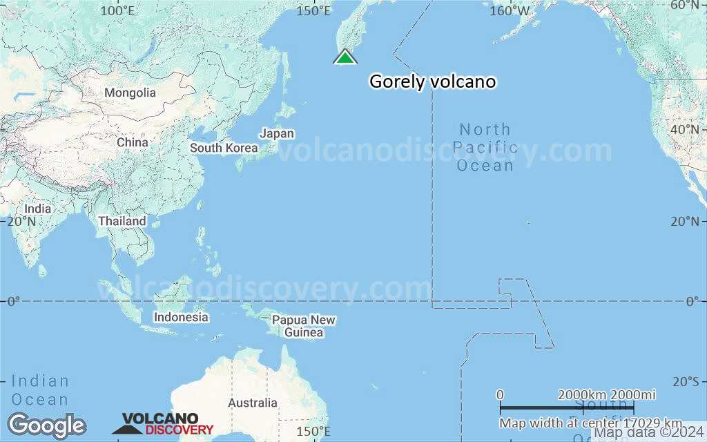
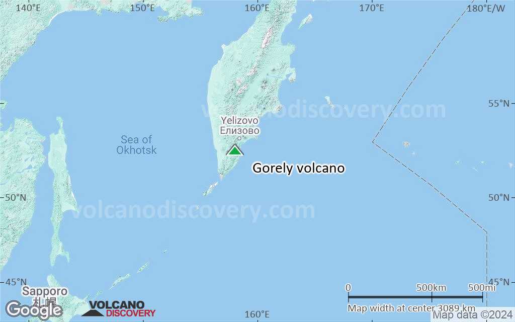
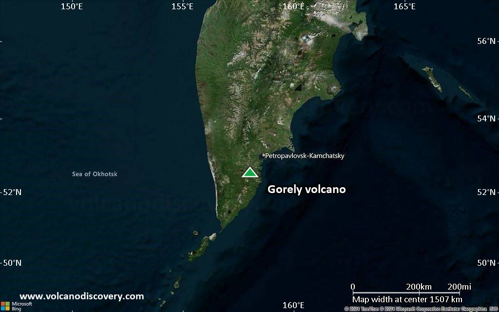
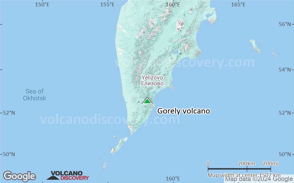
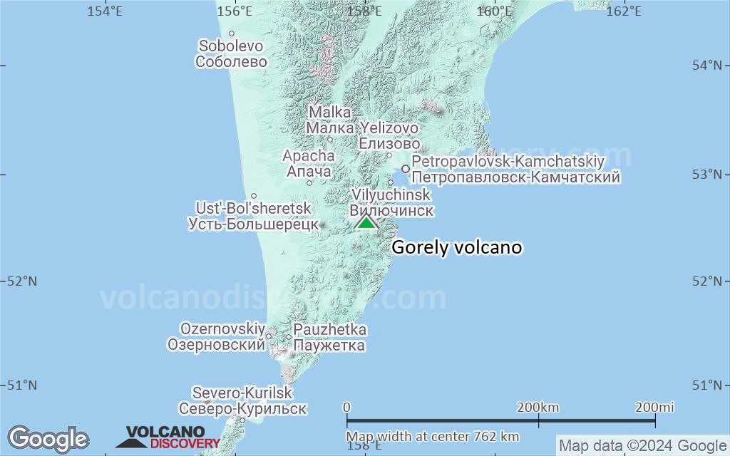
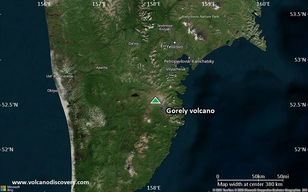
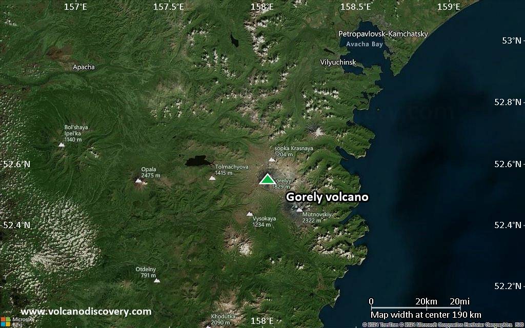
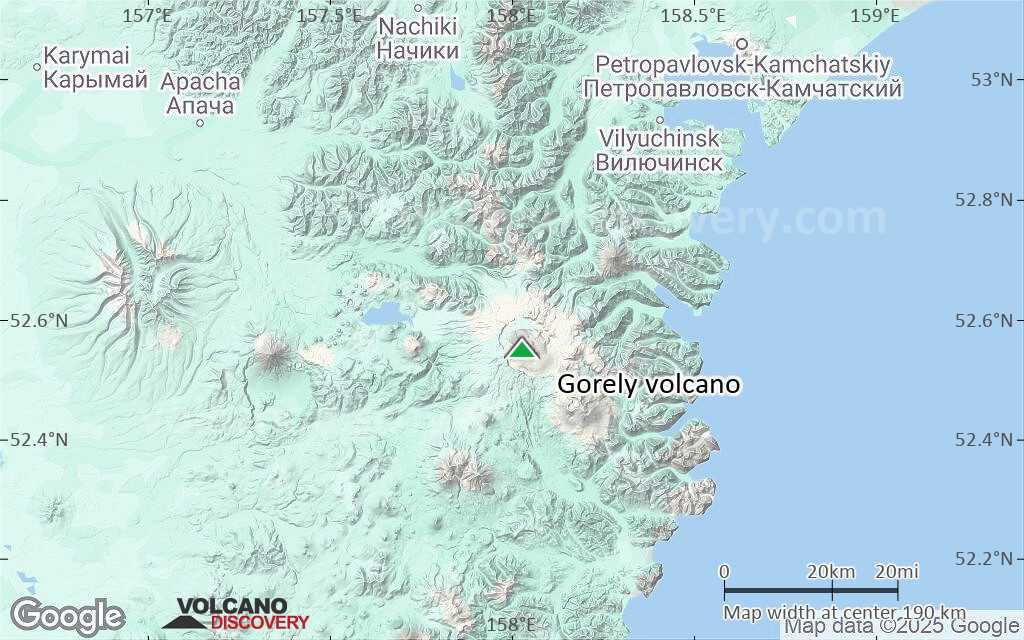
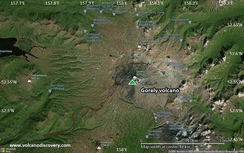
Gorely volcano is one of the most active volcanoes in southern Kamchatka and located 75 km SW of Petropavlovsk. It is a complex of several overlapping stratovolcanoes with many summit and flank craters. Activity in historic times were mainly small to medium-sized ash and steam eruptions.

[smaller] [larger]
Typical eruption style: Explosive, often water-magma interaction. Formation of crater lakes and lahars (mud flows).
Erupciones del volcán Gorely: 1821 (?), 1828, 1832, 1855, 1869, 1929-30, 1930-31, 1931, 1932 (?), 1947, 1961, June 1980 - July 81, Aug 1984- Sep 86, June 2010 (?)

Latest nearby earthquakes

Fecha y horaMag / Prof.Distancia / Ubicación
29 abr 04:58 (Kamchatka)
0.7

4.4 km
18 km al sureste Yelizovskiy Rayon, 72 km al sur de Petropávlovsk-Kamchatski, Kamchatka, Rusia Más
29 abr 03:23 (Kamchatka)
1.0

3.5 km
16 km al sureste 69 km From Petropavlovsk-Kamchatskiy Más
domingo, 27 abril 2025 GMT (1 sismo)
28 abr 08:19 (Kamchatka)
1.1

7.2 km
10.3 km al sureste 67 km From Petropavlovsk-Kamchatskiy Más
sábado, 26 abril 2025 GMT (1 sismo)
27 abr 11:46 (Kamchatka)
0.6

3.8 km
15 km al sureste 69 km From Petropavlovsk-Kamchatskiy Más
viernes, 25 abril 2025 GMT (1 sismo)
25 abr 16:22 (Kamchatka)
3.4

160 km
28 km al sur 88 km From Petropavlovsk-Kamchatskiy Más

Background

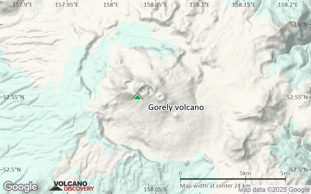
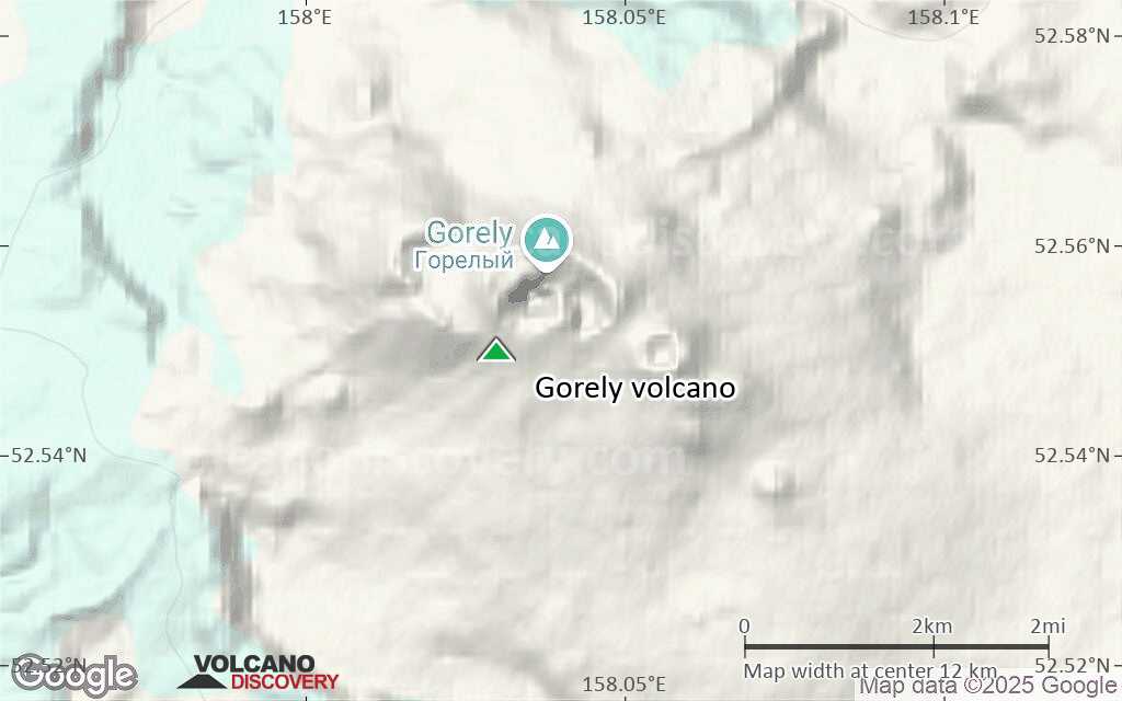
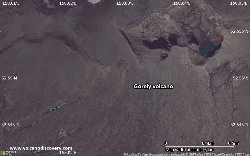
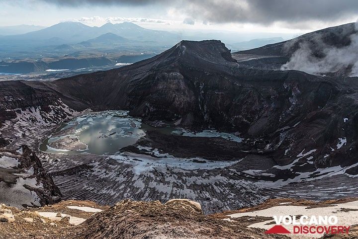
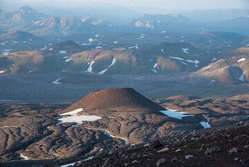
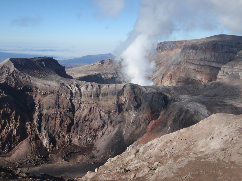
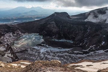
The large Gorely volcano has a very complex structure: The edifice fills a large 9 x 13.5 km caldera occupied by 3 closely spaced overlapping stratovolcanoes with 11 summit craters and more than 30 flank craters. The lavas of Gorely are mainly basalt and basaltic andesite and the volcano developed along a WNW-ESE line within the caldera. It is cut by 3 rift zones. Some of the craters contain acid or freshwater crater lakes.
The caldera formed after a giant plinian eruption that produced about 100 cubic miles of tephraabout 38,000-40,000 years ago.
Historic activity of Gorely volcano can be traced since the 19th century. 4 explosive eruptions from summit craters occured in 1828, 1832, 1855, and 1869. The first historic eruptions in 1929-30 produced several strong eruptions which ejected ash and larger fragments of rock, and ash plumes that reached the Pacific coast, Petropavlovsk-Kamchatsky, and the village of Nachiki at 150 km from the volcano.
In the 20th century, seven eruptions occured in 1929, 1930, 1931, 1947, 1961, 1980-1981, and 1984-1986. During the last 1984-1986 eruption, the ash plumes reached 3.5 km height and a crater was formed that is now filled with a lake.

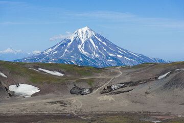
Gorely Volcano Photos

Erupciones volcánicas significativas: Gorely volcano

In the past 10,000 years, Gorely has had at least 50 confirmed volcanic eruptions, out of which 11 are documented by historical records, while the others can be inferred from geological evidence.
Additionally, there are 3 uncertain or discredited eruptions from Gorely volcano.
The table below lists all known eruptions (date in bold face) of Gorely volcano in historic times and during the past 10,000 years. Updates on the most recent volcanic activity of Gorely can be found on the news page of Gorely volcano.
FechaNotaVEIFallecidosDaños
2010 jun 6 - jun 22 ?Summit crater
Obs. históricas/documentos
1
desconocido
1984 ago 4 - 1986 sep 21 ?
Obs. históricas/documentos
2
desconocido
1980 jun 15 ±5 d. - 1981 jul 3
Obs. históricas/documentos
3
desconocido
1961 ene 16 ±15 d.
Obs. históricas/documentos
2
desconocido
1947 dic
Obs. históricas/documentos
2
desconocido
?? 1932
Erupción incierta
?
desconocido
1931 may - jul 15 ±45 d.
Obs. históricas/documentos
2
desconocido
1930 sep - 1931 ene 17
Obs. históricas/documentos
3
desconocido
1929 sep 1 - 1930 abr
Obs. históricas/documentos
3
desconocido
1869
Obs. históricas/documentos
2
desconocido
?? 1855 abr
Erupción incierta
2?
desconocido
1832 feb
Obs. históricas/documentos
3
desconocido
1828 jun
Obs. históricas/documentos
3
desconocido
?? 1821
Erupción incierta
?
desconocido
1750 ±50 y.2?
desconocido
1330 ±25 y. AD2?
desconocido
1030 ±25 y. AD3
desconocido
550 ? AD3
desconocido
250 ? AD3
desconocido
200 ? AD3
desconocido
50 ? AD3
desconocido
Remark:
Our list of volcanic eruptions closely follows the database of eruptions of the Smithsonian's Global Volcanism Project (GVP), the internationally most recognized data source for volcanic eruptions, but also includes significant eruptive episodes or related volcano events. "Volcanic eruptions" are usually to be understood as sequences of individual eruptive episodes that can follow each other, or even overlap (if several vents are involved), and can last many years, decades or even longer. For example, the current activity of Stromboli volcano is understood as a single eruption that has been ongoing since 1934.
Fuentes: NOAA National Centers for Environmental Information (NCEI), Global Significant Volcanic Eruptions Database. doi:10.7289/V5TD9V7K | Global Volcanism Project / Smithsonian Institution

Gorely Volcano FAQ

+When was the last eruption of Gorely volcano?

+How often does Gorely volcano erupt?

+How active is Gorely volcano at present?

+When was the largest eruption of Gorely volcano?

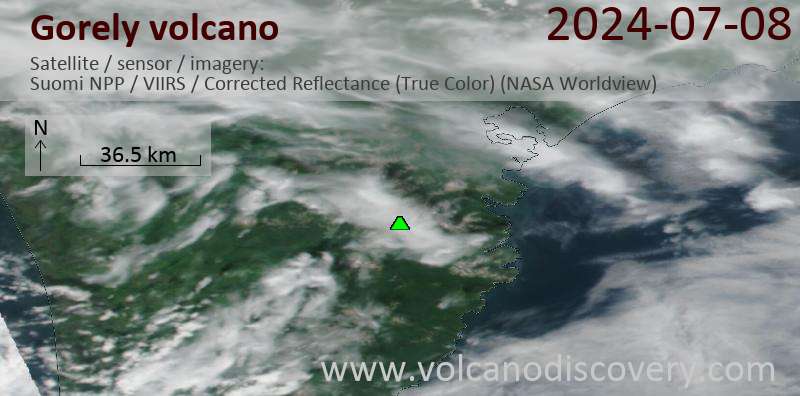
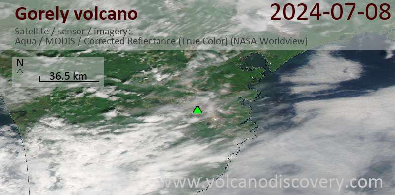
Últimas imágenes satelitales

Gorely imagen satelital sat1Gorely imagen satelital sat2
Gorely Tours de volcanes
Kamchatka (Russia)
Kamchatka - Land of Colors
volcano expedition to Kamchatka
16-19 days - Easy to Moderate
Price 0 €
no scheduled dates at present

Gorely Volcán Mapas

Below is a selection of maps showing the location and surroundings of the volcano at various resolutions based on aerial-imagery / terrain maps. Feel free to use them for non-commercial purposes on your blog or website as long as you credit them with a link back to this page (click to copy it).
Satellite/aerial-type map of Gorely volcano (world scale)
Terrain-type map of Gorely volcano (world scale)
Satellite/aerial-type map of Gorely volcano (region scale large)
Terrain-type map of Gorely volcano (region scale large)
Satellite/aerial-type map of Gorely volcano (region scale medium)
Terrain-type map of Gorely volcano (region scale medium)
Satellite/aerial-type map of Gorely volcano (region scale small)
Terrain-type map of Gorely volcano (region scale small)
Satellite/aerial-type map of Gorely volcano (local scale large)
Terrain-type map of Gorely volcano (local scale large)
Satellite/aerial-type map of Gorely volcano (local scale medium)
Terrain-type map of Gorely volcano (local scale medium)
Satellite/aerial-type map of Gorely volcano (local scale small)
Terrain-type map of Gorely volcano (local scale small)
Satellite/aerial-type map of Gorely volcano (scale of 10s of km)
Terrain-type map of Gorely volcano (scale of 10s of km)
Satellite/aerial-type map of Gorely volcano (scale of 20-40 km)
Terrain-type map of Gorely volcano (scale of 20-40 km)
Satellite/aerial-type map of Gorely volcano (scale of approx. 10-20 km)
Terrain-type map of Gorely volcano (scale of approx. 10-20 km)
Satellite/aerial-type map of Gorely volcano (scale of 5-10 km)
Satellite/aerial-type map of Gorely volcano (scale of few kilometers)
Volcanoes & Earthquakes - new app for Android
Guaranteed tours
9-25 jun 2025: Volcanoes and Spices - Halmahera N-Sulawesi (Indonesia)
7-22 jul 2025: From Krakatau to Bali - Java (Indonesia)
7-23 jul 2025: Volcanoes and Spices - Halmahera N-Sulawesi (Indonesia)
1-17 ago 2025: Volcanoes and Spices - Halmahera N-Sulawesi (Indonesia)
1-14 oct 2025: Desert, salt and volcanoes - Danakil desert (Ethiopia)
4-12 oct 2025: From Stromboli to Etna - Sicily and Eolian Islands (Italy)
6-21 oct 2025: From Krakatau to Bali - Java (Indonesia)
3-19 nov 2025: Volcanoes and Spices - Halmahera N-Sulawesi (Indonesia)
= spaces available   = guaranteed   = few spaces left   = booked out
dom, 26 ene 2014, 12:00

Gorely volcano (Kamchatka): activity decreased, alert level lowered to normal/green

KVERT había reducido el nivel de alerta del volcán a green, el 23 enero Degassing actividad sísmica disminuyó significativamente en diciembre y se mantuvo en niveles bajos desde. Leer todo
mié, 22 ene 2014, 08:35

Gorely volcano (Southern Kamchatka) activity update

KVERT no informaron cambios. El volcán continúa mostrando desgasificación intensa y elevada actividad sísmica. Leer todo

En esta página:

Try our free app!
Volcanoes & Earthquakes - new app for Android
Android | iOS version

More on VolcanoDiscovery

Why is there advertising on this site?

Support us - Help us upgrade our services!

We truly love working to bring you the latest volcano and earthquake data from around the world. Maintaining our website and our free apps does require, however, considerable time and resources.
We need financing to increase hard- and software capacity as well as support our editor team. We're aiming to achieve uninterrupted service wherever an earthquake or volcano eruption unfolds, and your donations can make it happen! Every donation will be highly appreciated. If you find the information useful and would like to support our team in integrating further features, write great content, and in upgrading our soft- and hardware, please make a donation (PayPal).

Planned features:Thanks to your past donations, these features have been added recently:
Download and Upgrade the Volcanoes & Earthquakes app to get one of the fastest seismic and volcano alerts online:
Android | IOS
Thank you!
Sources: VolcanoDiscovery / VolcanoAdventures and other sources as noted.
Use of material: Most text and images on our websites are owned by us. Re-use is generally not permitted without authorization. Contact us for licensing rights.
Volcanoes & Earthquakes
VolcanoDiscovery Home
Volcanes | Sismos | Fotos | News | | Shop | App
Adventure & Study Travel
Tours to Volcanoes and Volcanic Areas: walking tours, photo tours, study tours
Tours & Dates | FAQ | About us
Get our newsletter!
Company info
Contact | Legal info | Terms & conditions
Follow us
Follow us on facebook Follow us on Instagram Follow us on Bluesky Follow us on Twitter Visit our Youtube channel
EN | DE | EL | ES | FR | IT | RU
VolcanoDiscovery GmbH, Germany, Reg. nr.: HRB 103744, EU Tax Id: DE 297 465 123 owned and created by
Dr. Tom Pfeiffer, volcanologist, volcano photographer, tour organizer member of
IAVCEI
IAVCEI
Vulkanologische Gesellschaft
Volcanological Society
Ecotourism Greece
Ecotourism Greece
RUV insurance
Insured by R+V
VolcanoDiscovery © 2004- All Rights Reserved | Privacy - Cookie Settings