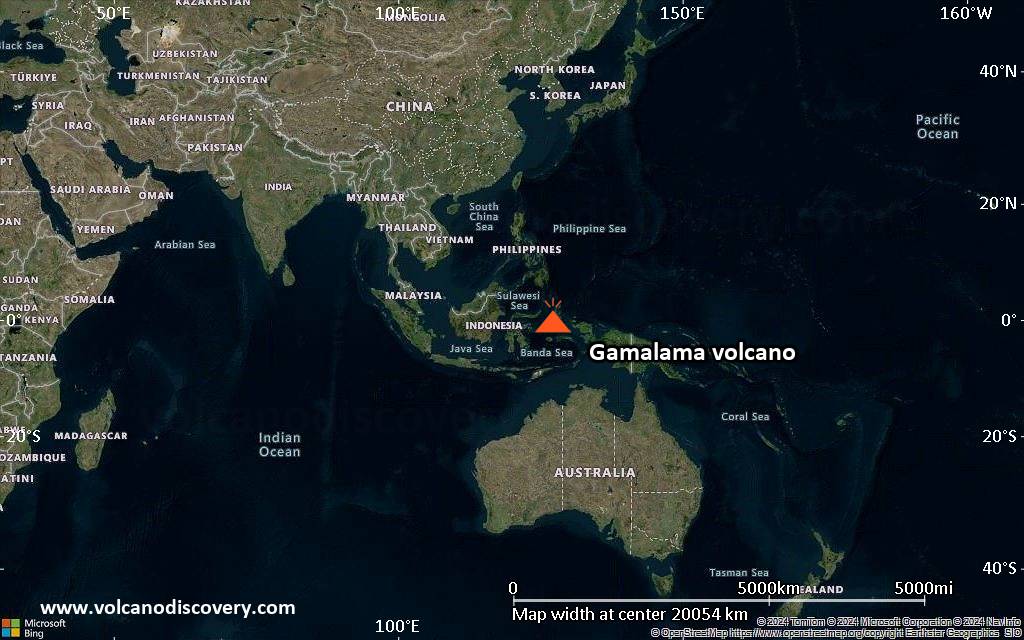
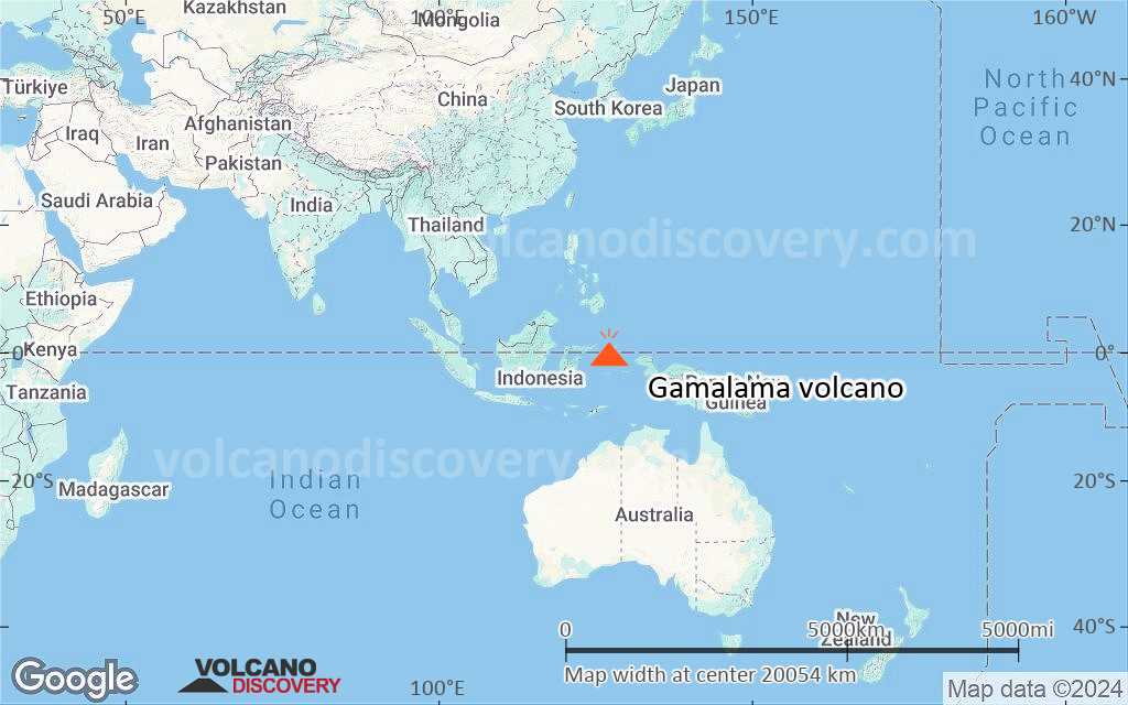
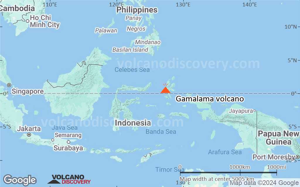
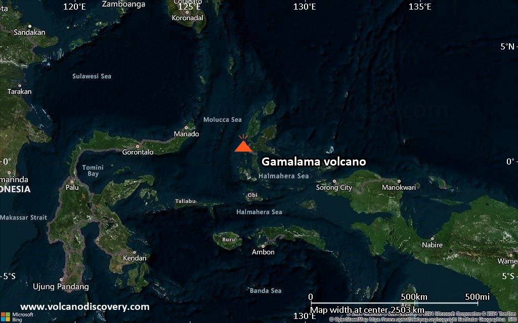
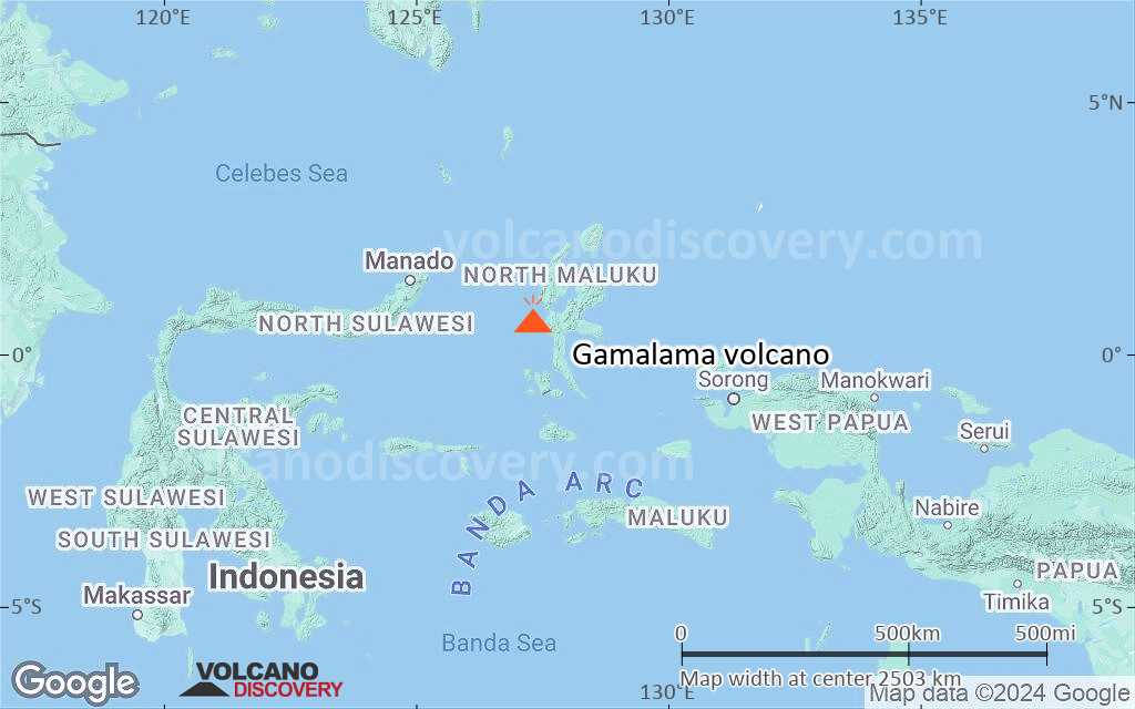
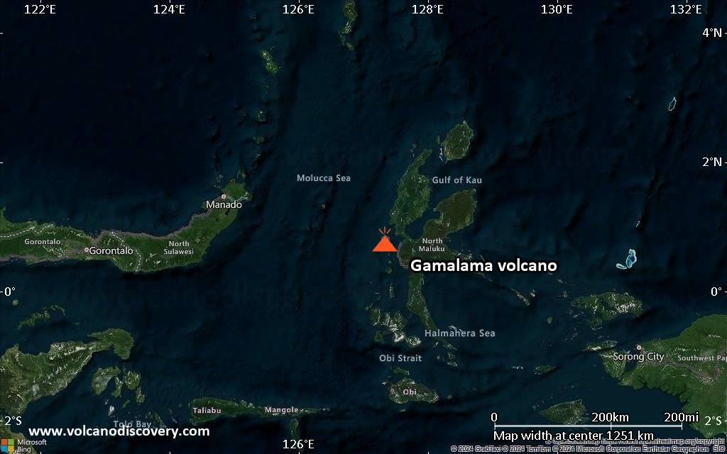
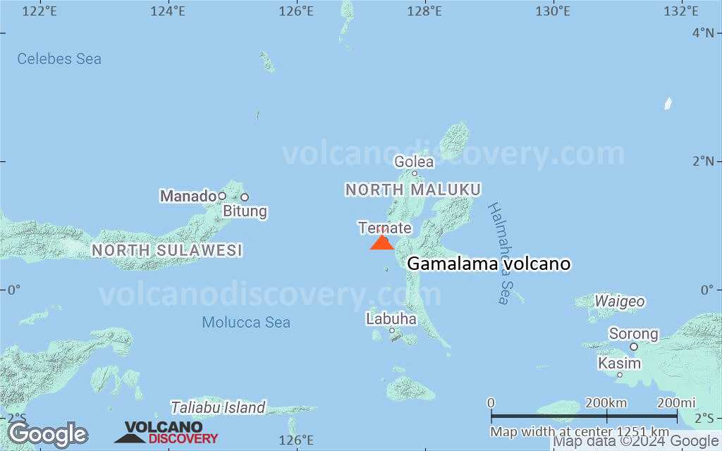
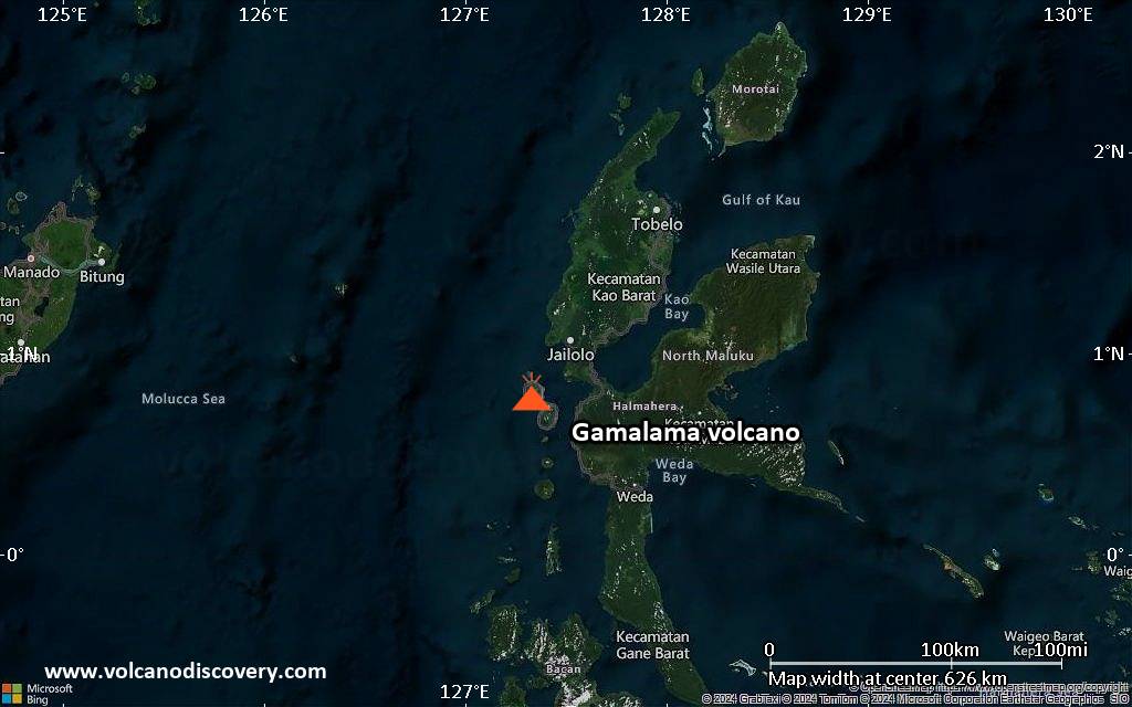
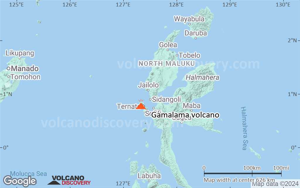
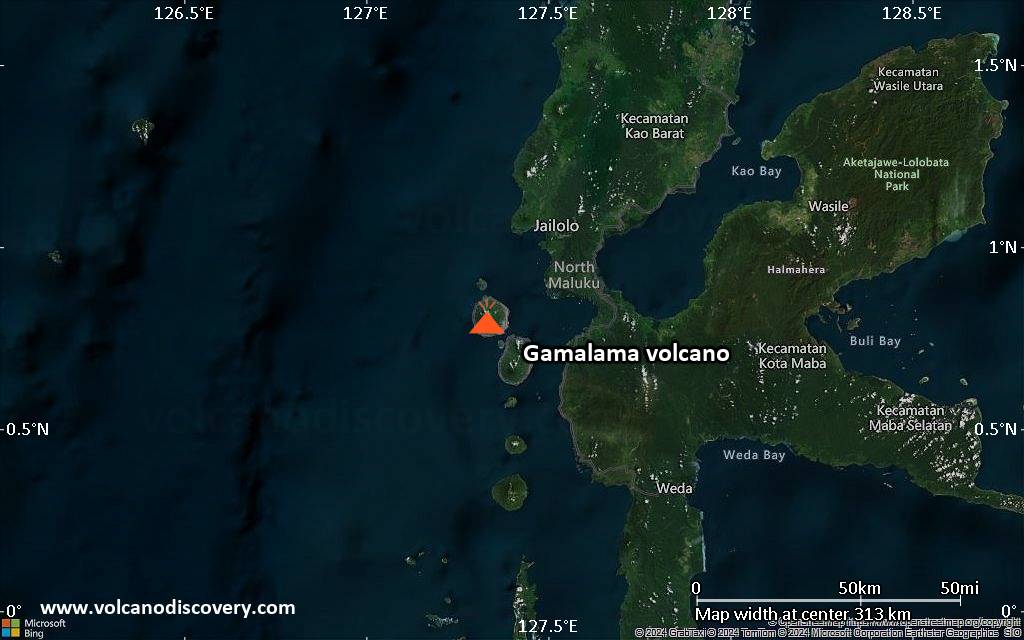
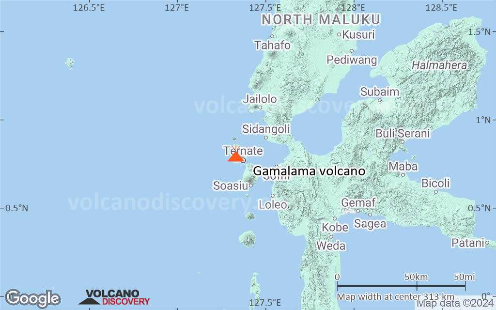
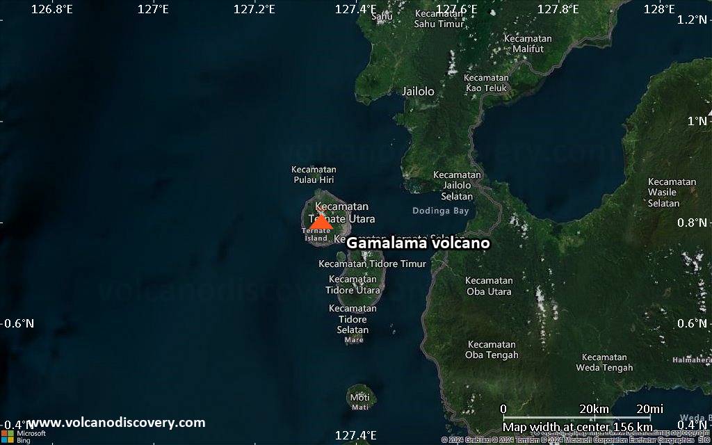
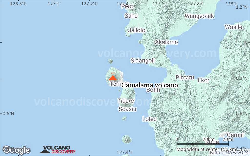
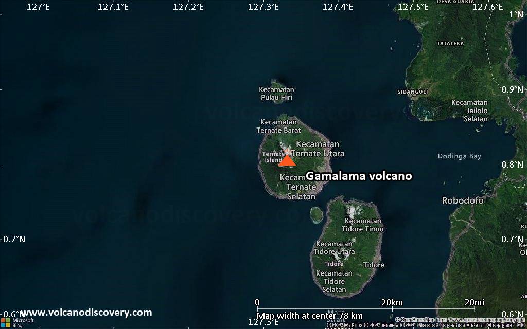
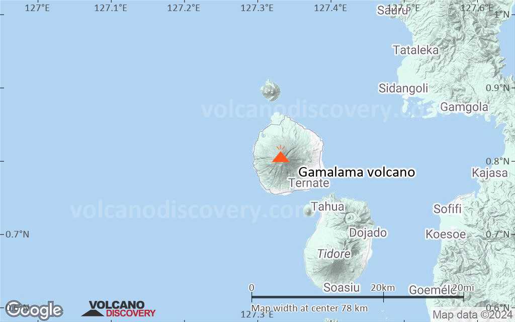
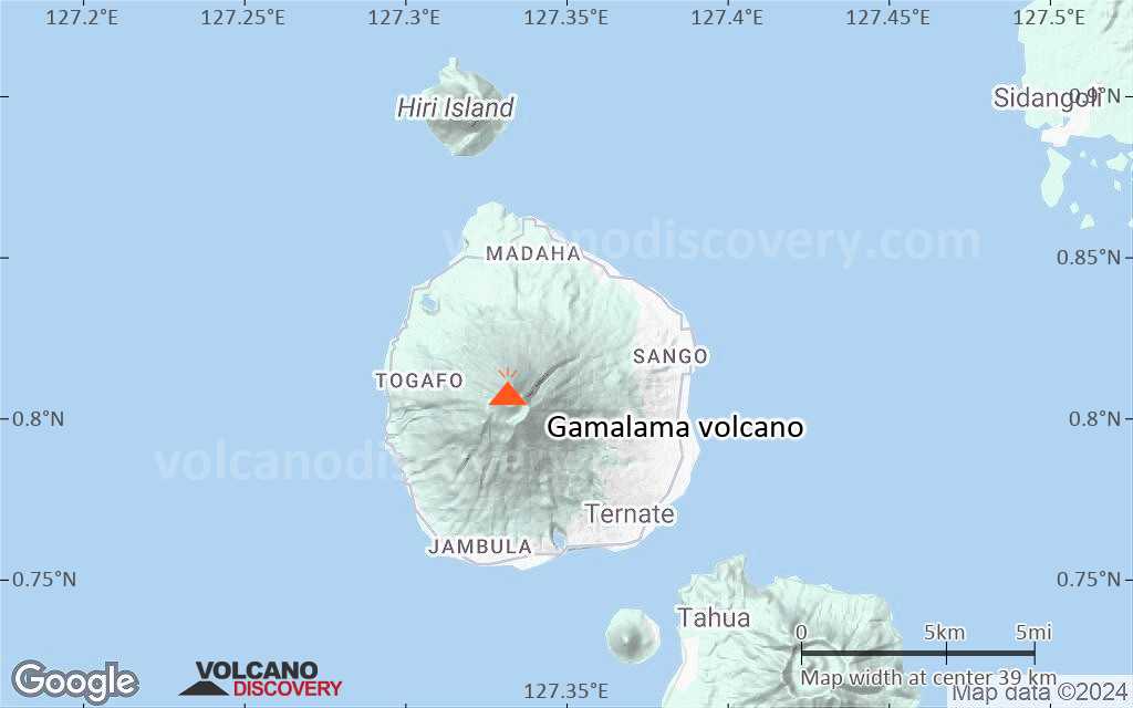
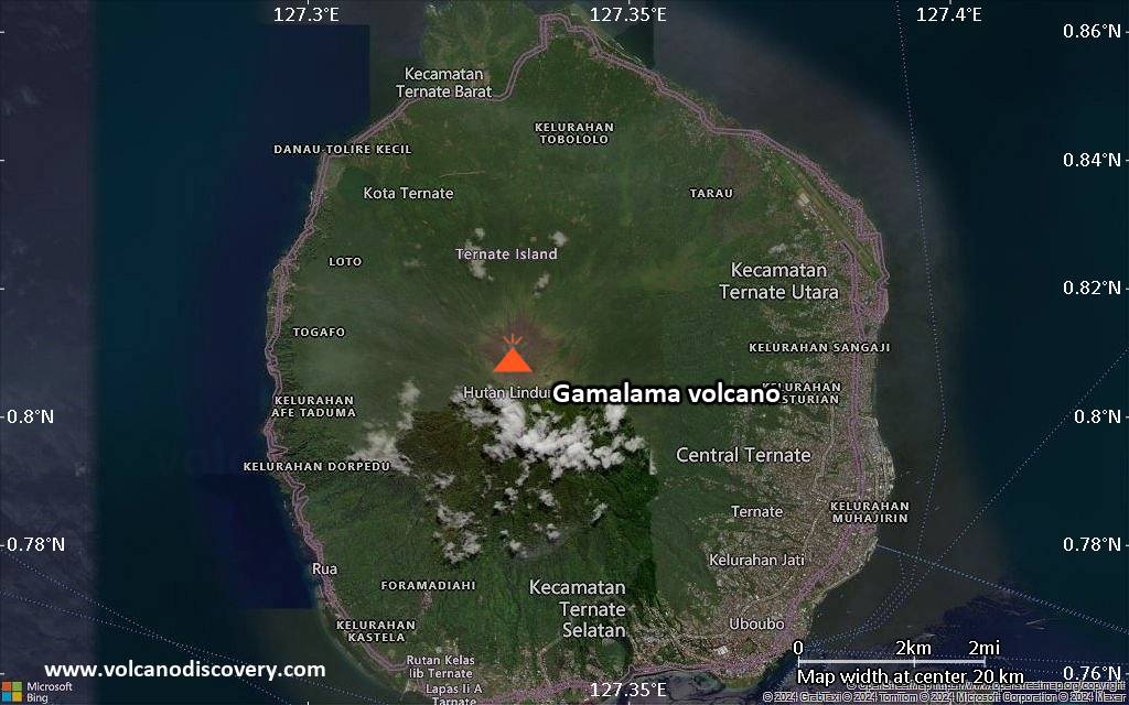
| RSS | EN | DE | EL | ES | FR | IT | RU

Gamalama Volcano

Updated: Aug 6, 2025 02:20 GMT -
Stratovolcano
Halmahera (Indonesia), 0.81°N / 127.33°E
Summit height: 1715 m / 5,627 ft
Current status: minor activity or eruption warning (3 out of 5)
Last update: 12 Feb 2025 (Smithsonian / USGS Weekly Volcanic Activity Report)

Gamalama (Peak of Ternate) is a near-perfect conical stratovolcano that forms the entire island of Ternate off the western coast of Halmahera. It is one of Indonesia's most active volcanoes.

[smaller] [larger]
Typical eruption style: Explosive.
Gamalama volcano eruptions: 1510, 1538, 1561, 1605, 1635, 1643, 1648, 1653, 1659, 1676, 1686, 1687, 1737, 1739, 1763, 1770, 1771-72, 1773-74, 1775, 1811, 1812, 1814, 1830(?), 1831, 1833, 1835, 1838, 1839, 1840, 1841(?), 1842, 1843, 1844(?), 1845(?), 1846, 1847, 1847, 1849-50, 1858(?), 1860(?), 1862, 1863(?), 1864, 1864(?), 1868, 1868-69, 1871, 1884(?), 1895, 1896(?), 1897, 1898, 1900(?), 1907, 1911, 1918, 1923, 1932, 1933, 1938, 1962-63, 1980, 1983, 1988, 1990, 1991(?), May 1993-94, 1996, 2003 (31 July - 2 Oct), 2007-08, 2012, 2014

Latest nearby earthquakes

Date and TimeMag / DepthDistance / Location
Jul 23, 10:38 am (Universal Time)
1.5

10 km
10.9 km (6.7 mi) to the SE Halmahera, Indonesia Info

Background

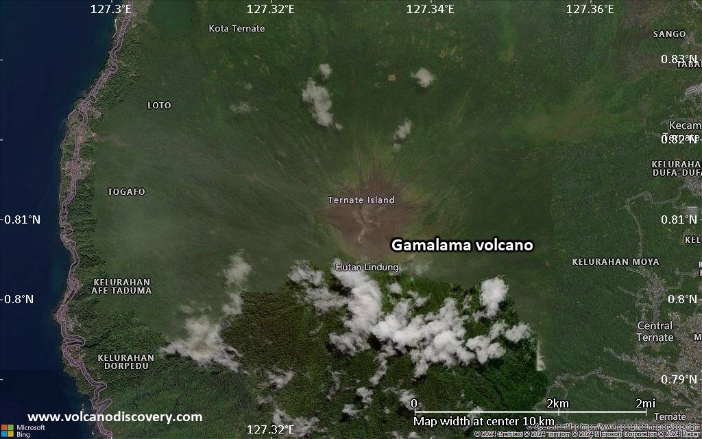
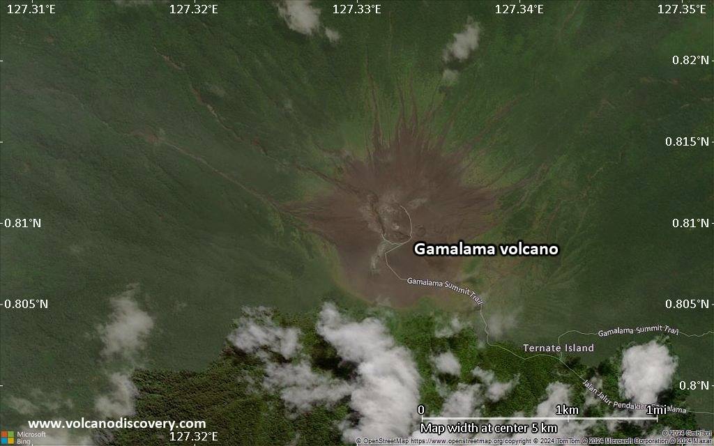
The island of Ternate was a major regional center in the Portuguese and Dutch spice trade for several centuries, which is the main reason the historic activity of Gamalana volcano is so well dosumented. Eruptions, recorded frequently since the 16th century, typically originated from the summit craters, although flank eruptions have occurred in 1763, 1770, 1775, and 1962-63. Some eruptions such as in 1771, 1773, 1775, 1838, 1871, and as lately as in 1962 caused fatalities.

Gamalana has 9 craters: Arfat Crater, Madiena, K1, K2, K3, K4, Laguna Lake, Tolire Jaha and Tolire Kecil. 3 cones, progressively younger to the north, form the summit of Gamalama volcano. Several maars and vents define a rift zone, parallel to the Halmahera island arc, that cuts the volcano.
---
Source: GVP, Smithsonian Institution

Gamalama Volcano Photos

Significant volcanic eruptions: Gamalama volcano

In the past 10,000 years, Gamalama has had at least 67 confirmed eruptions, all documented by historical records or observations. Additionally, there are 20 uncertain or discredited eruptions from Gamalama volcano.
The table below lists all known eruptions (date in bold face) of Gamalama volcano since around 1900. Updates on the most recent volcanic activity of Gamalama can be found on the news page of Gamalama volcano.
DateNoteVEIDeathsDamage
2018 Oct 4 - Oct 6
Historical obs./docs.
1
2016 Aug 3 - Aug 4Summit crater
Historical obs./docs.
1
2015 Jul 16 - Sep 8Summit crater
Historical obs./docs.
2
2014 Dec 18 - Dec 25Summit crater
Historical obs./docs.
2
2014 Dec 18
(eruption 2014 Dec 18 - Dec 25)
Historical obs./docs.
01
Info
2012 Sep 15 - Sep 17Summit crater
Historical obs./docs.
1
2011 Dec 27
(eruption 2011 Dec 5 - Dec 23)
Historical obs./docs.
34
Info
2011 Dec 5 - Dec 23Summit crater
Historical obs./docs.
2
?? 2008 May 10
Uncertain Eruption
1
?? 2007 Aug 23
Uncertain Eruption
1?
2003 Jul 31 - Oct 2 ±3 d.
Historical obs./docs.
2
1996 Jul 2 ±182 d.
Historical obs./docs.
2?
1994 Jan 16 ±15 d. - Oct 15 or later
Historical obs./docs.
2
1993 May 6 - May 21
Historical obs./docs.
2
?? 1991 Jun 15
Uncertain Eruption
1?
1990 Apr 25 - Apr 26
Historical obs./docs.
3?
1988 Feb 12 - Mar 16 ±15 d.
Historical obs./docs.
2
1983 Aug 9 - Aug 12
Historical obs./docs.
3
1980 Sep 4 - Sep 23
Historical obs./docs.
2
1962 Dec 31 - 1963 Jan 2 ?East flank
Historical obs./docs.
2
1962 Dec 31
(eruption 1962 Dec 31 - 1963 Jan 2 ?)
Historical obs./docs.
25
Info
1938 Sep 8
Historical obs./docs.
2
1933 Nov 12
Historical obs./docs.
2
1932 Nov 10 - Nov 13
Historical obs./docs.
2
1923 Apr 13 - May 6
Historical obs./docs.
2
1918 Aug - Sep 4
Historical obs./docs.
1
1911 Sep 2 - Sep 6
Historical obs./docs.
1
1907 Nov 17 - Nov 20
Historical obs./docs.
2
?? 1900 May - Jun 4 ±4 d.
Uncertain Eruption
1
Remark:
Our list of volcanic eruptions closely follows the database of eruptions of the Smithsonian's Global Volcanism Project (GVP), the internationally most recognized data source for volcanic eruptions, but also includes significant eruptive episodes or related volcano events. "Volcanic eruptions" are usually to be understood as sequences of individual eruptive episodes that can follow each other, or even overlap (if several vents are involved), and can last many years, decades or even longer. For example, the current activity of Stromboli volcano is understood as a single eruption that has been ongoing since 1934.
Sources: NOAA National Centers for Environmental Information (NCEI), Global Significant Volcanic Eruptions Database. doi:10.7289/V5TD9V7K | Global Volcanism Project / Smithsonian Institution

Eruptions of Gamalama volcano


2007-2008 eruption
Seismic activity increased at Gamalama volcano beginning 20 August 2007 and a few days later, there was a small eruption. On 23 August, white and gray plumes rose to an altitude of 2.1 km. Authorities banned access within a 2-km radius of the active crater.
Activity continued into 2008 with weak occasional ash and steam emissions. On 11 May 2008, CVGHM reported that emissions from Gamalama had risen to higher altitudes during the previous two days. On 10 May, white-to-gray plumes rose to an altitude of 1.8 km and drifted N. On 11 May, white plumes increased throughout the day from 1.7 to 2.2 km altitude.
---
Source: GVP monthly reports

2003 eruption: pyroclastic flows and ash fall on Ternate
On 31 July, a series of strong explosions occurred, producing ash plumes up to 2 km above the crater. A pyroclastic flow traveled down Togorar valley on the NE flank of Gamalama volcano.
On 1 August, ashfall was 1-3 cm thick in the E part of the island and some of the local population was evacuated. Ternate town ca. 7 km east of Gamalana was covered with thick ash. There were no reports of casualties or damage.
Ash explosions continued until October 2003.

1994 Aug 5 eruption: 3 km high ash plume
An unusually powerful and sudden eruption occurred on 5 August 1994 at 21h25 local time, producing an ash cloud reaching 3 km above the summit and strong ash fall in nearby areas. An aviation warning was issued for the area.
A felt earthquake a few minutes before the eruption had an intensity of MM II-III. Smaller eruptions happened in the following days and weeks, such as on 14 August when there was ashfall in Ternate. The frequency of eruptions in this period was 5-20 minor explosions/day.
---
Source: GVP monthly reports

1993 eruptions - powerful ash emissions and minor pyroclastic flows
Strong eruptions occurred in May 1993. Explosive eruptions produced ash plumes up to 3 km high and pyroclastic flows. ...more info

1990 eruption
A powerful series of eruptions at Gamalana began on 25 April 1990, with ash clouds reaching 5 km above the volcano and producing strong pyroclastic flows traveling 4.5 km distance, leaving a 5 m thick deposit. ...more info

1988 eruption
Gamalama volcano eruption on 12 February 1988 caused ash fall over Ternate Island and the evacuation of 3000 people.

1983 eruption: 5000 people evacuated
A strong eruption was reported on 9 August at 04h45 local time. A thick black eruption column containing incandescent material rose 1.5 km and caused a pyroclastic flow traveling down the N flank, destroying homes and plantations.
Ash fell W of the volcano, closing the local airport of Ternate. Explosions on 10 August produced 1.5-km ash columns.
More than 5,000 persons living near the volcano were evacuated. No casualties were reported.
---
Source: GVP monthly reports

1980 eruption: 40,000 people evacuated
Gamalama Volcano started erupting on 4 September 1980 ejecting incandescent tephra and glowing bombs to up to 1 km distance. A new crater was formed on the ENE side of the summit.
On 5 Sep eruptions caused forest fires and ash fall over large parts of the island. At Ternate City 7 km E of the crater ash fall reached 10 cm. About 40,000 people evacuated to Tidore Island. A new crater formed ENE of the summit. Eruptions continued until the end of September 1980. ...more info

Gamalama Volcano FAQ

+When was the last eruption of Gamalama volcano?

+How often does Gamalama volcano erupt?

+How active is Gamalama volcano at present?

+When was the largest eruption of Gamalama volcano?

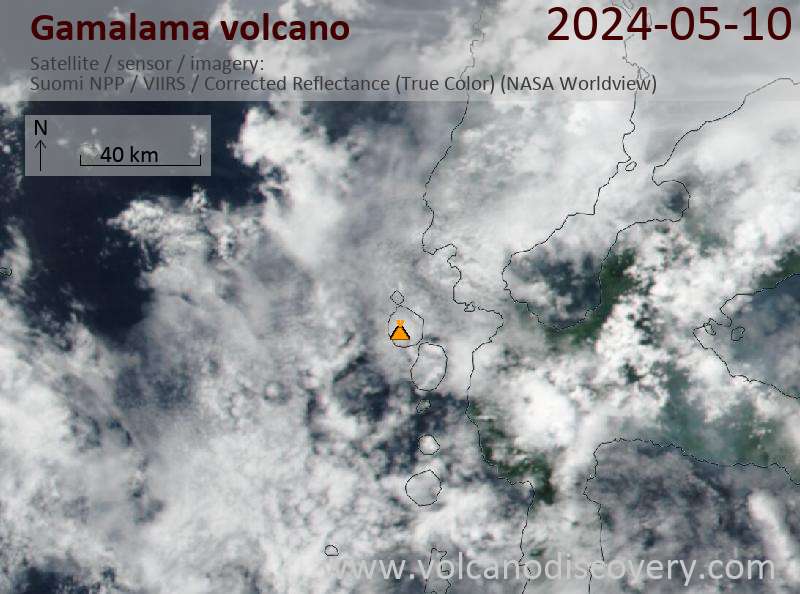
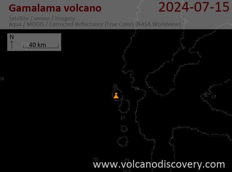
Latest satellite images

Gamalama satellite image sat1Gamalama satellite image sat2

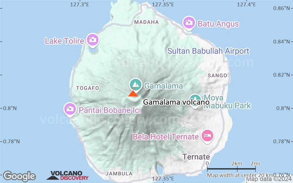
Gamalama Volcano Maps

Below is a selection of maps showing the location and surroundings of the volcano at various resolutions based on aerial-imagery / terrain maps. Feel free to use them for non-commercial purposes on your blog or website as long as you credit them with a link back to this page (click to copy it).
Satellite/aerial-type map of Gamalama volcano (world scale)
Terrain-type map of Gamalama volcano (world scale)
Satellite/aerial-type map of Gamalama volcano (region scale large)
Terrain-type map of Gamalama volcano (region scale large)
Satellite/aerial-type map of Gamalama volcano (region scale medium)
Terrain-type map of Gamalama volcano (region scale medium)
Satellite/aerial-type map of Gamalama volcano (region scale small)
Terrain-type map of Gamalama volcano (region scale small)
Satellite/aerial-type map of Gamalama volcano (local scale large)
Terrain-type map of Gamalama volcano (local scale large)
Satellite/aerial-type map of Gamalama volcano (local scale medium)
Terrain-type map of Gamalama volcano (local scale medium)
Satellite/aerial-type map of Gamalama volcano (local scale small)
Terrain-type map of Gamalama volcano (local scale small)
Satellite/aerial-type map of Gamalama volcano (scale of 10s of km)
Terrain-type map of Gamalama volcano (scale of 10s of km)
Satellite/aerial-type map of Gamalama volcano (scale of 20-40 km)
Terrain-type map of Gamalama volcano (scale of 20-40 km)
Satellite/aerial-type map of Gamalama volcano (scale of approx. 10-20 km)
Terrain-type map of Gamalama volcano (scale of approx. 10-20 km)
Satellite/aerial-type map of Gamalama volcano (scale of 5-10 km)
Satellite/aerial-type map of Gamalama volcano (scale of few kilometers)
Volcanoes & Earthquakes - new app for Android
Guaranteed tours
1-14 Oct 2025: Desert, salt and volcanoes - Danakil desert (Ethiopia)
4-12 Oct 2025: From Stromboli to Etna - Sicily and Eolian Islands (Italy)
6-21 Oct 2025: From Krakatau to Bali - Java (Indonesia)
3-19 Nov 2025: Volcanoes and Spices - Sulawesi/Halmahera (Indonesia)
9-19 Nov 2025: Guatemala Volcano Special - Guatemala
= spaces available   = guaranteed   = few spaces left   = booked out
Wed, 12 Feb 2025, 15:00

Gamalama volcano (Indonesia) - Smithsonian / USGS Weekly Volcanic Activity Report for 5 February-11 February 2025 (Continuing Activity)

Although there was no eruptive activity reported at Gamalama, in a 5 February press release the Pusat Vulkanologi dan Mitigasi Bencana Geologi (PVMBG) noted that the number of daily deep volcanic earthquakes had increased. A total of 36 deep volcanic earthquakes were recorded during 29 January-4 February, with the highest daily number (10) recorded on 1 February. The number of deep volcanic earthquakes generally averages 1-2 events per day. ... Read all
Wed, 28 Feb 2024, 15:00

Gamalama volcano (Halmahera) - Smithsonian / USGS Weekly Volcanic Activity Report for 21 February-27 February 2024 (Continuing Activity)

Although there was no eruptive activity reported at Gamalama, in a 23 February press release PVMBG noted that the number of daily deep volcanic earthquakes had significantly increased. A total of 14 deep volcanic earthquakes were recorded by the seismic network on 22 February, higher than the average of 2-3 events per day that had been recorded since January 2023. At 1623 on 22 February an observer saw a dense white-to-gray ash plume rising 400 m above the summit and drifting W. ... Read all

On this page:

Try our free app!
Volcanoes & Earthquakes - new app for Android
Android | iOS version

More on VolcanoDiscovery

Why is there advertising on this site?

Support us - Help us upgrade our services!

We truly love working to bring you the latest volcano and earthquake data from around the world. Maintaining our website and our free apps does require, however, considerable time and resources.
We need financing to increase hard- and software capacity as well as support our editor team. We're aiming to achieve uninterrupted service wherever an earthquake or volcano eruption unfolds, and your donations can make it happen! Every donation will be highly appreciated. If you find the information useful and would like to support our team in integrating further features, write great content, and in upgrading our soft- and hardware, please make a donation (PayPal).

Planned features:Thanks to your past donations, these features have been added recently:
Download and Upgrade the Volcanoes & Earthquakes app to get one of the fastest seismic and volcano alerts online:
Android | IOS
Thank you!
Sources: VolcanoDiscovery / VolcanoAdventures and other sources as noted.
Use of material: Most text and images on our websites are owned by us. Re-use is generally not permitted without authorization. Contact us for licensing rights.
Volcanoes & Earthquakes
VolcanoDiscovery Home
Volcanoes | Earthquakes | Photos | Volcano News | | Shop | App
Adventure & Study Travel
Tours to Volcanoes and Volcanic Areas: walking tours, photo tours, study tours
Tours & Dates | FAQ | About us
Get our newsletter!
Company info
Contact | Legal info | Terms & conditions
Follow us
Follow us on facebook Follow us on Instagram Follow us on Bluesky Follow us on Twitter Visit our Youtube channel
EN | DE | EL | ES | FR | IT | RU
VolcanoDiscovery GmbH, Germany, Reg. nr.: HRB 103744, EU Tax Id: DE 297 465 123 owned and created by
Dr. Tom Pfeiffer, volcanologist, volcano photographer, tour organizer member of
IAVCEI
IAVCEI
Vulkanologische Gesellschaft
Volcanological Society
Ecotourism Greece
Ecotourism Greece
RUV insurance
Insured by R+V
VolcanoDiscovery © 2004- All Rights Reserved | Privacy - Cookie Settings