Pinatubo Volcano
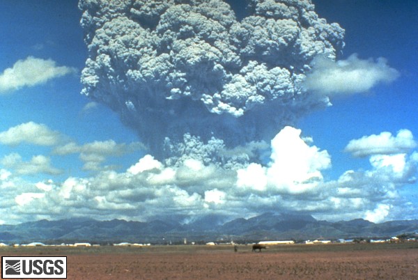
Pinatubo volcano exploded spectacularly on 15 June 1991. The Pinatubo eruption on 15 June 1991 was the second largest volcanic eruption of the 20th century.
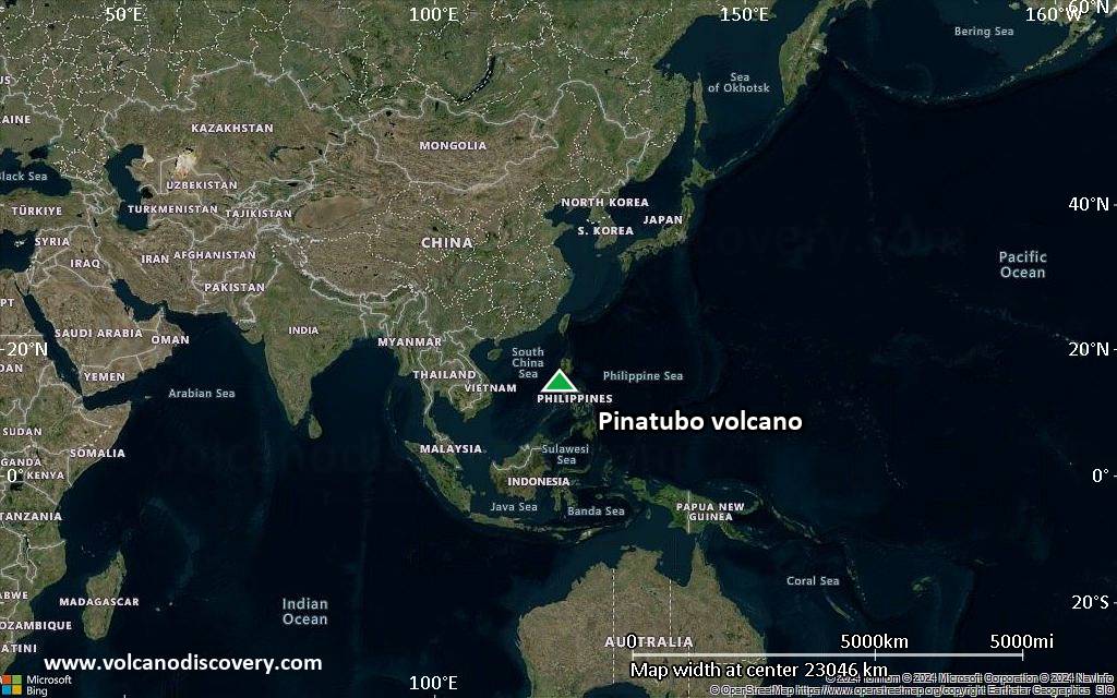
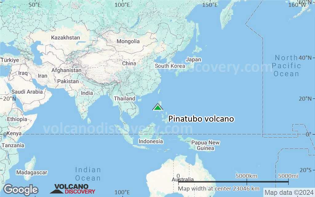
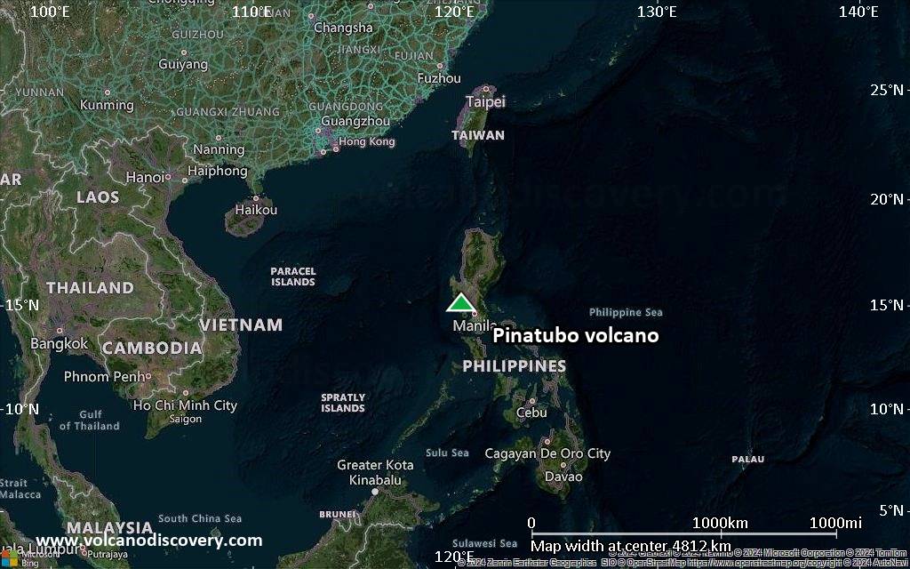
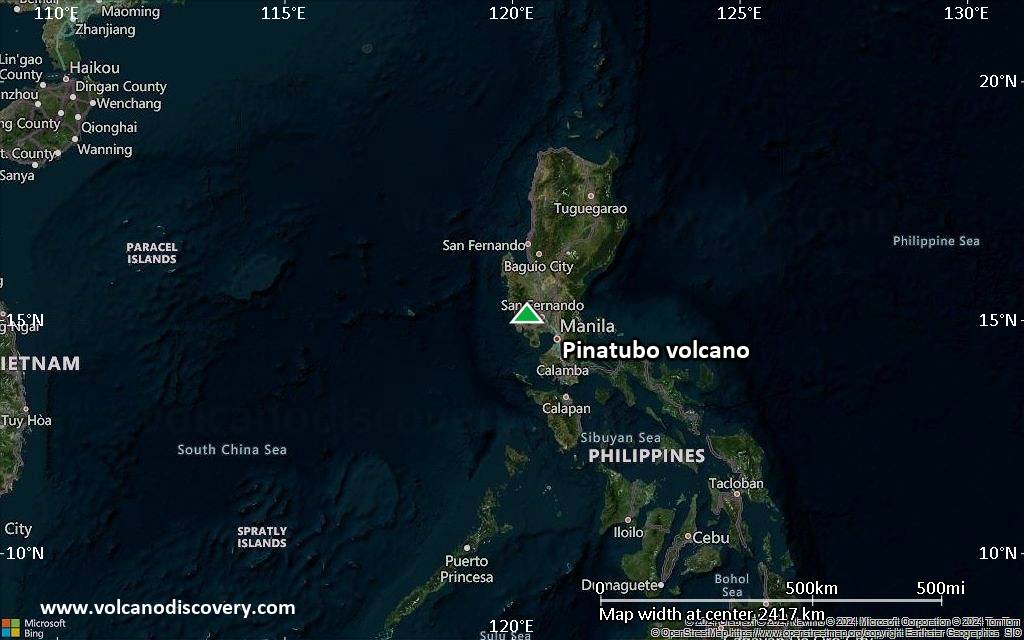
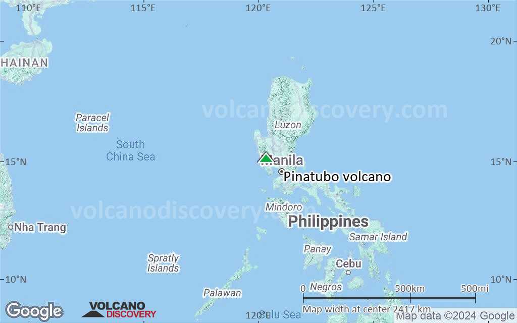
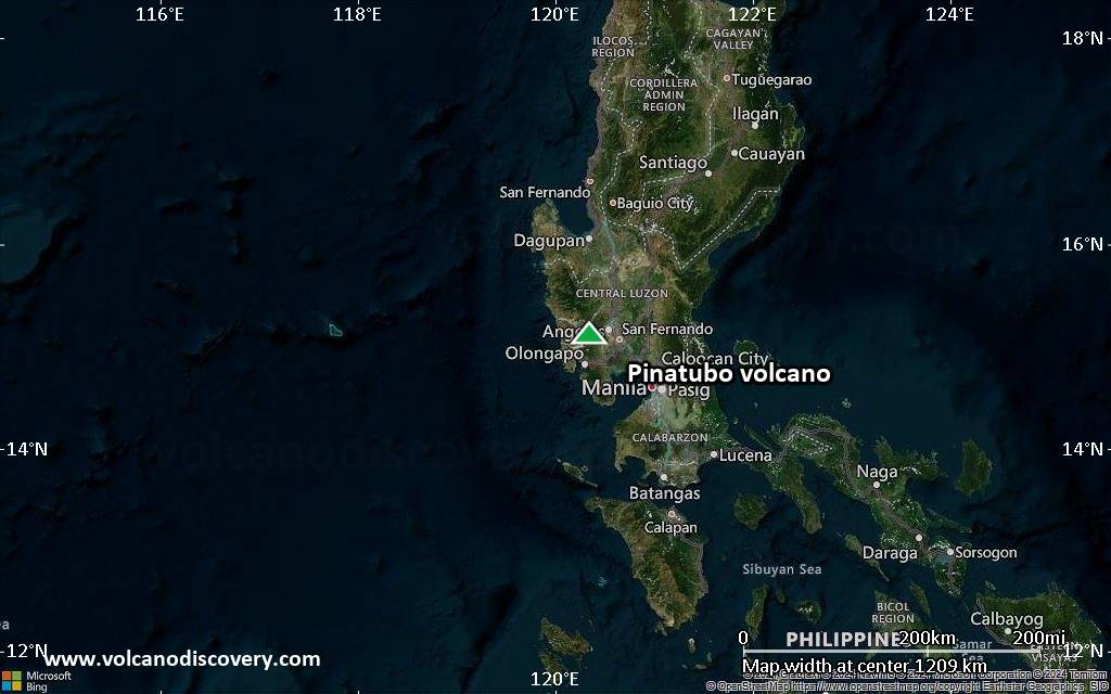
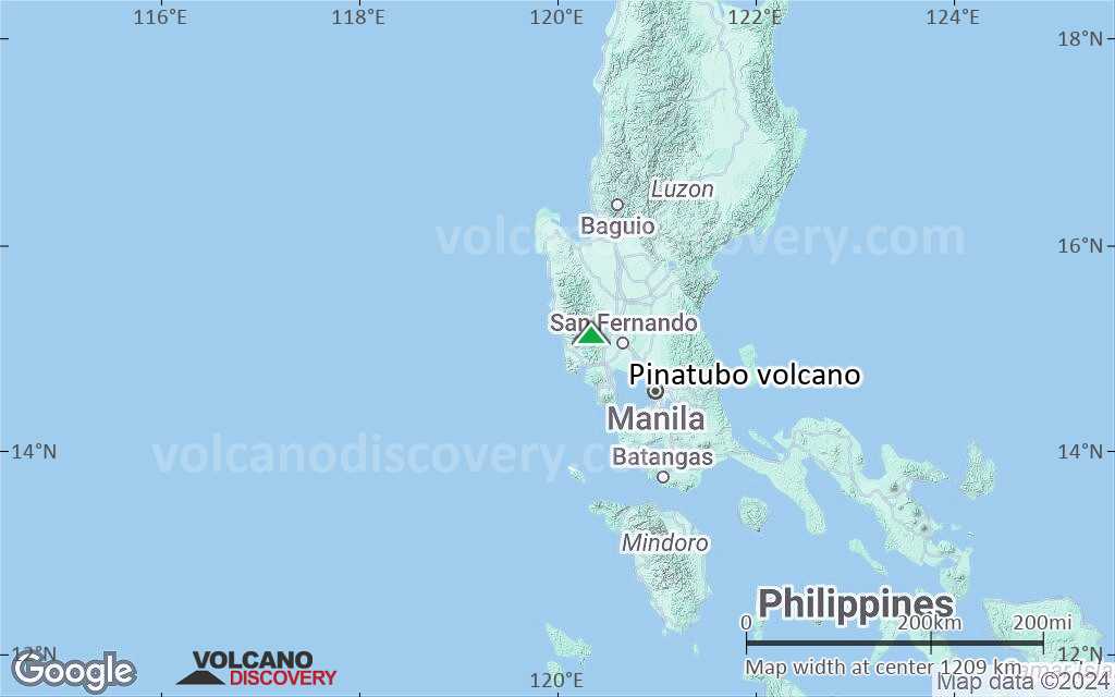
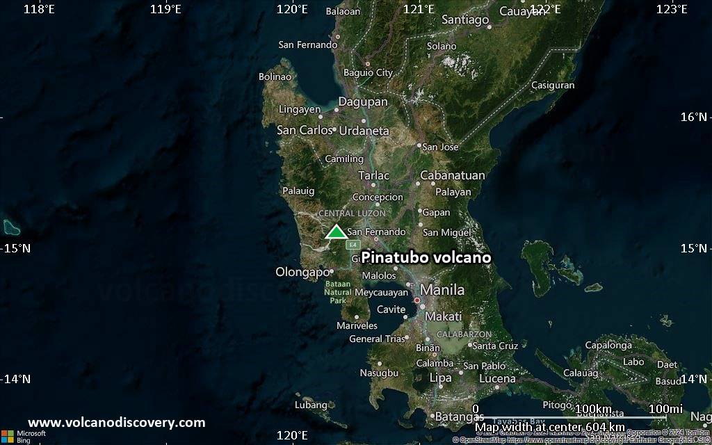
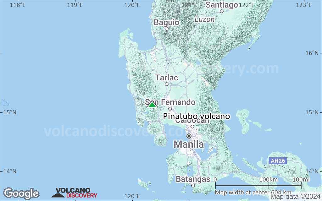
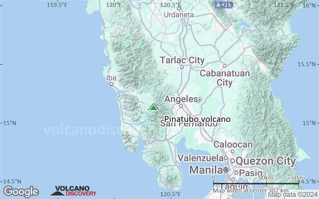
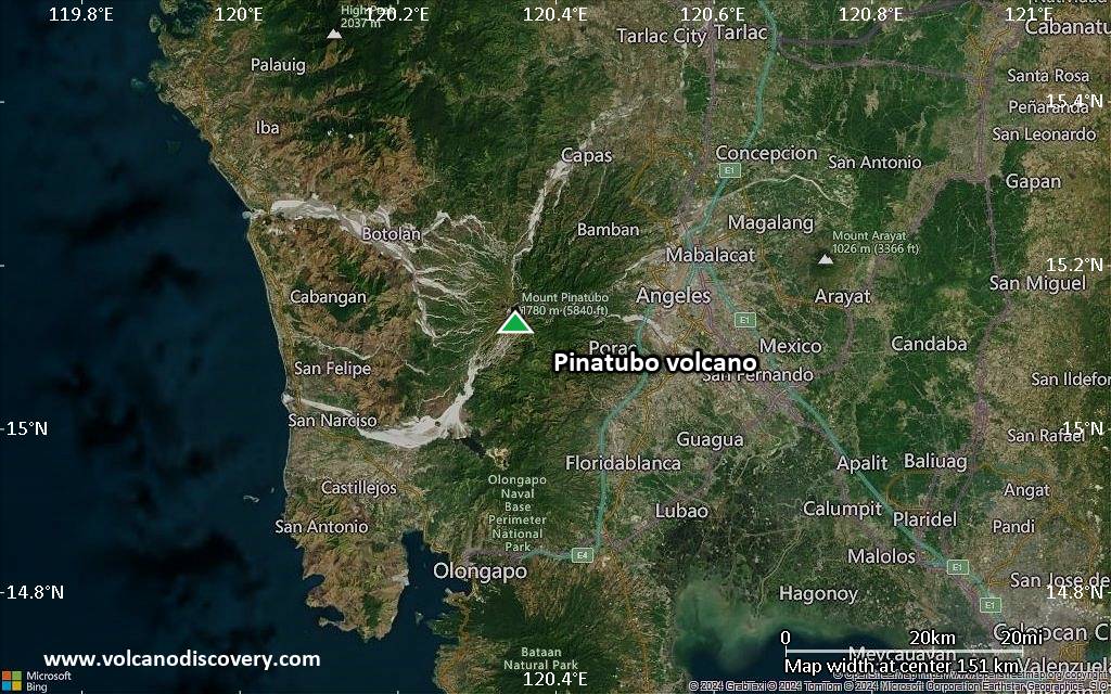
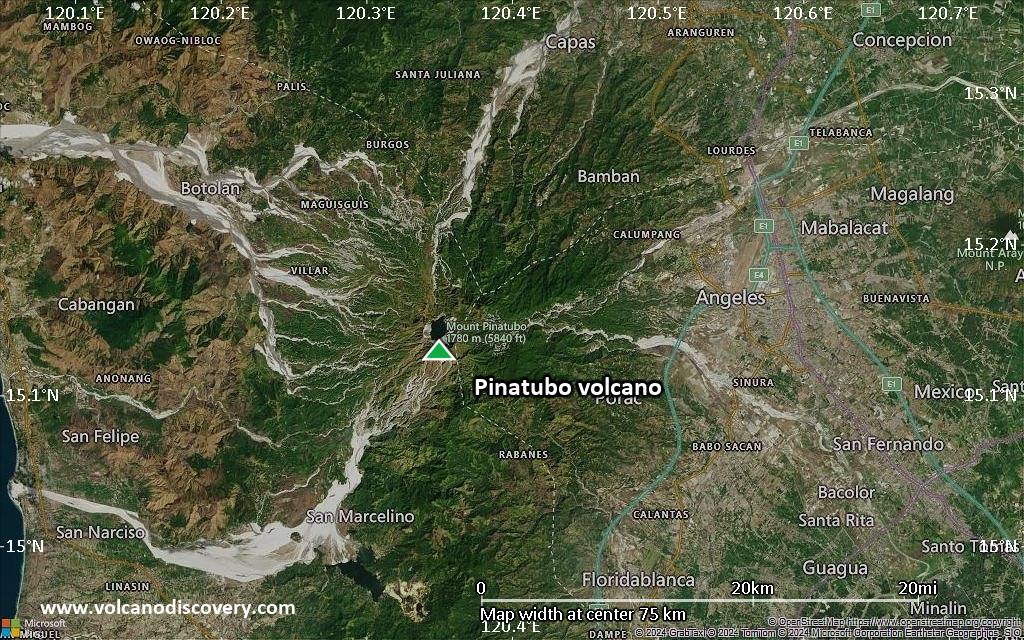
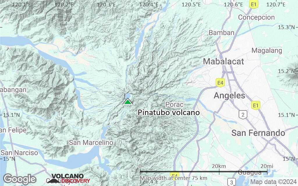
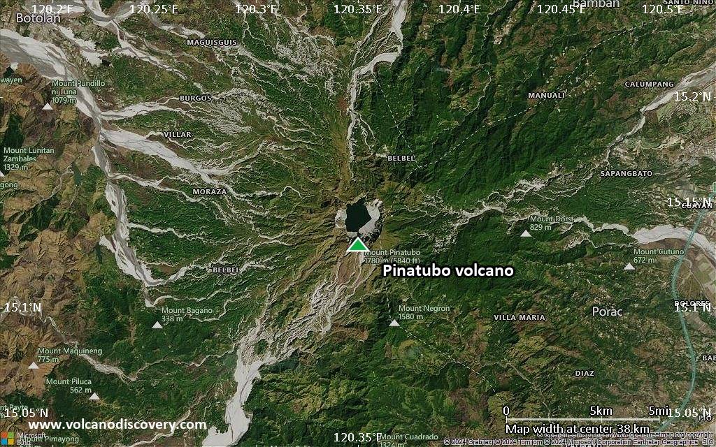
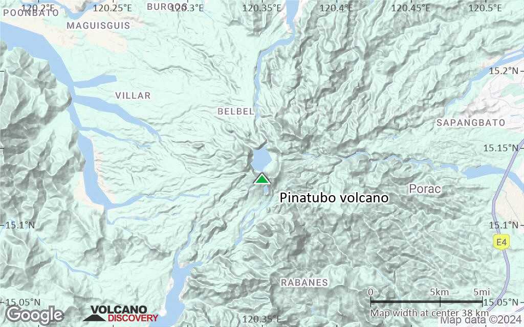
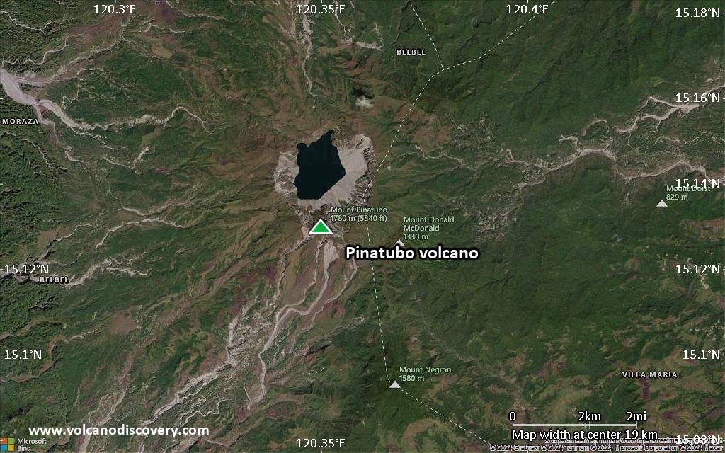
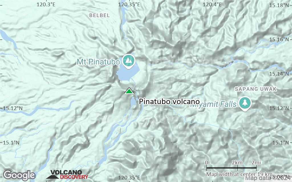
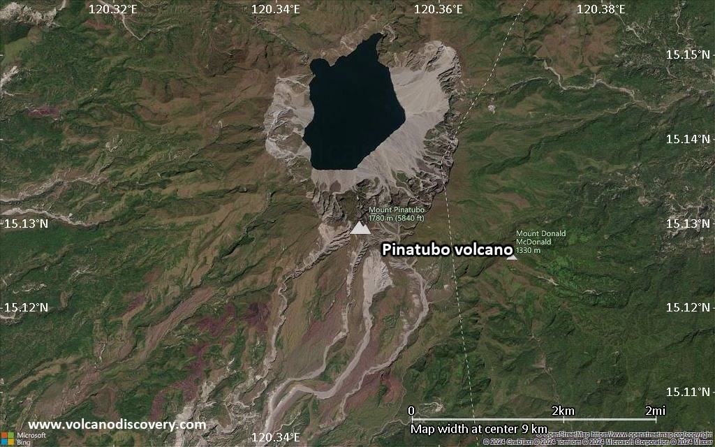
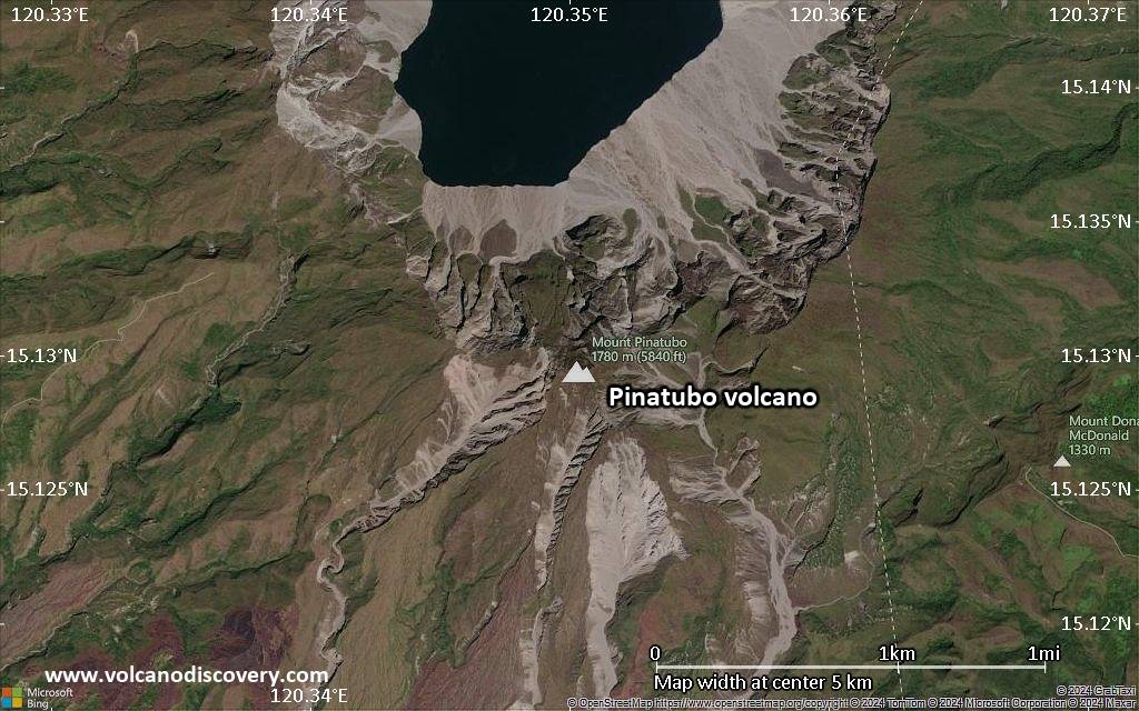
Pinatubo is a complex of lava domes located 100 km NW of Manila city, Luzon Island, Philippines.
Prior to the eruption, Pinatubo was a little known volcano and it had been dormant for 400 years. There were no known historic eruptions. Before the eruption in 1991 Pinatubo was 1745 m high (ca. 250 m more than now), and was only 200 m higher than the nearby peaks, which are remnants of older volcanic edifices of Mt Pinatubo and hid it from views from distance. Pinatubo mostly noted for a failed geothermal development project.
Eruptions of Mount Pinatubo
Pinatubo has had at least 6 periods of activity with large explosive eruptions in its past 35,000 years prior to the 1991 eruption. The 1991 eruption in this context actually ranks as one of the smaller eruptions. An eruption, which occurred 35,000 years ago and probably created the caldera, was likely much bigger.
Pinatubo volcano eruptions: 2021?, 1992, 1991 (Plinian eruption), 1450 ± 50 years, 1050 BC ± 500, 3550 BC (?), 7030 BC ± 300, 7460 BC ± 150, 15,000 BC, 33,000 BC
Latest nearby earthquakes
| Date and Time | Mag / Depth | Distance / Location | |||
|---|---|---|---|---|---|
| Nov 19, 08:49 pm (Universal Time) | 2.7 115 km | 18 km (11 mi) to the N | Info | ||
Background
Geology of Mt Pinatubo volcano
Regional setting:
Pinatubo is flanked to the west and probably underlain by by the Zambales Ophiolite Complex, an easterly-dipping section of Eocene oceanic crust which was uplifted in the late Oligocene.
The second unit are sediments of the Tarlac Formation, mostly sandstone and siltstone in the older parts, and conglomerates and volcanic sediments and dikes in the younger. The Tarlac formation is found in the north, east and southeast of Pinatubo and formed contemporary with the oldest known volcanic centers in the area, including Mount Mataba or the diorite of the Dizon Mine, the sub-surface remnant of an ancient vent.
The ancient volcanoes of the Tarlac Formation originated from the same east-dipping subduction along the Manila trench that continues to the present.
Ancient Pinatubo:
Pinatubo was formed in 2 stages. The ancestral Pinatubo started to form about 1 million years ago, and built an andesite - dacite stratovolcano whose center was at the same location as today. Remnants of this precessor are seen in the ancient 3.5x4.5 wide caldera. Ancient Pinatubo had a number of flank vents, that formed the domes of Mount Negron, Mount Cuadrado, Mataba, Bituin plug, and the volcanic plug of Tapungho.
Deep erosion in the Sacobia, Porac, Marimla, and Porac River valleys, and weathering of the lavas suggests that activity of the ancestral volcano ended several tens of thousands of years (or more) before the caldera-forming eruption and initial growth of the modern Pinatubo (ca. 35,000 years ago).
Modern Pinataubo:
After the 1991 eruption, scientists (mainly from PHILVOLCS & USGS) carried out intensive fieldwork on the deposits of present-day Pinatubo to analyze its eruptive history. They distinguished at least 6 eruptive periods of modern Pinatubo, characterized by repeated, large explosive eruptions:
Inararo Eruptive Period -- >35,000 14C yr B.P.
The largest eruption in the history of modern Pinatubo occurred 35,000 (radiocarbon) years ago. It deposited up to 100 m or more of pumice and ash flows on all sides of Mount Pinatubo.
Sacobia Eruptive Period -- ~17,000 yr B.P.
A phase of explosive eruptions occurred 17,000 years ago and produced 2 debris flow deposits which are visible on the north bank of the Sacobia River.
Pasbul Eruptive Period -- ~9,000 yr B.P.
A large explosive eruption occurred ca. 9000 years ago. It produced pyroclastic-flow and tephra-fall layers exposed along the road between Sitio Pasbul, Camias, Porac, and the Gumain River. The pyroclastic flows overtopped the southeastern rim of the Tayawan caldera and nearly or completely filled the valley of the Gumain River.
Crow Valley Eruptive Period -- ~6,000-5,000 yr B.P.
Large eruptions 6,000-5,000 years ago produced pyroclastic flow deposits on both sides of upper Crow valley.
Maraunot Eruptive Period -- ~3,900(?)-2,300 yr B.P.
Eruptions in this period produced pyroclastic flows and lahars.
Buag Eruptive Period -- ca. 1450 AD
The last activity cycle prior to the 1991 eruption was in 1450 ± 50 AD. It produced pyroclastic flows that entered all valley of Pinatubo except the Gumain and Porac rivers.
-------------
Sources of information
The most comprehensive information about Pinatubo volcano is collected in 62 scientific papers in the following volume:
- Newhall et al (1996) "Eruptive history of Mount Pinatubo", in NEWHALL, C.G. and PUNONGBAYAN, R.G. (eds.) (1996) "FIRE AND MUD: ERUPTIONS AND LAHARS OF MOUNT PINATUBO, PHILIPPINES", Philippine Institute of Volcanology and Seismology (PHILVOLCS) / USGS / University of Washington Press (online at pubs.usgs.gov/pinatubo/index.html)
- GVP Pinatubo volcano information
- Mount Pinatubo, Philippines USGS / CVO website about Pinatubo
-------------
Pinatubo Aeta people
The forested area of Pinatubo mountain was also known as home for a tribe of the Aeta people,- the small, dark skinned, and kinky haired people believed to be the nearest descendants of the original inhabitants of the Philippines, who arrived through land bridges that linked the Philippines with the Asian mainland some 30,000 years ago. They considered the mountain the home of Apo Namalyari, the Great Protector and Provider. (Source: CCP Encyclopedia of Arts)
Significant volcanic eruptions: Pinatubo volcano
| Date | Note | VEI | Deaths | Damage | |
|---|---|---|---|---|---|
Historical obs./docs. | 1 | ||||
| 1993 Oct 4 (eruption | Historical obs./docs. | 0 | 14 | Info | |
| Caldera floor Historical obs./docs. | 1 | ||||
| 1993 Jun 26 (eruption | Historical obs./docs. | 1 | 4 | Info | |
| Center of caldera lake Historical obs./docs. | 1 | ||||
| 1992 Jul 12 (eruption | Historical obs./docs. | 1 | 6 | Info | |
| Lower north flank and summit Historical obs./docs. | 6 | ||||
| 1991 Jun 15 (eruption | Historical obs./docs. | 6 | 800 | heavy | Info |
| 5? | |||||
| -1050 BC (eruption | Historical obs./docs. | 6 | Info | ||
| 6 | |||||
| -3550 BC (eruption | Historical obs./docs. | 6 | Info | ||
| 6 | |||||
| ? | |||||
| Tayawan caldera | 6? | ||||
Eruptions of Pinatubo volcano
On 31 October 2009 a magnitude 5.0 tectonic earthquake with a depth of 79 km hit 37 km WSW of the summit of Pinatubo volcano.
Heavy monsoon rains caused by typhoon Kiko generated heavy floods in August 2009. 12 people were killed in the town of Botolan in August 2009.
During 2001 the caldera lake on Mt Pinatubo rose to dangerous levels and the water changed color in January 2004.
The June 15, 1991 eruption was probably the second largest explosive eruption of the 20th century, second in size only to the Katmai 1912 eruption in Alaska. It was about ten times larger than the eruption of Mount St. Helens in 1980.
->Chronology of the 1991 eruption ...more info
Pinatubo Volcano FAQ
+When was the last eruption of Pinatubo volcano?
The last confirmed eruption of Pinatubo occurred in 2021.
+How often does Pinatubo volcano erupt?
There are no known historic eruptions, but evidence from geologic records shows that it has had at least 9 eruptions over the past 10,000 years. This number is likely much higher because many past eruptions might not have left evidence recognizeable today and/or the volcano might not have been studied in too much detail. Using the available data, a very conservative estimate is that Pinatubo volcano erupts every 1,100 years.
+How active is Pinatubo volcano at present?
Pinatubo volcano is occasionally active: Since 1900, it has had 4 eruptions, and been active during 4 years out of 126 as of now. This means, Pinatubo has been in eruption one in 31.5 years on average. The last eruption was in 2021 and ended 4 years ago.
+When was the largest eruption of Pinatubo volcano?
The largest eruption of Pinatubo volcano in historic times occurred in 1991. It ranks as a plinian eruption with a magnitude 6 on the VEI (Volcanic Explosivity Index) scale. Eruption of this size are often catastrophic on a regional scale.
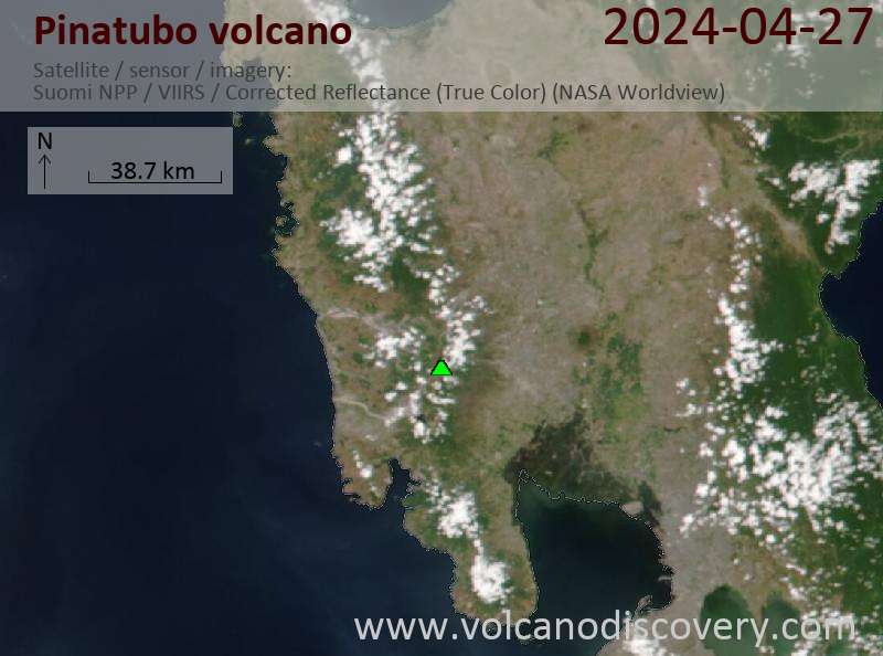
Latest satellite images
Pinatubo Volcano Maps