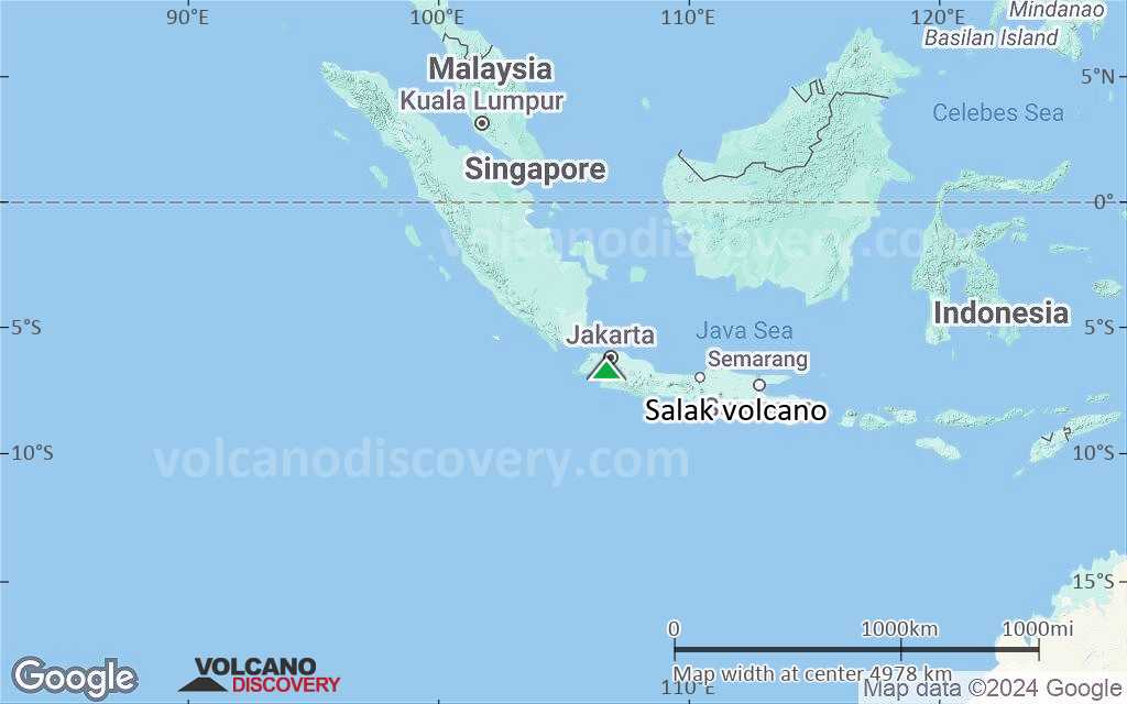
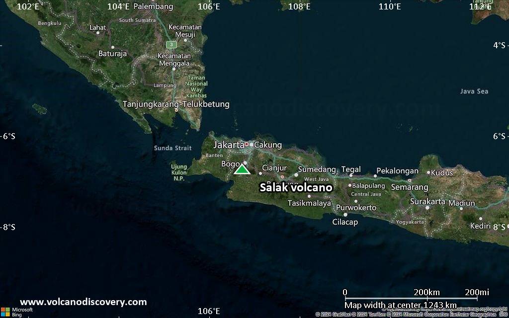
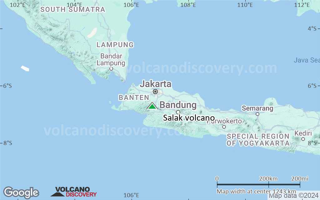
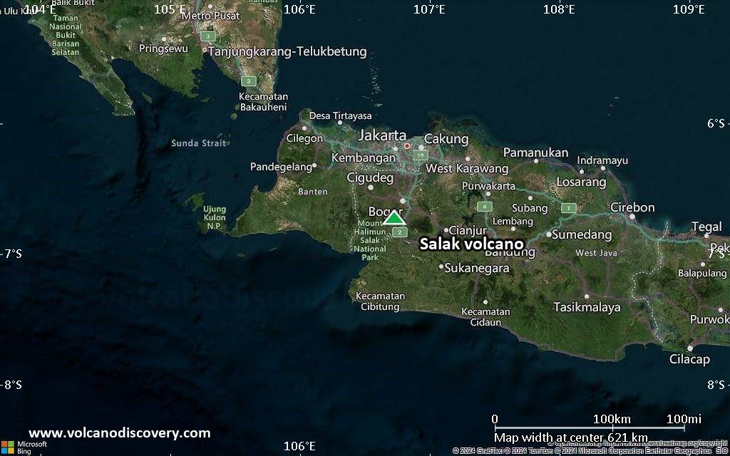
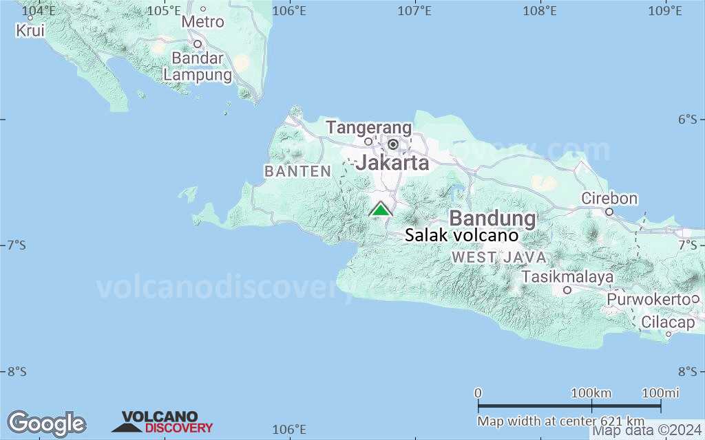
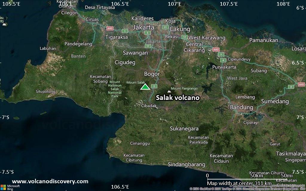
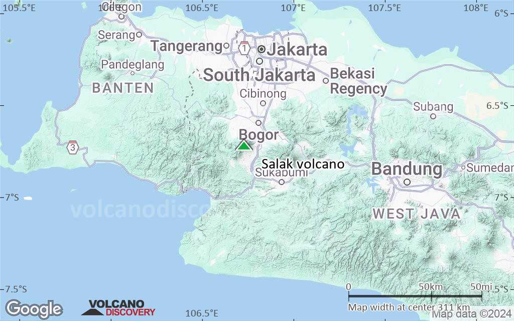
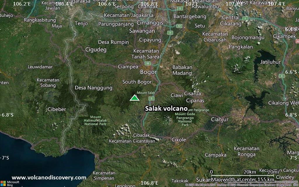
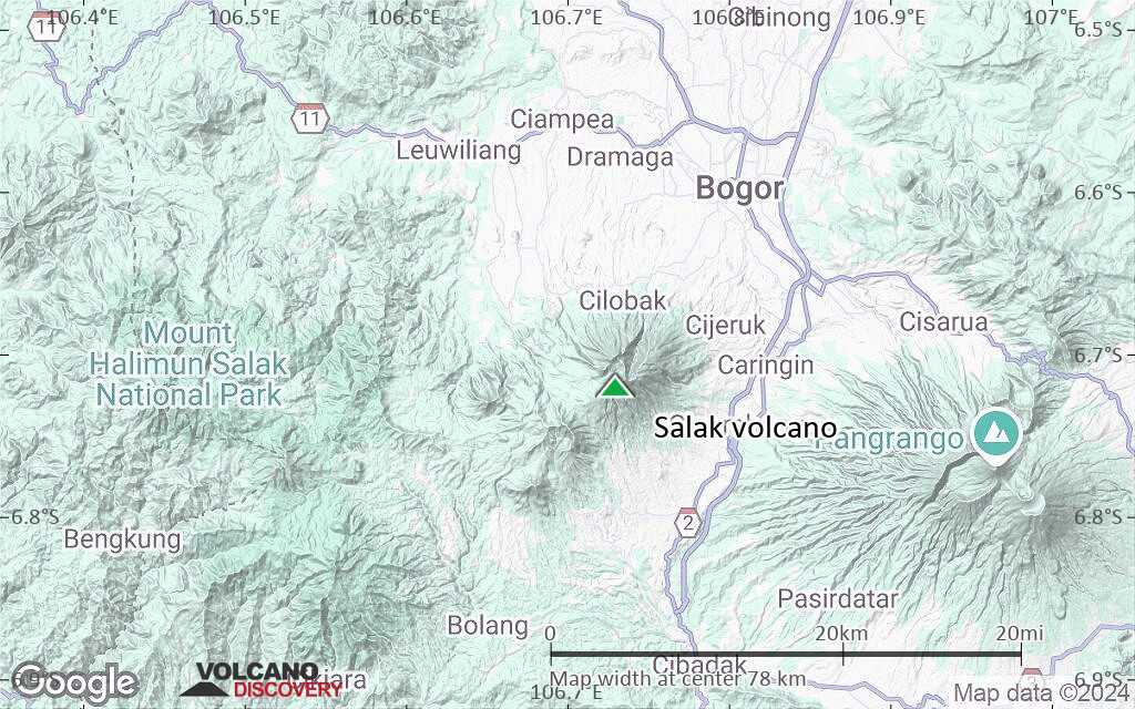
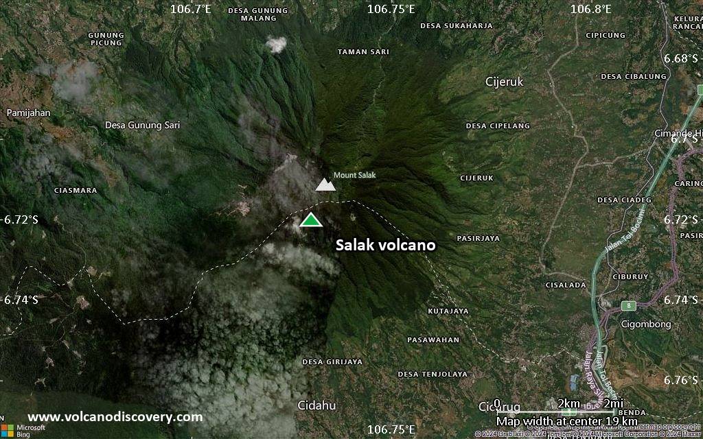
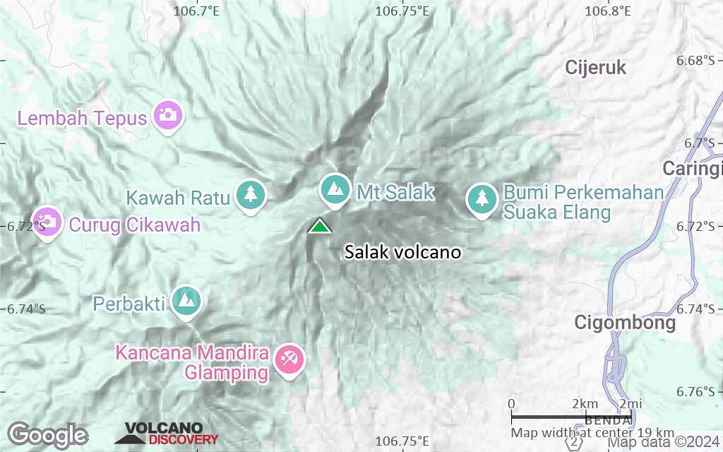
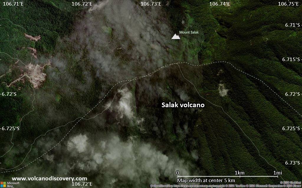
| RSS | EN | DE | EL | ES | FR | IT | RU

Salak Volcano

Updated: Nov 20, 2025 17:51 GMT -
stratovolcano
West Java, Indonesia, -6.72°S / 106.73°E
Summit height: 2211 m / 7,254 ft
Current status: normal or dormant (1 out of 5)
Last update: 11 Dec 2021 (FALSE ALARM: Indonesian authorities state an eruption has NOT occurred)

Salak volcano is at the NE end of an old eroded volcanic chain. Historic eruptions from Salak volcano were phreatic explosions from craters on its flank in a prominent fumarole area. Salak volcano is an area with intense hydrothermal exploration.

[smaller] [larger]
Typical eruption style: Explosive
Salak volcano eruptions: 1938, 1935, 1919, 1902-03, 1780, 1698-99

Latest nearby earthquakes

Date and TimeMag / DepthDistance / Location
Nov 16, 03:49 pm (GMT +7)
2.4

22 km
14 km (8.4 mi) to the SW Java, Indonesia Info
Saturday, November 15, 2025 GMT (1 quake)
Nov 15, 09:44 am (Universal Time)
2.5

141 km
30 km (19 mi) to the NW Java, Indonesia Info

Background

Flank cones occur on the SW flank and at the northern foot of the forested volcano. The summit is truncated by 2 large breached craters, one to the NE and one to the WN. The western crater breach originated from a debris avalanche that left a deposit extensing 10 km to the WNW from the summit.

Significant volcanic eruptions: Salak volcano

In the past 10,000 years, Salak has had at least 5 confirmed eruptions, all documented by historical records or observations. There is one uncertain or discredited eruption in 1699 AD from Salak volcano.
The table below lists all known eruptions (date in bold face) of Salak volcano in historic times and during the past 10,000 years. Updates on the most recent volcanic activity of Salak can be found on the news page of Salak volcano.
DateNoteVEIDeathsDamage
2007 Jul 7
(eruptive episode 2007 Jul 7)
Historical obs./docs.
06
Info
1938 Jan 31 ±5 d.Kawah Cikaluwung Putri
Historical obs./docs.
2
1935 FebKawah Cikaluwung Putri
Historical obs./docs.
2
1919Kawah Ratu
Historical obs./docs.
2
1902 - 1903Kawah Ratu
Historical obs./docs.
2
1780Kawah Ratu
Historical obs./docs.
2
?? 1699 AD Jan 5
Uncertain Eruption
?
Remark:
Our list of volcanic eruptions closely follows the database of eruptions of the Smithsonian's Global Volcanism Project (GVP), the internationally most recognized data source for volcanic eruptions, but also includes significant eruptive episodes or related volcano events. "Volcanic eruptions" are usually to be understood as sequences of individual eruptive episodes that can follow each other, or even overlap (if several vents are involved), and can last many years, decades or even longer. For example, the current activity of Stromboli volcano is understood as a single eruption that has been ongoing since 1934.
Sources: NOAA National Centers for Environmental Information (NCEI), Global Significant Volcanic Eruptions Database. doi:10.7289/V5TD9V7K | Global Volcanism Project / Smithsonian Institution

Eruptions of Salak volcano


2007 fatalities (6 students aphyxiated)
...more info

Salak Volcano FAQ

+When was the last eruption of Salak volcano?

+How often does Salak volcano erupt?

+How active is Salak volcano at present?

+When was the largest eruption of Salak volcano?

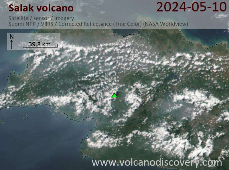
Latest satellite images

Salak satellite image sat1Salak satellite image sat2

Salak Volcano Maps

Below is a selection of maps showing the location and surroundings of the volcano at various resolutions based on aerial-imagery / terrain maps. Feel free to use them for non-commercial purposes on your blog or website as long as you credit them with a link back to this page (click to copy it).
Satellite/aerial-type map of Salak volcano (world scale)
Terrain-type map of Salak volcano (world scale)
Satellite/aerial-type map of Salak volcano (region scale large)
Terrain-type map of Salak volcano (region scale large)
Satellite/aerial-type map of Salak volcano (region scale medium)
Terrain-type map of Salak volcano (region scale medium)
Satellite/aerial-type map of Salak volcano (region scale small)
Terrain-type map of Salak volcano (region scale small)
Satellite/aerial-type map of Salak volcano (local scale large)
Terrain-type map of Salak volcano (local scale large)
Satellite/aerial-type map of Salak volcano (local scale medium)
Terrain-type map of Salak volcano (local scale medium)
Satellite/aerial-type map of Salak volcano (local scale small)
Terrain-type map of Salak volcano (local scale small)
Satellite/aerial-type map of Salak volcano (scale of 10s of km)
Terrain-type map of Salak volcano (scale of 10s of km)
Satellite/aerial-type map of Salak volcano (scale of 20-40 km)
Terrain-type map of Salak volcano (scale of 20-40 km)
Satellite/aerial-type map of Salak volcano (scale of approx. 10-20 km)
Terrain-type map of Salak volcano (scale of approx. 10-20 km)
Satellite/aerial-type map of Salak volcano (scale of 5-10 km)
Satellite/aerial-type map of Salak volcano (scale of few kilometers)
Volcanoes & Earthquakes - new app for Android
Guaranteed tours
20 Nov - 3 Dec 2025: Desert, salt and volcanoes - Danakil desert (Ethiopia)
2-10 May 2026: From Stromboli to Etna - Sicily and Eolian Islands (Italy)
= spaces available   = guaranteed   = few spaces left   = booked out

On this page:

Try our free app!
Volcanoes & Earthquakes - new app for Android
Android | iOS version

More on VolcanoDiscovery

Why is there advertising on this site?

Support Us – Help Us Enhance Our Services!

We’re passionate about delivering the latest volcano and earthquake data from around the globe — just for you. However, maintaining our website and free apps requires significant time, effort, and resources.
Your support helps us expand our hardware and software capabilities and empowers our dedicated editorial team. Our mission is to provide uninterrupted, real-time updates whenever an earthquake strikes or a volcano erupts — and your donations make this possible. Every contribution, big or small, is deeply appreciated. If you find our information valuable and want to help us add new features, create compelling content, and improve our technology, please consider making a donation:

Donate with PayPal:

Planned Features:

Thanks to your past donations, we have recently added:
Download the Volcanoes & Earthquakes app to stay among the first to receive the fastest seismic and volcano alerts online:
Android | iOS
Thank you for being part of our mission!
Sources: VolcanoDiscovery / VolcanoAdventures and other sources as noted.
Use of material: Most text and images on our websites are owned by us. Re-use is generally not permitted without authorization. Contact us for licensing rights.
Volcanoes & Earthquakes
VolcanoDiscovery Home
Volcanoes | Earthquakes | Photos | Volcano News | | Shop | App
Adventure & Study Travel
Tours to Volcanoes and Volcanic Areas: walking tours, photo tours, study tours
Tours & Dates | FAQ | About us
Get our newsletter!
Company info
Contact | Legal info | Terms & conditions
Follow us
Follow us on facebook Follow us on Instagram Follow us on Bluesky Follow us on Twitter Visit our Youtube channel
EN | DE | EL | ES | FR | IT | RU
VolcanoDiscovery GmbH, Germany, Reg. nr.: HRB 103744, EU Tax Id: DE 297 465 123 owned and created by
Dr. Tom Pfeiffer, volcanologist, volcano photographer, tour organizer member of
IAVCEI
IAVCEI
Vulkanologische Gesellschaft
Volcanological Society
Ecotourism Greece
Ecotourism Greece
RUV insurance
Insured by R+V
VolcanoDiscovery © 2004- All Rights Reserved | Privacy - Cookie Settings