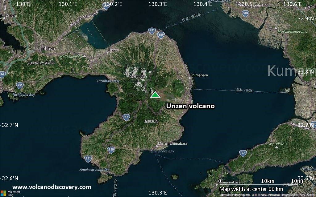
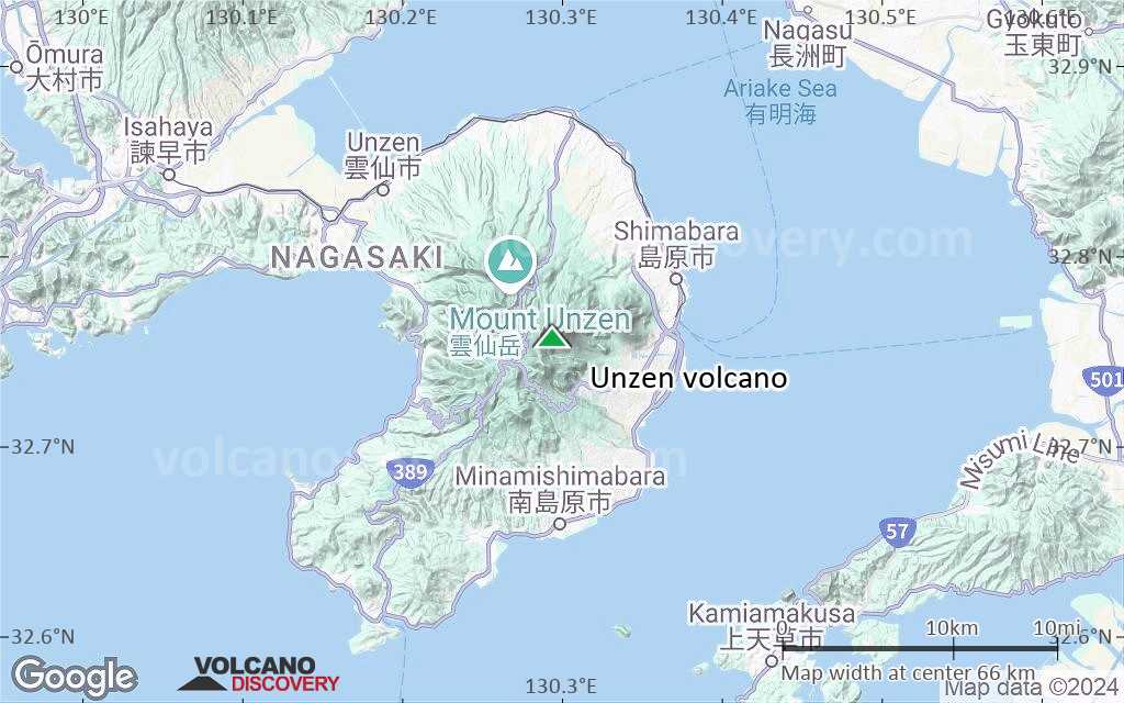
| RSS | EN | DE | EL | ES | FR | IT | RU

Unzen Volcano

Updated: Nov 24, 2025 21:16 GMT -
stratovolcano
Kyushu Island, Japan, 32.76°N / 130.29°E
Summit height: 1486 m / 4,875 ft
Current status: normal or dormant (1 out of 5)

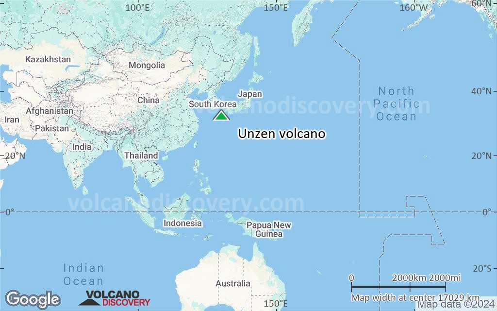
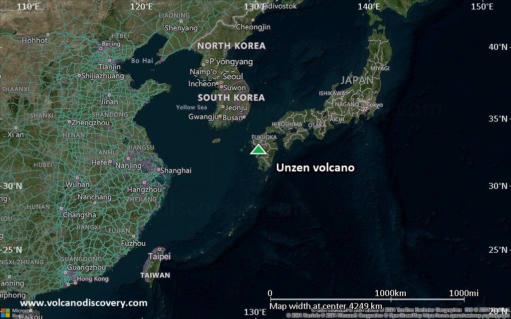
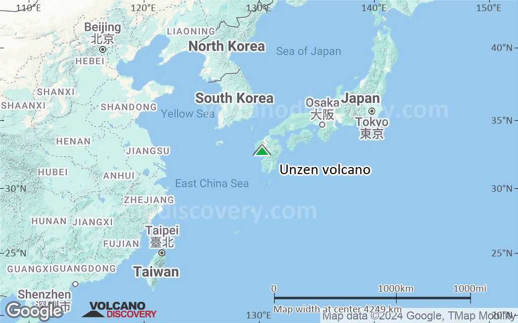
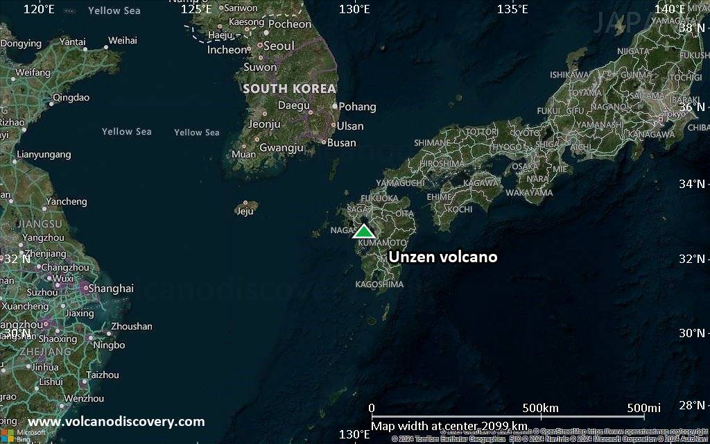
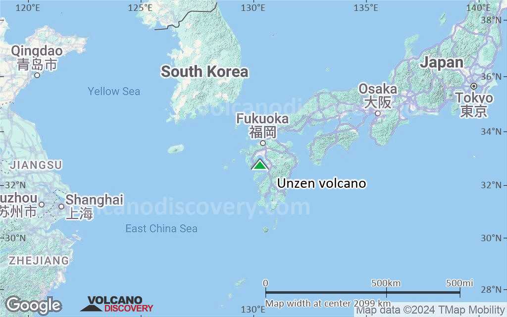
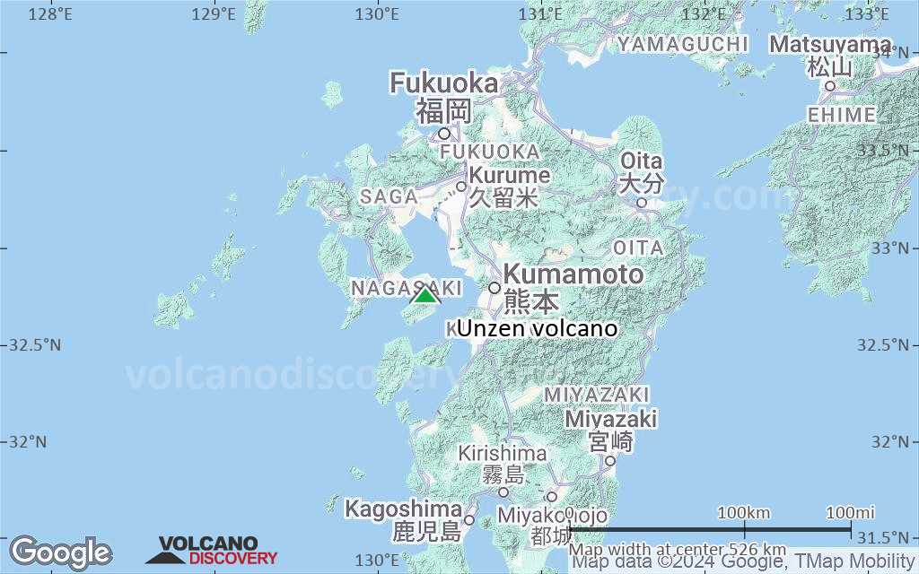
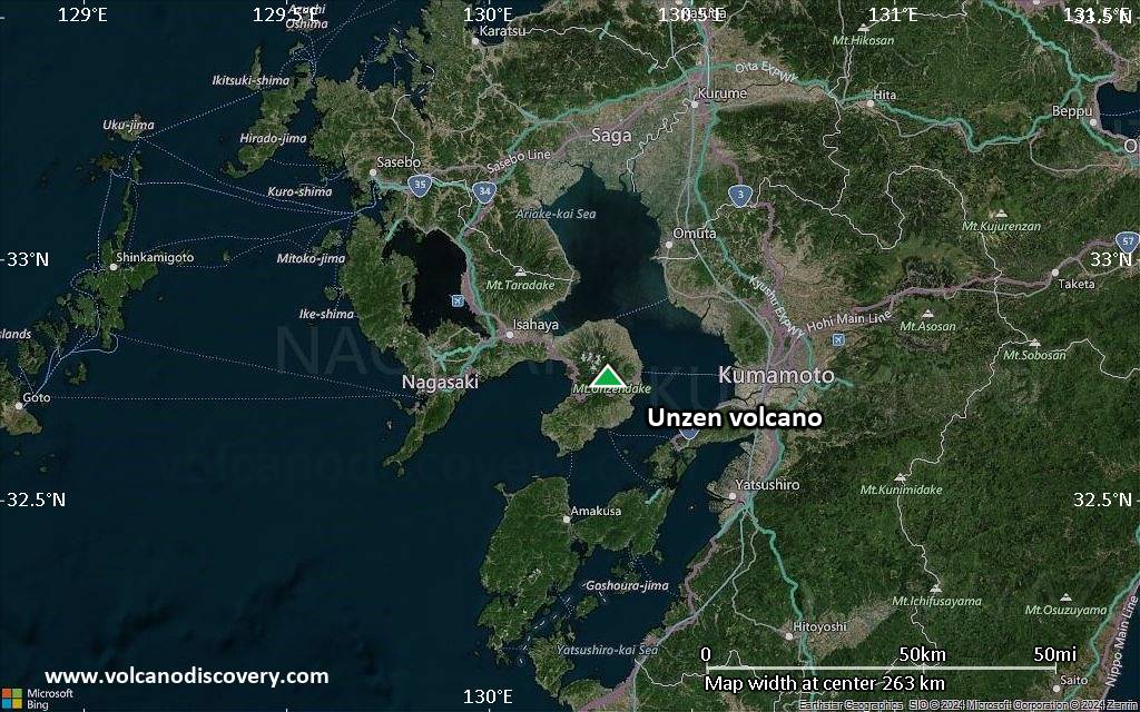
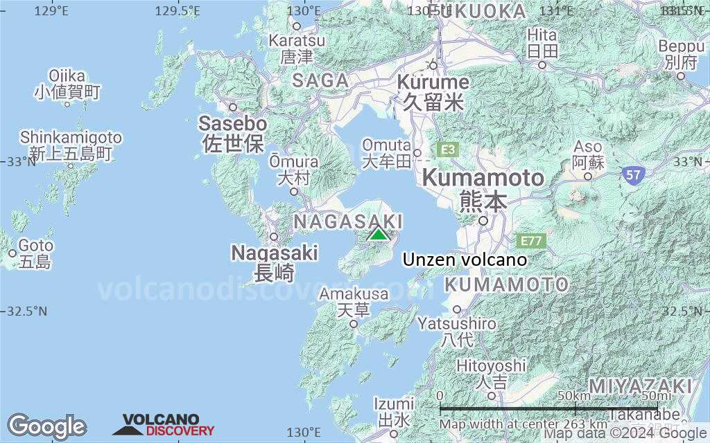
Unzen Volcano (雲仙岳 in Japanese, also Unzendake) is located on the Island of Kyushu about 40 kilometers east of Nagasaki city. It is one of Japan's most active and dangerous volcanoes. It killed 43 people during its latest eruption in 1991.

[smaller] [larger]
Typical eruption style: Explosive
Unzen volcano eruptions: 1996, 1990-95, 1798(?), 1792, 1690-92, 1663, 1663, 860(?)

Latest nearby earthquakes

Date and TimeMag / DepthDistance / Location
Nov 24, 07:58 am (GMT +9)
0.2

14 km
30 km (19 mi) to the SW Japan: Near Unzendake Info
Nov 24, 04:20 am (GMT +9)
0.7

9.9 km
23 km (14 mi) to the NE Japan: Northern Ariakekai Region Info
Nov 24, 01:49 am (GMT +9)
0.2

9.3 km
17 km (10.7 mi) to the W Japan: Near Unzendake Info
Nov 23, 07:56 pm (GMT +9)
0.1

12 km
25 km (15 mi) to the E Japan: NW Kumamoto Pref Info
Saturday, November 22, 2025 GMT (2 quakes)
Nov 23, 04:15 am (GMT +9)
0.2

12 km
11 km (6.8 mi) to the E Japan: NW Kumamoto Pref Info
Nov 22, 09:02 am (GMT +9)
0.6

3.1 km
29 km (18 mi) to the E Japan: NW Kumamoto Pref Info
Friday, November 21, 2025 GMT (2 quakes)
Nov 22, 03:09 am (GMT +9)
0.6

3.1 km
29 km (18 mi) to the E Japan: NW Kumamoto Pref Info
Nov 21, 07:30 pm (GMT +9)
0.9

8.1 km
22 km (14 mi) to the NW Japan: Near Unzendake Info
Thursday, November 20, 2025 GMT (1 quake)
Nov 20, 09:09 pm (GMT +9)
1.1

2.7 km
29 km (18 mi) to the E Japan: NW Kumamoto Pref Info

Background

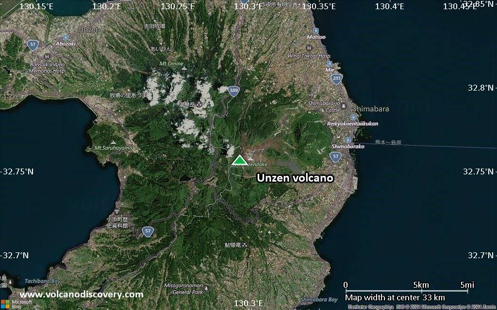
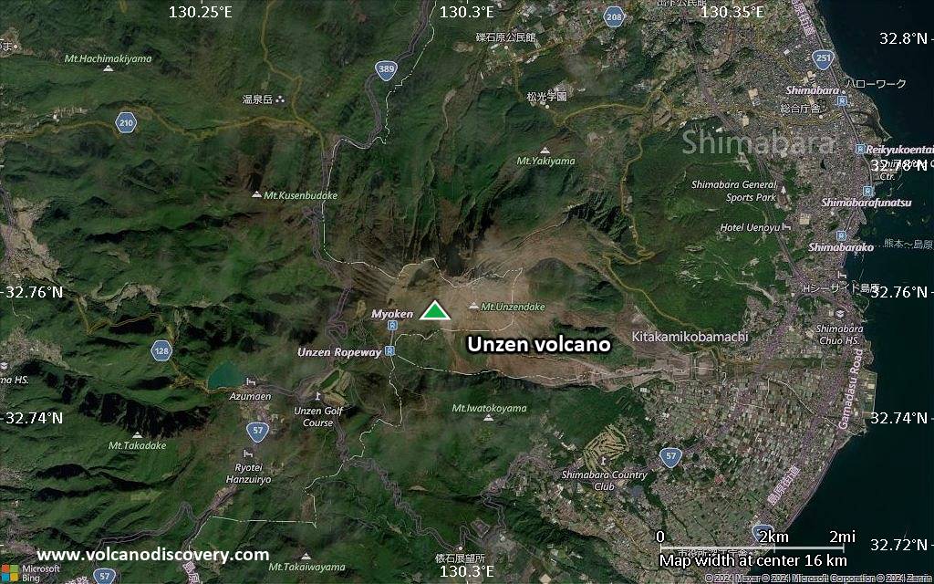
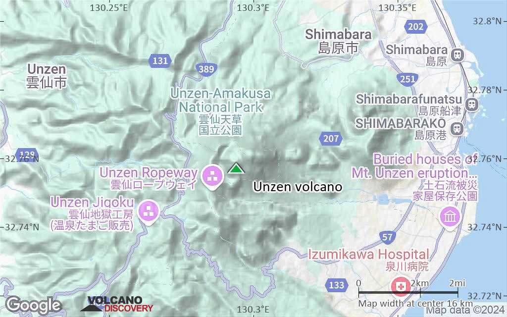
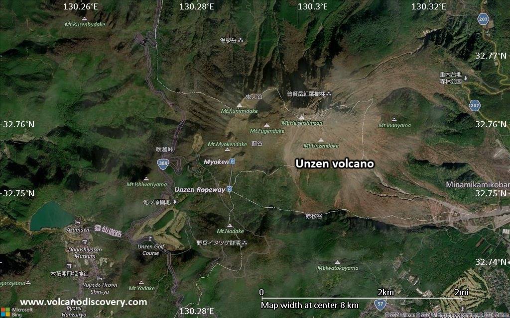
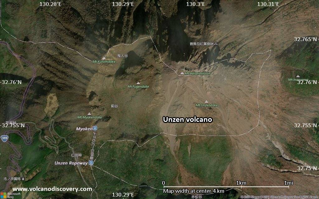
Unzen is a group of several overlapping active stratovolcanoes (including Kinugasa on the north, Fugen-dake at the east-center, and Kusenbu on the south) located near the city of Shimabara, Nagasaki Prefecture, on the island of Kyushu, Japan's southernmost main island. The massive basaltic to andesitic Unzen volcanic complex occupies much of the Shimabara Peninsula east of Nagasaki. Currently, Unzen's highest peaks are Fugendake (普賢岳) at 1,359 metres (4,459 ft) and Heisei Shinzan (平成新山) at 1,486 metres (4,875 ft).
The volcanoes formed along a 30-40 km long E-W aligned graben. The historically active vent of Unzen, Mayu-yama lava dome complex, is about 4,000 years old.
In 1792, the collapse of one of its several lava domes triggered a tsunami that killed about 15,000 people in Japan's worst-ever volcanic-related disaster. The last eruptions of the volcano were from 1990 to 1995. The largest eruption in this period occurred on June 3, 1991, when a pyroclastic flow that reached 4.5 kilometres distance from the crater killed 43 people including the famous French volcanologists Katia and Maurice Krafft.

Significant volcanic eruptions: Unzen volcano

In the past 10,000 years, Unzen has had at least 11 confirmed volcanic eruptions, out of which 5 are documented by historical records, while the others can be inferred from geological evidence.
Additionally, there are 4 uncertain or discredited eruptions from Unzen volcano.
The table below lists all known eruptions (date in bold face) of Unzen volcano in historic times and during the past 10,000 years. Updates on the most recent volcanic activity of Unzen can be found on the news page of Unzen volcano.
DateNoteVEIDeathsDamage
1996 Feb 10 - May 1Fugen-dake
Historical obs./docs.
2
1990 Nov 17 - 1995 Feb 16 ±15 d.Fugen-dake
Historical obs./docs.
1
1993 Jun 23
(eruption 1990 Nov 17 - 1995 Feb 16 ±15 d.)
Historical obs./docs.
11
Info
1991 Jun 3
(eruption 1990 Nov 17 - 1995 Feb 16 ±15 d.)
Historical obs./docs.
143
Info
1957 Jul
(eruptive episode 1957 Jul)
Historical obs./docs.
013
Info
?? 1798 Nov 13 - Dec
Uncertain Eruption
?
1792 Feb 10 - Jul 22Fugen-dake (summit, NNE), Mayu-yama
Historical obs./docs.
2
1792 May 21
(eruption 1792 Feb 10 - Jul 22)
Tsunami recorded
Historical obs./docs.
215,000
very heavy
Info
?? 1690 AD - 1692
Uncertain Eruption
?
1664 AD Apr 15
(eruption 1663 AD Apr - May)
Historical obs./docs.
230
Info
1663 AD Dec 11 - Dec 27 or laterNE flank of Fugen-dake (1200 m)
Historical obs./docs.
2?
1663 AD Apr - MayFugen-dake (Tsukumo-jima Pond)
Historical obs./docs.
2?
1657 AD
Discredited Eruption
?? 860 AD
Uncertain Eruption
?
1150 ±500 y. BCFugendake-Sancho?
1450 ±500 y. BCFugen-dake (Kazaana)?
2150 ±800 y. BCMayu-yama (Tengu-yama)?
2640 ±500 y. BCMayu-yama (Shichimen-zan)?
2720 ±300 y. BCFugen-dake?
4050 ±3000 y. BCFugen-dake (Shimanomine)?
Remark:
Our list of volcanic eruptions closely follows the database of eruptions of the Smithsonian's Global Volcanism Project (GVP), the internationally most recognized data source for volcanic eruptions, but also includes significant eruptive episodes or related volcano events. "Volcanic eruptions" are usually to be understood as sequences of individual eruptive episodes that can follow each other, or even overlap (if several vents are involved), and can last many years, decades or even longer. For example, the current activity of Stromboli volcano is understood as a single eruption that has been ongoing since 1934.
Sources: NOAA National Centers for Environmental Information (NCEI), Global Significant Volcanic Eruptions Database. doi:10.7289/V5TD9V7K | Global Volcanism Project / Smithsonian Institution

Eruptions of Unzen volcano


1991-93 eruption
In 1991, Unzen woke up from its 200-year slumber and started to extrude a new lava dome at the summit. The eruption quickly intensified, and in June, repeated collapses of the new lava dome generated pyroclastic flows that swept down its slopes at speeds as high as 200 kilometers per hour. The largest flow occurred on June 3, 1991 and killed 43 people caught by surprise by the unusually strong flow. ...more info

1792 landslide-triggered tsunami disaster at Unzen volcano
Unzen is infamous for Japan's greatest volcanic disaster. In 1792, about a month after lava stopped erupting from the volcano, a landslide from nearby Mount Mayuyama swept through ancient Shimabara City, entered the sea, and generated a tsunami that struck nearby areas.
More than 15,000 people were killed by the landslide and tsunami. The amphitheater-shaped scar of the landslide is still clearly visible on Mount Mayuyama just above the city.
From: Brantley and Scott, 1993, The Danger of Collapsing Lava Domes: Lessons for Mount Hood, Oregon: IN: Earthquakes & Volcanoes, v.24, n.6

Unzen Volcano FAQ

+When was the last eruption of Unzen volcano?

+How often does Unzen volcano erupt?

+How active is Unzen volcano at present?

+When was the largest eruption of Unzen volcano?

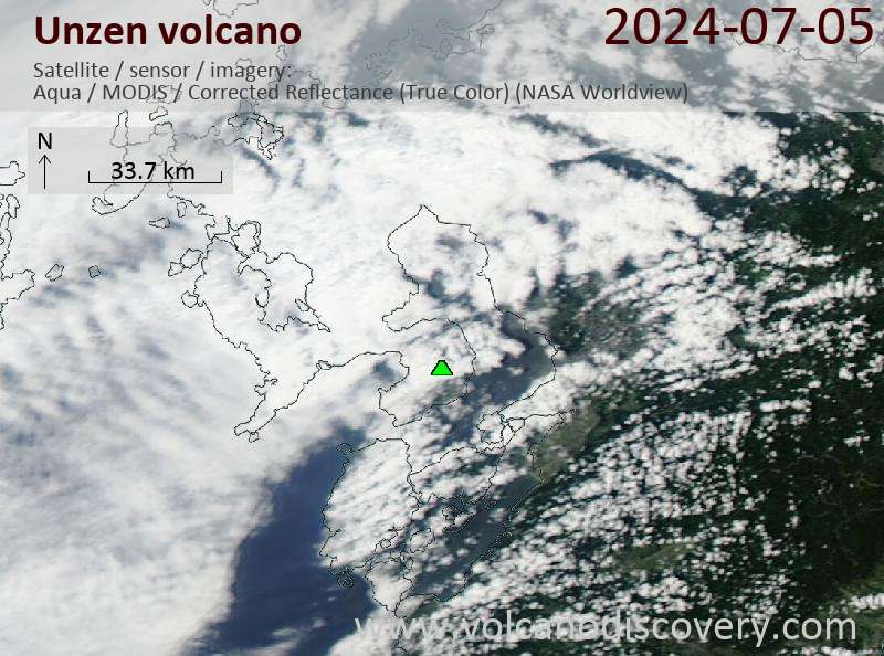
Latest satellite images

Unzen satellite image sat1Unzen satellite image sat2

Unzen Volcano Maps

Below is a selection of maps showing the location and surroundings of the volcano at various resolutions based on aerial-imagery / terrain maps. Feel free to use them for non-commercial purposes on your blog or website as long as you credit them with a link back to this page (click to copy it).
Satellite/aerial-type map of Unzen volcano (world scale)
Terrain-type map of Unzen volcano (world scale)
Satellite/aerial-type map of Unzen volcano (region scale large)
Terrain-type map of Unzen volcano (region scale large)
Satellite/aerial-type map of Unzen volcano (region scale medium)
Terrain-type map of Unzen volcano (region scale medium)
Satellite/aerial-type map of Unzen volcano (region scale small)
Terrain-type map of Unzen volcano (region scale small)
Satellite/aerial-type map of Unzen volcano (local scale large)
Terrain-type map of Unzen volcano (local scale large)
Satellite/aerial-type map of Unzen volcano (local scale medium)
Terrain-type map of Unzen volcano (local scale medium)
Satellite/aerial-type map of Unzen volcano (local scale small)
Terrain-type map of Unzen volcano (local scale small)
Satellite/aerial-type map of Unzen volcano (scale of 10s of km)
Terrain-type map of Unzen volcano (scale of 10s of km)
Satellite/aerial-type map of Unzen volcano (scale of 20-40 km)
Terrain-type map of Unzen volcano (scale of 20-40 km)
Satellite/aerial-type map of Unzen volcano (scale of approx. 10-20 km)
Terrain-type map of Unzen volcano (scale of approx. 10-20 km)
Satellite/aerial-type map of Unzen volcano (scale of 5-10 km)
Satellite/aerial-type map of Unzen volcano (scale of few kilometers)
Volcanoes & Earthquakes - new app for Android
Guaranteed tours
2-10 May 2026: From Stromboli to Etna - Sicily and Eolian Islands (Italy)
= spaces available   = guaranteed   = few spaces left   = booked out

No news in this list.

On this page:

Try our free app!
Volcanoes & Earthquakes - new app for Android
Android | iOS version

More on VolcanoDiscovery

Why is there advertising on this site?

Support Us – Help Us Enhance Our Services!

We’re passionate about delivering the latest volcano and earthquake data from around the globe — just for you. However, maintaining our website and free apps requires significant time, effort, and resources.
Your support helps us expand our hardware and software capabilities and empowers our dedicated editorial team. Our mission is to provide uninterrupted, real-time updates whenever an earthquake strikes or a volcano erupts — and your donations make this possible. Every contribution, big or small, is deeply appreciated. If you find our information valuable and want to help us add new features, create compelling content, and improve our technology, please consider making a donation:

Donate with PayPal:

Planned Features:

Thanks to your past donations, we have recently added:
Download the Volcanoes & Earthquakes app to stay among the first to receive the fastest seismic and volcano alerts online:
Android | iOS
Thank you for being part of our mission!
Sources: VolcanoDiscovery / VolcanoAdventures and other sources as noted.
Use of material: Most text and images on our websites are owned by us. Re-use is generally not permitted without authorization. Contact us for licensing rights.
Volcanoes & Earthquakes
VolcanoDiscovery Home
Volcanoes | Earthquakes | Photos | Volcano News | | Shop | App
Adventure & Study Travel
Tours to Volcanoes and Volcanic Areas: walking tours, photo tours, study tours
Tours & Dates | FAQ | About us
Get our newsletter!
Company info
Contact | Legal info | Terms & conditions
Follow us
Follow us on facebook Follow us on Instagram Follow us on Bluesky Follow us on Twitter Visit our Youtube channel
EN | DE | EL | ES | FR | IT | RU
VolcanoDiscovery GmbH, Germany, Reg. nr.: HRB 103744, EU Tax Id: DE 297 465 123 owned and created by
Dr. Tom Pfeiffer, volcanologist, volcano photographer, tour organizer member of
IAVCEI
IAVCEI
Vulkanologische Gesellschaft
Volcanological Society
Ecotourism Greece
Ecotourism Greece
RUV insurance
Insured by R+V
VolcanoDiscovery © 2004- All Rights Reserved | Privacy - Cookie Settings