Kumba Volcanic Field Ηφαίστειο
Updated: 8 Αυγούστου 2025 22:24 GMT -
Maar(s)
Cameroon, 4.61°N / 9.29°E 
+Τοπική ώρα:
Ανατολή ηλίου:
Ηλιοβασίλεμα:
Ανατολή Σελήνης:
Δύση του φεγγαριού:
Summit height: 600 m / 1969 ft
Current status: (probably) extinct (0 out of 5)
[smaller] [larger]
Kumba Volcanic Field volcano eruptions: None during the past 10,000 years
Less than few million years ago (Pleistocene)
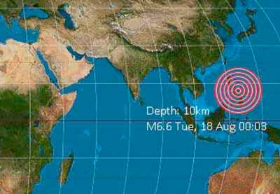
Latest nearby earthquakes
| Ημερομην. κ. ώρα | Mag / Βάθος | Απόσταση / Τοποθεσία | |||
|---|---|---|---|---|---|
Background
Volcanic field SW of Tombel Graben and NNE of Mount Cameroon (within rectangular area of 4°48'15"N, 9°30'E and 4°24'15"N, 9°5'E). This area is known for the maar lakes Barombe Mbo, Barombi Koto, and Mboandong.---
Source: Smithsonian / GVP volcano information
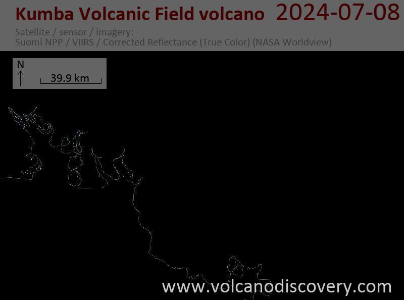
Τελευταίες δορυφορικές εικόνες

Kumba Volcanic Field Ηφαίστειο Χάρτες
Below is a selection of maps showing the location and surroundings of the volcano at various resolutions based on aerial-imagery / terrain maps. Feel free to use them for non-commercial purposes on your blog or website as long as you credit them with a link back to this page (click to copy it).

Satellite/aerial-type map of Kumba Volcanic Field volcano (world scale)

Terrain-type map of Kumba Volcanic Field volcano (world scale)

Satellite/aerial-type map of Kumba Volcanic Field volcano (region scale large)

Terrain-type map of Kumba Volcanic Field volcano (region scale large)

Satellite/aerial-type map of Kumba Volcanic Field volcano (region scale medium)

Terrain-type map of Kumba Volcanic Field volcano (region scale medium)

Satellite/aerial-type map of Kumba Volcanic Field volcano (region scale small)

Terrain-type map of Kumba Volcanic Field volcano (region scale small)

Satellite/aerial-type map of Kumba Volcanic Field volcano (local scale large)

Terrain-type map of Kumba Volcanic Field volcano (local scale large)

Satellite/aerial-type map of Kumba Volcanic Field volcano (local scale medium)

Terrain-type map of Kumba Volcanic Field volcano (local scale medium)

Satellite/aerial-type map of Kumba Volcanic Field volcano (local scale small)

Terrain-type map of Kumba Volcanic Field volcano (local scale small)

Satellite/aerial-type map of Kumba Volcanic Field volcano (scale of 10s of km)

Terrain-type map of Kumba Volcanic Field volcano (scale of 10s of km)

Satellite/aerial-type map of Kumba Volcanic Field volcano (scale of 20-40 km)

Terrain-type map of Kumba Volcanic Field volcano (scale of 20-40 km)

Satellite/aerial-type map of Kumba Volcanic Field volcano (scale of approx. 10-20 km)

Terrain-type map of Kumba Volcanic Field volcano (scale of approx. 10-20 km)

Satellite/aerial-type map of Kumba Volcanic Field volcano (scale of 5-10 km)

Satellite/aerial-type map of Kumba Volcanic Field volcano (scale of few kilometers)