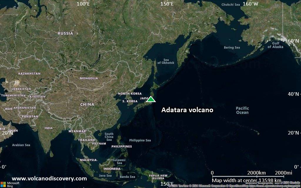
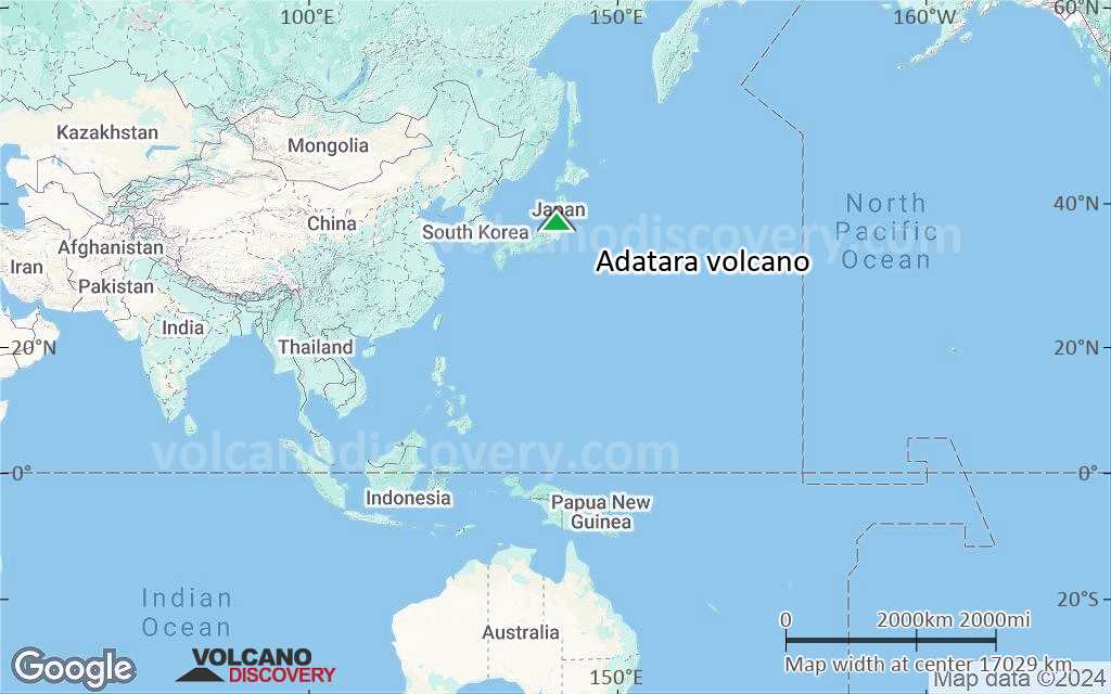
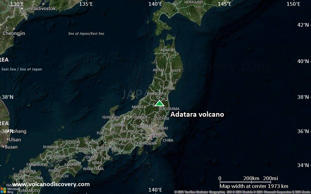
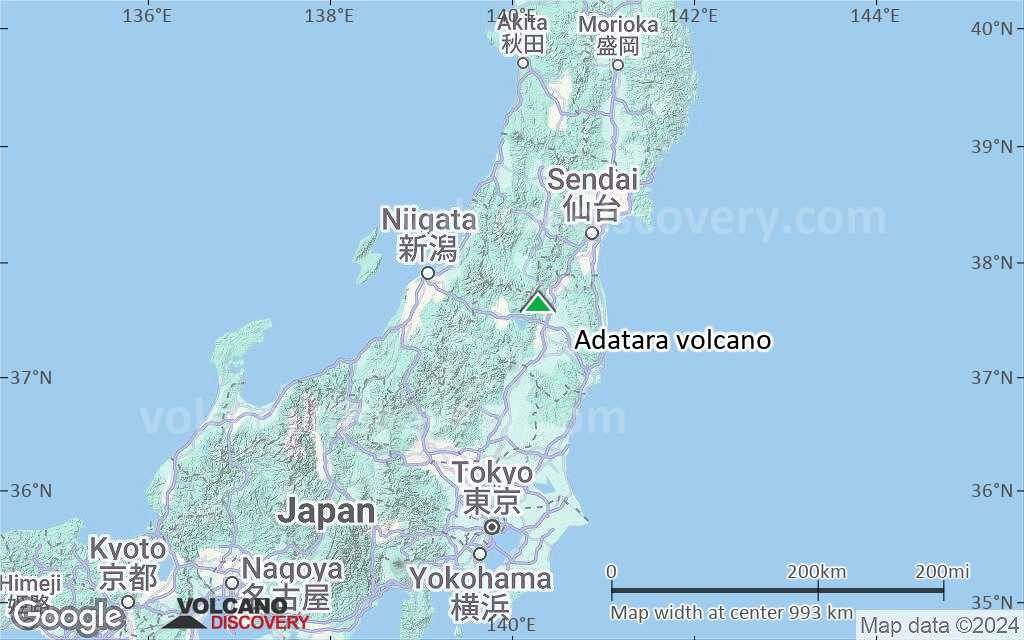
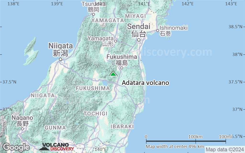
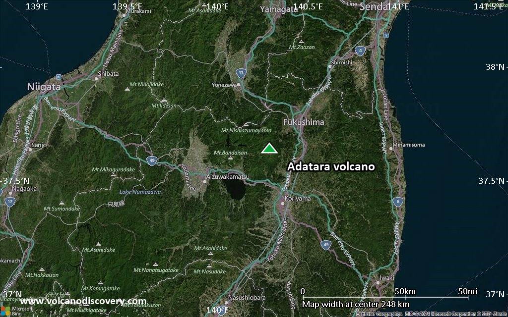
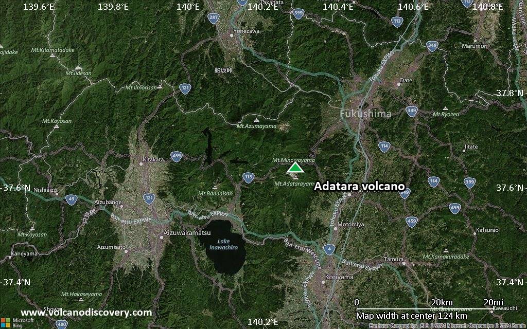
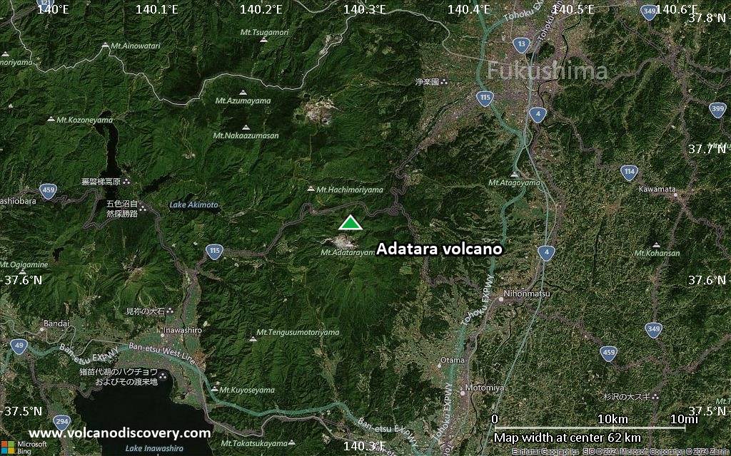
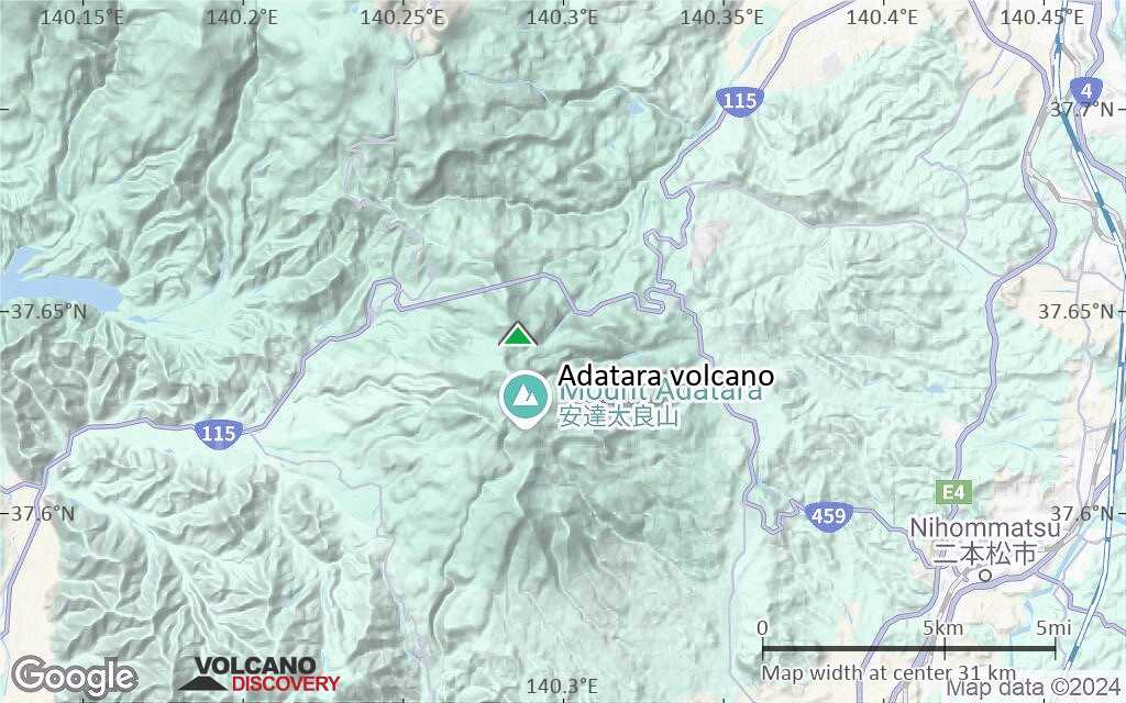
| RSS | EN | DE | EL | ES | FR | IT | RU

Adatara Volcano

Updated: May 2, 2025 01:46 GMT -
stratovolcanoes
Fukushima province, Japan, 37.64°N / 140.29°E
Summit height: 1718 m / 5,636 ft
Current status: normal or dormant (1 out of 5)
Last update: 26 Feb 2022

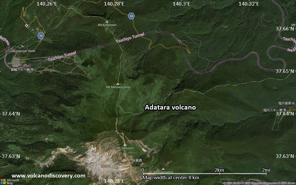
Adatara volcano is a group of overlapping stratovolcanoes east of Bandai volcano and located 15 km SW of Fukushima City. Its highest summit is Minowa-yama stratovolcano, north of Tetsu-zan, which is the currently active stratovolcano. The group forms a N-S directed elongated chain.
The volcano is known for its hot springs and fumaroles. Io-gawa river ("Sulfur River") exits the complex to the west.
72 workers of a sulfur mine in the summit crater were killed during an eruption in 1900. Historical eruptions were all from within the 1.2-km-wide, 350-m-deep Numonotaira crater of Tetsu-zan.

[smaller] [larger]
Typical eruption style: explosive
Adatara volcano eruptions: 1996, 1900, 1899, 1813 (?)

Latest nearby earthquakes

Date and TimeMag / DepthDistance / Location
May 2, 06:31 am (GMT +9)
0.6

6.8 km
26 km (16 mi) to the W 23 km north of Aizu-Wakamatsu, Fukushima, Japan Info
May 1, 10:10 pm (GMT +9)
0.4

7.1 km
24 km (15 mi) to the W 22 km north of Aizu-Wakamatsu, Fukushima, Japan Info
May 1, 06:37 pm (GMT +9)
0.7

8.8 km
11 km (7.1 mi) to the W 30 km southwest of Fukushima, Fukushima, Japan Info
Saturday, April 26, 2025 GMT (1 quake)
Apr 26, 03:53 pm (GMT +9)
0.7

9.4 km
24 km (15 mi) to the NW 36 km west of Fukushima, Fukushima, Japan Info
Thursday, April 24, 2025 GMT (1 quake)
Apr 25, 04:11 am (GMT +9)
1.5

10.9 km
25 km (15 mi) to the SW 10 km northeast of Aizu-Wakamatsu, Fukushima, Japan Info
Monday, April 21, 2025 GMT (1 quake)
Apr 21, 06:44 pm (GMT +9)
0.2

4.8 km
26 km (16 mi) to the W 41 km west of Fukushima, Fukushima, Japan Info
Sunday, April 20, 2025 GMT (1 quake)
Apr 21, 08:47 am (GMT +9)
0.4

6.9 km
27 km (17 mi) to the W Japan: Western Fukushima Pref Info

Background

The broad forested massif of Adatara volcano is mainly andesitic and consists of stratovolcanoes and lava domes built upon Tertiary sedimentary rocks on the south and rest on the flank of Azuma volcano on the north.
Adatara was constructed in 3 main stages that began about 550,000, 350,000, and 200,000 years ago. In the first stage, lava flows and pyroclastic flows formed the Maegatake cone. The second stage built the Osyozan cone. The 3rd stage erupted large amounts of lava flows, pyroclastic flows and andesitic lava domes and built the present-day chain of volcanoes.
---
Source:
Yamamoto, T., & Sakaguchi, K. (2000). Eruptive history of Adatara volcano, NE Japan, during last 250,000 years based on tephrostratigraphy. Journal of Geological Society of Japan, 106(12), 865–882. GEOLOGICAL SOCIETY OF JAPAN.

Significant volcanic eruptions: Adatara volcano

In the past 10,000 years, Adatara has had at least 12 confirmed volcanic eruptions, out of which 3 are documented by historical records, while the others can be inferred from geological evidence.
There is one uncertain or discredited eruption in 1813 from Adatara volcano.
The table below lists all known eruptions (date in bold face) of Adatara volcano in historic times and during the past 10,000 years. Updates on the most recent volcanic activity of Adatara can be found on the news page of Adatara volcano.
DateNoteVEIDeathsDamage
1997 Sep 15
(eruptive episode 1997 Sep 15)
Historical obs./docs.
04
Info
1996 Sep 1Numanotaira
Historical obs./docs.
1
1900 Jul 17Numanotaira
Historical obs./docs.
2
1900 Jul 17
Historical obs./docs.
272
Info
1899 Aug 24 - Nov 12Numanotaira
Historical obs./docs.
2
?? 1813 Jan 10
Uncertain Eruption
1?
950 ±50 y. ADNumanotaira?
50 ±900 y. BCNumanotaira?
590 ±200 y. BCNumanotaira3
1550 ±1100 y. BCNumanotaira?
2600 ±50 y. BCNumanotaira3
4300 ±850 y. BCNumanotaira3
6150 ±100 y. BCNumanotaira3
6650 ±100 y. BCNumanotaira3
8050 ? BCNumanotaira3
Remark:
Our list of volcanic eruptions closely follows the database of eruptions of the Smithsonian's Global Volcanism Project (GVP), the internationally most recognized data source for volcanic eruptions, but also includes significant eruptive episodes or related volcano events. "Volcanic eruptions" are usually to be understood as sequences of individual eruptive episodes that can follow each other, or even overlap (if several vents are involved), and can last many years, decades or even longer. For example, the current activity of Stromboli volcano is understood as a single eruption that has been ongoing since 1934.
Sources: NOAA National Centers for Environmental Information (NCEI), Global Significant Volcanic Eruptions Database. doi:10.7289/V5TD9V7K | Global Volcanism Project / Smithsonian Institution

Eruptions of Adatara volcano


1997 fatalities
On 15 September 1997 4 tourists were killed on Adatara volcano by inhaling lethal quantities of H2S gas, which had build up on the floor of Numano-taira crater.
The hikers were part of a group of 14 who visited Adatara volcano. 3 were killed initially and the 4th in his attempt to rescue the others. ...more info

Adatara Volcano FAQ

+When was the last eruption of Adatara volcano?

+How often does Adatara volcano erupt?

+How active is Adatara volcano at present?

+When was the largest eruption of Adatara volcano?

Latest satellite images

Adatara satellite image sat1Adatara satellite image sat2

Adatara Volcano Maps

Below is a selection of maps showing the location and surroundings of the volcano at various resolutions based on aerial-imagery / terrain maps. Feel free to use them for non-commercial purposes on your blog or website as long as you credit them with a link back to this page (click to copy it).
Satellite/aerial-type map of Adatara volcano (world scale)
Terrain-type map of Adatara volcano (world scale)
Satellite/aerial-type map of Adatara volcano (region scale large)
Terrain-type map of Adatara volcano (region scale large)
Satellite/aerial-type map of Adatara volcano (region scale medium)
Terrain-type map of Adatara volcano (region scale medium)
Satellite/aerial-type map of Adatara volcano (region scale small)
Terrain-type map of Adatara volcano (region scale small)
Satellite/aerial-type map of Adatara volcano (local scale large)
Terrain-type map of Adatara volcano (local scale large)
Satellite/aerial-type map of Adatara volcano (local scale medium)
Terrain-type map of Adatara volcano (local scale medium)
Satellite/aerial-type map of Adatara volcano (local scale small)
Terrain-type map of Adatara volcano (local scale small)
Satellite/aerial-type map of Adatara volcano (scale of 10s of km)
Terrain-type map of Adatara volcano (scale of 10s of km)
Satellite/aerial-type map of Adatara volcano (scale of 20-40 km)
Terrain-type map of Adatara volcano (scale of 20-40 km)
Satellite/aerial-type map of Adatara volcano (scale of approx. 10-20 km)
Terrain-type map of Adatara volcano (scale of approx. 10-20 km)
Satellite/aerial-type map of Adatara volcano (scale of 5-10 km)
Satellite/aerial-type map of Adatara volcano (scale of few kilometers)
Volcanoes & Earthquakes - new app for Android
Guaranteed tours
9-25 Jun 2025: Volcanoes and Spices - Sulawesi/Halmahera (Indonesia)
7-22 Jul 2025: From Krakatau to Bali - Java (Indonesia)
7-23 Jul 2025: Volcanoes and Spices - Sulawesi/Halmahera (Indonesia)
1-17 Aug 2025: Volcanoes and Spices - Sulawesi/Halmahera (Indonesia)
1-14 Oct 2025: Desert, salt and volcanoes - Danakil desert (Ethiopia)
4-12 Oct 2025: From Stromboli to Etna - Sicily and Eolian Islands (Italy)
6-21 Oct 2025: From Krakatau to Bali - Java (Indonesia)
3-19 Nov 2025: Volcanoes and Spices - Sulawesi/Halmahera (Indonesia)
= spaces available   = guaranteed   = few spaces left   = booked out
Tue, 18 Dec 2012, 12:05

Adatara volcano (Fukushima province, Japan) activity update

Location of the recent earthquake at Adatara volcano
A shallow magnitude 3.7 quake occurred yesterday under the Adatara group of volcanoes. ... Read all

On this page:

Try our free app!
Volcanoes & Earthquakes - new app for Android
Android | iOS version

More on VolcanoDiscovery

Why is there advertising on this site?

Support us - Help us upgrade our services!

We truly love working to bring you the latest volcano and earthquake data from around the world. Maintaining our website and our free apps does require, however, considerable time and resources.
We need financing to increase hard- and software capacity as well as support our editor team. We're aiming to achieve uninterrupted service wherever an earthquake or volcano eruption unfolds, and your donations can make it happen! Every donation will be highly appreciated. If you find the information useful and would like to support our team in integrating further features, write great content, and in upgrading our soft- and hardware, please make a donation (PayPal).

Planned features:Thanks to your past donations, these features have been added recently:
Download and Upgrade the Volcanoes & Earthquakes app to get one of the fastest seismic and volcano alerts online:
Android | IOS
Thank you!
Sources: VolcanoDiscovery / VolcanoAdventures and other sources as noted.
Use of material: Most text and images on our websites are owned by us. Re-use is generally not permitted without authorization. Contact us for licensing rights.
Volcanoes & Earthquakes
VolcanoDiscovery Home
Volcanoes | Earthquakes | Photos | Volcano News | | Shop | App
Adventure & Study Travel
Tours to Volcanoes and Volcanic Areas: walking tours, photo tours, study tours
Tours & Dates | FAQ | About us
Get our newsletter!
Company info
Contact | Legal info | Terms & conditions
Follow us
Follow us on facebook Follow us on Instagram Follow us on Bluesky Follow us on Twitter Visit our Youtube channel
EN | DE | EL | ES | FR | IT | RU
VolcanoDiscovery GmbH, Germany, Reg. nr.: HRB 103744, EU Tax Id: DE 297 465 123 owned and created by
Dr. Tom Pfeiffer, volcanologist, volcano photographer, tour organizer member of
IAVCEI
IAVCEI
Vulkanologische Gesellschaft
Volcanological Society
Ecotourism Greece
Ecotourism Greece
RUV insurance
Insured by R+V
VolcanoDiscovery © 2004- All Rights Reserved | Privacy - Cookie Settings