Villarrica Volcano
Updated: 8. Mai 2024 15:17 GMT -
Stratovolcano 2847 m / 9,340 ft
Central Chile, -39.42°S / -71.93°W
Aktueller Status: Ausbruch (4 von 5)
Central Chile, -39.42°S / -71.93°W
Aktueller Status: Ausbruch (4 von 5)
Last update: 6 Mär 2024 (Smithsonian / USGS Weekly Volcanic Activity Report)
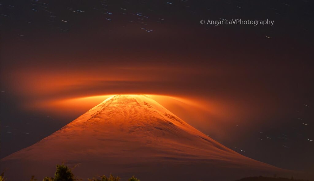
Snow-covered Villarrica, one of Chile's most active volcanoes, rises above the lake and town of the same name. It erupts basaltic lava and is one of the few permanently active volcanoes in the world, with frequent strombolian activity and sometimes a small lava lake present in its summit crater.
[smaller] [larger]
Ausbrüche des Villarrica: 2010-2012, 2008, 2005, 1985-2001 (lava lake), 1984-85, 1983, 1980, 1977, 1971-72, 1964, 1963(?), 1960-61, 1958-59, 1950(?), 1948-49, 1938, 1935, 1933, 1929, 1921, 1920-29, 1919(?), 1915-18(?), 1910?, 1909, 1908, 1907, 1906, 1904, 1897-98(?), 1893-94(?), 1883, 1879, 1877, 1875-76, 1874, 1869(?), 1867-68, 1864, 1859-60, 1853, 1852(?), 1837, 1832, 1822, 1815-18, 1806, 1801, 1799, 1796, 1792, 1790, 1787, 1780, 1777, 1759, 1751, 1745, 1742, 1737, 1716, 1688, 1657?, 1647?, 1640, 1594, 1562, 1558
Letzte Erdbeben in der Nähe
| Uhrzeit | Mag. / Tiefe | Entfernung / Ort | |||
Beschreibung
The volcano is also known as Rucapillán, a Mapuche word meaning "House of the Pillán". It is the westernmost of three large stratovolcanoes that trend perpendicular to the Andean chain along the Gastre Fault.The volcanic edifice was built at the rim of two overlapping calderas: one 6-km wide caldera formed about 10,000 years ago, and a second, 2 km wide caldera about 3500 years ago. The volcano is located at the NW margin of the older caldera. More than 30 scoria cones and fissure vents dot Villarrica's flanks. Plinian eruptions and pyroclastic flows that have extended up to 20 km from the volcano have been produced during the past few thousands years. Lava flows up to 18 km long have issued from summit and flank vents. Historical eruptions, documented since 1558, have consisted largely of mild-to-moderate explosive activity with occasional lava effusion. Glaciers cover 40 sq km of the volcano. Hazards from Villarrica include massive lahars (mud flows) caused by melting of snow and glacier ice as well as rainfalls, such as during the eruptions of 1964 and 1971 when large lahars damaged towns on its flanks.
Villarrica, along with Quetrupillán and the Chilean portion of Lanín, are protected within Villarrica National Park. Ascents of the volcano are popular with several guided ascents reaching the top during summer.
Latest satellite images