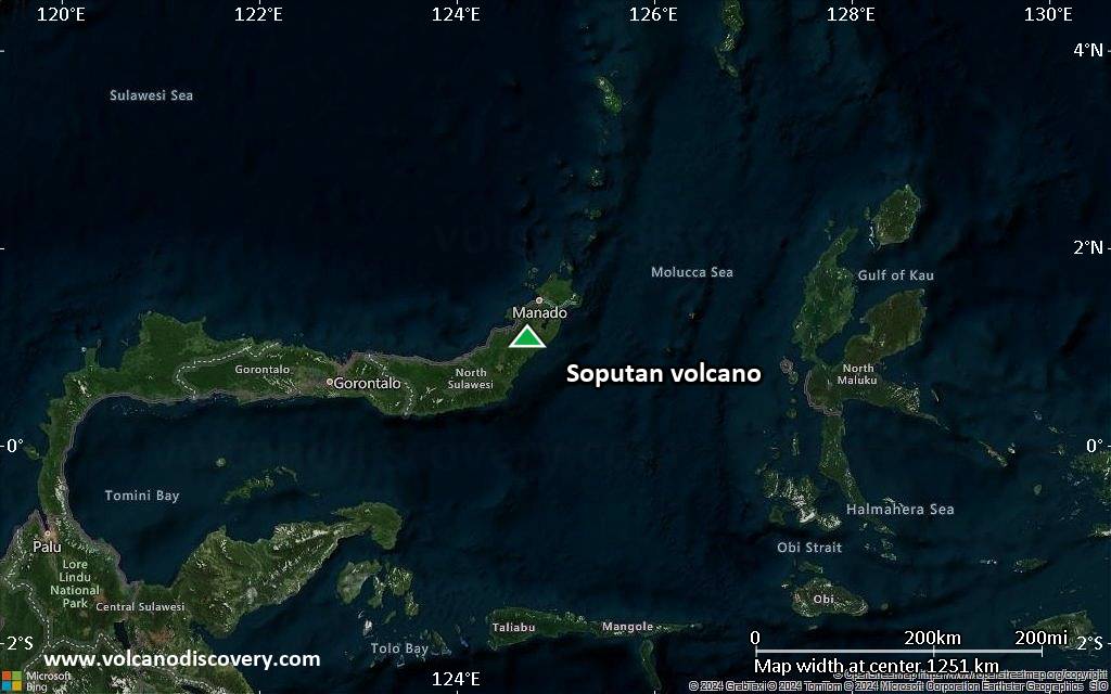
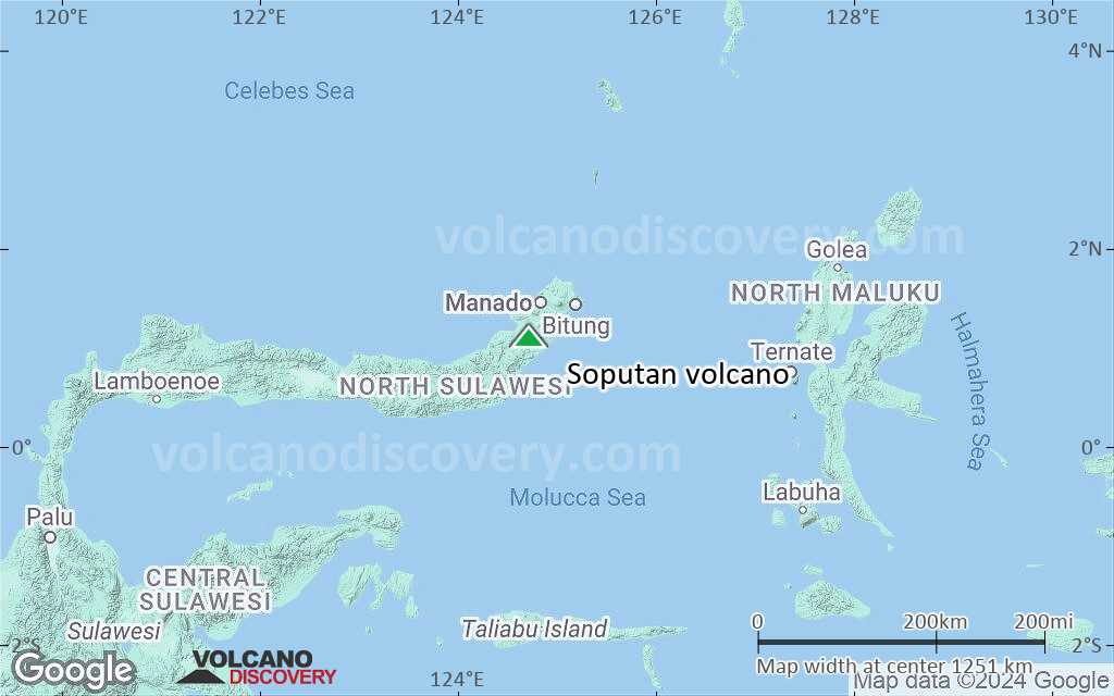
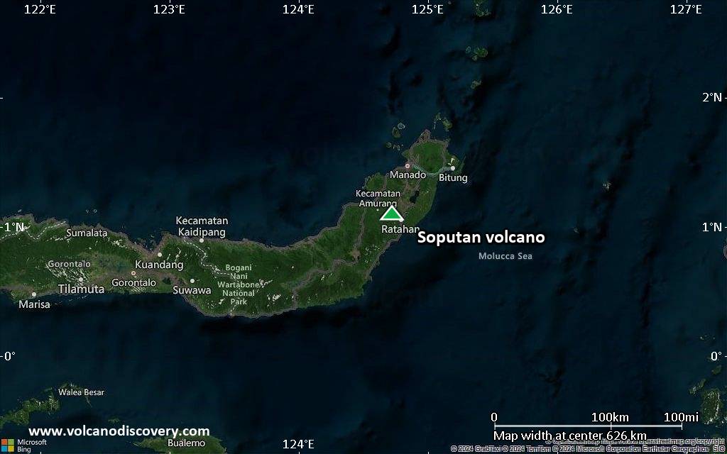
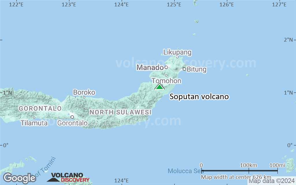
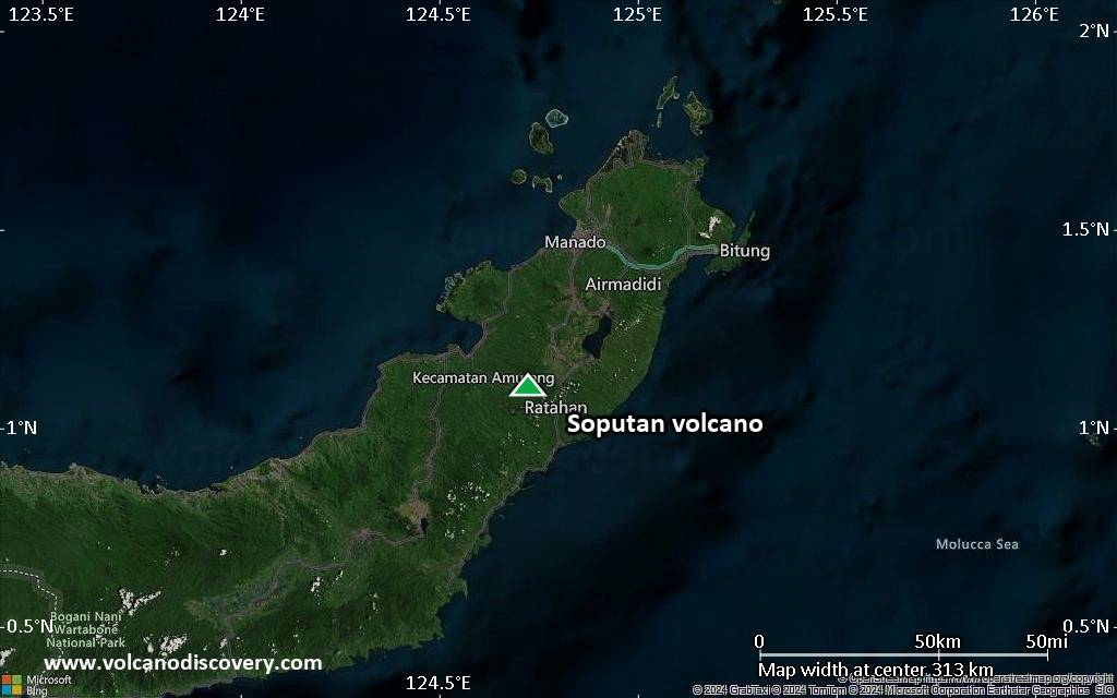
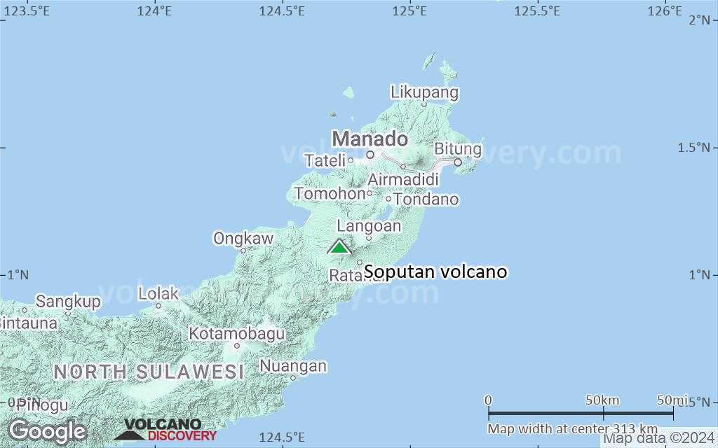
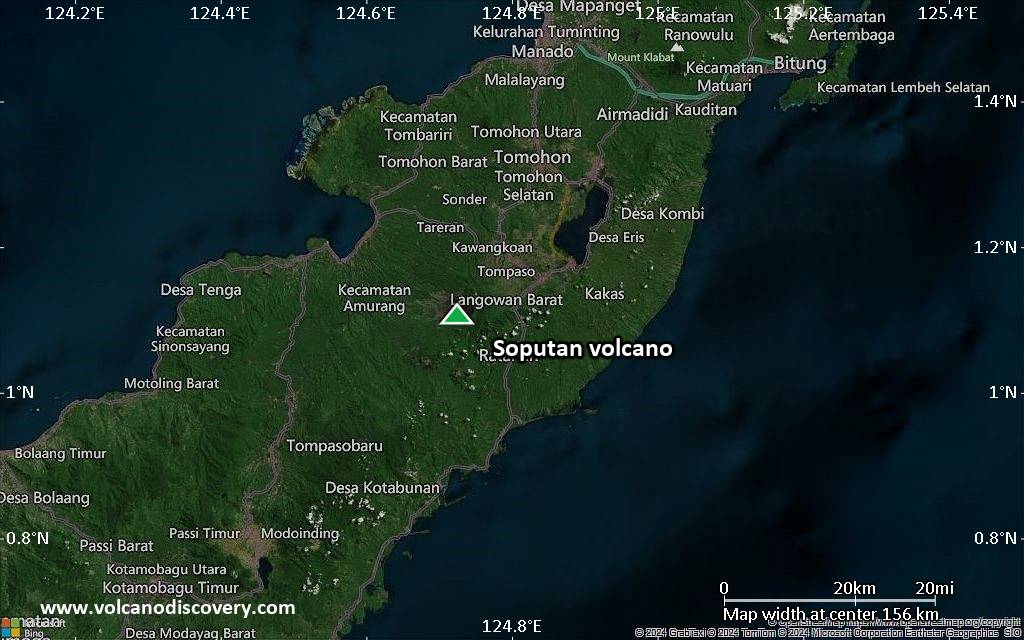
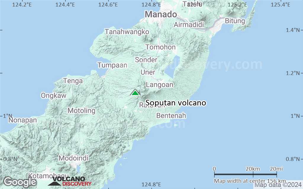
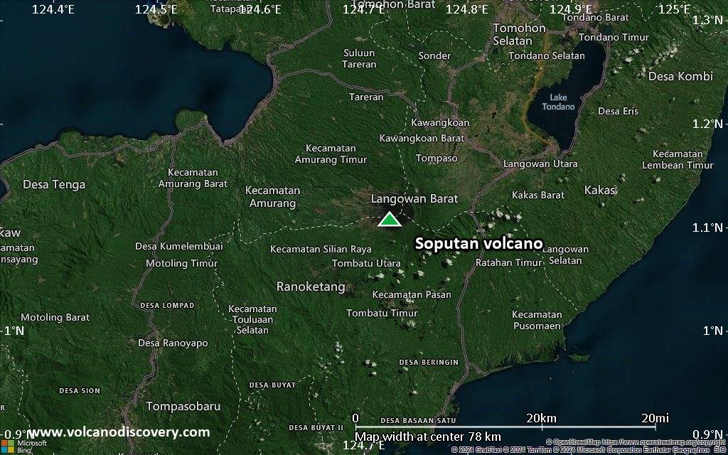
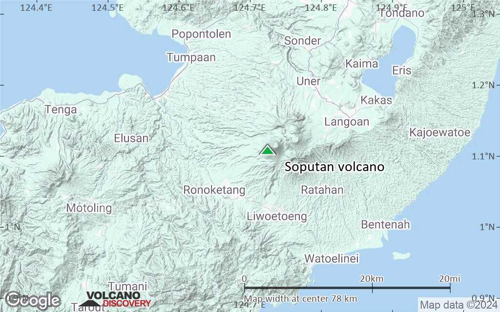
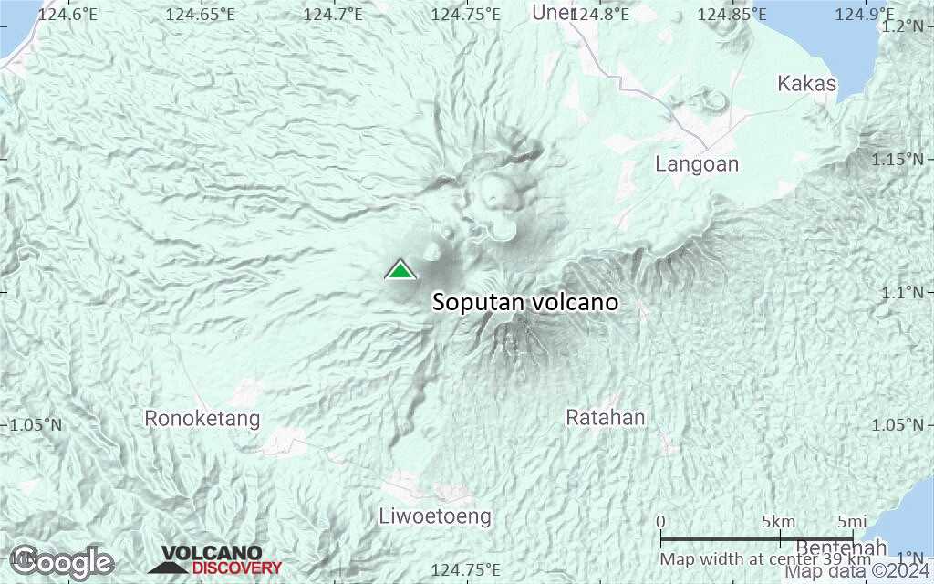
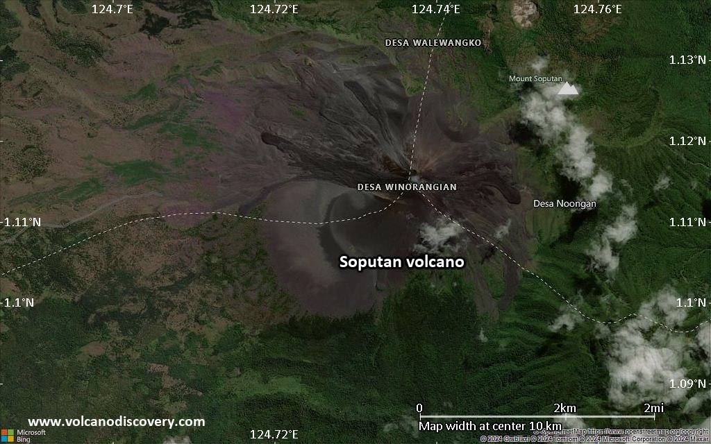
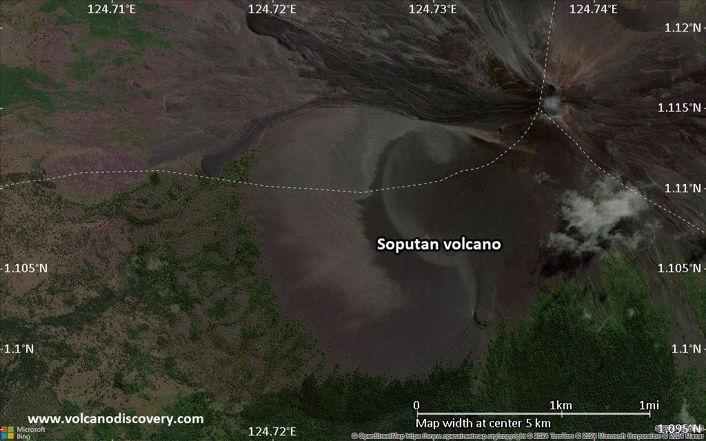
| RSS | EN | DE | EL | ES | FR | IT | RU

Soputan Volcano

Updated: Jun 19, 2025 07:48 GMT -
Stratovolcano
North Sulawesi, Indonesia, 1.11°N / 124.73°E
Summit height: 1784 m (5,853 ft)
Current status: normal or dormant (1 out of 5)
Last update: 23 Mar 2022 (occasional minor ash emissions)

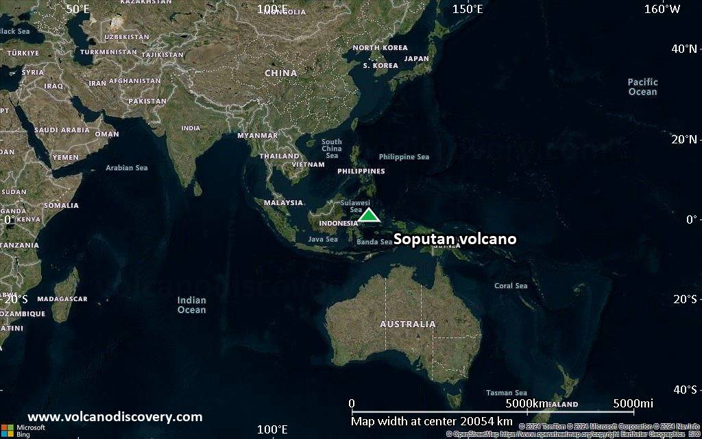
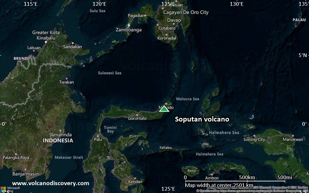
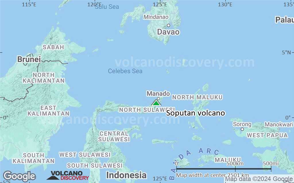
The small Soputan stratovolcano on the southern rim of the Quaternary Tondano caldera on the northern arm of Sulawesi Island is one of Sulawesi's most active volcanoes. The youthful, largely unvegetated volcano rises to 1784 m and is located SW of Sempu volcano. It was constructed at the southern end of a SSW-NNE trending line of vents. During historical time the locus of eruptions has included both the summit crater and Aeseput, a prominent NE-flank vent that formed in 1906 and was the source of intermittent major lava flows until 1924.

[smaller] [larger]
Typical eruption style: Explosive, construction of lava domes, pyroclastic flows, strombolian activity.
Soputan volcano eruptions: 1785, 1819, 1833(?), 1845, 1890, 1901, 1906, 1907, 1908-09, 1910, 1911-12, 1913, 1915, 1917, 1923-24, 1947, 1953, 1966-67, 1968, 1970, 1971, 1973, 1982, 1984, 1985, 1989, 1991-96, 2000-03, 2004, 2005, 2006, 2007, 2008, 2011, 2012, 2013, 2015, 2016

Latest nearby earthquakes

Date and TimeMag / DepthDistance / Location

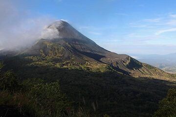
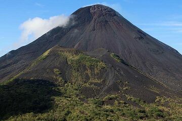
Soputan Volcano Photos

Significant volcanic eruptions: Soputan volcano

In the past 10,000 years, Soputan has had at least 41 confirmed eruptions, all documented by historical records or observations.
The table below lists all known eruptions (date in bold face) of Soputan volcano since around 1900. Updates on the most recent volcanic activity of Soputan can be found on the news page of Soputan volcano.
DateNoteVEIDeathsDamage
2020 Mar 23 - Apr 2
Historical obs./docs.
2
2018 Oct 2 - Dec 16
Historical obs./docs.
3
2016 Jan 2 - Feb 7Puncak Crater
Historical obs./docs.
3
2015 Jan 6 - Mar 9Summit crater and WSW flank
Historical obs./docs.
3
2012 Aug 26 - Sep 19Summit crater
Historical obs./docs.
3
2011 Jul 3 - Aug 15Summit crater and flank
Historical obs./docs.
3
2008 Jun 6 - Nov 2 ?
Historical obs./docs.
3?
2007 Jun 16 ±15 d. - Nov 9 ?
Historical obs./docs.
3
2006 Dec 14 - Dec 26 ?
Historical obs./docs.
1
2005 Dec 26 - 2006 Jan 24 ?
Historical obs./docs.
1
2005 Apr 19 - Jul 18 ?
Historical obs./docs.
2
2004 Oct 18 - Dec 27 ?
Historical obs./docs.
3?
2000 May 13 - 2003 Sep 4 ?
Historical obs./docs.
2
1991 May 22 - 1996 Sep 29 or later
Historical obs./docs.
2
1989 Apr 22 - Apr 23
Historical obs./docs.
2
1985 May 19 - May 20
Historical obs./docs.
2
1984 May 24 - Aug 31
Historical obs./docs.
3
1982 Aug 26 - Nov 10
Historical obs./docs.
3
1973 Jan 6 - May 27
Historical obs./docs.
2
1971 May 19
Historical obs./docs.
1
1970 Feb 16 ±15 d. - May 26 ±5 d.
Historical obs./docs.
2
1968 Jul 16 ±15 d. - Aug 16 ±15 d.
Historical obs./docs.
1
1966 May 21 - 1967 Nov 16 ±15 d.Kawah Soputan
Historical obs./docs.
3
1953 Nov 16 ±15 d.NE flank (Aeseput)
Historical obs./docs.
2
1947 Aug 22 - Aug 27NE flank (Aeseput)
Historical obs./docs.
2
1923 Nov 27 - 1924 Jan 18NE flank (Aeseput)
Historical obs./docs.
2
1917 NovNE flank (Aeseput)
Historical obs./docs.
2
1915 Apr - JunNE flank (Aeseput Weru)
Historical obs./docs.
2
1913 Apr - JulNE flank (Aeseput)
Historical obs./docs.
2
1911 Nov - 1912 AprNE flank (Aeseput)
Historical obs./docs.
2
1910 Nov 15 ±45 d.NE flank (Aeseput)
Historical obs./docs.
2
1908 Jun - 1909 JunNE flank (Aeseput)
Historical obs./docs.
2
1907 Jun 5 - Jun 25 ?NE flank (Aeseput)
Historical obs./docs.
2
1906 Jun 17 - SepNE flank (Aeseput)
Historical obs./docs.
2
1901 Feb 4
Historical obs./docs.
2
Remark:
Our list of volcanic eruptions closely follows the database of eruptions of the Smithsonian's Global Volcanism Project (GVP), the internationally most recognized data source for volcanic eruptions, but also includes significant eruptive episodes or related volcano events. "Volcanic eruptions" are usually to be understood as sequences of individual eruptive episodes that can follow each other, or even overlap (if several vents are involved), and can last many years, decades or even longer. For example, the current activity of Stromboli volcano is understood as a single eruption that has been ongoing since 1934.
Sources: NOAA National Centers for Environmental Information (NCEI), Global Significant Volcanic Eruptions Database. doi:10.7289/V5TD9V7K | Global Volcanism Project / Smithsonian Institution

Soputan Volcano FAQ

+When was the last eruption of Soputan volcano?

+How often does Soputan volcano erupt?

+How active is Soputan volcano at present?

+When was the largest eruption of Soputan volcano?

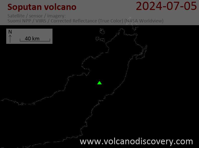
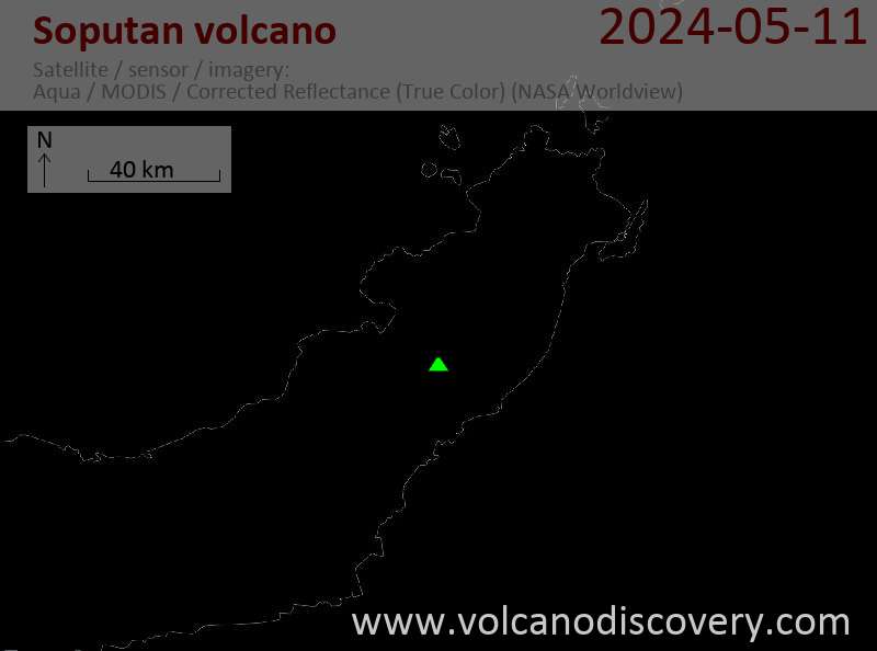
Latest satellite images

Soputan satellite image sat1Soputan satellite image sat2
Soputan Volcano Tours
Sulawesi/Halmahera (Indonesia)
Volcanoes and Spices
17-day volcano trekking tour to the Molucca Sea: N-Sulawesi, Karangetang and Halmahera
17 days / 16 nights - Moderate
Price 3570 €
1-17 Aug 2025
8-24 Sep 2025
6-22 Oct 2025

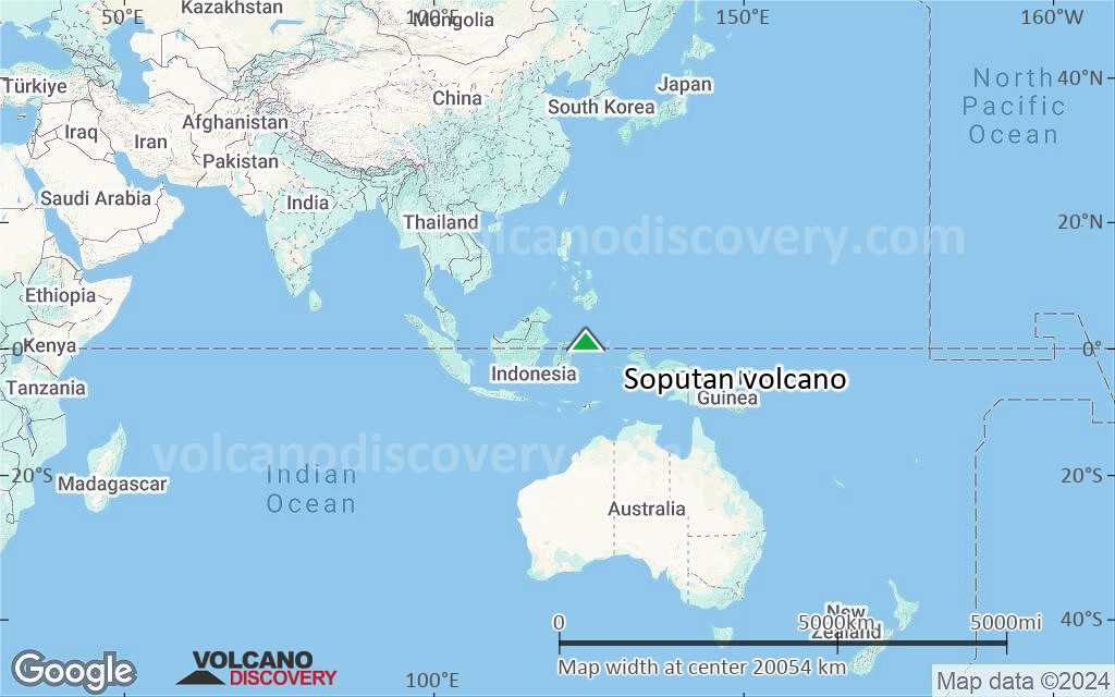
Soputan Volcano Maps

Below is a selection of maps showing the location and surroundings of the volcano at various resolutions based on aerial-imagery / terrain maps. Feel free to use them for non-commercial purposes on your blog or website as long as you credit them with a link back to this page (click to copy it).
Satellite/aerial-type map of Soputan volcano (world scale)
Terrain-type map of Soputan volcano (world scale)
Satellite/aerial-type map of Soputan volcano (region scale large)
Terrain-type map of Soputan volcano (region scale large)
Satellite/aerial-type map of Soputan volcano (region scale medium)
Terrain-type map of Soputan volcano (region scale medium)
Satellite/aerial-type map of Soputan volcano (region scale small)
Terrain-type map of Soputan volcano (region scale small)
Satellite/aerial-type map of Soputan volcano (local scale large)
Terrain-type map of Soputan volcano (local scale large)
Satellite/aerial-type map of Soputan volcano (local scale medium)
Terrain-type map of Soputan volcano (local scale medium)
Satellite/aerial-type map of Soputan volcano (local scale small)
Terrain-type map of Soputan volcano (local scale small)
Satellite/aerial-type map of Soputan volcano (scale of 10s of km)
Terrain-type map of Soputan volcano (scale of 10s of km)
Satellite/aerial-type map of Soputan volcano (scale of 20-40 km)
Terrain-type map of Soputan volcano (scale of 20-40 km)
Satellite/aerial-type map of Soputan volcano (scale of approx. 10-20 km)
Terrain-type map of Soputan volcano (scale of approx. 10-20 km)
Satellite/aerial-type map of Soputan volcano (scale of 5-10 km)
Satellite/aerial-type map of Soputan volcano (scale of few kilometers)
Volcanoes & Earthquakes - new app for Android
Guaranteed tours
1-17 Aug 2025: Volcanoes and Spices - Sulawesi/Halmahera (Indonesia)
1-14 Oct 2025: Desert, salt and volcanoes - Danakil desert (Ethiopia)
4-12 Oct 2025: From Stromboli to Etna - Sicily and Eolian Islands (Italy)
6-21 Oct 2025: From Krakatau to Bali - Java (Indonesia)
3-19 Nov 2025: Volcanoes and Spices - Sulawesi/Halmahera (Indonesia)
= spaces available   = guaranteed   = few spaces left   = booked out
Soputan volcano
Soputan volcano
Tue, 5 May 2020, 07:04

Soputan volcano (North Sulawesi, Indonesia): occasional minor ash emissions

Plume rising from Soputan volcano on 4 May (image: PVMBG)
Volcanic Ash Advisory Center (VAAC) Darwin recorded on 2 May at 00:07 local time new emissions of steam and ash that rose 1,148 ft (350 m) above the summit. ... Read all

On this page:

Try our free app!
Volcanoes & Earthquakes - new app for Android
Android | iOS version

More on VolcanoDiscovery

Why is there advertising on this site?

Support us - Help us upgrade our services!

We truly love working to bring you the latest volcano and earthquake data from around the world. Maintaining our website and our free apps does require, however, considerable time and resources.
We need financing to increase hard- and software capacity as well as support our editor team. We're aiming to achieve uninterrupted service wherever an earthquake or volcano eruption unfolds, and your donations can make it happen! Every donation will be highly appreciated. If you find the information useful and would like to support our team in integrating further features, write great content, and in upgrading our soft- and hardware, please make a donation (PayPal).

Planned features:Thanks to your past donations, these features have been added recently:
Download and Upgrade the Volcanoes & Earthquakes app to get one of the fastest seismic and volcano alerts online:
Android | IOS
Thank you!
Sources: VolcanoDiscovery / VolcanoAdventures and other sources as noted.
Use of material: Most text and images on our websites are owned by us. Re-use is generally not permitted without authorization. Contact us for licensing rights.
Volcanoes & Earthquakes
VolcanoDiscovery Home
Volcanoes | Earthquakes | Photos | Volcano News | | Shop | App
Adventure & Study Travel
Tours to Volcanoes and Volcanic Areas: walking tours, photo tours, study tours
Tours & Dates | FAQ | About us
Get our newsletter!
Company info
Contact | Legal info | Terms & conditions
Follow us
Follow us on facebook Follow us on Instagram Follow us on Bluesky Follow us on Twitter Visit our Youtube channel
EN | DE | EL | ES | FR | IT | RU
VolcanoDiscovery GmbH, Germany, Reg. nr.: HRB 103744, EU Tax Id: DE 297 465 123 owned and created by
Dr. Tom Pfeiffer, volcanologist, volcano photographer, tour organizer member of
IAVCEI
IAVCEI
Vulkanologische Gesellschaft
Volcanological Society
Ecotourism Greece
Ecotourism Greece
RUV insurance
Insured by R+V
VolcanoDiscovery © 2004- All Rights Reserved | Privacy - Cookie Settings