| RSS | EN | DE | EL | ES | FR | IT | RU

Mendeleev Ηφαίστειο

Updated: 1 Μαΐου 2025 21:32 GMT -
stratovolcano
Νησί Κουνασίρ (Νήσοι Κουρίλ), 43.98°N / 145.74°E
Summit height: 888 m / 2,913 ft
Current status: normal or dormant (1 out of 5)

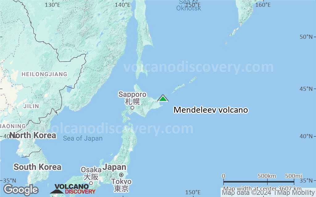
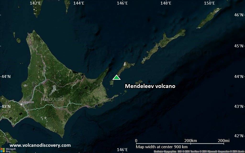
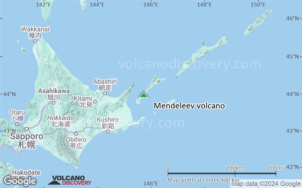
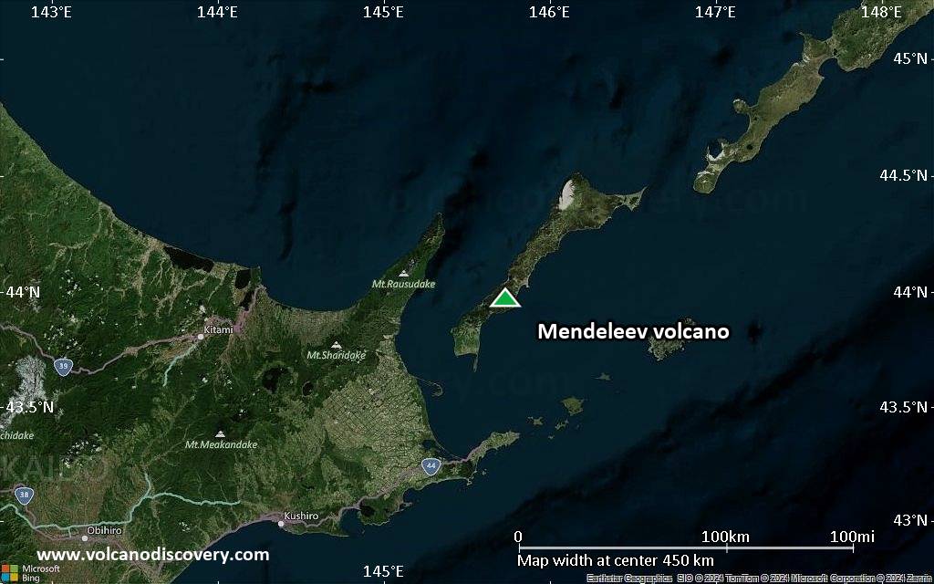
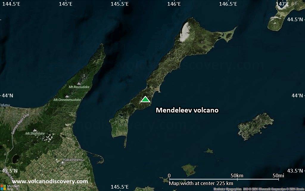
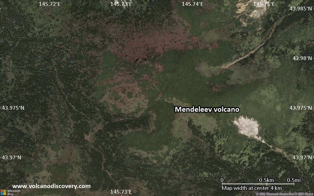
Mendeleev (Raususan or Rausudake in Japanese) is a low stratovolcano on Kunashir Island in the southern Kurile Islands, 40 km from Hokkiado in Northern Japan. The volcano is composed of 3 nested calderas measuring 6x9 km (the oldest caldera), 3x3.5 km, and 1x1 km (youngest caldera).
A large sub-aerial eruption occurred during the formation of the youngest 1x1 km
caldera. It was followed by the growth of an extrusive lava dome 2550 ± 40 years ago. The effusive activity continued for several centuries.
Mendeleev volcano contains a shallow magma chamber at 4.5 km depth and a deep magma source at a depth of 30-60 km.

[smaller] [larger]
Typical eruption style: explosive
Mendeleev volcano eruptions: 1901(?), 1880, 2270 BC ± 50

Latest nearby earthquakes

Ημερομην. κ. ώραMag / ΒάθοςΑπόσταση / Τοποθεσία
30 Απρ 07:00 (GMT +11)
3.3

142 km
20 km νοτιοανατολικά Sea of Okhotsk, 23 km νότια από Γιούζνο-Κουρίλσκ, Yuzhno-Kurilsky, Όμπλαστ της Σαχαλίνης, ΡωσίαI FELT IT Περ.

Background

Mendeleev volcano is dominantly andesitic-dacitic in composition. A central cone formed inside the younger caldera and was breached to the west by a large debris avalanche about 4200 years ago. A lava dome that grew inside the avalanche scarp forms the 888 m high point of the volcano.
Additional lava domes in the northern part of the older caldera are considered to represent flank activity of the younger caldera. The only unambiguous historical eruption was a small phreatic explosion in 1880. 4 solfatara fields lie at the eastern and northern flanks of the central cone, and the Goriachy Pliazh geothermal field is located outside the caldera along the eastern coast.
---
Sources:
- Mendeleev volcano information from GVP
- Abdurakhmanov et al (2004) "MENDELEEV VOLCANO: HISTORY OF DEVELOPMENT AND RECENT STATE (KUNASHIR ISL., KURILE ISLANDS)", IV International Biennial Workshop on Subduction Processes emphasizing the Japan-Kurile-Kamchatka-Aleutian Arcs, Petropavlovsk-Kamchatsky, August 21-27, 2004, web.ru/conf/kamchatka_2004

Σημαντικές ηφαιστειακές εκρήξεις: Mendeleev volcano

In the past 10,000 years, Mendeleev has had only one confirmed historic eruption in 1880 and one around 2270 BC inferred from geological evidence.
There is one uncertain or discredited eruption in 1900 from Mendeleev volcano.
The table below lists all known eruptions (date in bold face) of Mendeleev volcano in historic times and during the past 10,000 years. Updates on the most recent volcanic activity of Mendeleev can be found on the news page of Mendeleev volcano.
ΗμερομηνίαΣημείωσηVEIΘάνατοιΖημιά
?? 1900
Αβέβαιη έκρηξη
2?
άγνωστο
1880NE solfatara field
Ιστορικές παρατ.εις/έγγραφα.
1
άγνωστο
2270 ±50 y. BCWest side of central cone?
άγνωστο
Remark:
Our list of volcanic eruptions closely follows the database of eruptions of the Smithsonian's Global Volcanism Project (GVP), the internationally most recognized data source for volcanic eruptions, but also includes significant eruptive episodes or related volcano events. "Volcanic eruptions" are usually to be understood as sequences of individual eruptive episodes that can follow each other, or even overlap (if several vents are involved), and can last many years, decades or even longer. For example, the current activity of Stromboli volcano is understood as a single eruption that has been ongoing since 1934.
Πηγές: NOAA National Centers for Environmental Information (NCEI), Global Significant Volcanic Eruptions Database. doi:10.7289/V5TD9V7K | Global Volcanism Project / Smithsonian Institution

Εκρήξεις ηφαιστείου Mendeleev


2000 seismic swarm
Earthquake swarms occurred at Mendeleev volcano in the summer of 2000. The earthquakes were less than 20 km deep.

1990 increased fumarolic activity
In 1990, activity in the NW fumarolic field of Mendeleev volcano increased. Molten sulphur was observed at the upper basic fumarole. A new thermal area was observed as well as an increase of temperatures of other hot springs.

1987 earthquake swarm
An earthquake swarm at 10 km depth occurred at Mendeleev volcano during 4-5 May 1987. In the same month, a small steam-gas emission occurred in the NE fumarole field.

1984 temperature increase
In 1984, temperatures of the Revushchaya fumarole reached 130 deg C and produced a flow of molten sulphur.

1978 fumarole activity
On 15 August 1978 the temperature of the Spokoiny fumarole in the NW field increased to 113 deg C and was accompanied by the appearance of molten sulphur.

1977 earthquake swarm
In February-April 1977, a seismic swarm with more than 200 earthquakes occurred at Mendeleev volcano.
The earthquakes were caused by drilling at Goryachy Plyazh geothermal field. In late August 1977, harmonic emissions of steam-and-gas plumes which reached up to 150-200 m height occurred at the NE fumarole field.

1946 activity
In 1946, local inhabitants near Mendeleev heard a roar produced by escaping hot gases and steam from the NE fumarole field.

1901 activity
Thundering noises were reported from Mendeleev volcano in 1901, indicating a possible eruption.

1880 eruption
A small phreatic explosion happened at Mendeleev volcano in 1880 from the NE fumarolic field.

Mendeleev Volcano FAQ

+When was the last eruption of Mendeleev volcano?

+How often does Mendeleev volcano erupt?

+When was the largest eruption of Mendeleev volcano?

Τελευταίες δορυφορικές εικόνες

Mendeleev δορυφορική εικόνα sat1Mendeleev δορυφορική εικόνα sat2

Mendeleev Ηφαίστειο Χάρτες

Below is a selection of maps showing the location and surroundings of the volcano at various resolutions based on aerial-imagery / terrain maps. Feel free to use them for non-commercial purposes on your blog or website as long as you credit them with a link back to this page (click to copy it).
Satellite/aerial-type map of Mendeleev volcano (world scale)
Terrain-type map of Mendeleev volcano (world scale)
Satellite/aerial-type map of Mendeleev volcano (region scale large)
Terrain-type map of Mendeleev volcano (region scale large)
Satellite/aerial-type map of Mendeleev volcano (region scale medium)
Terrain-type map of Mendeleev volcano (region scale medium)
Satellite/aerial-type map of Mendeleev volcano (region scale small)
Terrain-type map of Mendeleev volcano (region scale small)
Satellite/aerial-type map of Mendeleev volcano (local scale large)
Terrain-type map of Mendeleev volcano (local scale large)
Satellite/aerial-type map of Mendeleev volcano (local scale medium)
Terrain-type map of Mendeleev volcano (local scale medium)
Satellite/aerial-type map of Mendeleev volcano (local scale small)
Terrain-type map of Mendeleev volcano (local scale small)
Satellite/aerial-type map of Mendeleev volcano (scale of 10s of km)
Terrain-type map of Mendeleev volcano (scale of 10s of km)
Satellite/aerial-type map of Mendeleev volcano (scale of 20-40 km)
Terrain-type map of Mendeleev volcano (scale of 20-40 km)
Satellite/aerial-type map of Mendeleev volcano (scale of approx. 10-20 km)
Terrain-type map of Mendeleev volcano (scale of approx. 10-20 km)
Satellite/aerial-type map of Mendeleev volcano (scale of 5-10 km)
Satellite/aerial-type map of Mendeleev volcano (scale of few kilometers)
Volcanoes & Earthquakes - new app for Android
Guaranteed tours
9-25 Jun 2025: Volcanoes and Spices - N-Sulawesi Halmahera (Ινδονησία)
7-22 Jul 2025: From Krakatau to Bali - Java (Indonesia)
7-23 Jul 2025: Volcanoes and Spices - N-Sulawesi Halmahera (Ινδονησία)
1-17 Aug 2025: Volcanoes and Spices - N-Sulawesi Halmahera (Ινδονησία)
1-14 Oct 2025: Desert, salt and volcanoes - Danakil desert (Ethiopia)
4-12 Oct 2025: From Stromboli to Etna - Sicily and Eolian Islands (Italy)
6-21 Oct 2025: From Krakatau to Bali - Java (Indonesia)
3-19 Nov 2025: Volcanoes and Spices - N-Sulawesi Halmahera (Ινδονησία)
= spaces available   = guaranteed   = few spaces left   = booked out

No news in this list.

Στην σελίδα:

Try our free app!
Volcanoes & Earthquakes - new app for Android
Android | iOS version

More on VolcanoDiscovery

Why is there advertising on this site?

Support us - Help us upgrade our services!

We truly love working to bring you the latest volcano and earthquake data from around the world. Maintaining our website and our free apps does require, however, considerable time and resources.
We need financing to increase hard- and software capacity as well as support our editor team. We're aiming to achieve uninterrupted service wherever an earthquake or volcano eruption unfolds, and your donations can make it happen! Every donation will be highly appreciated. If you find the information useful and would like to support our team in integrating further features, write great content, and in upgrading our soft- and hardware, please make a donation (PayPal).

Planned features:Thanks to your past donations, these features have been added recently:
Download and Upgrade the Volcanoes & Earthquakes app to get one of the fastest seismic and volcano alerts online:
Android | IOS
Thank you!
Sources: VolcanoDiscovery / VolcanoAdventures and other sources as noted.
Use of material: Most text and images on our websites are owned by us. Re-use is generally not permitted without authorization. Contact us for licensing rights.
Volcanoes & Earthquakes
VolcanoDiscovery Home
Ηφαίστεια | Σεισμοί | Photos | News | | Shop | App
Adventure & Study Travel
Tours to Volcanoes and Volcanic Areas: walking tours, photo tours, study tours
Tours & Dates | FAQ | About us
Get our newsletter!
Company info
Contact | Legal info | Terms & conditions
Follow us
Follow us on facebook Follow us on Instagram Follow us on Bluesky Follow us on Twitter Visit our Youtube channel
EN | DE | EL | ES | FR | IT | RU
VolcanoDiscovery GmbH, Germany, Reg. nr.: HRB 103744, EU Tax Id: DE 297 465 123 owned and created by
Dr. Tom Pfeiffer, volcanologist, volcano photographer, tour organizer member of
IAVCEI
IAVCEI
Vulkanologische Gesellschaft
Volcanological Society
Ecotourism Greece
Ecotourism Greece
RUV insurance
Insured by R+V
VolcanoDiscovery © 2004- All Rights Reserved | Privacy - Cookie Settings