Big Pine Volcanic Field Volcano
Updated: 10 mayo 2024 09:34 GMT -
Pyroclastic cone(s) 1950 m / 6398 ft
California, United States, 37.05°N / -118.25°W
Current status: (probably) extinct (0 out of 5)
California, United States, 37.05°N / -118.25°W
Current status: (probably) extinct (0 out of 5)
[smaller] [larger]
Erupciones del volcán Big Pine Volcanic Field: None during the past 10,000 years
Less than few million years ago (Pleistocene)
Latest nearby earthquakes
| Fecha / Hora | Revista / Prof. | Distancia / Ubicación | |||
| 9 may 05:05 (Los Angeles) | 1.6 5.2 km | Más | |||
| domingo, 5 mayo 2024 GMT (4 sismos) | |||||
| 5 may 12:20 (Los Angeles) | 1.6 10.4 km | Más | |||
| 5 may 07:34 (Los Angeles) | 1.6 8.9 km | Más | |||
| 5 may 01:51 (Los Angeles) | 2.7 12 km | 25 km al norte | Más | ||
| 5 may 00:59 (Los Angeles) | 2.3 9.5 km | 27 km al noreste | Más | ||
| miércoles, 1 mayo 2024 GMT (1 sismo) | |||||
| 30 abr 21:24 (Los Angeles) | 1.6 5.6 km | Más | |||
Background
The Big Pine (Aberdeen) volcanic field in the Owens Valley contains more than 40 vents over a 1000 km2 region of the Owens Valley. The basaltic field consists of cinder cones that produced lava flows up to 9 km long and a single rhyolitic lava dome. Activity was episodic throughout the Quaternary. Chesterman (1982) considers the latest activity to be of Holocene or late Pleistocene age; other sources attribute the last eruptions to the Pleistocene.---
Source: Smithsonian / GVP volcano information
Big Pine Volcanic Field Volcano Photos
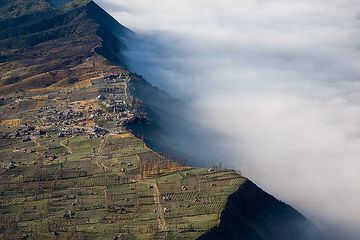
Ver en Cemoro Lawang aldea en el borde de la caldera (Photo: Tom Pfeiffer)
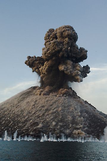
Una andanada de bombas cae al agua, algunas bastante lejos de la orilla. (Photo: Iris Karinkanta)
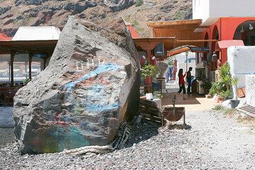
Gran roca que una vez cayó en la playa en el puerto de Therasia (Photo: Tom Pfeiffer)
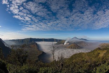
La caldera Tengger en la mañana (Photo: Tom Pfeiffer)
Latest satellite images