Longonot Volcán
Updated: 2 mayo 2025 10:43 GMT -
Stratovolcano
Kenya, -0.91°S / 36.45°E 
+Hora local:
Salida del sol:
Puesta del sol:
Salida de la luna:
Puesta de la luna:
Summit height: 2776 m / 9,108 ft
Current status: normal or dormant (1 out of 5)
[smaller] [larger]
Erupciones del volcán Longonot: 1863 ± 5 years
Latest nearby earthquakes
| Fecha y hora | Mag / Prof. | Distancia / Ubicación | |||
|---|---|---|---|---|---|
Background
The trachytic Longonot stratovolcano SE of Lake Naivasha in the Gregory Rift valley contains a 8 x 12 km caldera. Formation of the caldera accompanied large explosive eruptions about 21,000 years ago. A large central cone that was constructed within the caldera forms the 2776-m-high summit of the volcano. The younger cone is truncated by a circular, 1.8-km-wide crater. Post-caldera lavas are found on the caldera floor and the volcano's flanks, marking a late stage of effusive eruptions. A well-preserved satellitic cone is located on the NE flank. Masai tradition records a lava flow on the northern flank during the 19th century. Similarly youthful-looking lava flows occur on the SW flank.---
Smithsonian / GVP volcano information
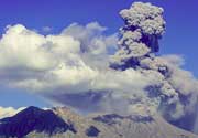
Longonot Volcano Photos
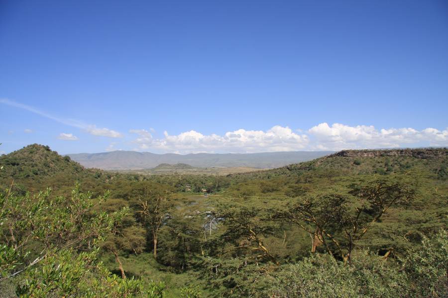
Crater Lake, cerca del lago Naivasha, Hells Gate NP y Mt. Longonot, distrito de Kakuru, Valle del Rift, Kenia (Photo: WNomad)

Volcán Monte Longonot de Kijabe, Kenia (Photo: WNomad)
Erupciones volcánicas significativas: Longonot volcano
No historic eruptions are known from Longonot volcano, but evidence from at least 3 eruptions during the past 10,000 years can be found in the geological record.
The table below lists all known eruptions (date in bold face) of Longonot volcano in historic times and during the past 10,000 years. Updates on the most recent volcanic activity of Longonot can be found on the news page of Longonot volcano.
| Fecha | Nota | VEI | Fallecidos | Daños | |
|---|---|---|---|---|---|
| Northern flank | ? | desconocido | |||
| ? | desconocido | ||||
| ? | desconocido | ||||
Remark:
Our list of volcanic eruptions closely follows the database of eruptions of the Smithsonian's Global Volcanism Project (GVP), the internationally most recognized data source for volcanic eruptions, but also includes significant eruptive episodes or related volcano events. "Volcanic eruptions" are usually to be understood as sequences of individual eruptive episodes that can follow each other, or even overlap (if several vents are involved), and can last many years, decades or even longer. For example, the current activity of Stromboli volcano is understood as a single eruption that has been ongoing since 1934.
Fuentes: NOAA National Centers for Environmental Information (NCEI), Global Significant Volcanic Eruptions Database. doi:10.7289/V5TD9V7K | Global Volcanism Project / Smithsonian Institution
Longonot Volcano FAQ
+When was the last eruption of Longonot volcano?
The last confirmed eruption of Longonot occurred around 1863.
Últimas imágenes satelitales
Longonot Volcán Mapas
Below is a selection of maps showing the location and surroundings of the volcano at various resolutions based on aerial-imagery / terrain maps. Feel free to use them for non-commercial purposes on your blog or website as long as you credit them with a link back to this page (click to copy it).

Satellite/aerial-type map of Longonot volcano (world scale)

Terrain-type map of Longonot volcano (world scale)

Satellite/aerial-type map of Longonot volcano (region scale large)

Terrain-type map of Longonot volcano (region scale large)

Satellite/aerial-type map of Longonot volcano (region scale medium)

Terrain-type map of Longonot volcano (region scale medium)
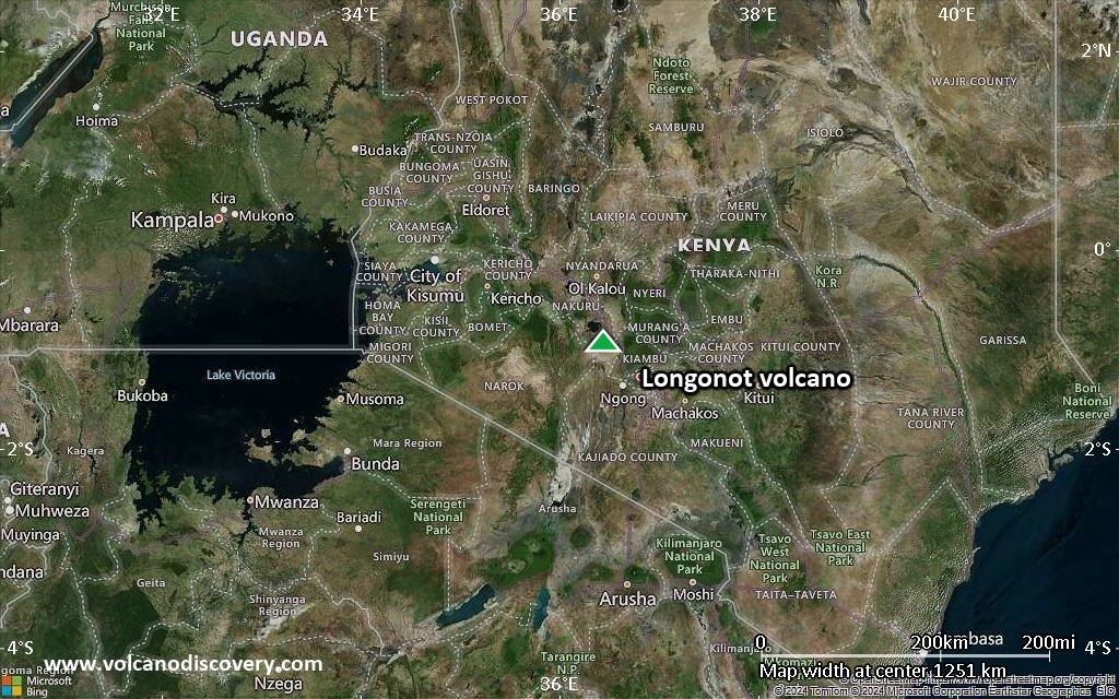
Satellite/aerial-type map of Longonot volcano (region scale small)

Terrain-type map of Longonot volcano (region scale small)

Satellite/aerial-type map of Longonot volcano (local scale large)

Terrain-type map of Longonot volcano (local scale large)

Satellite/aerial-type map of Longonot volcano (local scale medium)

Terrain-type map of Longonot volcano (local scale medium)

Satellite/aerial-type map of Longonot volcano (local scale small)

Terrain-type map of Longonot volcano (local scale small)

Satellite/aerial-type map of Longonot volcano (scale of 10s of km)

Terrain-type map of Longonot volcano (scale of 10s of km)

Satellite/aerial-type map of Longonot volcano (scale of 20-40 km)

Terrain-type map of Longonot volcano (scale of 20-40 km)

Satellite/aerial-type map of Longonot volcano (scale of approx. 10-20 km)

Terrain-type map of Longonot volcano (scale of approx. 10-20 km)

Satellite/aerial-type map of Longonot volcano (scale of 5-10 km)
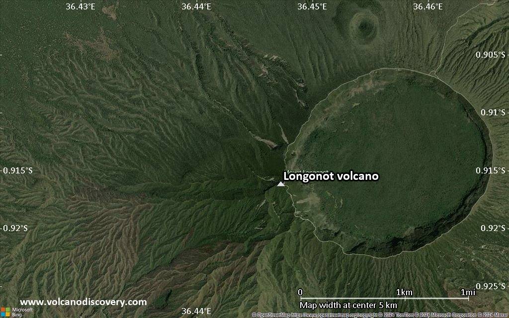
Satellite/aerial-type map of Longonot volcano (scale of few kilometers)