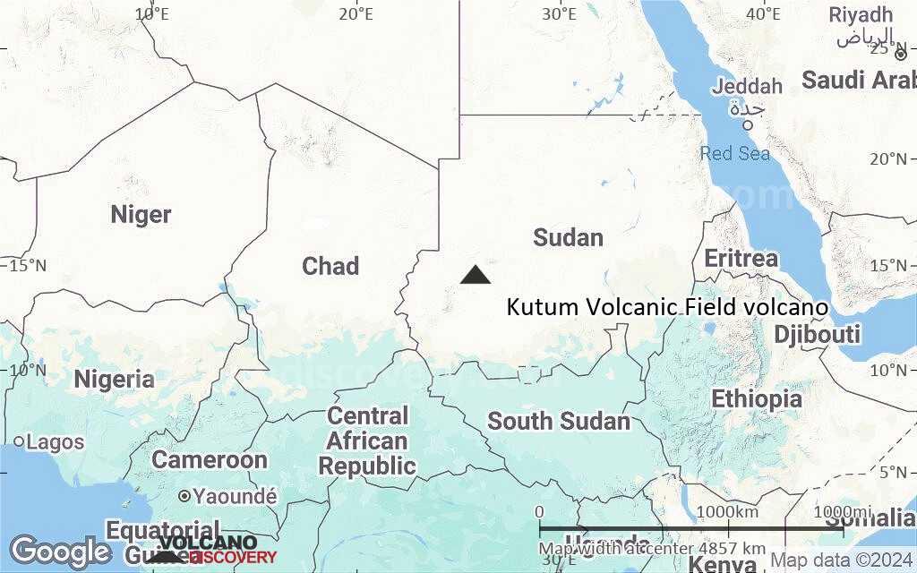
Kutum Volcanic Field Vulcano
Updated: 13 maggio 2025 17:11 GMT -
Scoria cones
Sudan, 14.57°N / 25.85°E 
Summit height: unknown summit elevation
Current status: (probably) extinct (0 out of 5)
[smaller] [larger]
Eruzioni del vulcano Kutum Volcanic Field: unknown, no recent eruptions
Latest nearby earthquakes
| Data e ora | Mag / Prof. | Distanza / Posizione | |||
|---|---|---|---|---|---|
Background
The Kutum basaltic volcanic field in the northern Dafur area of western Sudan, is located SW of the larger Meidob volcanic field. As with other Saharan volcanic fields, Kutum (also known as the Tagabo Hills or Berti Hills) contains very well-preserved cones, lava flows, and explosion craters. They were considered to be of late-Pleistocene or even Holocene age (Almond, 1974). Franz et al. (1997), however, assigned only Tertiary age ranges for rocks from Tagabo Hills.---
Smithsonian / GVP volcano information
Ultime immagini satellitari
Kutum Volcanic Field Vulcano Mappe
Below is a selection of maps showing the location and surroundings of the volcano at various resolutions based on aerial-imagery / terrain maps. Feel free to use them for non-commercial purposes on your blog or website as long as you credit them with a link back to this page (click to copy it).

Satellite/aerial-type map of Kutum Volcanic Field volcano (world scale)

Terrain-type map of Kutum Volcanic Field volcano (world scale)

Satellite/aerial-type map of Kutum Volcanic Field volcano (region scale large)
Terrain-type map of Kutum Volcanic Field volcano (region scale large)

Satellite/aerial-type map of Kutum Volcanic Field volcano (region scale medium)

Terrain-type map of Kutum Volcanic Field volcano (region scale medium)

Satellite/aerial-type map of Kutum Volcanic Field volcano (region scale small)

Terrain-type map of Kutum Volcanic Field volcano (region scale small)

Satellite/aerial-type map of Kutum Volcanic Field volcano (local scale large)

Terrain-type map of Kutum Volcanic Field volcano (local scale large)

Satellite/aerial-type map of Kutum Volcanic Field volcano (local scale medium)

Terrain-type map of Kutum Volcanic Field volcano (local scale medium)

Satellite/aerial-type map of Kutum Volcanic Field volcano (local scale small)

Terrain-type map of Kutum Volcanic Field volcano (local scale small)

Satellite/aerial-type map of Kutum Volcanic Field volcano (scale of 10s of km)

Terrain-type map of Kutum Volcanic Field volcano (scale of 10s of km)

Satellite/aerial-type map of Kutum Volcanic Field volcano (scale of 20-40 km)

Terrain-type map of Kutum Volcanic Field volcano (scale of 20-40 km)

Satellite/aerial-type map of Kutum Volcanic Field volcano (scale of approx. 10-20 km)

Terrain-type map of Kutum Volcanic Field volcano (scale of approx. 10-20 km)

Satellite/aerial-type map of Kutum Volcanic Field volcano (scale of 5-10 km)

Satellite/aerial-type map of Kutum Volcanic Field volcano (scale of few kilometers)