| RSS | EN | DE | EL | ES | FR | IT | RU
1 sismo Mag. 1+
Numero di sismi rispetto alla media a lungo termine, ultimi 7 giorni

Ultimi terremoti in o vicino a Gran Bretagna dal 2025, - elenco completo, mappa, statistiche

Ultimo
Vedi tutto
Mag. 2.3 sismo 2.7 km a nord est da Crewe - Inghilterra, Regno Unito - 17 giu 2025 -
Il più forte dal 2025Mag. 3.4 North Sea - 27 gen 2025 -
Aggiornato: 23 giu. 2025 20:18 GMT -
Trova tutti gli ultimi sismi in o vicino a Gran Bretagna nel nostro elenco qui sotto! Gli eventi vengono spesso segnalati in pochi minuti. Utilizza l'icona di aggiornamento per trovare terremoti verificatosi appena ora!
Nelle ultime 24 ore, Gran Bretagna no ha avuto sismi confermati.
Negli ultimi 174 giorni ci sono stati 86 terremoti di magnitudo fino a 3.4 in Gran Bretagna:
  • 6 sismi di magnitudo 3 o superiore
  • 14 sismi di magnitudo tra 2 e 3
  • 66 sismi sotte magnitudo 2
Numero di sismi all'anno
Leggi di più
Sismi più vecchi mostrati in giallo, quelli più recenti in rosso.
[sismi -] [sismi +] [più piccolo] [più grande]
Filtra per magnitudo:
Tutto
1.0+
2.0+
3.0+
Controlla subito se ci sono nuovi sismi!
in sec
Interrompe l'aggiornamento automatico
Mostra tutti i sismi recenti o significativi dal 2025, magnitudine 0 o superiore, entro una distanza massima di 100 km (66 di 86 sismi, mostra di più):
Ultimi terremoti in o vicino a Gran Bretagna dal 2025, - elenco completo, mappa, statistiche
Data e oraMag
Prof.
Vulcano più vicinoPosizioneDettagliCarta
17 giu 10:25 (Tempo Universale)
2.3

8 km
Crewe,cheshire
Info
17 giu 01:09 (Tempo Universale)
0.7

3 km
Kinnelhead,d And G
Info
lunedì, 16 giugno 2025 GMT (2 sismi)
16 giu 02:51 (Tempo Universale)
0.9

2 km
Comrie,perth And Kinross
Info
16 giu 02:18 (Tempo Universale)
1.4

2 km
Comrie,perth And Kinross
Info
venerdì, 13 giugno 2025 GMT (2 sismi)
13 giu 03:55 (Tempo Universale)
1.0

2 km
Comrie,perth And Kinross
Info
13 giu 00:43 (Tempo Universale)
1.3

5 km
Great Asby,cumbria
Info
sabato, 7 giugno 2025 GMT (3 sismi)
7 giu 20:51 (GMT +1)
0.5

1 km
56 km a sud ovest Ireland: Irish Sea
Info
7 giu 09:25 (Tempo Universale)
2.7

12 km
106 km a nord United Kingdom
Info
7 giu 09:25 (Tempo Universale)
2.4

0 km
153 km a nord Viking Graben
Info
Mostra di più
Stima dell'energia sismica combinata rilasciata: 2.4 x 10¹⁰ joules (6.55 MWh, equivalente a 5.64 tonnellate di TNT) | equivalente a UN terremoto di magnitudo 3.7 | sull'energia sismica

Gran Bretagna Quake-O-Meter

L'attività sismica è aumentata o diminuita?
Numero di sismi: -
Numero di sismi rispetto alla media
Attività sismica: ? %
Attività sismica rispetto alla media
Sotto la media
Gamma normale
Sopra la media
Aggiornato

Sismi, magnitudo e profondità nel tempo

Ultime 48 ore
Ultimi 7 giorni
14 giorni
30 giorni
1 anno
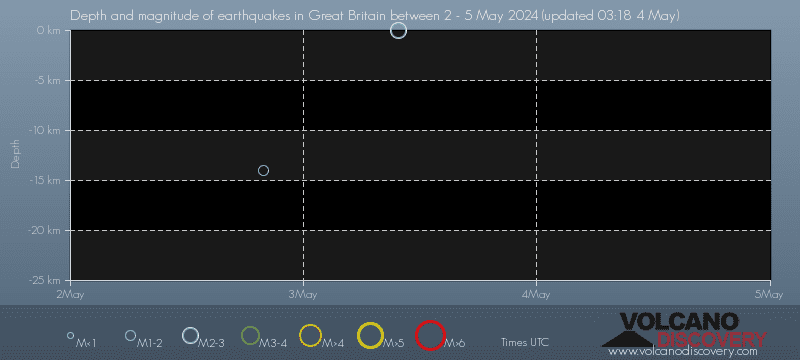
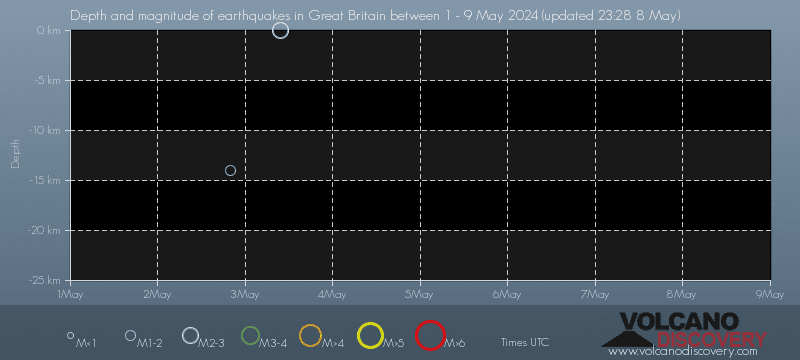
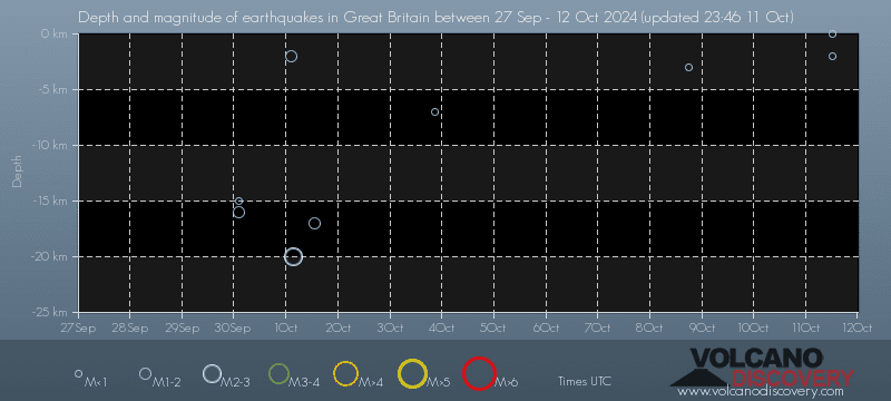
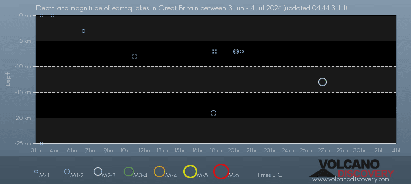
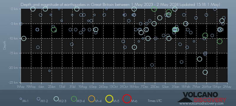
Grafico della profondità dei sismi
Profondità e magnitudo dei sismi nel tempo
Grafico della profondità dei sismi
Profondità e magnitudo dei sismi nel tempo
Grafico della profondità dei sismi
Profondità e magnitudo dei sismi nel tempo
Grafico della profondità dei sismi
Profondità e magnitudo dei sismi nel tempo
Grafico della profondità dei sismi
Profondità e magnitudo dei sismi nel tempo

Ultimi segnali sismici

Seismic station: Eskdalemuir Array, site EKR10, Scotland (EKR10/IM network) | Mostra sulla mappa | Station Info
Seismic station Eskdalemuir Array, site EKR10, Scotland: seismogram of vertical movement current 24 hours interval (source: IRIS/NSF SAGE)
Seismogram (vertical component) current 24 hours interval. Source: IRIS query builder webtool
Mostra di più

Catalogo dei sismi - Cerca sismi passati

Cerca terremoti in quest'area per giorno, mese, anno o intervallo di date:
o
Cerca sismi!
Sentito un sismo? Segnalalo!
Sismi vicino a me!

Statistiche sismiche

Numero medio di terremoti

Sulla base dei dati degli ultimi 55 anni et l'archivio dei sismi fino al 1900, si verificano in media circa 97 terremoti all'anno nel Regno Unito:
  • Mag. 5 o superiore: 0.04 terremoti all'anno (o 1 terremoto ogni 22.7 anni)
  • Mag. 4 o superiore: 0.98 terremoti all'anno (o 1 terremoto ogni 1 anni)
  • Mag. 3 o superiore: 6.3 terremoti all'anno
  • Mag. 2 o superiore: 28.6 terremoti all'anno
  • Mag. 1 o superiore: 75 terremoti all'anno (o 6.3 terremoti al mese)
Il Regno Unito ha relativamente pochi terremoti. Tuttavia, Il Regno Unito ha avuto almeno 3 sismi sopra magnitudo 5 dal 1970, il che suggerisce che sismi forti di questa magnitudo si verificano, anche se raramente, probabilmente in media all'incirca ogni 15 a 20 anni.

Numero di terremoti nel tempo

Ultimi 90 giorni
30 giorni
7 giorni
24 ore
2024
2025 finora
Numero di terremoti nel tempo: Ultimi 90 giorni
Numero di terremoti nel tempo: 30 giorni
Numero di terremoti nel tempo: 7 giorni
Numero di terremoti nel tempo: 24 ore
Numero di terremoti nel tempo: 2024
Numero di terremoti nel tempo: 2025 finora

Incorpora o condividi la mappa autonoma

Sismi più grandi in o vicino a Gran Bretagna

Il terremoto più forte degli ultimi 10 anni

Mag. 4.9 sismo Inner Seas off the West Coast of Scotland - 85 km a ovest da Greenock, Regno Unito - 1 lug 2020 -
Il sismo più grande che si è verificato in o vicino a Gran Bretagna negli ultimi 10 anni è stato un terremoto di magnitudo 4.9 che ha colpito Scozia,  Regno Unito, 5 anni fa il mercoledì 1 lug 2020 alle 05:21 ora locale (Europe/London GMT +1). Il sismo era avvenuto a 85 km di distanza a ovest da Greenock ed aveva und profondità di 11 km.

Il terremoto più forte dal 1900

Mag. 6.0 sismo Mare del Nord - 89 km a nord est da Grimsby, Regno Unito - 7 giu 1931 -
94 anni fa, domenica 7 giu 1931 alle 00:25 (GMT +0 ora locale), Inghilterra,  Regno Unito, è stato colpito da un sismo di magnitudo 6.0. Questo è stato il più grande terremoto avvenuto in o vicino a Gran Bretagna in più di 100 anni (dal 1900).
Di seguito è riportato un elenco e una mappa dei sismi in o vicino a Gran Bretagna più grandi degli ultimi anni e dal 1900.
Data e oraMag
Prof.
###DIST_LABEL###PosizioneDettagliCarta
1 lug 2020 05:21 (London)
4.9

11 km
10 km a nord ovest Inner Seas off the West Coast of Scotland, 85 km a ovest da Greenock, Regno Unito Info
23 apr 2020 05:30 (GMT +0)
4.0

10 km
55 km a sud-est North Sea 2 reportsInfo
22 feb 2020 18:42 (GMT +0)
4.0

5 km
264 km a est North Sea Info
24 set 2019 13:38 (GMT +0)
4.5

10 km
227 km a nord est North Sea 7 reportsInfo
9 giu 2018 22:14 (Tempo Universale)
4.1

10 km
6 km a sud-est7 km NNE of Withernsea, United Kingdom Info
17 feb 2018 15:31 (London)
4.3

12 km
Neath Port Talbot, 13 km a nord est da Swansea, Regno Unito 5491 reportsInfo
30 giu 2017 13:33 (GMT +0)
4.3

0 km
233 km a nord est CENTRAL NORTH SEA (CENTRAL GRABEN) Info
3 gen 2017 18:52 (Tempo Universale)
4.0

10 km
134 km a est North Sea 2 reportsInfo
3 nov 2016 10:57 (GMT +0)
4.2

116 km
198 km a nord est North Sea 1 reportInfo
6 ago 2015 15:03 (Tempo Universale)
4.0

10 km
49 km a sud-est North Sea Info
22 mag 2015 01:52 (Tempo Universale)
4.0

10 km
United Kingdom 941 reportsInfo
9 ott 2014 20:15 (London)
5.5

120 km
4 km a nord ovest 5.5 SCOTLAND, UNITED KINGDOM 2 reportsInfo
25 ago 2013 09:58 (Tempo Universale)
4.1

8 km
16 km a ovestnear e of Magnitude 4.2, Near of Glasgow Info
30 ago 2012 15:47 (Paris)
4.1

16 km
29 km a sud-est FRANCE Info
27 feb 2008 00:56 (Tempo Universale)
4.8

18 km
England, United Kingdom Info
4 giu 2007 17:34 (Tempo Universale)
4.2

10 km
225 km a nord est North Sea (United Kingdom) Info
28 apr 2007 08:18 (London)
4.6

10 km
1 km WNW of Lympne, United Kingdom Info
23 gen 2007 17:32 (GMT +0)
4.1

10 km
59 km a sud-est 57 km ENE of Broadstairs, United Kingdom Info
7 gen 2007 01:50 (GMT +0)
4.8

10 km
158 km a nord 206 km W of Florø, Norway Info
18 mar 2004 10:15 (London)
4.1

10 km
England, United Kingdom Info
21 ott 2002 11:42 (Tempo Universale)
4.3

5 km
England, United Kingdom Info
22 set 2002 23:53 (Tempo Universale)
4.8

9.4 km
England, United Kingdom Info
28 ott 2001 17:25 (London)
4.2

12 km
5 km E of Long Clawson, United Kingdom Info
1 giu 2001 00:42 (London)
4.0

29 km
11 km a sud 20 km NNW of Flexbury, United Kingdom Info
21 dic 2000 23:53 (GMT +0)
4.0

10 km
39 km a sud-est 38 km NNE of Cromer, United Kingdom Info
8 dic 2000 05:53 (GMT +0)
4.7

10 km
167 km a nord est 169 km ESE of Lerwick, United Kingdom Info
23 set 2000 04:23 (Tempo Universale)
4.0

13 km
England, United Kingdom Info
25 ott 1999 20:15 (London)
4.5

10 km
10 km N of Hirwaun, United Kingdom Info
15 feb 1994 11:15 (London)
4.4

10 km
7 km ESE of Thetford, United Kingdom Info
2 apr 1990 13:46 (Tempo Universale)
4.7

18 km
England, United Kingdom Info
17 set 1988 09:49 (Tempo Universale)
4.9

25 km
147 km a nord Norwegian Sea Info
19 lug 1984 07:56 (London)
5.0

13 km
4 km a sud ovest 5 km SSE of Criccieth, United Kingdom Info
26 dic 1979 04:57 (London)
4.5

10 km
6 km SSE of Brampton, United Kingdom Info
3 nov 1976 09:58 (Tempo Universale)
4.5

15 km
United Kingdom Info
27 nov 1975 20:26 (Tempo Universale)
4.8

52 km
United Kingdom Info
2 lug 1973 17:38 (London)
4.4

0 km
6 km a nord ovest United Kingdom Info
27 feb 1970 09:16 (Tempo Universale)
4.6

0 km
121 km a nord North Sea Info
22 lug 1967 11:59 (London)
4.9

0 km
8 km a sud-est United Kingdom Info
7 giu 1931 00:25 (GMT +0)
6.0

0 km
73 km a est Mare del Nord, 89 km a nord est da Grimsby, Regno Unito Info

Mappa dei terremoti più forti in o vicino a Gran Bretagna

[più piccolo] [più grande]

Sismi in o vicino a Gran Bretagna

Terremoti nelle regioni vicine

Su questa pagina:

Try our free app!
Volcanoes & Earthquakes - new app for Android
Android | iOS version

More on VolcanoDiscovery

Why is there advertising on this site?

Support us - Help us upgrade our services!

We truly love working to bring you the latest volcano and earthquake data from around the world. Maintaining our website and our free apps does require, however, considerable time and resources.
We need financing to increase hard- and software capacity as well as support our editor team. We're aiming to achieve uninterrupted service wherever an earthquake or volcano eruption unfolds, and your donations can make it happen! Every donation will be highly appreciated. If you find the information useful and would like to support our team in integrating further features, write great content, and in upgrading our soft- and hardware, please make a donation (PayPal).

Planned features:Thanks to your past donations, these features have been added recently:
Download and Upgrade the Volcanoes & Earthquakes app to get one of the fastest seismic and volcano alerts online:
Android | IOS
Thank you!
Sources: VolcanoDiscovery / VolcanoAdventures and other sources as noted.
Use of material: Most text and images on our websites are owned by us. Re-use is generally not permitted without authorization. Contact us for licensing rights.
Volcanoes & Earthquakes
VolcanoDiscovery Home
Vulcani | Earthquakes | Photos | News | | Shop | App
Adventure & Study Travel
Tours to Volcanoes and Volcanic Areas: walking tours, photo tours, study tours
Tours & Dates | FAQ | About us
Get our newsletter!
Company info
Contact | Legal info | Terms & conditions
Follow us
Follow us on facebook Follow us on Instagram Follow us on Bluesky Follow us on Twitter Visit our Youtube channel
EN | DE | EL | ES | FR | IT | RU
VolcanoDiscovery GmbH, Germany, Reg. nr.: HRB 103744, EU Tax Id: DE 297 465 123 owned and created by
Dr. Tom Pfeiffer, volcanologist, volcano photographer, tour organizer member of
IAVCEI
IAVCEI
Vulkanologische Gesellschaft
Volcanological Society
Ecotourism Greece
Ecotourism Greece
RUV insurance
Insured by R+V
VolcanoDiscovery © 2004- All Rights Reserved | Privacy - Cookie Settings