


East Eifel Volcanic Field Вулкан
Updated: 27 ноя 2025 13:07 GMT -
Maar(s)
Germany, 50.4°N / 7.33°E 
Summit height: 588 m / 1929 ft
Current status: (probably) extinct (0 out of 5)
[smaller] [larger]
East Eifel Volcanic Field volcano eruptions: None during the past 10,000 years
Less than 2.58 million years ago (Pleistocene)
Latest nearby earthquakes
| Дата и время | Маг / Глуб. | Расстояние / Расположение | |||
|---|---|---|---|---|---|
| 25 ноя 18:55 (Всемирное время) | 2? 3.3 km | 8.4 km к северо-западу | Более | ||
| 25 ноя 05:49 (Всемирное время) | 0.5 4 km | 10.9 km к северо-западу | Более | ||
| 25 ноя 06:49 (GMT +1) | 0.3 4.7 km | 10.6 km к северо-западу | Более | ||
| Суббота, 22 ноября 2025 GMT (1 земл.) | |||||
| 22 ноя 23:07 (GMT +1) | 0.3 10 km | 6.4 km к юго-востоку | Более | ||
| Четверг, 20 ноября 2025 GMT (2 земл.) | |||||
| 20 ноя 11:18 (Всемирное время) | 0.5 5.8 km | 10.3 km к северо-западу | Более | ||
| 20 ноя 01:27 (Всемирное время) | 0.3 8.8 km | 1.6 km к северо-востоку | Более | ||
| Среда, 19 ноября 2025 GMT (1 земл.) | |||||
| 19 ноя 01:41 (Всемирное время) | 2? 8.8 km | 30 km к югу | Более | ||
| Вторник, 18 ноября 2025 GMT (1 земл.) | |||||
| 18 ноя 13:30 (Всемирное время) | 0.7 13 km | 3.6 km к юго-востоку | Более | ||
| Суббота, 15 ноября 2025 GMT (3 земл.) | |||||
| 15 ноя 03:32 (Всемирное время) | 1.0 11 km | 4.8 km к юго-востоку | Более | ||
Background
Activity at the East Eifel volcanic field began about 0.65-0.45 million years ago (Ma) with the formation of scoria cones, lava flows and tephra deposits. The Reiden volcanic complex at the western end produced a series of scoria cones, lava flows and lava domes from 0.45 to 0.35 Ma. Activity resumed around 0.215 Ma, continuing until 0.115 Ma, with the formation of scoria cones, maars and lava flows. The latest eruption, at the Laacher See maar, took place about 12,900 years ago (40Argon/39Argon age) and produced about 20 km3 of tephra (Schmincke et al., 2002).---
Smithsonian / GVP volcano information
East Eifel Volcanic Field Volcano Photos

Знаменитый Вингертсбергванд, превосходное обнажение проксимальных пирокластических падений и отложений волн, образовавших извержение в (Photo: Tobias Schorr)...

Пирокластические отложения в результате извержения вулкана Лаахер-Зее 10700 лет назад (вулканическое поле Восточный Эйфель, Западная Герман (Photo: Tobias Schorr)...
Последние спутниковые изображения


East Eifel Volcanic Field Вулкан Карты
Below is a selection of maps showing the location and surroundings of the volcano at various resolutions based on aerial-imagery / terrain maps. Feel free to use them for non-commercial purposes on your blog or website as long as you credit them with a link back to this page (click to copy it).

Satellite/aerial-type map of East Eifel Volcanic Field volcano (world scale)

Terrain-type map of East Eifel Volcanic Field volcano (world scale)

Satellite/aerial-type map of East Eifel Volcanic Field volcano (region scale large)

Terrain-type map of East Eifel Volcanic Field volcano (region scale large)

Satellite/aerial-type map of East Eifel Volcanic Field volcano (region scale medium)

Terrain-type map of East Eifel Volcanic Field volcano (region scale medium)

Satellite/aerial-type map of East Eifel Volcanic Field volcano (region scale small)

Terrain-type map of East Eifel Volcanic Field volcano (region scale small)

Satellite/aerial-type map of East Eifel Volcanic Field volcano (local scale large)

Terrain-type map of East Eifel Volcanic Field volcano (local scale large)
Satellite/aerial-type map of East Eifel Volcanic Field volcano (local scale medium)

Terrain-type map of East Eifel Volcanic Field volcano (local scale medium)

Satellite/aerial-type map of East Eifel Volcanic Field volcano (local scale small)

Terrain-type map of East Eifel Volcanic Field volcano (local scale small)

Satellite/aerial-type map of East Eifel Volcanic Field volcano (scale of 10s of km)

Terrain-type map of East Eifel Volcanic Field volcano (scale of 10s of km)

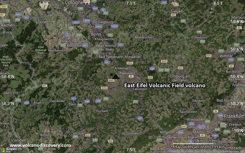
Satellite/aerial-type map of East Eifel Volcanic Field volcano (scale of 20-40 km)

Terrain-type map of East Eifel Volcanic Field volcano (scale of 20-40 km)

Satellite/aerial-type map of East Eifel Volcanic Field volcano (scale of approx. 10-20 km)

Terrain-type map of East Eifel Volcanic Field volcano (scale of approx. 10-20 km)

Satellite/aerial-type map of East Eifel Volcanic Field volcano (scale of 5-10 km)

Satellite/aerial-type map of East Eifel Volcanic Field volcano (scale of few kilometers)


