Cotopaxi Volcano
Cotopaxi is one of South America's most famous volcanoes and one of its most active ones. With its 5911 m it also ranks among the world's highest active volcanoes (26th highest).
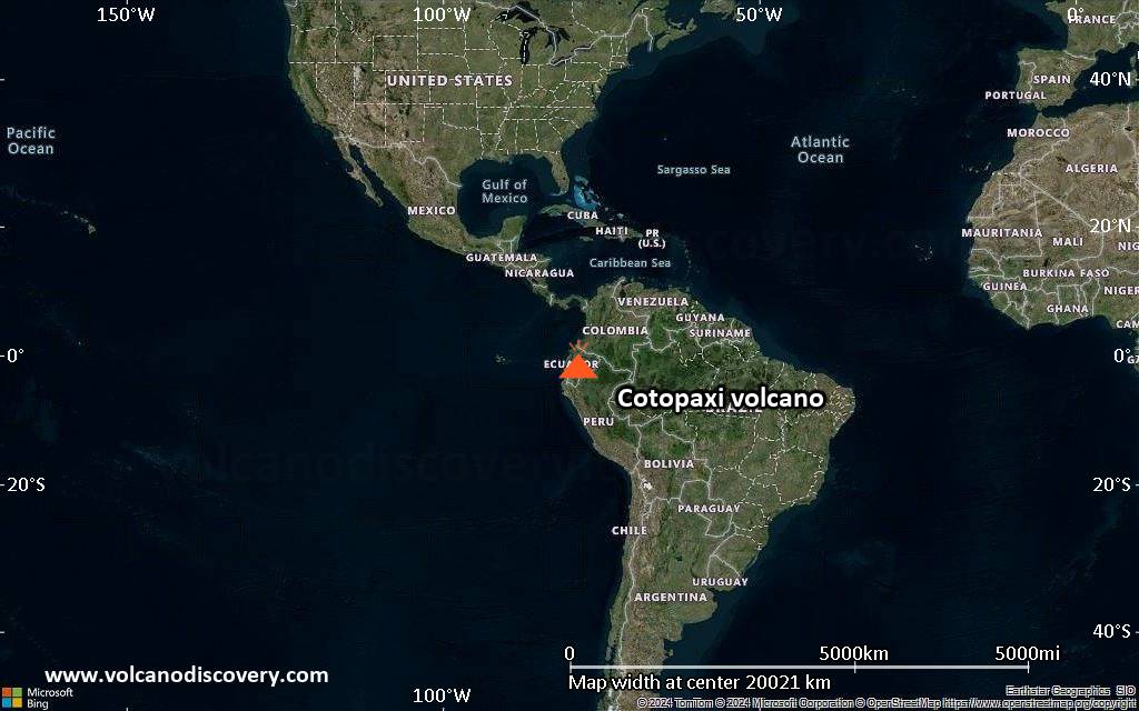
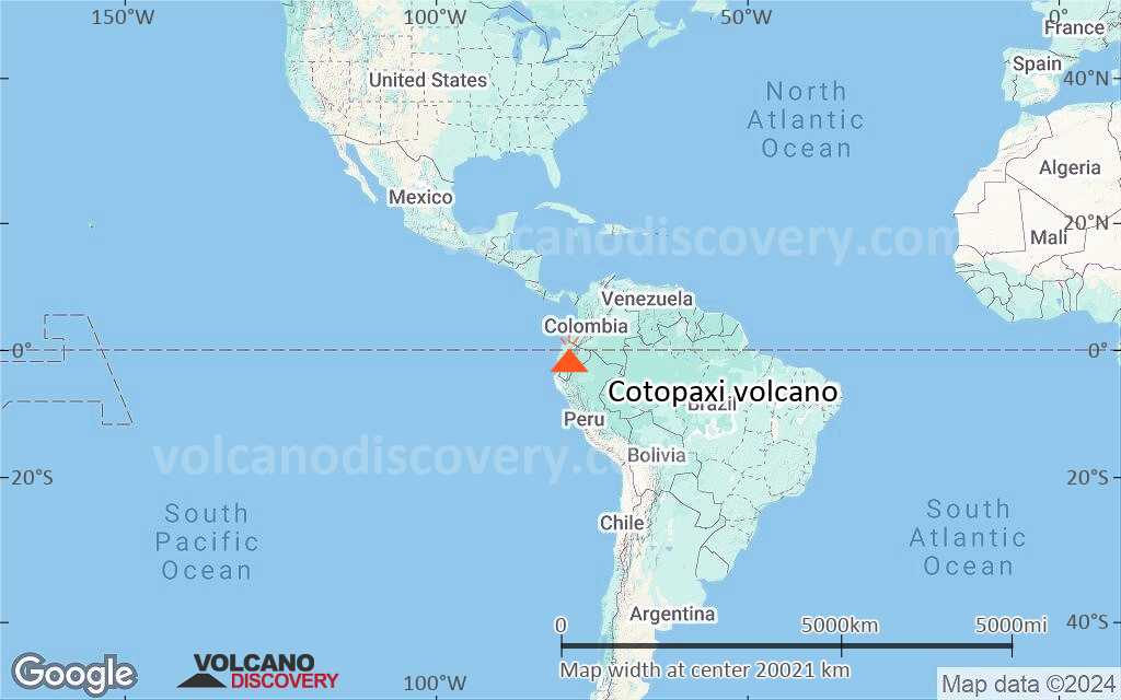
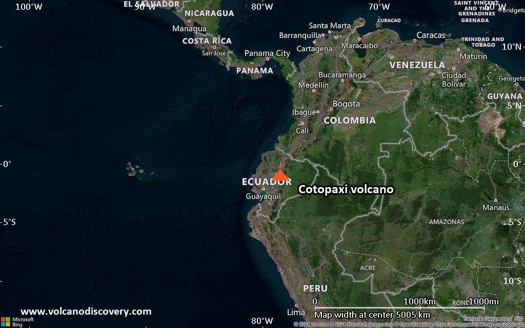
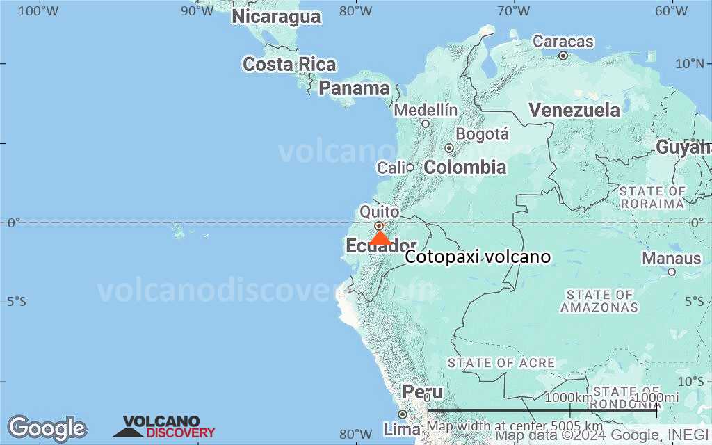
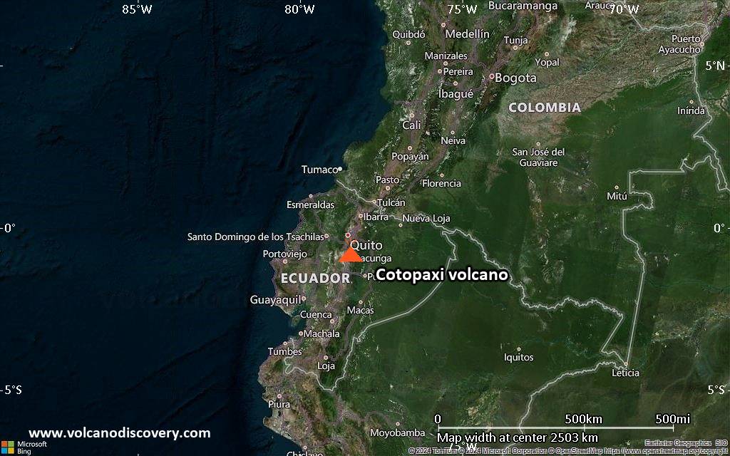
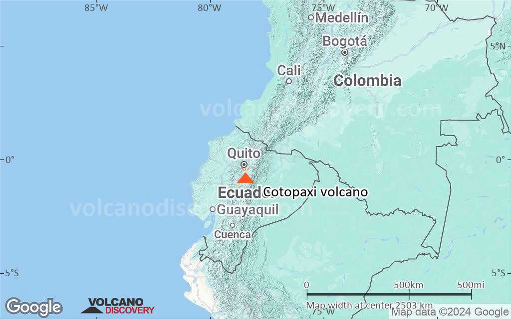
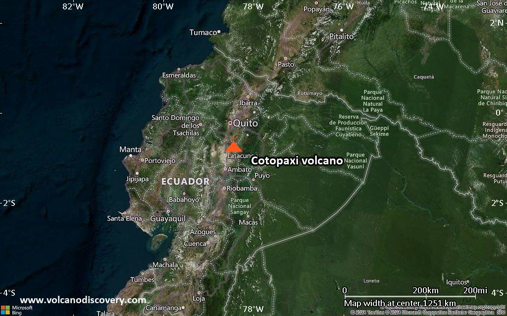
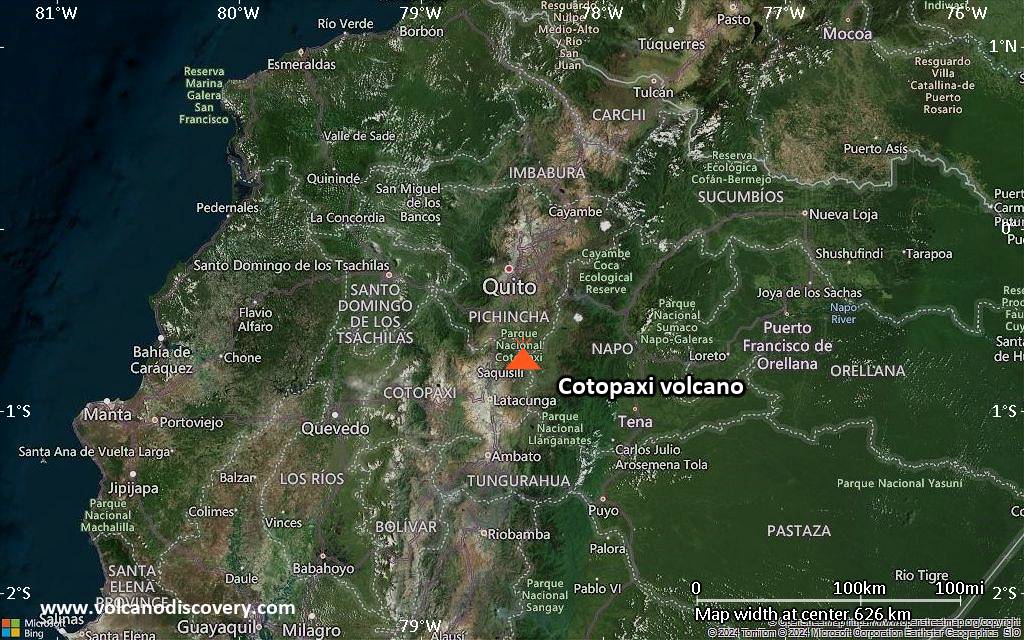
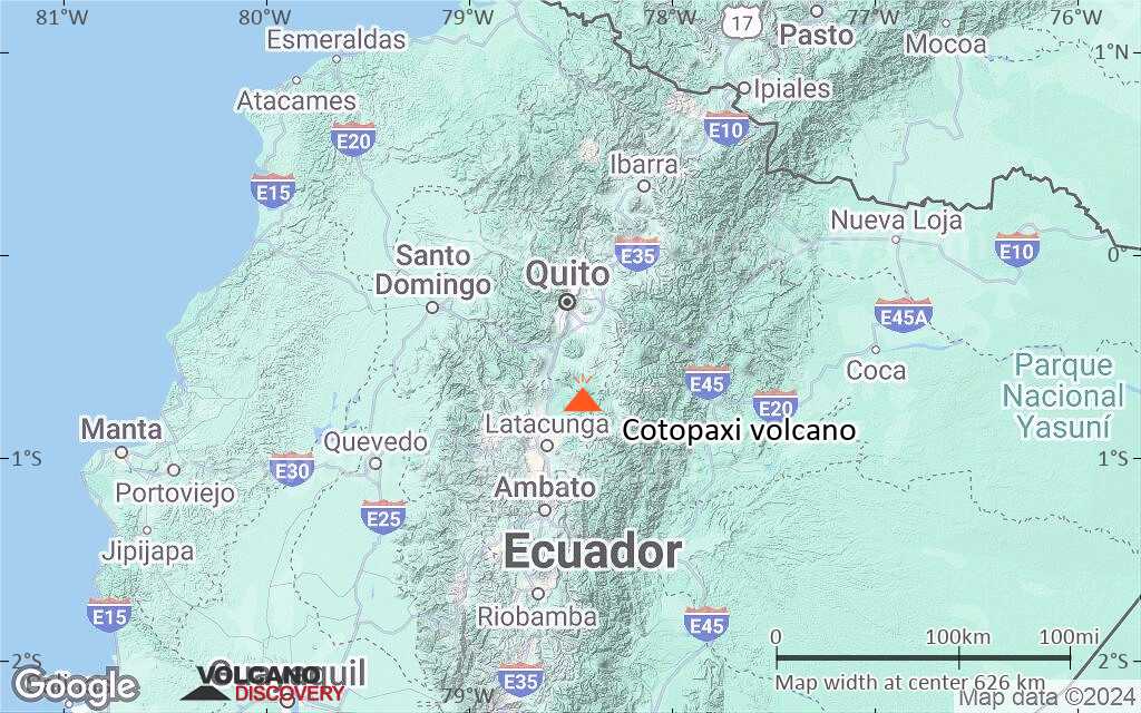
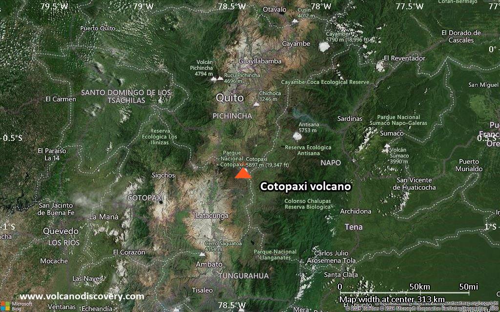
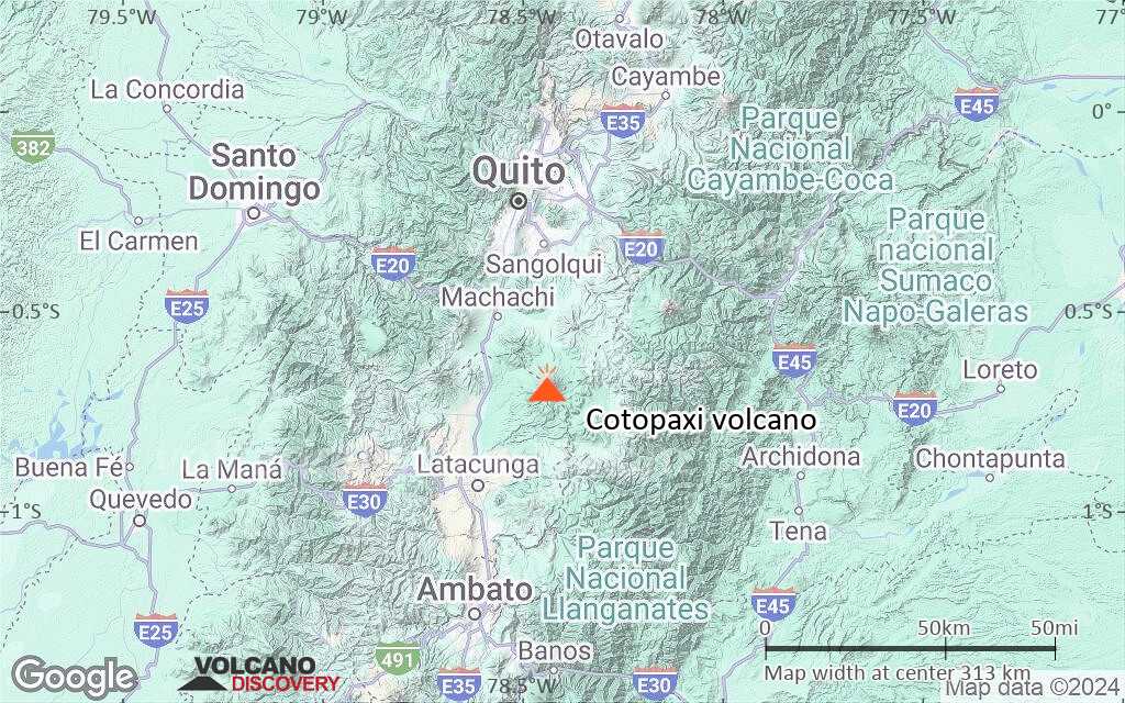
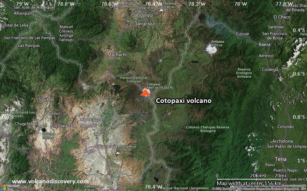
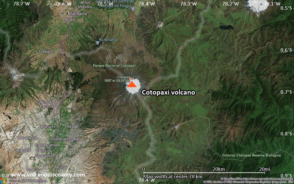
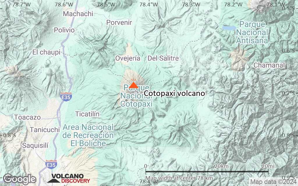
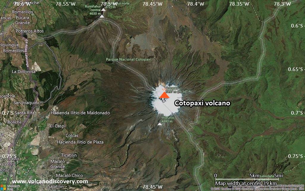
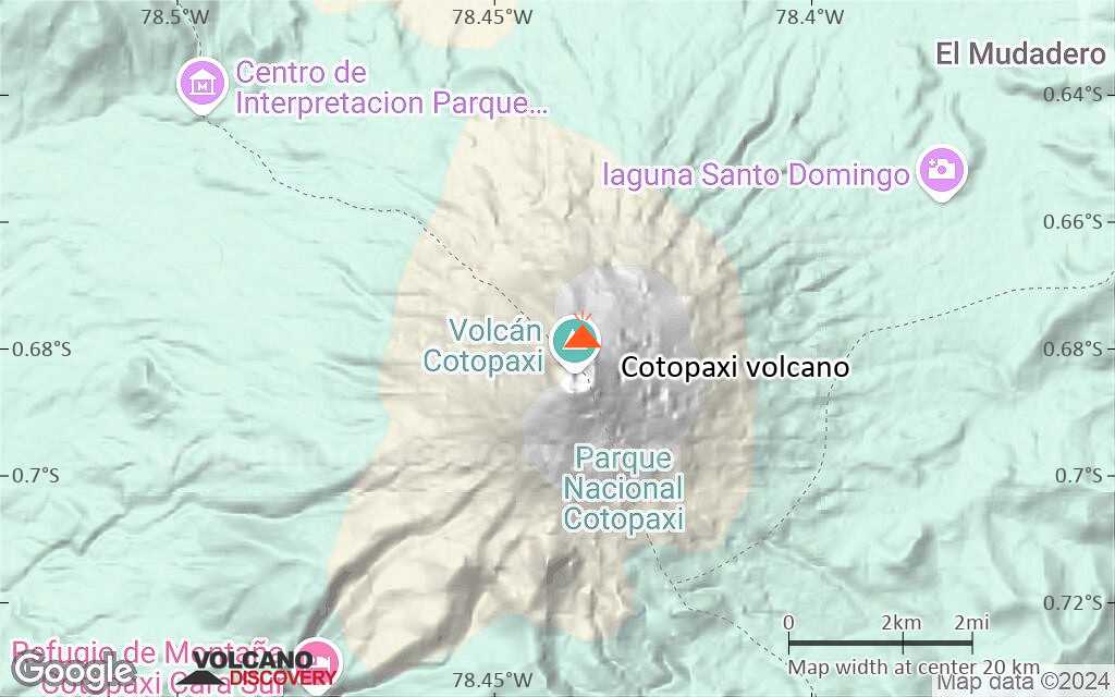
The majestic, snow covered symmetrical stratovolcano is located on the Eastern Cordillera of the Ecuadorian Andes, 60 km south of Quito and 35 km northeast of Latacunga.
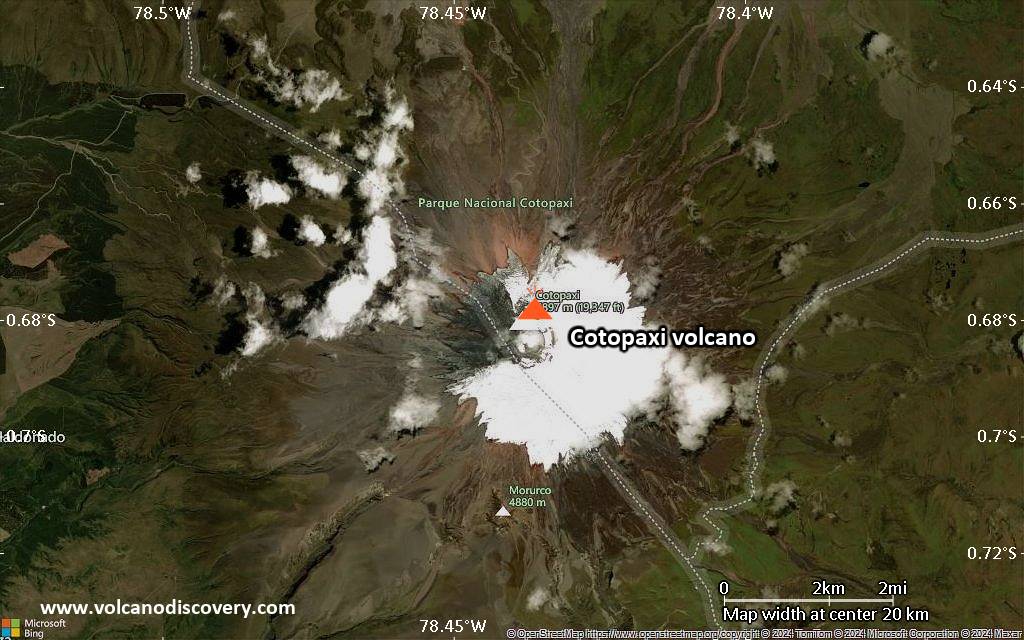
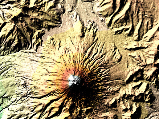
Cotopaxi's steep cone has nested summit craters, the outer of which measures 550 x 800 m in diameter.
Cotopaxi erupted more than 50 times since 1738. The most violent historical eruptions of Cotopaxi volcano were in 1744, 1768, 1877, and 1904. its eruptions often produced pyroclastic flows and destructive mud flows (lahars). Some lahars have travelled more than 100 km and reached the Pacific to the west and the Amazon Basin to the east.
At the moment, it has been dormant for over 70 years, which is an unusual long interval in its recent history.
Cotopaxi volcano eruptions: 2015-16, 1942(?), 1940, 1939(?), 1931(?), 1928-30(?), 1905-08, 1903, 1895, 1886, 1885, 1883?, 1883, 1882, 1880, 1879, 1878, 1877, 1870-76, 1870, 1869, 1868, 1867, 1866, 1863, 1860-62, 1859, 1858, 1857, 1856, 1856, 1855, 1854, 1853, 1852, 1851, 1850, 1845, 1844, 1803, 1768, 1766, 1750, 1747-49, 1746, 1744, 1743, 1743, 1742, 1742, 1740-41, 1738, 1698, 1534, 1533, 1532, 1400, 1260, 1130, 950, 770, 760, 740, 550, 370, 180, 140, 110, 70, 80 BC, 230 BC, 1510 BC, 2220 BC, 2640 BC
Latest nearby earthquakes
| Date and Time | Mag / Depth | Distance / Location | |||
|---|---|---|---|---|---|
Background
Cotopaxi has often produced lahars during eruptions melting the snow on the upper flanks. The lahars have eroded deep valleys in all directions from the summit of the andesitic volcano. These valleys alternative with large andesitic lava flows that extend as far as the base of the volcano.The modern stratovolcano was built above the scar left by a major debris avalanche which destroyed an older edifice about 5000 years ago.
A rare high altitude hummingbird (Oreotrochilus chimborazo) has been discovered to live on the slopes of Cotopaxi between 13,000 and 15,000 ft where it nests on protected cliffs.
Significant volcanic eruptions: Cotopaxi volcano
There is one uncertain or discredited eruption in 1942 from Cotopaxi volcano.
| Date | Note | VEI | Deaths | Damage | |
|---|---|---|---|---|---|
| Summit crater Historical obs./docs. | 2 | ||||
| Summit crater Historical obs./docs. | 2 | ||||
?? | Uncertain Eruption | 3? | |||
Historical obs./docs. | 2 | ||||
Historical obs./docs. | 2 | ||||
Historical obs./docs. | 2 | ||||
Historical obs./docs. | 2 | ||||
Historical obs./docs. | 2 | ||||
Historical obs./docs. | 1 | ||||
Historical obs./docs. | 2 | ||||
Historical obs./docs. | 2 | ||||
Historical obs./docs. | 3 | ||||
Historical obs./docs. | 2 | ||||
Historical obs./docs. | 2 | ||||
Historical obs./docs. | 2 | ||||
Historical obs./docs. | 2 | ||||
Historical obs./docs. | 2 | ||||
Historical obs./docs. | 2 | ||||
Historical obs./docs. | 2 | ||||
Historical obs./docs. | 3 | ||||
Historical obs./docs. | 2 | ||||
Historical obs./docs. | 2 | ||||
Historical obs./docs. | 4 | ||||
| 1877 Jun 25 (eruption | Historical obs./docs. | 4 | 340 | Info | |
Historical obs./docs. | 2 | ||||
Historical obs./docs. | 3 | ||||
Historical obs./docs. | 2 | ||||
Historical obs./docs. | 2 | ||||
Historical obs./docs. | 2 | ||||
Historical obs./docs. | 2 | ||||
Historical obs./docs. | 2 | ||||
Historical obs./docs. | 2 | ||||
Historical obs./docs. | 2 | ||||
Historical obs./docs. | 2 | ||||
Historical obs./docs. | 2 | ||||
Historical obs./docs. | 2 | ||||
Historical obs./docs. | 2 | ||||
Historical obs./docs. | 2 | ||||
Historical obs./docs. | 2 | ||||
Historical obs./docs. | 3 | ||||
Historical obs./docs. | 2 | ||||
Historical obs./docs. | 2 | ||||
Historical obs./docs. | 2 | ||||
Historical obs./docs. | 2 | ||||
Historical obs./docs. | 2 | ||||
Historical obs./docs. | 3 | ||||
Eruptions of Cotopaxi volcano
The last significant eruption of Cotopaxi volcano was in 1907 and produced ash explosions and small pyroclastic flows but no lava flows.
The eruptions in 1905 and August 1906 consisted in small ash explosions.
A medium-sized eruption (VEI 3) started on 26 Sep 1903 and lasted until December 1904. The eruption occurred from the central vent and produced tall ash plumes, pyroclastic flows and lahars. During explosions on or around 23 October, lightnings were noted by observers, the Times reports the next day: "Since Thursday, electric discharges have been notices on the eastern side of the Andes. Rumblings were heard near the towns this morning, and ashes fell for three-quarters of an hour." (The Times, 25 Oct 1903, "COTOPAXI IN ERUPTION")
One of the largest eruptions of Cotopaxi in historic times began on 3 July 1880. A powerful explosion sent an ash column of 20,000 ft (ca. 6 km) height above the crater in less than a minute.
The British explorer Edward Whymper was climbing Chimborazo at the time of the eruption and reported extremely vivid and strange light and color effects when the large ash plume drifted over him: "... several hours passed before the ash commenced to intervene between the sun and ourselves; and, when it did so, we witnessed effects which simply amazed us. We saw a green sun..." (click to read more) ...more info
4 large eruptions occurred at Cotopaxi between January and September 1877. The explosions produced high eruption columns, heavy ash fall, pyroclastic flows and lahars. The eruption caused much damage and there were fatalities.
A 3 day long eruption occurred at Cotopaxi from 13-15 September 1853 and produced ashfall, pyroclastic flows and small lahars.
One of the largest historical eruptions of Cotopaxi occurred on 4 April 1768. A large vulcanian explosion took place (VEI 4) and generated a high ash plume, heavy ash fall and pyroclastic flows. Large bombs were falling at great distances. The eruption caused fatalities and extensive damage. ...more info
Several small to medium-sized explosions occurred in 1866. Lahars and floods damaged the town of Latacunga and the fallout of coarse pumice west of the volcano destroyed several farms.
A major explosive eruption started in May 1744 at Cotopaxi volcano. It produced extensive ash fall 7-10 cm thick 10 km west of the crater.
2 larger explosive eruptions occurred in December 1742, producing ashfall, pyroclastic flows, and destructive lahars. The eruption caused fatalities.
In 1534 the conquistadors were at war with the locals for control over Ecuador. It is reported that during a battle on the flanks of Cotopaxi, the volcano started an eruption and filled the air with "hot ash" (pyroclastic surges?). The locals viewed the event as a divine sign from their god fled in fear. The Spanish who had no experience with volcanic activity were terrorized and did the same.
A lahar from the 1534 eruption destroyed La Contiega village.
The Chillos Valley Lahar from Cotopaxi volcano's north and NE slopes is the largest known debris flow in the northern Andes during the Holocene (11,700 years ago to present).
It descended river systems and flowed 326 km north–northwest to the Pacific Ocean and more than 130 km east into the Amazon basin. The massive avalanche occurred around 4500 years ago.
Cotopaxi Volcano FAQ
+When was the last eruption of Cotopaxi volcano?
The last confirmed eruption of Cotopaxi occurred during 2022 - 2023.
+How often does Cotopaxi volcano erupt?
Since 1532 AD, Cotopaxi volcano has had at least 60 historically documented eruptions. This means that it erupts on average every 8.2 years.
Many eruptions of Cotopaxi have lasted more than one year. In total, the volcano has been in eruption during 75 out of 493 years until now. In other words, Cotopaxi has been active at least one in 6.6 years on average. Note that this value is likely an underestimate, because the known history of eruptions from Cotopaxi is likely incomplete, especially further back in time.
+How active is Cotopaxi volcano at present?
Cotopaxi volcano is relatively active: Since 1900, it has had 21 eruptions, and been active during 21 years out of 126 as of now. This means, Cotopaxi has been in eruption one in 6 years on average. The last eruption was from 2022 until 2023 and ended 2 years ago.
+When was the largest eruption of Cotopaxi volcano?
The largest eruption known from the younger geological history of Cotopaxi volcano occurred around 1130 AD. It ranks as a sub-plinian eruption with a magnitude 4 on the VEI (Volcanic Explosivity Index) scale.
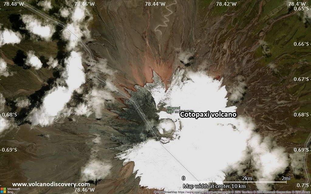
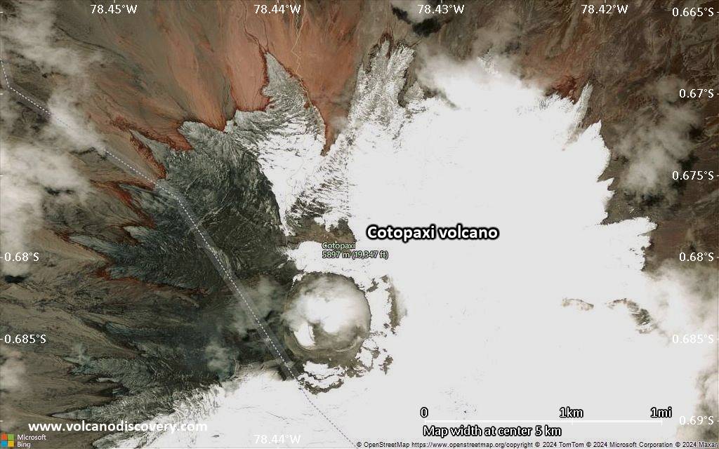
Latest satellite images

Cotopaxi Volcano Maps