Kontakt | RSS | EN | DE | EL | ES | FR | IT | RU

Taupo Volcano

Updated: 13. Mai 2024 04:33 GMT -
Caldera 760 m / 2,493 ft
New Zealand, -38.82°S / 176°E
Aktueller Status: normal / ruhend (1 von 5)
Last update: 31 Mai 2023 (Smithsonian / USGS Weekly Volcanic Activity Report)

[smaller] [larger]
Typische Aktivität: unspecified
Ausbrüche des Taupo: 260 AD (?) 

Letzte Erdbeben in der Nähe

UhrzeitMag. / TiefeEntfernung / Ort
11. Mai. 14:15 (Auckland)
2.3

88 km
15 km westlich New Zealand
Info
Freitag, 10. Mai 2024 GMT (1 Beben)
10. Mai. 14:37 (Weltzeit)
1.8

6.6 km
New Zealand
Info
Sonntag, 5. Mai 2024 GMT (1 Beben)
5. Mai. 19:22 (Auckland)
1.9

3.5 km
New Zealand
Info
Freitag, 3. Mai 2024 GMT (1 Beben)
3. Mai. 15:52 (Auckland)
2.1

4.1 km
19 km südwestlich New Zealand
Info
Donnerstag, 2. Mai 2024 GMT (1 Beben)
3. Mai. 01:23 (Auckland)
2.3

145 km
27 km nordwestlich New Zealand
Info
Montag, 29. April 2024 GMT (1 Beben)
30. Apr. 02:20 (Auckland)
2.0

3.7 km
New Zealand 2 BerichteInfo

Beschreibung

Taupo, the most active rhyolitic volcano of the Taupo volcanic zone, is a large, roughly 35-km-wide caldera with poorly defined margins. It is a type example of an "inverse volcano" that slopes inward towards the most recent vent location. The Taupo caldera, now filled by Lake Taupo, largely formed as a result of the voluminous eruption of the Oruanui Tephra about 22,600 years before present (BP). This was the largest known eruption at Taupo, producing about 1170 cu km of tephra. This eruption was preceded during the late Pleistocene by the eruption of a large number of rhyolitic lava domes north of Lake Taupo. Large explosive eruptions have occurred frequently during the Holocene from many vents within Lake Taupo and near its margins. The most recent major eruption took place about 1800 years BP from at least three vents along a NE-SW-trending fissure centered on the Horomotangi Reefs. This extremely violent eruption was New Zealand's largest during the Holocene and produced the thin but widespread phreatoplinian Taupo Ignimbrite, which covered 20,000 sq km of North Island.
---
Smithsonian / GVP volcano information

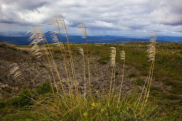
Taupo Volcano Photos
Latest satellite images

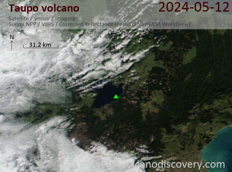
taupo satellite image sat1taupo satellite image sat2
News
Mi, 31. Mai 2023, 14:00

Taupo volcano (North Island, New Zealand) - Smithsonian / USGS Weekly Volcanic Activity Report for 24 May-30 May 2023 (Continuing Activity)

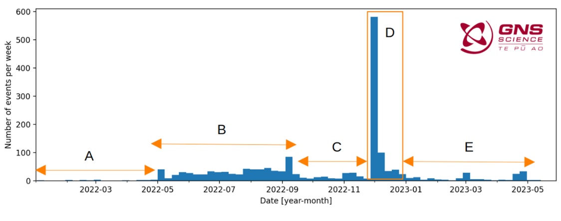
GeoNet reported that earthquake activity and ground deformation at Taupo declined during January-April and returned to background levels in May. The Volcanic Alert Level was lowered to 0 (the lowest level on a six-level scale) on 30 May and the Aviation Color Code remained at Green (the lowest level on a four-color scale). Unrest at the volcano started in early May 2022; during the year there were just over 1,800 earthquakes located beneath the volcano along with ground deformation both on the lake floor and around the lake. ... Read all
Mi, 31. Mai 2023, 06:17

Taupo volcano (New Zealand): activity returned to background levels

Rapid drop in seismic activity at the volcano since January 2023 (image: GeoNet New Zealand)
The ongoing seismic unrest beneath the volcano, starting exactly one year ago, has paused. ... Read all

Auf dieser Seite:

App herunterladen
Volcanoes & Earthquakes - new app for Android
Android | iOS-Version

Mehr auf VolcanoDiscovery

Warum gibt es Werbung auf dieser Seite?

Unterstützen Sie unsere Arbeit!

Diese Webseite und die dazugehörigen Apps und Tools instandzuhalten und kostenlos Nachrichten zu Vulkanen, Erdbeben und anderen Themen bereitzustellen, verschlingt enorm viel Zeit und auch Geld.
Wenn Sie die Infos mögen und uns in der Arbeit dazu unterstützen wollen, würden wir uns über eine Spende (über PayPal oder mit Kreditkarte) sehr freuen.
Online Zahlung (Kreditkarte)
Damit können wir Ihnen auch in Zukunft neue Features entwickeln und Bestehende laufend verbessern.Vielen Dank!
Sources: VolcanoDiscovery / VolcanoAdventures and other sources as noted.
Use of material: Most text and images on our websites are owned by us. Re-use is generally not permitted without authorization. Contact us for licensing rights.
Volcanoes & Earthquakes
VolcanoDiscovery Home
Vulkane | Erdbeben | Fotos | News | App
Adventure & Study Travel
Reisen zu Vulkanen und Vulkangebieten: Wanderreisen, Studienreisen, Fotoreisen
Tours & Dates | FAQ | About us
Get our newsletter!
Company info
Kontakt | Impressum | AGB
Follow us
Follow us on facebook Follow us on Instagram Follow us on Twitter Visit our Youtube channel
EN | DE | EL | ES | FR | IT | RU
VolcanoDiscovery GmbH, Germany, Reg. nr.: HRB 103744, EU Tax Id: DE 297 465 123 owned and created by
Dr. Tom Pfeiffer, volcanologist, volcano photographer, tour organizer member of
IAVCEI
IAVCEI
Vulkanologische Gesellschaft
Volcanological Society
Ecotourism Greece
Ecotourism Greece
RUV insurance
Insured by R+V
VolcanoDiscovery © 2004- All Rights Reserved | Datenschutz - Cookie Einstellungen