Taupo Volcano
Updated: Apr 30, 2024 00:34 GMT -
Caldera 760 m / 2,493 ft
New Zealand, -38.82°S / 176°E
Current status: normal or dormant (1 out of 5)
New Zealand, -38.82°S / 176°E
Current status: normal or dormant (1 out of 5)
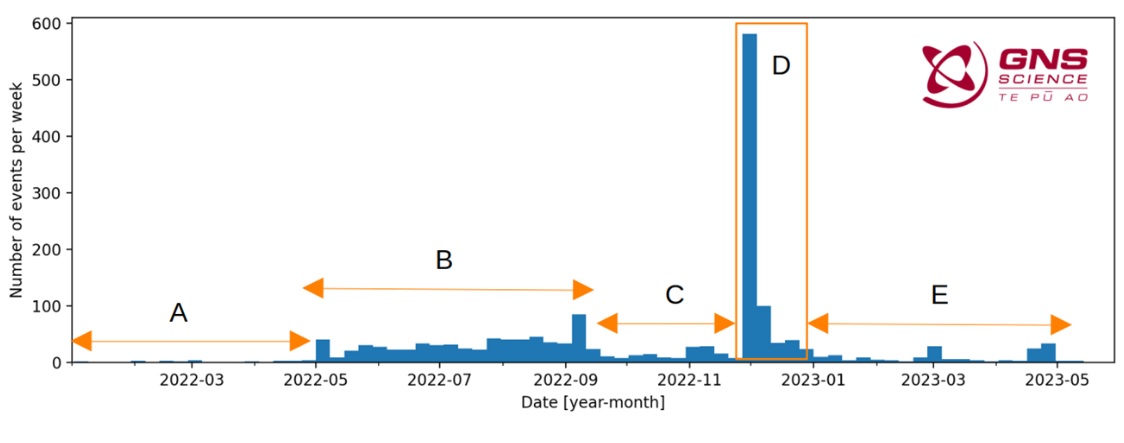
Last update: 31 May 2023 (Smithsonian / USGS Weekly Volcanic Activity Report)
[smaller] [larger]
Taupo volcano eruptions: 260 AD (?)
Latest nearby earthquakes
| Time | Mag. / Depth | Distance / Location | |||
| Apr 28, 04:22 am (Auckland) | 2.6 100 km | 17 km (10.4 mi) to the N | Info | ||
| Apr 27, 10:30 pm (Auckland) | 2.5 4.5 km | 23 km (14 mi) to the NE | Info | ||
| Apr 27, 10:26 pm (Auckland) | 2.6 5.5 km | 25 km (15 mi) to the NE | Info | ||
| Thursday, April 18, 2024 GMT (1 quake) | |||||
| Apr 18, 10:00 pm (Auckland) | 2.1 5 km | Info | |||
| Wednesday, April 17, 2024 GMT (2 quakes) | |||||
| Apr 17, 11:29 pm (Auckland) | 2.2 4.9 km | Info | |||
| Apr 17, 10:44 pm (Auckland) | 2.4 5 km | 21 km (13 mi) to the NE | Info | ||
Background
Taupo, the most active rhyolitic volcano of the Taupo volcanic zone, is a large, roughly 35-km-wide caldera with poorly defined margins. It is a type example of an "inverse volcano" that slopes inward towards the most recent vent location. The Taupo caldera, now filled by Lake Taupo, largely formed as a result of the voluminous eruption of the Oruanui Tephra about 22,600 years before present (BP). This was the largest known eruption at Taupo, producing about 1170 cu km of tephra. This eruption was preceded during the late Pleistocene by the eruption of a large number of rhyolitic lava domes north of Lake Taupo. Large explosive eruptions have occurred frequently during the Holocene from many vents within Lake Taupo and near its margins. The most recent major eruption took place about 1800 years BP from at least three vents along a NE-SW-trending fissure centered on the Horomotangi Reefs. This extremely violent eruption was New Zealand's largest during the Holocene and produced the thin but widespread phreatoplinian Taupo Ignimbrite, which covered 20,000 sq km of North Island.---
Smithsonian / GVP volcano information
Taupo Volcano Photos
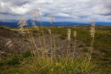
Panorama over the Taupo volcanic zone seen from the rim of Tarawera volcano (Photo: Tom Pfeiffer)
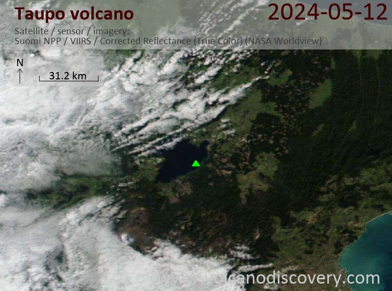
Latest satellite images