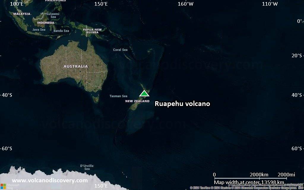
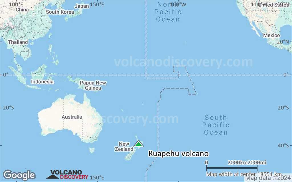
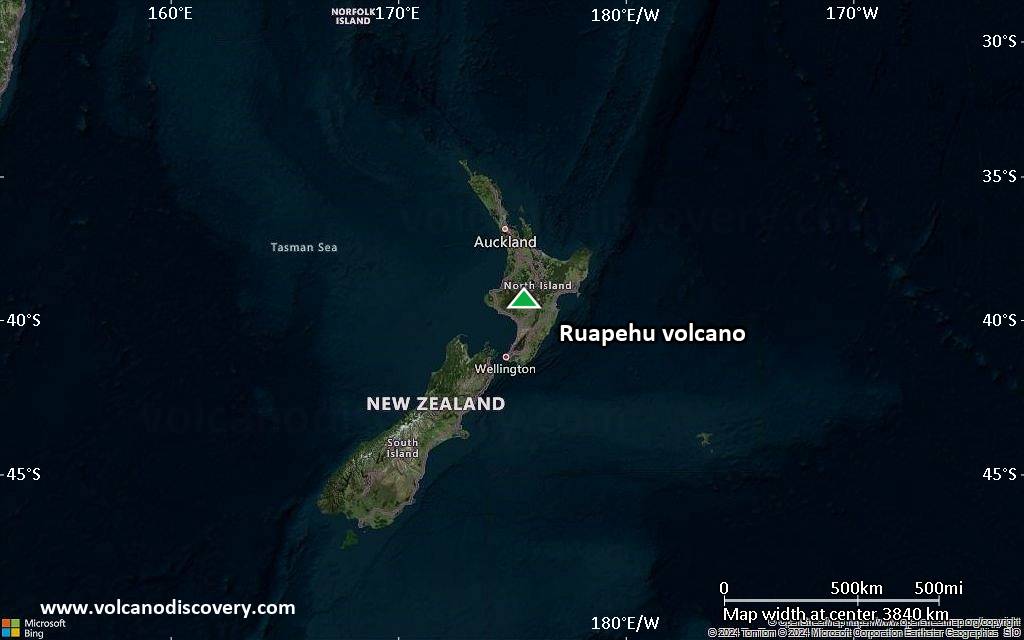
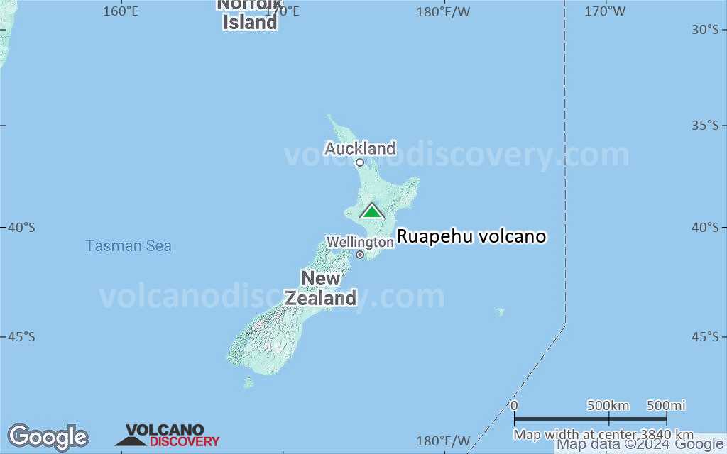
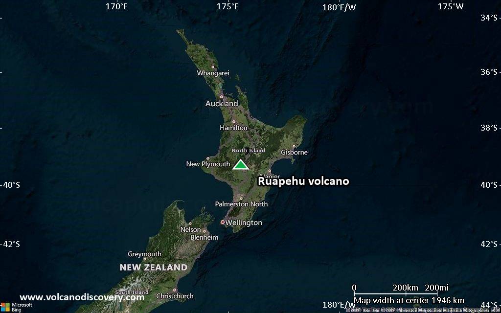
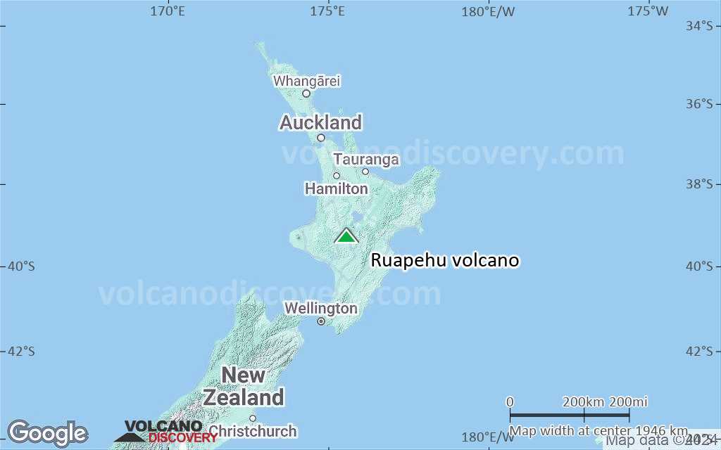
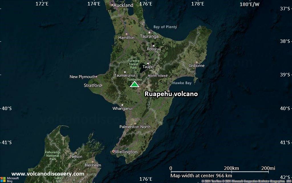
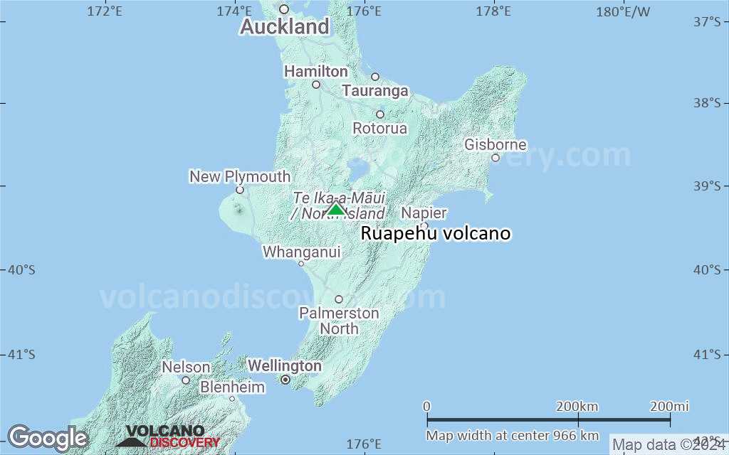
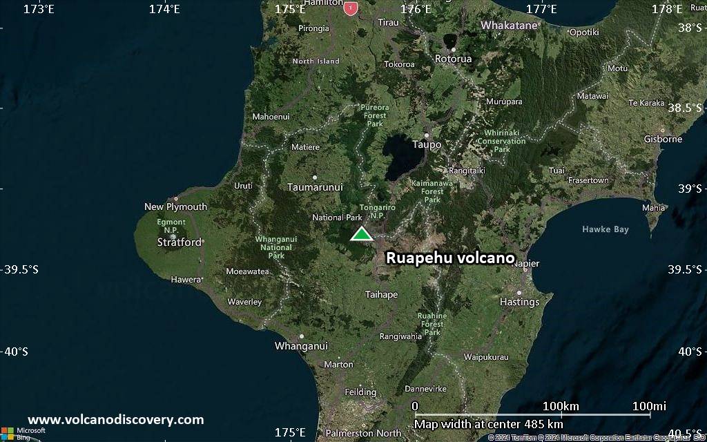
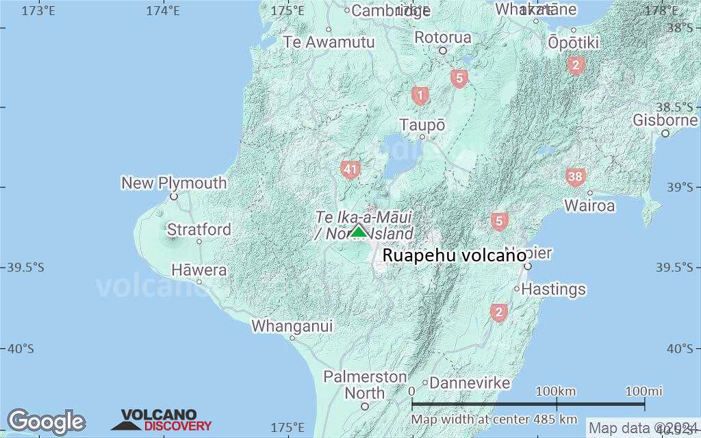
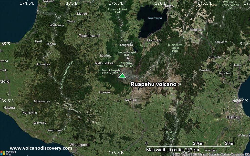
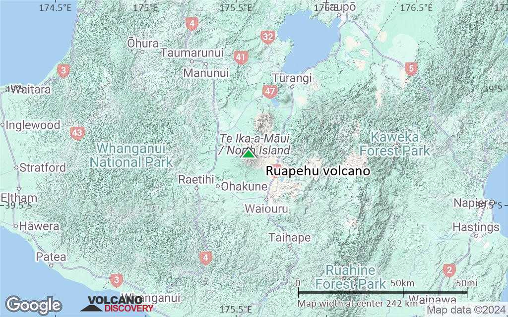
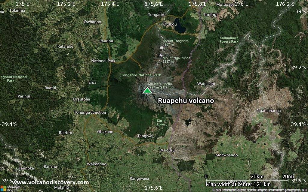
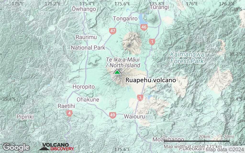
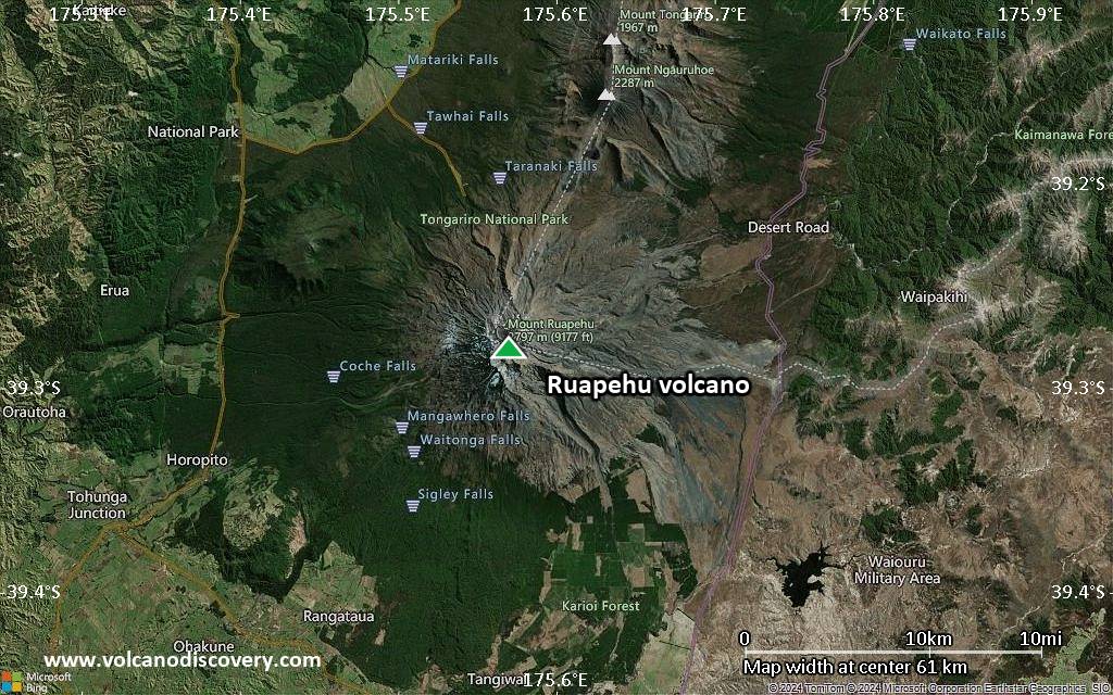
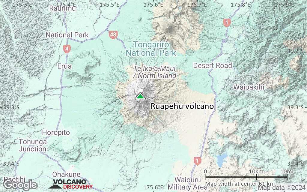
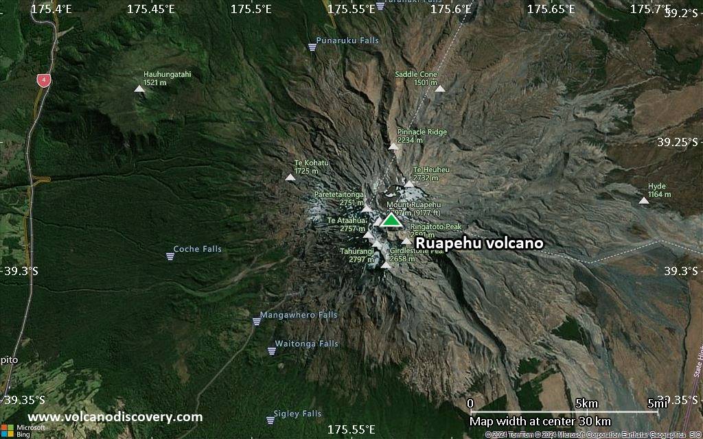
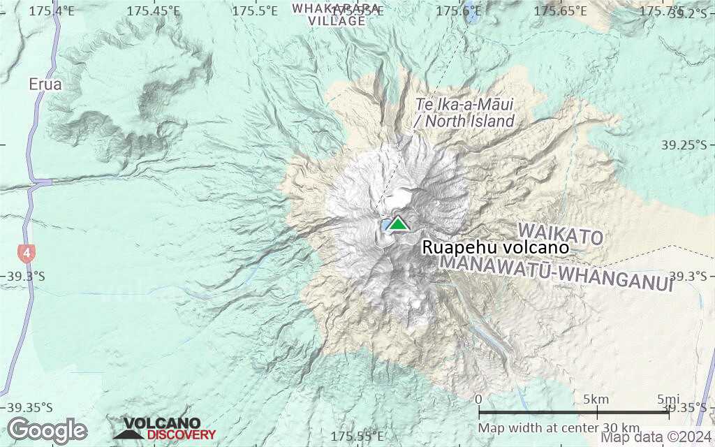
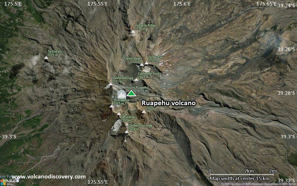
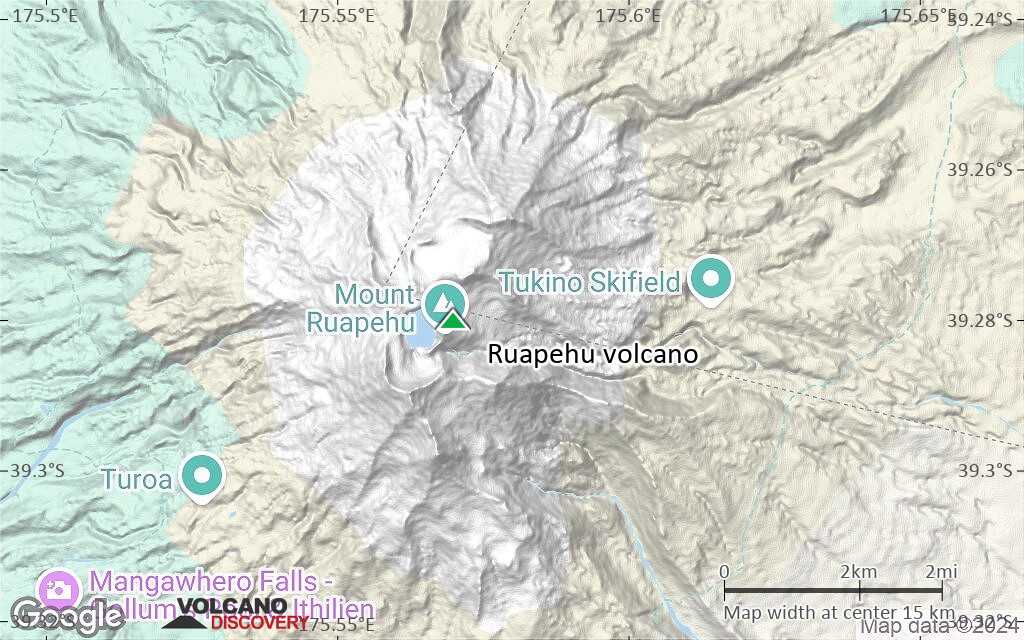
| RSS | EN | DE | EL | ES | FR | IT | RU

Ruapehu Volcán

Updated: 29 oct. 2025 10:42 GMT -
Stratovolcano
Isla del Norte (New Zealand), -39.28°S / 175.57°E
Summit height: 2797 m / 9,176 ft
Current status: normal or dormant (1 out of 5)
Last update: 30 sep 2025 (minor unrest continues)
Ruhapehu volcano
Ruhapehu volcano

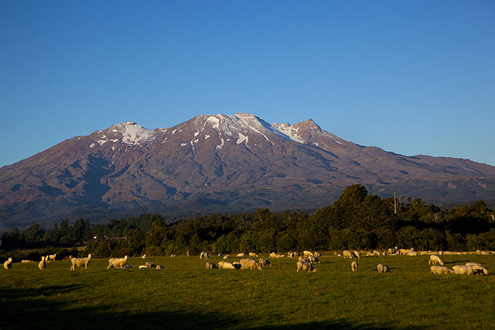
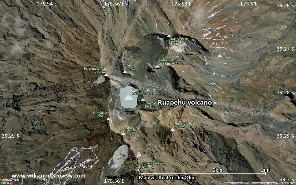
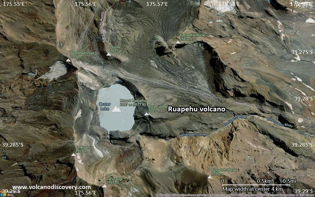
Ruapehu is one of New Zealand's most active volcanoes and forms the highest peak of the North Island. The andesitic stratovolcano has an age of around 200,000 years and contains a large summit crater containing a lake. Eruptions from the vent inside the lake often cause the lake to drain and form dangerous lahars.

[smaller] [larger]
Typical eruption style: Mildly explosive, formation of lahars
Erupciones del volcán Ruapehu:

Latest nearby earthquakes

Fecha y horaMag / Prof.Distancia / Ubicación
29 oct 01:59 (GMT +13)
0.8

14 km
24 km al sureste New Zealand Más
28 oct 15:04 (GMT +13)
1.2

16 km
26 km al sureste New Zealand Más
lunes, 27 octubre 2025 GMT (1 sismo)
27 oct 21:49 (Auckland)
1.6

12 km
18 km al suroeste New Zealand Más
domingo, 26 octubre 2025 GMT (3 sismos)
27 oct 06:26 (Auckland)
1.3

15 km
19 km al sureste New Zealand Más
27 oct 00:39 (Auckland)
2.1

3.7 km
18 km al noreste New Zealand Más
26 oct 19:27 (GMT +13)
0.6

80 km
8.4 km al este New Zealand Más
sábado, 25 octubre 2025 GMT (1 sismo)
25 oct 14:36 (Auckland)
1.4

10.6 km
28 km al sureste New Zealand Más
miércoles, 22 octubre 2025 GMT (2 sismos)
22 oct 17:27 (Auckland)
1.6

72 km
10.5 km al norte New Zealand Más
22 oct 17:09 (Auckland)
2.7

41 km
19 km al sur New Zealand Más

Background

Ruapehu is a complex volcanic edifice constructed over several cycles and has a NNE-SSW elongated shape. The cone is surrounded by a large plain formed by debris from flank collapse and lahar deposits.
A series of very explosive (Plinian) eruptions occurred at Ruapehu between about 22,600 and 10,000 years ago. Since then, only one vent has probably been active, Crater Lake in the summit region. Activity in historic time consisted of mild explosive phreatic and phreatomagmatic eruptions often accompanied by lahars threatening the popular ski area on the volcano as well as structures in the surrounding valleys.
On 24th December 1953, a tephra dam holding in the crater lake failed passively, hence the lake drained to produce a catastrophic lahar that destroyed a rail bridge 42 km from the volcano, just as the Wellington-Auckland passenger train was crossing and fell into the valley, causing 151 fatalities.

Erupciones volcánicas significativas: Ruapehu volcano

In the past 10,000 years, Ruapehu has had at least 64 confirmed volcanic eruptions, out of which 58 are documented by historical records, while the others can be inferred from geological evidence.
Additionally, there are 2 uncertain or discredited eruptions from Ruapehu volcano.
The table below lists all known eruptions (date in bold face) of Ruapehu volcano since around 1900. Updates on the most recent volcanic activity of Ruapehu can be found on the news page of Ruapehu volcano.
FechaNotaVEIFallecidosDaños
2007 sep 25
Obs. históricas/documentos
1
desconocido
2006 oct 4
Obs. históricas/documentos
1
desconocido
1997 oct 9 - oct 18
Obs. históricas/documentos
1
desconocido
1996 jun 16 - sep 1
Obs. históricas/documentos
3
desconocido
?? 1996 mar 21 o antes
Erupción incierta
?
desconocido
1995 ene 11 ? - nov 9
Obs. históricas/documentos
3
desconocido
?? 1994 feb 12 - abr 1
Erupción incierta
1
desconocido
1992 feb 8 - mar 6
Obs. históricas/documentos
1
desconocido
1991 jul 5 ? - jul 14 ?
Obs. históricas/documentos
1
desconocido
1990 jun 17 - sep 8 o antes
Obs. históricas/documentos
0
desconocido
1990 ene 7 - ene 26
Obs. históricas/documentos
1
desconocido
1989 jul 1 - sep 20 ?
Obs. históricas/documentos
1
desconocido
1988 dic 8 - 1989 mar 5 ?
Obs. históricas/documentos
1
desconocido
1988 mar 20 - may 25 ±3 d.
Obs. históricas/documentos
1
desconocido
1987 ago 24 - ago 30
Obs. históricas/documentos
1
desconocido
1986 feb 8 - feb 9 ?
Obs. históricas/documentos
1
desconocido
1985 nov 15
Obs. históricas/documentos
1
desconocido
1985 may 21 o antes - jun 9 ?
Obs. históricas/documentos
1
desconocido
1984 oct 25 ? - dic 16 ±15 d.
Obs. históricas/documentos
1
desconocido
1984 abr 2
Obs. históricas/documentos
1
desconocido
1981 oct 25 ? - 1982 abr 12 ±3 d.
Obs. históricas/documentos
1
desconocido
1980 oct 18 - nov 3
Obs. históricas/documentos
1
desconocido
1980 ene 15 ? - mar 27 ?
Obs. históricas/documentos
1
desconocido
1979 jun 30 - jul 15
Obs. históricas/documentos
1
desconocido
1977 jul 16 - 1979 ene 17
Obs. históricas/documentos
2
desconocido
1976 sep 12 o antes - nov 22 ?
Obs. históricas/documentos
1
desconocido
1976 mar 6
Obs. históricas/documentos
1
desconocido
1975 oct 17 o antes
Obs. históricas/documentos
1
desconocido
1975 abr 24 - abr 27
Obs. históricas/documentos
2
desconocido
1973 oct 31 - 1974 oct 25
Obs. históricas/documentos
1
desconocido
1972 oct 22 - 1973 ene 10
Obs. históricas/documentos
1
desconocido
1971 abr 3 - nov 1
Obs. históricas/documentos
2
desconocido
1970 sep 16 - sep 17
Obs. históricas/documentos
1
desconocido
1969 jun 22 - jun 23
Obs. históricas/documentos
2
desconocido
1968 abr 6 - jun 10
Obs. históricas/documentos
2
desconocido
1967 jul 22 - oct 4 ?
Obs. históricas/documentos
1
desconocido
1966 abr 4 - sep 27
Obs. históricas/documentos
1
desconocido
1959 may 21 - ago 31
Obs. históricas/documentos
1
desconocido
1956 nov 18
Obs. históricas/documentos
1
desconocido
1953 dic 24
(episodio eruptivo 1953 dic 24)
Obs. históricas/documentos
0151
desconocido
Información
1952 jul 16 ±15 d.
Obs. históricas/documentos
1
desconocido
1951 mar 19
Obs. históricas/documentos
1
desconocido
1950 jun 26
Obs. históricas/documentos
1
desconocido
1948 may 1
Obs. históricas/documentos
1
desconocido
1946 nov 21 - 1947 may 31
Obs. históricas/documentos
1
desconocido
1946 abr - jun
Obs. históricas/documentos
2
desconocido
1945 mar 8 - dic
Obs. históricas/documentos
3
desconocido
1944 oct
Obs. históricas/documentos
2
desconocido
1942 ago 10
Obs. históricas/documentos
2
desconocido
1940 abr
Obs. históricas/documentos
2
desconocido
1936 may 9 ? - may 13
Obs. históricas/documentos
2
desconocido
1934 dic - 1935 feb
Obs. históricas/documentos
2
desconocido
1934 ago 11
Obs. históricas/documentos
2
desconocido
1925 ene 22
Obs. históricas/documentos
2
desconocido
1921 oct
Obs. históricas/documentos
2
desconocido
1918 jun 29
Obs. históricas/documentos
2
desconocido
1906 mar 15
Obs. históricas/documentos
2
desconocido
1903
Obs. históricas/documentos
2
desconocido
Remark:
Our list of volcanic eruptions closely follows the database of eruptions of the Smithsonian's Global Volcanism Project (GVP), the internationally most recognized data source for volcanic eruptions, but also includes significant eruptive episodes or related volcano events. "Volcanic eruptions" are usually to be understood as sequences of individual eruptive episodes that can follow each other, or even overlap (if several vents are involved), and can last many years, decades or even longer. For example, the current activity of Stromboli volcano is understood as a single eruption that has been ongoing since 1934.
Fuentes: NOAA National Centers for Environmental Information (NCEI), Global Significant Volcanic Eruptions Database. doi:10.7289/V5TD9V7K | Global Volcanism Project / Smithsonian Institution

Ruapehu Volcano FAQ

+When was the last eruption of Ruapehu volcano?

+How often does Ruapehu volcano erupt?

+How active is Ruapehu volcano at present?

+When was the largest eruption of Ruapehu volcano?

Últimas imágenes satelitales

Ruapehu imagen satelital sat1Ruapehu imagen satelital sat2

Ruapehu Volcán Mapas

Below is a selection of maps showing the location and surroundings of the volcano at various resolutions based on aerial-imagery / terrain maps. Feel free to use them for non-commercial purposes on your blog or website as long as you credit them with a link back to this page (click to copy it).
Satellite/aerial-type map of Ruapehu volcano (world scale)
Terrain-type map of Ruapehu volcano (world scale)
Satellite/aerial-type map of Ruapehu volcano (region scale large)
Terrain-type map of Ruapehu volcano (region scale large)
Satellite/aerial-type map of Ruapehu volcano (region scale medium)
Terrain-type map of Ruapehu volcano (region scale medium)
Satellite/aerial-type map of Ruapehu volcano (region scale small)
Terrain-type map of Ruapehu volcano (region scale small)
Satellite/aerial-type map of Ruapehu volcano (local scale large)
Terrain-type map of Ruapehu volcano (local scale large)
Satellite/aerial-type map of Ruapehu volcano (local scale medium)
Terrain-type map of Ruapehu volcano (local scale medium)
Satellite/aerial-type map of Ruapehu volcano (local scale small)
Terrain-type map of Ruapehu volcano (local scale small)
Satellite/aerial-type map of Ruapehu volcano (scale of 10s of km)
Terrain-type map of Ruapehu volcano (scale of 10s of km)
Satellite/aerial-type map of Ruapehu volcano (scale of 20-40 km)
Terrain-type map of Ruapehu volcano (scale of 20-40 km)
Satellite/aerial-type map of Ruapehu volcano (scale of approx. 10-20 km)
Terrain-type map of Ruapehu volcano (scale of approx. 10-20 km)
Satellite/aerial-type map of Ruapehu volcano (scale of 5-10 km)
Satellite/aerial-type map of Ruapehu volcano (scale of few kilometers)
Volcanoes & Earthquakes - new app for Android
Guaranteed tours
3-19 nov 2025: Volcanoes and Spices - Halmahera N-Sulawesi (Indonesia)
3-19 nov 2025: From Krakatau to Bali - Java (Indonesia)
20 nov - 3 dic 2025: Desert, salt and volcanoes - Danakil desert (Ethiopia)
2-10 may 2026: From Stromboli to Etna - Sicily and Eolian Islands (Italy)
= spaces available   = guaranteed   = few spaces left   = booked out
mar, 30 sep 2025, 04:02

Ruapehu volcano (New Zealand): minor unrest continues

Daily mean temperatures at the Crater Lake since 2020 with the coolong trend (image: GNS Science/GeoNet )
The Crater Lake usually experiences two to three heating and cooling episodes within any 12-month period. During these cycles, the lake temperature typically rises to 30–40 °C before cooling back to 10–15 °C. Since reaching 41 °C in May 2022, there have been five subsequent heating episodes, with each peak—except one—lower than the previous, indicating an overall downward trend in maximum lake temperatures. ... Leer todo
jue, 21 ago 2025, 19:21

Ruapehu Volcano (New Zealand) activity update Aug 21, 2025 - Unrest

The GeoNet (GeoNet) reported that unrest continued at Ruapehu between 22 July 2025 (local) and 20 August 2025 (local). The alert level at Ruapehu remained at "1 - Minor volcanic unrest" (level 1 on a 0–5 level scale). The aviation alert level remained at "Green" (level 1 on a 4-level scale). ... Leer todo

En esta página:

Try our free app!
Volcanoes & Earthquakes - new app for Android
Android | iOS version

More on VolcanoDiscovery

Why is there advertising on this site?

¡Apóyanos – Ayúdanos a mejorar nuestros servicios!

Nos encanta trabajar para traerte los datos más recientes sobre volcanes y terremotos de todo el mundo, solo para ti. Sin embargo, mantener nuestro sitio web y nuestras aplicaciones gratuitas requiere mucho tiempo, esfuerzo y recursos.
Tu apoyo nos permite ampliar la capacidad de nuestro hardware y software, así como fortalecer a nuestro equipo editorial. Nuestra misión es ofrecer actualizaciones continuas en tiempo real siempre que ocurra un terremoto o una erupción volcánica — ¡y tus donaciones lo hacen posible! Cada contribución, grande o pequeña, es profundamente apreciada. Si encuentras útil la información que ofrecemos y deseas ayudarnos a integrar nuevas funciones, crear contenido atractivo y mejorar nuestra tecnología, por favor considera hacer una donación:

Usa PayPal:

Funciones planeadas:

Gracias a tus donaciones anteriores, recientemente hemos añadido:
Descarga la app Volcanes & Terremotos para ser de los primeros en recibir alertas rápidas en línea sobre terremotos y volcanes:
Android | iOS
¡Gracias por formar parte de nuestra misión!
Sources: VolcanoDiscovery / VolcanoAdventures and other sources as noted.
Use of material: Most text and images on our websites are owned by us. Re-use is generally not permitted without authorization. Contact us for licensing rights.
Volcanoes & Earthquakes
VolcanoDiscovery Home
Volcanes | Sismos | Fotos | News | | Shop | App
Adventure & Study Travel
Tours to Volcanoes and Volcanic Areas: walking tours, photo tours, study tours
Tours & Dates | FAQ | About us
Get our newsletter!
Company info
Contact | Legal info | Terms & conditions
Follow us
Follow us on facebook Follow us on Instagram Follow us on Bluesky Follow us on Twitter Visit our Youtube channel
EN | DE | EL | ES | FR | IT | RU
VolcanoDiscovery GmbH, Germany, Reg. nr.: HRB 103744, EU Tax Id: DE 297 465 123 owned and created by
Dr. Tom Pfeiffer, volcanologist, volcano photographer, tour organizer member of
IAVCEI
IAVCEI
Vulkanologische Gesellschaft
Volcanological Society
Ecotourism Greece
Ecotourism Greece
RUV insurance
Insured by R+V
VolcanoDiscovery © 2004- All Rights Reserved | Privacy - Cookie Settings