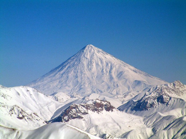
Iran lies at the collission zone between the Eurasian and the Arabian tectonic plate. It has some active intraplate volcanoes, most notably Mt Damavand stratovolcano, which is also the highest mountain of the Middle Eastern region.
Bazman | Bijar Volcanic Field | Damavand | Dehaj-Meduk | East Neh | Gandom Beryan | Hormuz Islands | Kuh-e Ayyub Ansar | Qal'eh Hasan Ali | Sabalan | Sahand | Shahsavaran | Taftan | unnamed | unnamed| Date and Time | Mag / Depth | Nearest Volcano / Location | |||
|---|---|---|---|---|---|
| Oct 24, 04:05 am (Tehran) | 3.2 7.1 km | 376 km (234 mi) S of | Iran: Qasr-E-Shirin, Kermanshah (İran) I FELT IT | Info | |
| Wednesday, October 22, 2025 GMT (1 quake) | |||||
| Oct 23, 12:28 am (Tehran) | 2.7 6.1 km | 101 km (63 mi) SW of | Turkey-Iran Border Region I FELT IT | Info | |
| Tuesday, October 21, 2025 GMT (2 quakes) | |||||
| Oct 21, 11:32 am (Tehran) | 5.0 10 km | 545 km (339 mi) W of | 47 km ENE of Nūrābād, Iran I FELT IT - 2 reports | Info | |
| Oct 21, 07:31 am (Istanbul) | 2.7 7 km | 190 km (118 mi) W of | Yüksekova (Hakkari) I FELT IT | Info | |
| Monday, October 20, 2025 GMT (2 quakes) | |||||
| Oct 20, 09:44 pm (Tehran) | 4.5 10 km | 566 km (352 mi) W of | Southern Iran I FELT IT - 1 report | Info | |
| Oct 20, 03:25 pm (Tehran) | 4.7 35 km | 275 km (171 mi) E of | Northern Iran I FELT IT | Info | |
| Date | Mag | Region | Deaths | Damage | |
|---|---|---|---|---|---|
| 2003 Dec 26 | 6.6 | Southeastern Bam, Baravat | 31,000 | very heavy | Info |
| 1997 May 10 | 7.2 | Birjand, Ghaen; Afghanistan | 1,728 | very heavy | Info |
| 1990 Jun 20 | 7.3 | Rasht, Qazvin, Zanjan, Rudbar, Manjil | 40,000 | catastrophic | Info |
| 1981 Jul 28 | 7.0 | Se, Kerman | 3,000 | catastrophic | Info |
| 1981 Jun 11 | 6.6 | Se Golbaft | 1,400 | moderate | Info |
| 1978 Sep 16 | 7.4 | Tabas | 20,000 | heavy | Info |
| 1972 Apr 10 | 6.6 | Qir, Karzin, Jahrom, Firuzabad | 5,374 | very heavy | Info |
| 1968 Aug 31 | 7.1 | Dasht-e-bayaz | 10,488 | heavy | Info |
| 1962 Sep 1 | 7.2 | Buyin-zara | 12,225 | heavy | Info |
| 1930 May 6 | 7.1 | Salmas | 2,539 | very heavy | Info |
| 1923 May 25 | 6.0 | Turbat-haklari | 2,200 | heavy | Info |
| 1909 Jan 23 | 7.3 | Silakor | 5,500 | moderate | Info |
The deadliest earthquake in Iran since 1900 was the magnitude 7.3 earthquake in ![]() Iran, Gilan Province on Jun, 20, 1990. It resulted in 40,000 fatalities and 105,000 injured people. A tsunami was generated by the quake as well and contributed to its desctuctive effects. The height of the tsunami waves reached 2 m (7 ft). This was the 7th worst quake in Iran during recorded history.
Iran, Gilan Province on Jun, 20, 1990. It resulted in 40,000 fatalities and 105,000 injured people. A tsunami was generated by the quake as well and contributed to its desctuctive effects. The height of the tsunami waves reached 2 m (7 ft). This was the 7th worst quake in Iran during recorded history.
Since 1900, at least 146 earthquakes claimed an estimated total of 150,000 fatalities in Iran.
There were 210 damaging or deadly quakes during this period that caused economic losses of approx. $14.3 billion US Dollars combined.