Long Valley Volcano
Updated: Apr 30, 2025 23:37 GMT -
caldera
California, 37.7°N / -118.87°W 
Summit height: 3390 m / 11,122 ft
Current status: normal or dormant (1 out of 5)
Last update: 19 Jul 2013
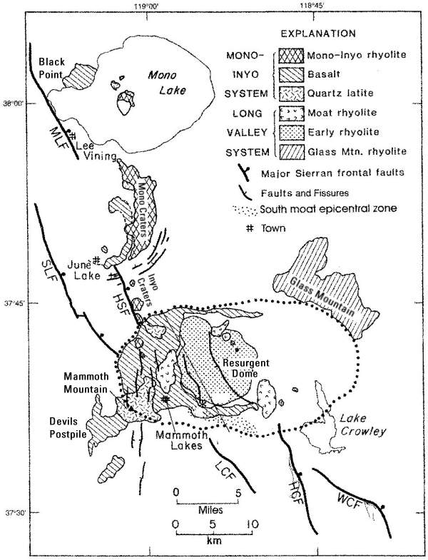
The large 17 x 32 km Long Valley caldera east of the central Sierra Nevada Range, California, is the result of a giant explosive eruption that happened about 760,000 years ago and formed the widespread and voluminous Bishop Tuff.
The caldera has been showing unrest in recent years, in the form of deformation of the caldera floor and earthquake swarms. It contains numerous hot springs and fumaroles. In order to better study and monitor the caldera and possible further changes, USGS established the Long Valley Observatory (http://volcanoes.usgs.gov/lvo/).
[smaller] [larger]
Long Valley volcano eruptions: 111,000-57,000 years ago (formation of Mammoth Mountain)
Latest nearby earthquakes
| Date and Time | Mag / Depth | Distance / Location | |||
|---|---|---|---|---|---|
| Apr 30, 05:46 am (Universal Time) | 1.4 3.7 km | 16 km (9.8 mi) to the S | Info | ||
| Tuesday, April 29, 2025 GMT (2 quakes) | |||||
| Apr 29, 11:10 pm (Universal Time) | 1.2 4.8 km | 23 km (14 mi) to the S | Info | ||
| Apr 29, 03:08 pm (Universal Time) | 0.7 2.2 km | 5.4 km (3.3 mi) to the S | Info | ||
| Monday, April 28, 2025 GMT (2 quakes) | |||||
| Apr 28, 09:05 pm (Universal Time) | 1.2 4.6 km | 25 km (16 mi) to the SW | Info | ||
| Apr 28, 01:53 pm (Universal Time) | 1.3 6.2 km | 26 km (16 mi) to the SE | Info | ||
| Friday, April 25, 2025 GMT (1 quake) | |||||
| Apr 25, 12:19 am (Universal Time) | 0.4 4.3 km | 19 km (12 mi) to the S | Info | ||
| Thursday, April 24, 2025 GMT (1 quake) | |||||
| Apr 24, 12:02 am (Universal Time) | 1.6 2.5 km | 15 km (9.5 mi) to the S | Info | ||
| Wednesday, April 23, 2025 GMT (2 quakes) | |||||
| Apr 23, 10:02 pm (Universal Time) | 1.3 7.3 km | 19 km (12 mi) to the SE | Info | ||
| Apr 23, 08:26 am (Universal Time) | 2.2 6.2 km | 27 km (17 mi) to the S | Info | ||
Background
Following the Bishop Tuff eruption and the formation of Long Valley caldera 760,000 years ago, activity continued in the central part of the caldera to form a lava dome. Smaller explosive eruptions of rhyodacite pumice occurred as well from outer ring fracture vents. The last activity was about 50,000 years ago.In its early history, the caldera contained a large lake where the new lava dome formed an island. Beach deposits can be seen on the caldera walls today. Later, the lake drained through the Owens River Gorge.
The younger Inyo Craters overlap the caldera on the NW but are chemically and tectonically distinct from the Long Valley magmatic system.
Long Valley Volcano Photos
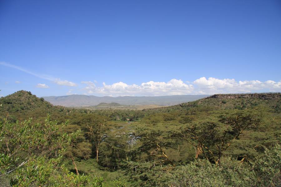
Crater Lake, close to Lake Naivasha, Hells Gate N.P. and Mt. Longonot, Kakuru district, Rift Valley, Kenya (Photo: WNomad)
Along the path down into the other valley, volcanic dikes can be found cutting through sedimentary rock. (Photo: Tom Pfeiffer)
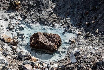
Turquoise water from a river along a small valley with fumaroles. (Photo: Tom Pfeiffer)
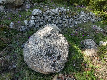
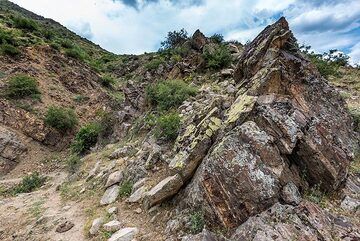
A volcanic bomb at the western part of the Makrylongos valley on Methana. (Photo: Tobias Schorr)
Eruptions of Long Valley volcano
Long Term Trends
Seismic trend: Earthquake activity at Long Valley caldera has remained low since mid-1999, averaging just five to ten earthquake per day with magnitudes less than M2 and occasional events M3.
Deformation trend: Renewed uplift of the resurgent dome that began in early 2002 ended in early 2003 largely offsetting the 2 cm of subsidence that accumulated from early 1999 through the end of 2001. The resurgent dome has since shown minor fluctuations in uplift and subsidence but remains roughly 80 cm higher than in the late 1970's.
CO2 trend: The diffuse carbon dioxide gas flux in the Horseshoe Lake tree-kill area has shown little change from the relatively high levels of 50 to 150 tons per day sustained for the past several years.
(Source: Long Valley Observatory Recent Status Report (USGS)
2002 seismic swarm
The M7.9 earthquake at the Denali Fault earthquake of 3 November 2002 was followed and perhaps triggered 60 small tremors in Long Valley.
The M7.9 earthquake at the Denali Fault earthquake of 3 November 2002 was followed and perhaps triggered 60 small tremors in Long Valley.
1996 earthquake swarm
One of the most intense earthquake swarms at the Long Valley caldera occurred in March and April 1996. About 25 earthquakes were recorded at magnitude 3 or higher.
One of the most intense earthquake swarms at the Long Valley caldera occurred in March and April 1996. About 25 earthquakes were recorded at magnitude 3 or higher.
1992 Landers earthquake triggers seismic swarm
On 28 June 1992, a magnitude 7.3 earthquake struck the Mojave Desert 400 km south of Long Valley caldera. 30 seconds after the S wave of the earthquake had passed, an earthquake swarm was triggered beneath the south-moat of Long Valley. This was the first documented case, where a remote earthquake triggered seismic activity in another area.
On 28 June 1992, a magnitude 7.3 earthquake struck the Mojave Desert 400 km south of Long Valley caldera. 30 seconds after the S wave of the earthquake had passed, an earthquake swarm was triggered beneath the south-moat of Long Valley. This was the first documented case, where a remote earthquake triggered seismic activity in another area.
1990 gas emission - trees dying
During the early 1990's, large amounts of CO2 seeping through the soil caused trees to die off at several places on Mammoth Mountain on the southwest edge of Long Valley Caldera. Such emissions of volcanic gas, originating from the magma chamber, often precede volcanic eruptions. But vice versa, only about 1 in 6 such episodes at calderas is followed by an eruption.
(Source: USGS)
1989 long-lasting seismic swarm
Between May-Dec 1989 a long swarm of small earthquakes occurred under the SE rim of the caldera, probably caused by the intrusion of magma at 3 km depth. It was accompanied by minor deformation (approximately 1 cm of uplift) and included only four M~3 earthquakes, but thousands of smaller earthquakes. ...more info
Between May-Dec 1989 a long swarm of small earthquakes occurred under the SE rim of the caldera, probably caused by the intrusion of magma at 3 km depth. It was accompanied by minor deformation (approximately 1 cm of uplift) and included only four M~3 earthquakes, but thousands of smaller earthquakes. ...more info
1982 new fumaroles
In January 1982, a new group of fumaroles was discovered in the vicinity of Casa Diablo Hot Springs, about 2.5 km E of the earthquake epicenters, and existing fumaroles in the area had become more vigorous.
---
Source: GVP monthly reports
In January 1982, a new group of fumaroles was discovered in the vicinity of Casa Diablo Hot Springs, about 2.5 km E of the earthquake epicenters, and existing fumaroles in the area had become more vigorous.
---
Source: GVP monthly reports
1980 seismic swarm
Following the M5.8 Wheeler Crest earthquake on 4 October 1978, a series of M3-4 earthquake swarms occurred intermittently within the south moat of Long Valley caldera and beneath the south flank of Mammoth Mountain.
The most intense of these swarms began on 25 May 1980 and included four strong magnitude 6 shocks, three of which struck on the same day.
The first was located just west of Convict Lake near the south margin of the caldera, the second beneath the south moat, the third within the Sierra Nevada block about 5 km south of the caldera. The fourth on 27 May 1980 M6 earthquake was 10 km south of the caldera.
Immediately following these shocks, scientists from the U.S. Geological Survey (USGS) began a reexamination of the Long Valley area and detected other evidence of unrest—a dome-like uplift in the caldera. Their measurements showed that the center of the caldera had risen almost a foot since the summer of 1979, after decades of stability. This continuing swelling, which by early 2000 totaled nearly 2.5 feet and affects more than 100 square miles, is caused by new magma rising beneath the caldera.
---
Source:
Living With a Restless Caldera—Long Valley, California (USGS)
1941 earthquakes
In September 1941, a cluster of four M>5 earthquakes and one M6 event occurred along the Sierra Nevada escarpment ca. 10 km southeast of the Long Valley caldera.
---
Source: Wallace, T. C., W. U. Savage, and J. S. Barker (1984). The 1941 earthquake sequence near Long Valley
caldera, California (abstract), EOS, Trans. Am. Geophys. Union 45, 1117
19th century activity
In 1872, the magnitude 7.6 Owens Valley earthquake was felt throughout most of California, and a number of moderate (magnitude 5 to 6) earthquakes have shaken the Long Valley area during this century.
In 1872, the magnitude 7.6 Owens Valley earthquake was felt throughout most of California, and a number of moderate (magnitude 5 to 6) earthquakes have shaken the Long Valley area during this century.
Latest satellite images
Long Valley Volcano Maps
Below is a selection of maps showing the location and surroundings of the volcano at various resolutions based on aerial-imagery / terrain maps. Feel free to use them for non-commercial purposes on your blog or website as long as you credit them with a link back to this page (click to copy it).

Satellite/aerial-type map of Long Valley volcano (world scale)

Terrain-type map of Long Valley volcano (world scale)

Satellite/aerial-type map of Long Valley volcano (region scale large)

Terrain-type map of Long Valley volcano (region scale large)

Satellite/aerial-type map of Long Valley volcano (region scale medium)

Terrain-type map of Long Valley volcano (region scale medium)

Satellite/aerial-type map of Long Valley volcano (region scale small)

Terrain-type map of Long Valley volcano (region scale small)

Satellite/aerial-type map of Long Valley volcano (local scale large)

Terrain-type map of Long Valley volcano (local scale large)

Satellite/aerial-type map of Long Valley volcano (local scale medium)

Terrain-type map of Long Valley volcano (local scale medium)

Satellite/aerial-type map of Long Valley volcano (local scale small)

Terrain-type map of Long Valley volcano (local scale small)

Satellite/aerial-type map of Long Valley volcano (scale of 10s of km)

Terrain-type map of Long Valley volcano (scale of 10s of km)

Satellite/aerial-type map of Long Valley volcano (scale of 20-40 km)

Terrain-type map of Long Valley volcano (scale of 20-40 km)

Satellite/aerial-type map of Long Valley volcano (scale of approx. 10-20 km)

Terrain-type map of Long Valley volcano (scale of approx. 10-20 km)

Satellite/aerial-type map of Long Valley volcano (scale of 5-10 km)

Satellite/aerial-type map of Long Valley volcano (scale of few kilometers)