


Nonda Volcán
Updated: 28 nov. 2025 08:37 GMT -
stratovolcano
Islas Salomón, -7.67°S / 156.6°E 
+Hora local:
Salida del sol:
Puesta del sol:
Salida de la luna:
Puesta de la luna:
Summit height: 760+ m / 2,493 ft
Current status: normal or dormant (1 out of 5)
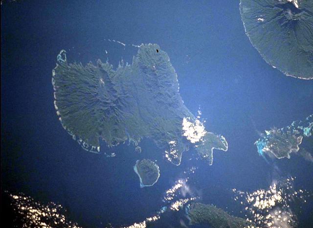
Vella Lavella Island (left center) in the New Georgia Islands in the Solomon Islands chain. North lies to the upper left in this NASA Space Shuttle image. Nonda volcano, the youngest volcanic feature of Vella Lavella Island, is a lava dome located within a well-preserved crater in the northern part of the island. The Paraso thermal area, the small light-colored area at the upper left-center portion of the island, displays solfataras, hot springs, and boiling mud pots. Kolombangara Island is at the upper right. (NASA Space Shuttle image ISS002-727A-2, 2001)
Nonda volcano is an andesitic stratovolcano on Vella Lavella Island in the Solomon Islands. Its lava dome inside a well-preserved crater is the youngest volcanic edifice on the island.
There are no confirmed historical eruptions, but inhabitants reported "smoke" and explosive activity in the vicinity of Nonda Hill at the time of a major earthquake in 1959.
[smaller] [larger]
Erupciones del volcán Nonda: unclear reports about possible activity in 1959
no recent eruptions, fumarolic activity
Latest nearby earthquakes
| Fecha y hora | Mag / Prof. | Distancia / Ubicación | |||
|---|---|---|---|---|---|
Background
Vella Lavella Island is thought to consist of overlapping extinct volcanoes of Pliocene to possibly Pleistocene age, but based on the fumarolic activity it is included in the list of potentially active volcanoes of the world. The Paraso thermal area has solfataras, hot springs, and boiling mud pots.Sources:
- Smithsonian / GVP volcano information
- Taylor G R (1976) "Residual volcanic emanations from the British Solomon Islands." In: Johnson R W (ed) "Volcanism in Australasia", Amsterdam, Elsevier, p 343-354
Nonda Volcano Photos

Lava fresca del interior del lago inundando la corteza más antigua del lago. hawai_e7042.jpg (Photo: Tom Pfeiffer)

Las olas son cada vez más fuertes en otoño e inundan el muelle poco profundo frente al mar. La mayoría de los barcos cormorán ahora están cerrados y sus puertas selladas ...

Como la zona experimenta hundimientos, de hasta 20 cm por día, los muros de la presa deben levantarse lo más rápido posible para evitar inundaciones en las zonas más baja...

"Un fuerte desbordamiento del borde occidental comenzó a las 10:30 am (16 de enero) y produjo una avalancha de lava que se dirigió en dirección suroeste". (Enku) (Photo: ...
Últimas imágenes satelitales
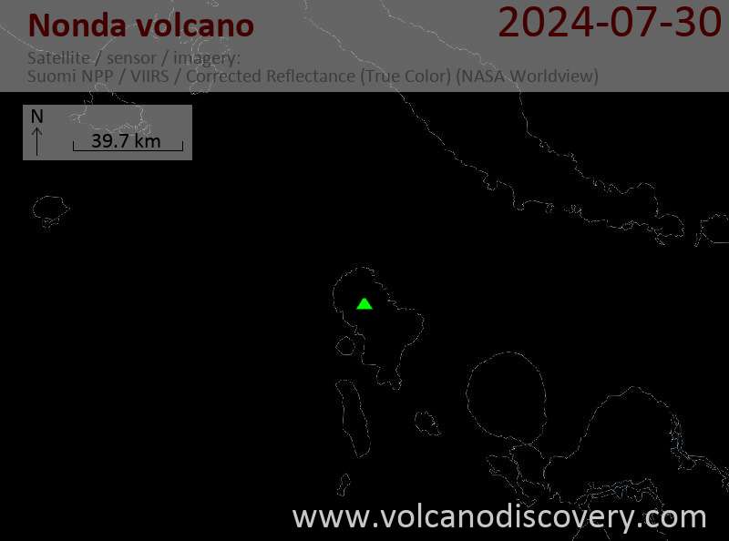
Nonda Volcán Mapas
Below is a selection of maps showing the location and surroundings of the volcano at various resolutions based on aerial-imagery / terrain maps. Feel free to use them for non-commercial purposes on your blog or website as long as you credit them with a link back to this page (click to copy it).

Satellite/aerial-type map of Nonda volcano (world scale)

Terrain-type map of Nonda volcano (world scale)

Satellite/aerial-type map of Nonda volcano (region scale large)

Terrain-type map of Nonda volcano (region scale large)

Satellite/aerial-type map of Nonda volcano (region scale medium)

Terrain-type map of Nonda volcano (region scale medium)

Satellite/aerial-type map of Nonda volcano (region scale small)

Terrain-type map of Nonda volcano (region scale small)

Satellite/aerial-type map of Nonda volcano (local scale large)

Terrain-type map of Nonda volcano (local scale large)

Satellite/aerial-type map of Nonda volcano (local scale medium)

Terrain-type map of Nonda volcano (local scale medium)

Satellite/aerial-type map of Nonda volcano (local scale small)

Terrain-type map of Nonda volcano (local scale small)

Satellite/aerial-type map of Nonda volcano (scale of 10s of km)

Terrain-type map of Nonda volcano (scale of 10s of km)

Satellite/aerial-type map of Nonda volcano (scale of 20-40 km)

Terrain-type map of Nonda volcano (scale of 20-40 km)

Satellite/aerial-type map of Nonda volcano (scale of approx. 10-20 km)

Terrain-type map of Nonda volcano (scale of approx. 10-20 km)

Satellite/aerial-type map of Nonda volcano (scale of 5-10 km)

Satellite/aerial-type map of Nonda volcano (scale of few kilometers)


