| RSS | EN | DE | EL | ES | FR | IT | RU

Chiliques Volcan

Updated: 25 mai 2025 08:16 GMT -
stratovolcano
Northern Chile / Bolivia / Argentina border, -23.58°S / -67.7°W
Summit height: 5778 m / 18,956 ft
Condition actuelle: normal / en sommeil (1 sur 5)

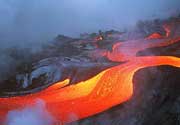
Volcán Chiliques is a stratovolcano in northern Chile immediately south of Laguna Lejía. The volcano consists of a symmetrical cone rising 1000 m from the surrounding terrain and contains a 500 m wide crater. Several young lava flows are seen on its flanks and some might be younger than 10,000 years. The largest flow extends 5 km to the NW, but older flows have reached 10 km distance on the north flank towards Laguna Lejía.
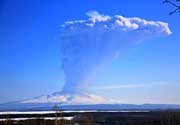
In April 2002, first signs of a possible reawakening of the volcano were detected as new hot spots inside the crater.

[smaller] [larger]
Style éruptif tipique: explosive, lava domes
Eruptions du volcan Chiliques: none in recent times, but probably within the past 10,000 years

Derniers séismes proches

Date et l'heureMag / Prof.Distance / Lieux
22 mai 10:10 (Temps Universel)
2.7

165 km
17 km à l'ouest 161 km au sud-est de Calama, El Loa, Antofagasta, Chili Info

Eruptions du volcan Chiliques


2002 hot spots detected in crater
Until 2002, the volcano had been considered dormant or even extinct, but satellite images discovered weak hot spots in the crater and on the upper flank, which had not been there previously. These are probably new fumaroles, that might be indicators of a re-awakening of the volcano. This observation does NOT mean that an eruption of the volcano took place (even though it would be a very remote possibility that a small extrusion of lava took place and was only detected after it started to cool down again.) ...plus d'info

Dernières images satellite

Chiliques image satellite sat1Chiliques image satellite sat2

Chiliques Volcan Cartes

Below is a selection of maps showing the location and surroundings of the volcano at various resolutions based on aerial-imagery / terrain maps. Feel free to use them for non-commercial purposes on your blog or website as long as you credit them with a link back to this page (click to copy it).
Satellite/aerial-type map of Chiliques volcano (world scale)
Terrain-type map of Chiliques volcano (world scale)
Satellite/aerial-type map of Chiliques volcano (region scale large)
Terrain-type map of Chiliques volcano (region scale large)
Satellite/aerial-type map of Chiliques volcano (region scale medium)
Terrain-type map of Chiliques volcano (region scale medium)
Satellite/aerial-type map of Chiliques volcano (region scale small)
Terrain-type map of Chiliques volcano (region scale small)
Satellite/aerial-type map of Chiliques volcano (local scale large)
Terrain-type map of Chiliques volcano (local scale large)
Satellite/aerial-type map of Chiliques volcano (local scale medium)
Terrain-type map of Chiliques volcano (local scale medium)
Satellite/aerial-type map of Chiliques volcano (local scale small)
Terrain-type map of Chiliques volcano (local scale small)
Satellite/aerial-type map of Chiliques volcano (scale of 10s of km)
Terrain-type map of Chiliques volcano (scale of 10s of km)
Satellite/aerial-type map of Chiliques volcano (scale of 20-40 km)
Terrain-type map of Chiliques volcano (scale of 20-40 km)
Satellite/aerial-type map of Chiliques volcano (scale of approx. 10-20 km)
Terrain-type map of Chiliques volcano (scale of approx. 10-20 km)
Satellite/aerial-type map of Chiliques volcano (scale of 5-10 km)
Satellite/aerial-type map of Chiliques volcano (scale of few kilometers)
Volcanoes & Earthquakes - new app for Android
Départs garantis:
9-25 juin 2025: Volcans et Épices - Mer des Moluques (Sulawesi, Indonésie)
7-22 juil. 2025: Du Krakatau à Bali - Java (Indonésie)
7-23 juil. 2025: Volcans et Épices - Mer des Moluques (Sulawesi, Indonésie)
1-17 août 2025: Volcans et Épices - Mer des Moluques (Sulawesi, Indonésie)
1-14 oct. 2025: Désert, sels et volcans - Désert de Danakil (Éthiopie)
4-12 oct. 2025: Montagnes de Feu - du Stromboli à l'Etna - Eoliennes + Etna
6-21 oct. 2025: Du Krakatau à Bali - Java (Indonésie)
3-19 nov. 2025: Volcans et Épices - Mer des Moluques (Sulawesi, Indonésie)
= Places libres   = Départ garanti   = Quelques places disponibles   = Groupe fermé
Actualités

No news in this list.

Sur cette page:

Try our free app!
Volcanoes & Earthquakes - new app for Android
Android | iOS version

More on VolcanoDiscovery

Why is there advertising on this site?

Support us - Help us upgrade our services!

We truly love working to bring you the latest volcano and earthquake data from around the world. Maintaining our website and our free apps does require, however, considerable time and resources.
We need financing to increase hard- and software capacity as well as support our editor team. We're aiming to achieve uninterrupted service wherever an earthquake or volcano eruption unfolds, and your donations can make it happen! Every donation will be highly appreciated. If you find the information useful and would like to support our team in integrating further features, write great content, and in upgrading our soft- and hardware, please make a donation (PayPal).

Planned features:Thanks to your past donations, these features have been added recently:
Download and Upgrade the Volcanoes & Earthquakes app to get one of the fastest seismic and volcano alerts online:
Android | IOS
Thank you!
Copyright: VolcanoDiscovery ou autres sources indiquées.
Utilisation des documents: Les textes, les images et les vidéos de ce site internet sont protégées par copyright. Toute reproduction et tout usage sans accord préalable ne sont pas autorisés. Si vous désirez acquérir pour certains documents (photos, vidéos, textes ou autres) le droit de reproduction, d'édition et, plus généralement, de toute utilisation destinée à un usage public, qu'elle soit commerciale ou pas, vous êtes priés de nous contacter.
Volcanoes & Earthquakes
VolcanoDiscovery Home
Volcans | Séismes | Photos | Actualités | | Shop | App
Adventure & Study Travel
Tours to Volcanoes and Volcanic Areas: walking tours, photo tours, study tours
Voyages |
Get our newsletter!
Company info
Contact | Mentions légales | Terms & conditions
Follow us
Follow us on facebook Follow us on Instagram Follow us on Bluesky Follow us on Twitter Visit our Youtube channel
EN | DE | EL | ES | FR | IT | RU
VolcanoDiscovery GmbH, Germany, Reg. nr.: HRB 103744, EU Tax Id: DE 297 465 123 owned and created by
Dr. Tom Pfeiffer, volcanologist, volcano photographer, tour organizer member of
IAVCEI
IAVCEI
Vulkanologische Gesellschaft
Volcanological Society
Ecotourism Greece
Ecotourism Greece
RUV insurance
Insured by R+V
VolcanoDiscovery © 2004- All Rights Reserved | Privacy - Changer Préférences