Macdonald Volcano
Updated: 1 mai 2024 13:00 GMT -
Submarine volcano -39 m / - 128 ft
Austral Islands, Kerguelen Plateau, Australia, -28.98°S / -140.25°W
Condition actuelle: normal / en sommeil (1 sur 5)
Austral Islands, Kerguelen Plateau, Australia, -28.98°S / -140.25°W
Condition actuelle: normal / en sommeil (1 sur 5)
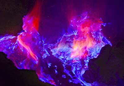
Macdonald, also known as Tamarii seamount, is a submarine volcano in the central Pacific Ocean. It was discovered in 1967 and has been frequently in eruption.
Note: there is also a volcano with the same name, McDonald Island, a small group of islands belonging to Australia in the southern Indian ocean.
[smaller] [larger]
Eruptions du volcan Macdonald: 1987, 1986, 1983 (Oct), 1983 (Mar), 1982, 1980 (Nov), 1980 (Feb), 1979, 1977, 1936?, 1928?
Derniers séismes proches
| Heure | Mag. / Profondeur | Distance / Lieu | |||
Introduction
Discovered by the detection of teleseismic waves in 1967, Macdonald seamount (also known as Tamarii seamount) rises from a depth of about 1800 m to within 27 m of the sea surface at the eastern end of the Austral Islands. The alkali-basaltic submarine volcano marks the site of a hotspot that was the source of the Austral-Cook island chain. The summit of the seamount, named after volcanologist Gordon Macdonald, consists of a flat plateau about 100 x 150 m wide with an average depth of about 40 m.The summit plateau is capped with spatter cones that form steep-sided pinnacles. Most eruptions of Macdonald have been seismically detected, but in 1987 and 1989 pumice emission was observed from research vessels. Pumice rafts observed in the South Pacific in 1928 and 1936 may also have originated from Macdonald seamount.
---
Smithsonian / GVP volcano information
Latest satellite images