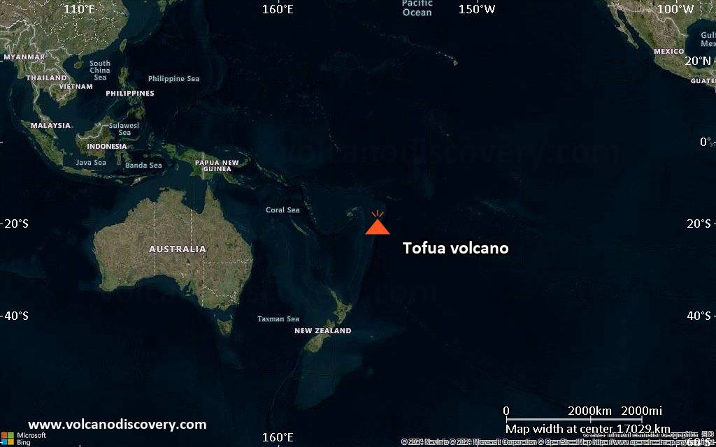
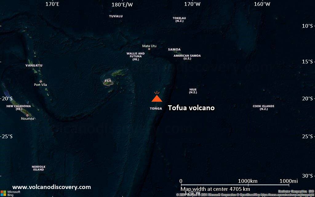
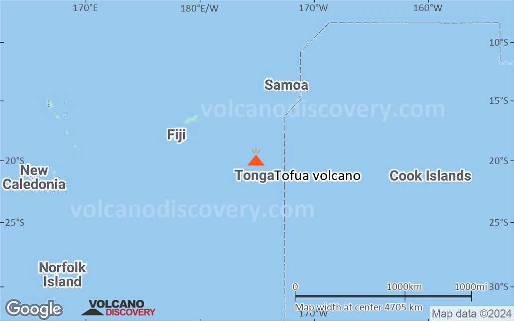
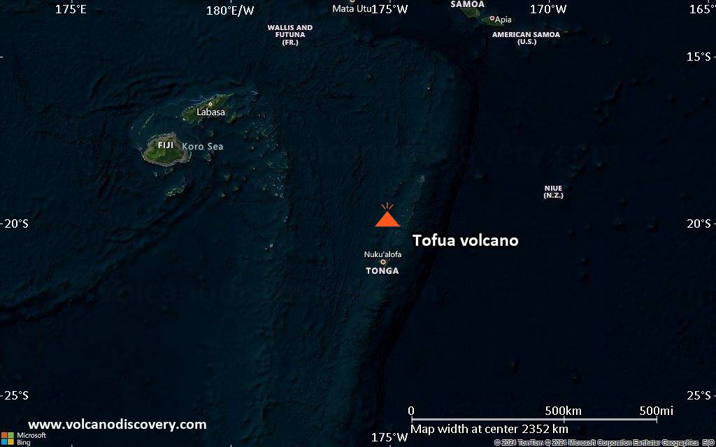
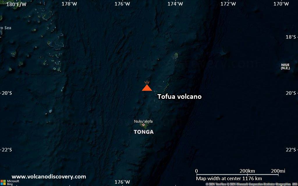
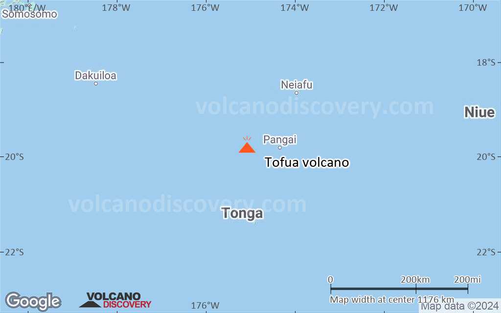
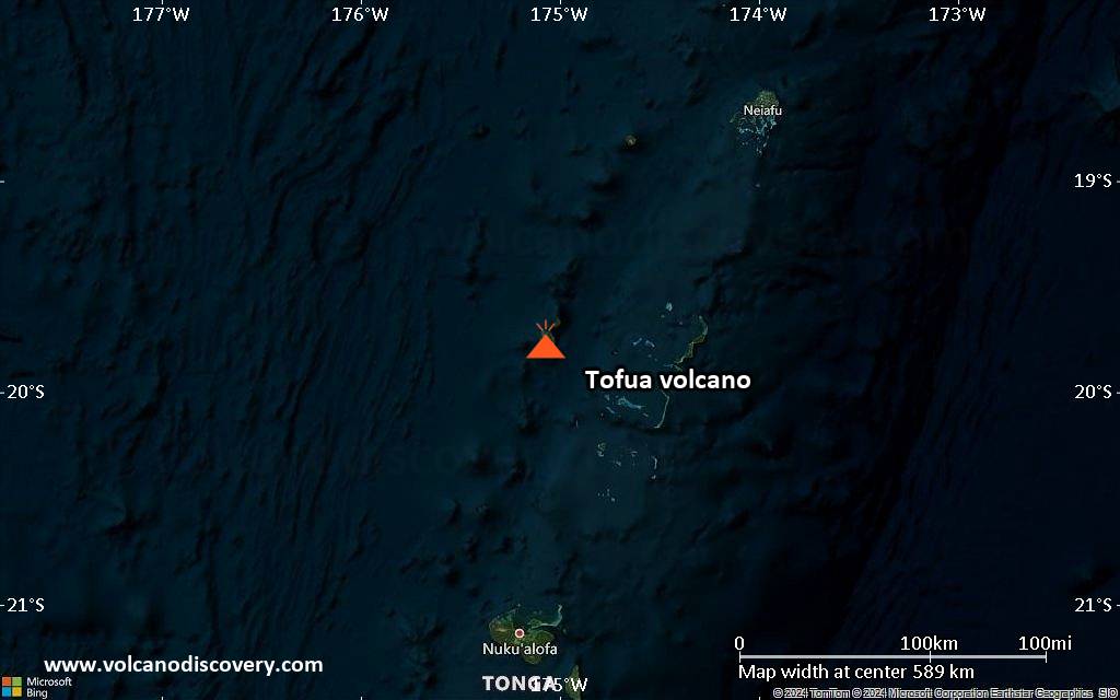
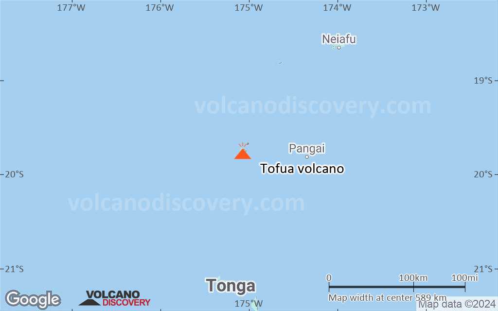
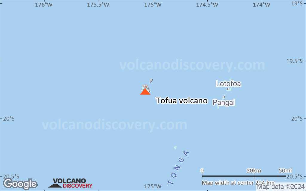
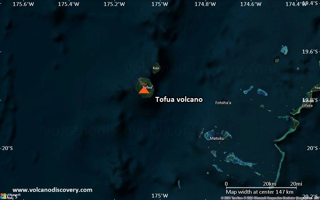
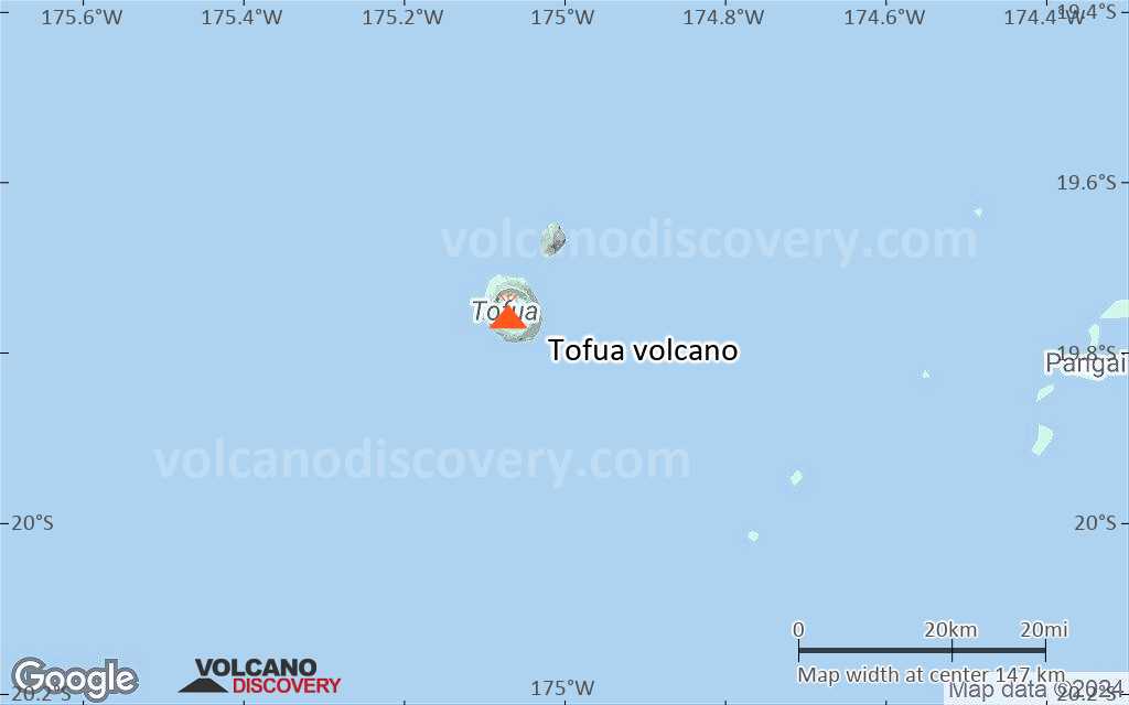
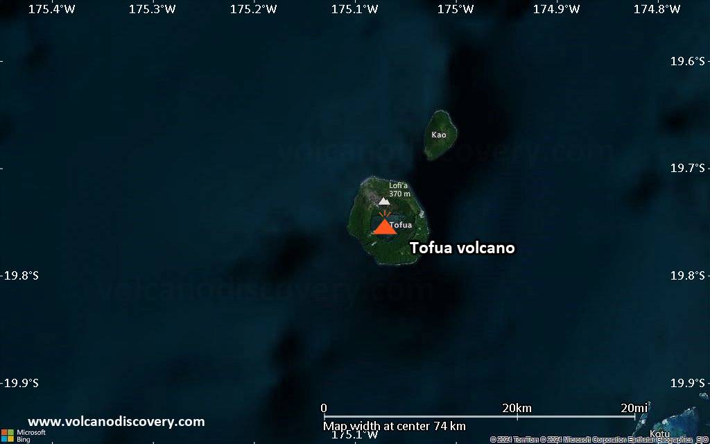
| RSS | EN | DE | EL | ES | FR | IT | RU

Tofua Volcan

Updated: 10 mai 2025 00:05 GMT -
caldera
Tonga Islands, -19.75°S / -175.07°W
Summit height: 515 m / 1,690 ft
Condition actuelle: Activité petite ou avertissement éruption imminente (3 sur 5)
Last update: 29 mai 2024 (Smithsonian / USGS Weekly Volcanic Activity Report)
Aerial photo of Tofua (Tonga Ministry of Lands, Survey, and Natural Resources, 1990, published in Taylor and Ewart, 1997)

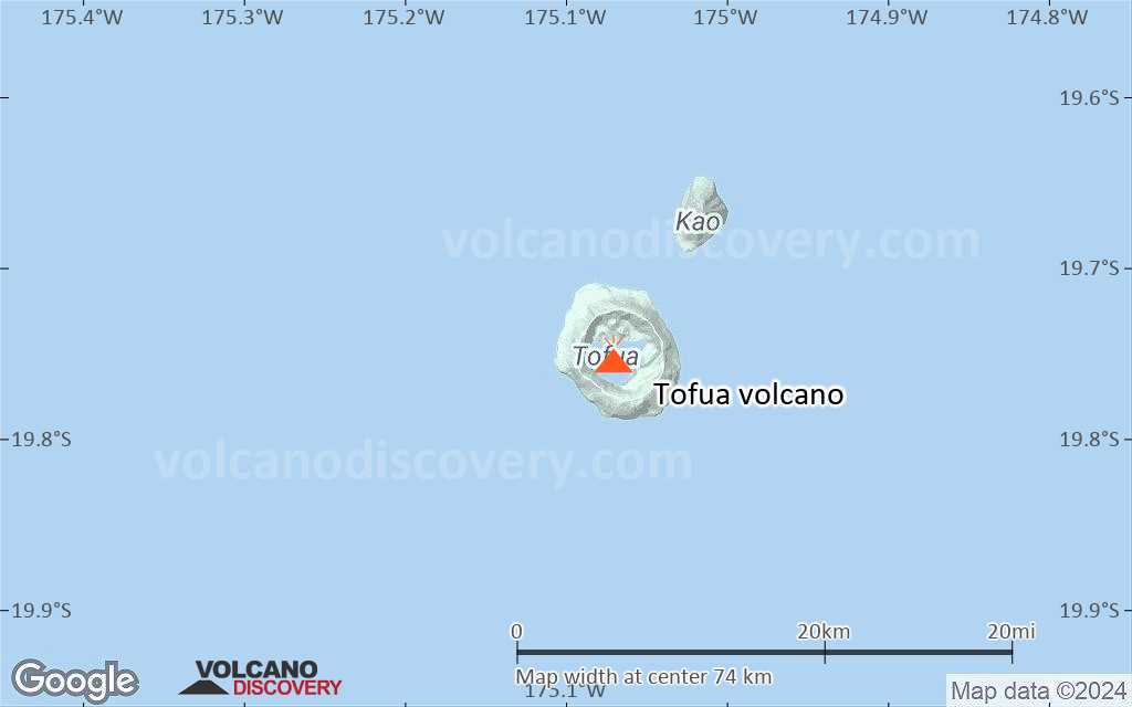
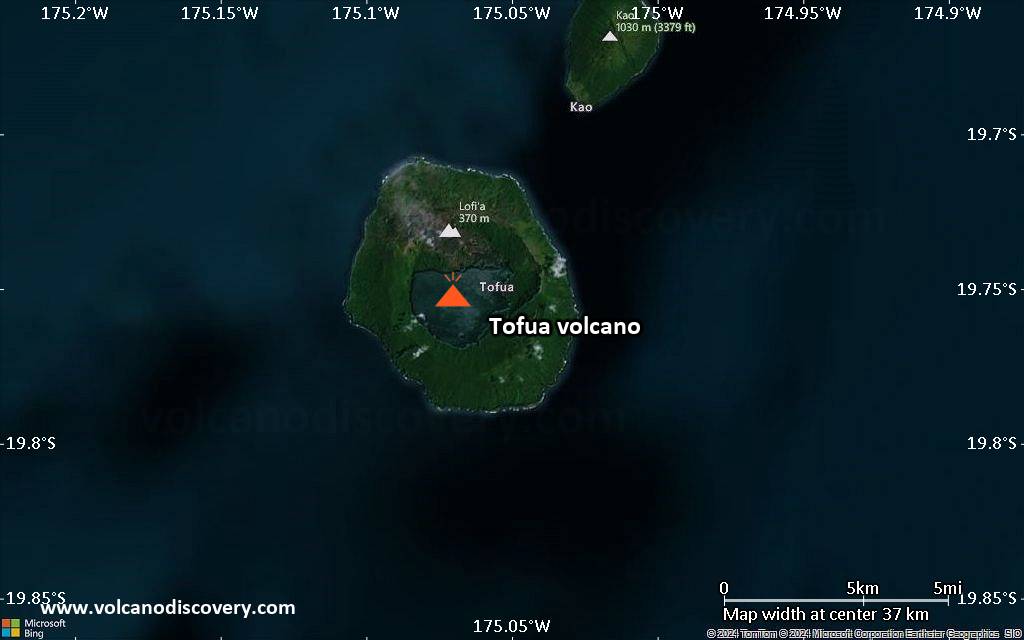
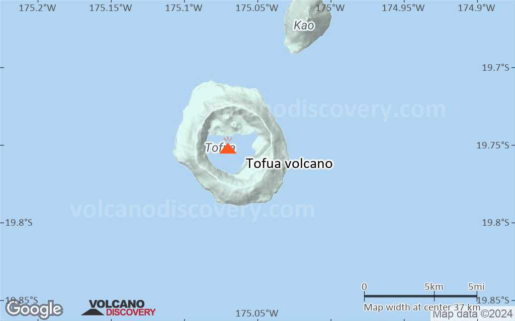
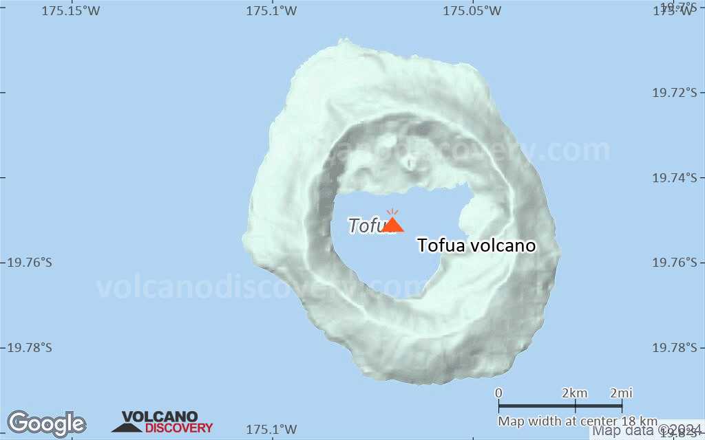
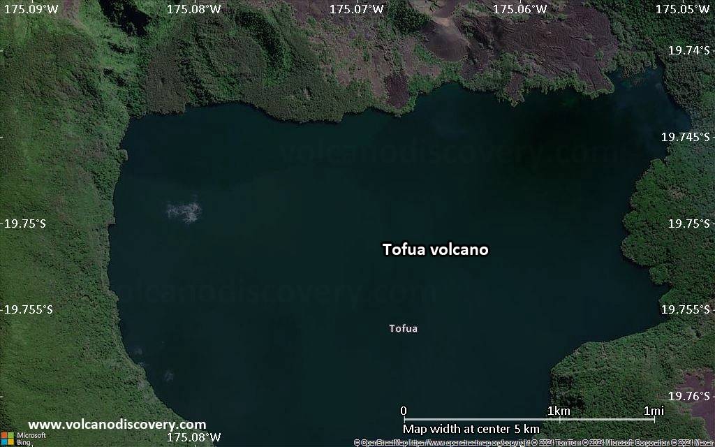
Tofua volcano is the subaerial part of a large frequently active stratovolcano. It forms the 8 km wide circular Tofua Island, dominated by the 5 km wide caldera containing a freshwater lake at only 30 m above sea level and surrounded by steep 300 m cliffs.
The island is know for Captain Bligh who was stranded there during the famous Bounty Mutiny 1789. The first historical eruption of Tofua was observed by Captain Cook in 1774.

[smaller] [larger]
Style éruptif tipique: explosive
Eruptions du volcan Tofua: 2006-09, 2004, 1958, 1906, 1889, 1885, 1854, 1792, 1774

Derniers séismes proches

Date et l'heureMag / Prof.Distance / Lieux

Introduction

The easternmost cone has three craters and produced young basaltic-andesite lava flows, some of which traveled into the caldera lake. The largest and northernmost of the cones, Lofia, has a steep-sided crater that is 70 m wide and 120 m deep and has been the source of historical eruptions, first reported in the 18th century. The fumarolically active crater of Lofia has a flat floor formed by a ponded lava flow. (Smithsonian / GVP volcano information)

Éruptions volcaniques importantes: volcano Tofua

In the past 10,000 years, Tofua has had at least 11 confirmed eruptions, all documented by historical records or observations. There is one uncertain or discredited eruption in 1993 from Tofua volcano.
The table below lists all known eruptions (date in bold face) of Tofua volcano in historic times and during the past 10,000 years. Updates on the most recent volcanic activity of Tofua can be found on the news page of Tofua volcano.
DateNoteVEIMortsDommages
2015 Oct 2 - en coursLofia crater
Obs./docs historiques
0
inconnu
2004 Mar 19 - 2014 Oct 18Lofia crater
Obs./docs historiques
1?
inconnu
?? 1993 Avr 29
Éruption incertaine
0
inconnu
1958 Déc 31 ±120 d. - 1960 ?Northern part of caldera
Obs./docs historiques
2
inconnu
1906 DécNorthern part of caldera
Obs./docs historiques
2
inconnu
1906 Jan - FévNorthern part of caldera
Obs./docs historiques
2
inconnu
1892 Août 30
(éruption 1885 Oct)
Tsunami enregistré
Obs./docs historiques
2
inconnu
Infos
1885 Oct
Obs./docs historiques
2
inconnu
1854
Obs./docs historiques
2
inconnu
1847 Jul 10 ou avant
Obs./docs historiques
1
inconnu
1845 Jul 1 ±60 d.
Obs./docs historiques
0
inconnu
1792
Obs./docs historiques
0
inconnu
1774 Jun
Obs./docs historiques
2
inconnu
Remark:
Our list of volcanic eruptions closely follows the database of eruptions of the Smithsonian's Global Volcanism Project (GVP), the internationally most recognized data source for volcanic eruptions, but also includes significant eruptive episodes or related volcano events. "Volcanic eruptions" are usually to be understood as sequences of individual eruptive episodes that can follow each other, or even overlap (if several vents are involved), and can last many years, decades or even longer. For example, the current activity of Stromboli volcano is understood as a single eruption that has been ongoing since 1934.
Sources: NOAA National Centers for Environmental Information (NCEI), Global Significant Volcanic Eruptions Database. doi:10.7289/V5TD9V7K | Global Volcanism Project / Smithsonian Institution

Tofua Volcano FAQ

+When was the last eruption of Tofua volcano?

+How often does Tofua volcano erupt?

+How active is Tofua volcano at present?

+When was the largest eruption of Tofua volcano?

Dernières images satellite

Tofua image satellite sat1Tofua image satellite sat2

Tofua Volcan Cartes

Below is a selection of maps showing the location and surroundings of the volcano at various resolutions based on aerial-imagery / terrain maps. Feel free to use them for non-commercial purposes on your blog or website as long as you credit them with a link back to this page (click to copy it).
Satellite/aerial-type map of Tofua volcano (world scale)
Terrain-type map of Tofua volcano (world scale)
Satellite/aerial-type map of Tofua volcano (region scale large)
Terrain-type map of Tofua volcano (region scale large)
Satellite/aerial-type map of Tofua volcano (region scale medium)
Terrain-type map of Tofua volcano (region scale medium)
Satellite/aerial-type map of Tofua volcano (region scale small)
Terrain-type map of Tofua volcano (region scale small)
Satellite/aerial-type map of Tofua volcano (local scale large)
Terrain-type map of Tofua volcano (local scale large)
Satellite/aerial-type map of Tofua volcano (local scale medium)
Terrain-type map of Tofua volcano (local scale medium)
Satellite/aerial-type map of Tofua volcano (local scale small)
Terrain-type map of Tofua volcano (local scale small)
Satellite/aerial-type map of Tofua volcano (scale of 10s of km)
Terrain-type map of Tofua volcano (scale of 10s of km)
Satellite/aerial-type map of Tofua volcano (scale of 20-40 km)
Terrain-type map of Tofua volcano (scale of 20-40 km)
Satellite/aerial-type map of Tofua volcano (scale of approx. 10-20 km)
Terrain-type map of Tofua volcano (scale of approx. 10-20 km)
Satellite/aerial-type map of Tofua volcano (scale of 5-10 km)
Satellite/aerial-type map of Tofua volcano (scale of few kilometers)
Volcanoes & Earthquakes - new app for Android
Départs garantis:
9-25 juin 2025: Volcans et Épices - Mer des Moluques (Sulawesi, Indonésie)
7-22 juil. 2025: Du Krakatau à Bali - Java (Indonésie)
7-23 juil. 2025: Volcans et Épices - Mer des Moluques (Sulawesi, Indonésie)
1-17 août 2025: Volcans et Épices - Mer des Moluques (Sulawesi, Indonésie)
1-14 oct. 2025: Désert, sels et volcans - Désert de Danakil (Éthiopie)
4-12 oct. 2025: Montagnes de Feu - du Stromboli à l'Etna - Eoliennes + Etna
6-21 oct. 2025: Du Krakatau à Bali - Java (Indonésie)
3-19 nov. 2025: Volcans et Épices - Mer des Moluques (Sulawesi, Indonésie)
= Places libres   = Départ garanti   = Quelques places disponibles   = Groupe fermé
mer., 29 mai 2024, 14:00

Tofua volcano - Smithsonian / USGS Weekly Volcanic Activity Report for 22 May-28 May 2024 (New Activity / Unrest)

At 0900 on 23 May Tonga Geological Services reported that elevated activity at Tofua had ceased during the previous week. The characteristics of a thermal anomaly identified in a satellite image indicated a return to baseline levels. The Aviation Color Code was lowered to Green (the lowest color on a four-color scale), the Maritime Alert Level was lowered to Green (the lowest level on a four-color scale), and the Alert level for residents of Vava'u and Ha'apai remained at Green (the lowest color on a four-color scale). ... Tout lire
mer., 15 mai 2024, 14:00

Tofua volcano (Tonga Ridge) - Smithsonian / USGS Weekly Volcanic Activity Report for 8 May-14 May 2024 (New Activity / Unrest)

Tonga Geological Services reported that unrest at Tofua continued during 8-14 May. Thermal anomalies were detected daily and had intensities that fluctuated at low levels. The Aviation Color Code remained at Yellow (the second lowest color on a four-color scale); the Maritime Alert Level remained at Orange (the second highest level on a four-color scale) and mariners were advised to stay 2 km away from the island; the Alert level for residents of Vava'u and Ha'apai remained at Green (the lowest color on a four-color scale). ... Tout lire

Sur cette page:

Try our free app!
Volcanoes & Earthquakes - new app for Android
Android | iOS version

More on VolcanoDiscovery

Why is there advertising on this site?

Support us - Help us upgrade our services!

We truly love working to bring you the latest volcano and earthquake data from around the world. Maintaining our website and our free apps does require, however, considerable time and resources.
We need financing to increase hard- and software capacity as well as support our editor team. We're aiming to achieve uninterrupted service wherever an earthquake or volcano eruption unfolds, and your donations can make it happen! Every donation will be highly appreciated. If you find the information useful and would like to support our team in integrating further features, write great content, and in upgrading our soft- and hardware, please make a donation (PayPal).

Planned features:Thanks to your past donations, these features have been added recently:
Download and Upgrade the Volcanoes & Earthquakes app to get one of the fastest seismic and volcano alerts online:
Android | IOS
Thank you!
Copyright: VolcanoDiscovery ou autres sources indiquées.
Utilisation des documents: Les textes, les images et les vidéos de ce site internet sont protégées par copyright. Toute reproduction et tout usage sans accord préalable ne sont pas autorisés. Si vous désirez acquérir pour certains documents (photos, vidéos, textes ou autres) le droit de reproduction, d'édition et, plus généralement, de toute utilisation destinée à un usage public, qu'elle soit commerciale ou pas, vous êtes priés de nous contacter.
Volcanoes & Earthquakes
VolcanoDiscovery Home
Volcans | Séismes | Photos | Actualités | | Shop | App
Adventure & Study Travel
Tours to Volcanoes and Volcanic Areas: walking tours, photo tours, study tours
Voyages |
Get our newsletter!
Company info
Contact | Mentions légales | Terms & conditions
Follow us
Follow us on facebook Follow us on Instagram Follow us on Bluesky Follow us on Twitter Visit our Youtube channel
EN | DE | EL | ES | FR | IT | RU
VolcanoDiscovery GmbH, Germany, Reg. nr.: HRB 103744, EU Tax Id: DE 297 465 123 owned and created by
Dr. Tom Pfeiffer, volcanologist, volcano photographer, tour organizer member of
IAVCEI
IAVCEI
Vulkanologische Gesellschaft
Volcanological Society
Ecotourism Greece
Ecotourism Greece
RUV insurance
Insured by R+V
VolcanoDiscovery © 2004- All Rights Reserved | Privacy - Changer Préférences