Ghegam Vulcano
Updated: 11 maggio 2025 23:25 GMT -
stratovolcano, cinder cones
Armenia, 40.23°N / 44.95°E 
Summit height: 3597 m
Current status: normal or dormant (1 out of 5)
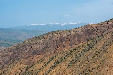
The Ghegam Ridge, located in west-central Armenia between the capital city of Yerevan and Lake Sevan, contains a broad concentration of lava domes and pyroclastic cones of Pleistocene-to-Holocene age.
[smaller] [larger]
Eruzioni del vulcano Ghegam: none in historic times
Latest nearby earthquakes
Background
The volcanoes and associated lava flows cover a 65-km-long, 35-km-wide area west of Lake Sevan and south of the Hrazdan River and are concentrated along 3 NNW-SSE-trending alignments. Lava flows from the central and eastern clusters flowed into Lake Sevan. Initial explosive eruptions at the Ghegam Ridge volcanic field were followed by the extrusion of rhyolitic obsidian lava domes and flows. The latest activity produced a series of andesitic and basaltic-andesite cinder cones and lava flows. The central and eastern portions of the Ghegam Ridge contains large areas of Holocene eruptions with morphologically fresh lava flows devoid of vegetation.Ghegam Volcano Photos
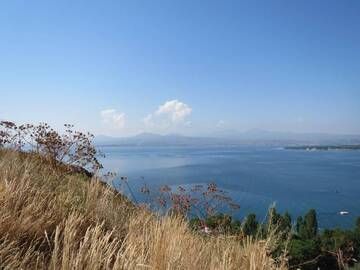
Campo vulcanico di Ghegam Ridge con il suo vulcano più alto, il monte Azhdahak, Lago Sevan, Armenia (Photo: WNomad)
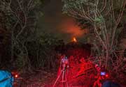
La cresta di Ghegam, un giovane campo di coni di cenere e colate laviche, è visibile sullo sfondo dietro una gola con massicci strati di colate di cenere esposti. (Photo:...
Eruzioni vulcaniche significative: Ghegam volcano
No historic eruptions are known from Ghegam volcano, but at least one eruption around 1900 BC can be inferred from geological evidence.
The table below lists all known eruptions (date in bold face) of Ghegam volcano in historic times and during the past 10,000 years. Updates on the most recent volcanic activity of Ghegam can be found on the news page of Ghegam volcano.
| Data | Nota | VEI | Deceduti | Danni | |
|---|---|---|---|---|---|
| North part of eastern cone cluster | ? | sconosciuto | |||
Remark:
Our list of volcanic eruptions closely follows the database of eruptions of the Smithsonian's Global Volcanism Project (GVP), the internationally most recognized data source for volcanic eruptions, but also includes significant eruptive episodes or related volcano events. "Volcanic eruptions" are usually to be understood as sequences of individual eruptive episodes that can follow each other, or even overlap (if several vents are involved), and can last many years, decades or even longer. For example, the current activity of Stromboli volcano is understood as a single eruption that has been ongoing since 1934.
Fonti: NOAA National Centers for Environmental Information (NCEI), Global Significant Volcanic Eruptions Database. doi:10.7289/V5TD9V7K | Global Volcanism Project / Smithsonian Institution
Ghegam Volcano FAQ
+When was the last eruption of Ghegam volcano?
The last confirmed eruption of Ghegam occurred around 1900 BC.
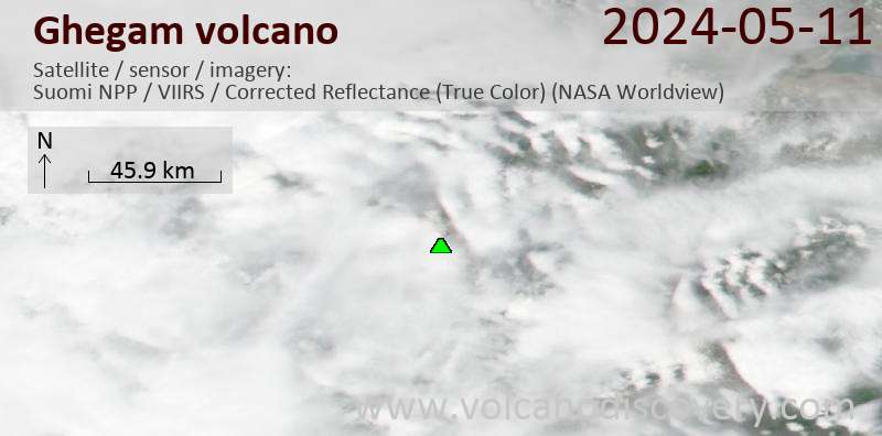
Ultime immagini satellitari
Ghegam Tour dei vulcani
Armenia
Land of History
12-day walking & study tour to Armenia
12 days / 11 nights - Easy to Moderate
Price 2500 €
Price 2500 €
no scheduled dates at present
Ghegam Vulcano Mappe
Below is a selection of maps showing the location and surroundings of the volcano at various resolutions based on aerial-imagery / terrain maps. Feel free to use them for non-commercial purposes on your blog or website as long as you credit them with a link back to this page (click to copy it).

Satellite/aerial-type map of Ghegam volcano (world scale)

Terrain-type map of Ghegam volcano (world scale)

Satellite/aerial-type map of Ghegam volcano (region scale large)

Terrain-type map of Ghegam volcano (region scale large)

Satellite/aerial-type map of Ghegam volcano (region scale medium)

Terrain-type map of Ghegam volcano (region scale medium)

Satellite/aerial-type map of Ghegam volcano (region scale small)

Terrain-type map of Ghegam volcano (region scale small)

Satellite/aerial-type map of Ghegam volcano (local scale large)

Terrain-type map of Ghegam volcano (local scale large)

Satellite/aerial-type map of Ghegam volcano (local scale medium)

Terrain-type map of Ghegam volcano (local scale medium)

Satellite/aerial-type map of Ghegam volcano (local scale small)

Terrain-type map of Ghegam volcano (local scale small)

Satellite/aerial-type map of Ghegam volcano (scale of 10s of km)

Terrain-type map of Ghegam volcano (scale of 10s of km)

Satellite/aerial-type map of Ghegam volcano (scale of 20-40 km)

Terrain-type map of Ghegam volcano (scale of 20-40 km)

Satellite/aerial-type map of Ghegam volcano (scale of approx. 10-20 km)

Terrain-type map of Ghegam volcano (scale of approx. 10-20 km)

Satellite/aerial-type map of Ghegam volcano (scale of 5-10 km)

Satellite/aerial-type map of Ghegam volcano (scale of few kilometers)