| RSS | EN | DE | EL | ES | FR | IT | RU

Kolumbo Vulkan

Updated: 7. Sep. 2025 19:13 GMT -
submarine volcano
Griechenland, 36.52°N / 25.49°E
Summit height: -18 m / -60 ft
Aktueller Status: normal / ruhend (1 von 5)
Last update: 10 Mär 2025
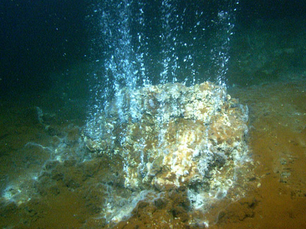
Hydrothermal vents occur when sea water enters the crust and comes in contact with the volcano's magma chamber. The hot fluid becomes enriched with minerals and then emerges through the vent; when it comes in contact with the colder seawater, its minerals are deposited and create mounds and 'chimneys'. Cyanobacteria use the hot water and minerals as an energy source through a process called chemosynthesis; this vent is covered with red, white, and black bacterial mats. Image taken by the ROV Hercules developed by the Institute for Exploration at Kolumbo underwater volcano, located northeast of Santorini in the Aegean Sea. Image courtesy of the Institute for Exploration, the University of Rhode Island (URI) Graduate School of Oceanography (GSO), and the URI Institute for Archaeological Oceanography.

Kolumbo (or Kolumbos) volcano is an active submarine volcano located 8 km NE of Santorini Island in the Aegean Sea. The volcano forms an elliptical SW-NE elongated 3 km wide cone with a 500 m deep and 1.5 km wide crater, whose rim's highest parts rise to 18-15 m beneath sea level.
The crater floor, in particular in its northern part, contains a large and very active high-temperature fumarole field.
The crater of Kolumbo volcano is a small caldera which could have (at least in parts) formed during the volcano's only known, but very violent last eruption which occurred in 1650 AD.

[smaller] [larger]
Typische Aktivität: explosive
Ausbrüche des Kolumbo: 1650

Letzte Erdbeben in der Nähe

Datum und UhrzeitMag / TiefeDistanz / Ort
7. Sep. 17:13 (Weltzeit)
2.2

7.6 km
24 km nordöstlich Ägäisches Meer, 27 km südwestlich von Amorgos , Griechenland Info
7. Sep. 15:16 (GMT +3)
2.2

6.5 km
21 km nordöstlich Santorini Isl. - S. Greece Info
7. Sep. 11:21 (GMT +3)
2.9

8.4 km
23 km nordöstlich 18 km SW From Arkesini Amorgos  I FELT IT Info
7. Sep. 06:52 (GMT +3)
3.0

10 km
13 km südlich Greece: 9.8 km E of Thira  I FELT IT - 1 BerichtInfo
7. Sep. 00:47 (Weltzeit)
1.8

5 km
15 km nordöstlich Santorini Isl. - S. Greece Info
Samstag, 6. September 2025 GMT (2 Beben)
6. Sep. 23:09 (Weltzeit)
2.1

6.9 km
19 km nordöstlich Greece: 22 km SW From Arkesini Amorgos Info
6. Sep. 14:58 (Weltzeit)
1.5

8.5 km
19 km nordöstlich 22 km SW From Arkesini Amorgos Info
Dienstag, 2. September 2025 GMT (1 Beben)
2. Sep. 10:29 (GMT +3)
3.1

6.8 km
19 km südwestlich 7 km SSW From Oia  I FELT IT - 19 BerichteInfo
Montag, 1. September 2025 GMT (1 Beben)
2. Sep. 00:02 (Athens)
3.6

14 km
29 km nordöstlich 14 km SSW From Arkesini Amorgos  I FELT IT - 7 BerichteInfo

Beschreibung

The large hydrothermal field in the northern part of the caldera at about 500 m depth contains a massive Kuroko-style sulfide deposit. Only few such deposits are known world-wide and they are of great interest, especially because of the typically high content of gold and silver in the sulfides. In 2010, the exploration Vessel (E/V) Nautilus discovered steep, up to 6 m high chimneys of sulfides above one of the vents.
1650 eruption of Kolumbo volcano
The 1650 eruption was a very explosive event and ejected pumice and ash as far as Turkey, and produced pyroclastic flows that killed about 70 people on Santorini. During the eruption, it constructed a temporary island (hence it's name Kolumbo, in Greece "swimming"). A tsunami occurred as well, probably during the collapse of the cone. It caused damage on nearby islands up to 150 km and invaded the flat coastal areas especially on the eastern side of Santorini, where ruins from Roman times were uncovered. The eruption also caused damage killed a great number of livestock because of poisonous gasses, mainly H2S.

Links:
- Thera 2006 Expedition Summary (NOAA Ocean Explorer)
- Special Volume of Oceanography(pdf)
- Follow Dr. Robert Ballard and his team as they explore the ocean on the E/V Nautilus

Neueste Satellitenbilder

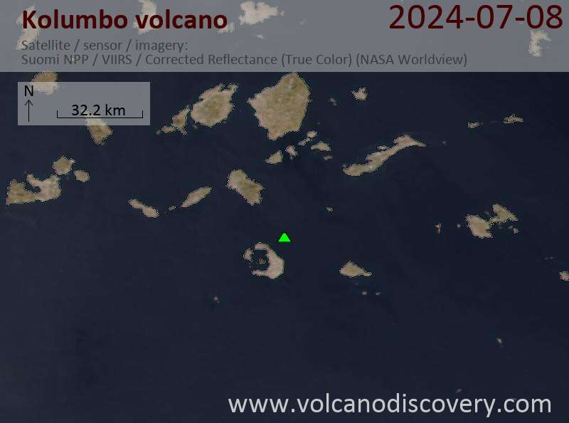
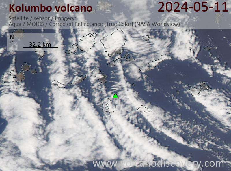
Kolumbo Satellitenbild sat1Kolumbo Satellitenbild sat2

Kolumbo Vulkan Karten

Below is a selection of maps showing the location and surroundings of the volcano at various resolutions based on aerial-imagery / terrain maps. Feel free to use them for non-commercial purposes on your blog or website as long as you credit them with a link back to this page (click to copy it).
Satellite/aerial-type map of Kolumbo volcano (world scale)
Terrain-type map of Kolumbo volcano (world scale)
Satellite/aerial-type map of Kolumbo volcano (region scale large)
Terrain-type map of Kolumbo volcano (region scale large)
Satellite/aerial-type map of Kolumbo volcano (region scale medium)
Terrain-type map of Kolumbo volcano (region scale medium)
Satellite/aerial-type map of Kolumbo volcano (region scale small)
Terrain-type map of Kolumbo volcano (region scale small)
Satellite/aerial-type map of Kolumbo volcano (local scale large)
Terrain-type map of Kolumbo volcano (local scale large)
Satellite/aerial-type map of Kolumbo volcano (local scale medium)
Terrain-type map of Kolumbo volcano (local scale medium)
Satellite/aerial-type map of Kolumbo volcano (local scale small)
Terrain-type map of Kolumbo volcano (local scale small)
Satellite/aerial-type map of Kolumbo volcano (scale of 10s of km)
Terrain-type map of Kolumbo volcano (scale of 10s of km)
Satellite/aerial-type map of Kolumbo volcano (scale of 20-40 km)
Terrain-type map of Kolumbo volcano (scale of 20-40 km)
Satellite/aerial-type map of Kolumbo volcano (scale of approx. 10-20 km)
Terrain-type map of Kolumbo volcano (scale of approx. 10-20 km)
Satellite/aerial-type map of Kolumbo volcano (scale of 5-10 km)
Satellite/aerial-type map of Kolumbo volcano (scale of few kilometers)
Volcanoes & Earthquakes - new app for Android
Garantierte Reisen
6.-21. Okt 2025: Von Krakatau bis Bali - Java (Indonesien)
3.-19. Nov 2025: Volcanoes and Spices - N-Sulawesi + Halmahera (Indonesien)
9.-19. Nov 2025: Guatemala Volcano Special - Guatemala
20. Nov - 3. Dez 2025: Wüste, Salz und Vulkane - Danakilwüste (Äthiopien)
2.-10. Mai 2026: Feuerberge Siziliens - vom Stromboli zum Ätna - Äolische Inseln + Ätna
= Plätze frei   = garantiert   = Wenig freie Plätze   = Ausgebucht
Mo, 10. Mär 2025, 11:12

Kolumbo submarine volcano (Greece): earthquakes in the area decrease, unlikely related to volcanic activity

Earthquakes over time (past 30 days) near Kolumbo volcano
The earthquake swarm in the area half way between Santorini and Amorgos Island continues to decrease. Only occasionally, earthquakes have been reaching magnitudes higher than 3. Alles lesen
Di, 20. Apr 2021, 18:13

Moderate earthquake near undersea volcano beside Santorini, Greece. Should we worry?

This morning's earthquake near Kolumbo volcano offshore Santorini
This morning, a magnitude 4.0 earthquake occurred 10 km northeast of Santorini Island. The quake hit at 11.21 am local time. It was felt by many people on Santorini, especially in the northern part of the island in the town of Oia, mostly as weak shaking that lasted a few seconds. ... Alles lesen
Map of the Kolumbo submarine crater and other submarine cones on the north-east trending Kolumbo volcano-tectonic rift. Figure courtesy of Haraldur Sigurdsson, Steven Carey, Matina Alexandir and Katy Croff. (from: oceanexplorer.noaa.gov/explorations/06blacksea/logs/summary_thera/summary_thera.html)

Auf dieser Seite:

Try our free app!
Volcanoes & Earthquakes - new app for Android
Android | iOS version

More on VolcanoDiscovery

Warum gibt es Werbung auf dieser Seite?

Gemeinsam VolcanoDiscovery weiterentwickeln!

Tag für Tag arbeiten wir mit Leidenschaft daran, Ihnen die neuesten Daten zu Vulkanen und Erdbeben in aller Welt in Echtzeit bereitzustellen. Die Pflege unserer Website und unserer kostenlosen Apps erfordert jedoch erheblichen Zeitaufwand, Engagement und technische Ressourcen.
Mit Ihrer Unterstützung können wir unsere Hard- und Softwarekapazitäten ausbauen, unser Redaktionsteam stärken und sicherstellen, dass wir Sie weiterhin informieren können. Unser Ziel: ein unterbrechungsfreier und möglichst vollständiger Service, sobald sich ein Erdbeben oder Vulkanausbruch ereignet. Ihre Unterstützung macht dies möglich – jeder Beitrag zählt! Wenn Sie unsere Dienste und Infos hilfreich finden und sich an dieser Mission beteiligen möchten, unterstützen Sie uns noch heute:

Spenden mit Karte oder Apple/Google Pay:

5 € spenden Zahlungslink zur Unterstützung von VolcanoDiscovery mit 5 EUR
10 € Zahlungslink zur Unterstützung von VolcanoDiscovery mit 10 EUR
25 € Zahlungslink zur Unterstützung von VolcanoDiscovery mit 25 EUR
50 € Zahlungslink zur Unterstützung von VolcanoDiscovery mit 50 EUR
100 € Zahlungslink zur Unterstützung von VolcanoDiscovery mit 100 EUR
250 € Zahlungslink zur Unterstützung von VolcanoDiscovery mit 250 EUR

Spenden mit PayPal:

Geplante Verbesserungen:

Dank Ihrer bisherigen Spenden konnten wir bereits umsetzen:
Laden Sie die App „Vulkane & Erdbeben“ herunter, um bei Vulkanen und Erdbeben immer auf dem aktuellsten Stand zu sein und neueste Nachrichten zu erhalten!
Android | iOS
Vielen Dank, dass Sie Teil dieser Mission sind!
Sources: VolcanoDiscovery / VolcanoAdventures and other sources as noted.
Use of material: Most text and images on our websites are owned by us. Re-use is generally not permitted without authorization. Contact us for licensing rights.
Volcanoes & Earthquakes
VolcanoDiscovery Home
Vulkane | Erdbeben | Fotos | News | | Shop | App
Adventure & Study Travel
Reisen zu Vulkanen und Vulkangebieten: Wanderreisen, Studienreisen, Fotoreisen
Tours & Dates | FAQ | About us
Get our newsletter!
Company info
Kontakt | Impressum | AGB
Follow us
Follow us on facebook Follow us on Instagram Follow us on Bluesky Follow us on Twitter Visit our Youtube channel
EN | DE | EL | ES | FR | IT | RU
VolcanoDiscovery GmbH, Germany, Reg. nr.: HRB 103744, EU Tax Id: DE 297 465 123 owned and created by
Dr. Tom Pfeiffer, volcanologist, volcano photographer, tour organizer member of
IAVCEI
IAVCEI
Vulkanologische Gesellschaft
Volcanological Society
Ecotourism Greece
Ecotourism Greece
RUV insurance
Insured by R+V
VolcanoDiscovery © 2004- All Rights Reserved | Datenschutz - Cookie Einstellungen