Kolumbo Volcan
Updated: 22 mai 2025 12:32 GMT -
submarine volcano
Grèce, 36.52°N / 25.49°E 
Summit height: -18 m / -60 ft
Condition actuelle: normal / en sommeil (1 sur 5)
Last update: 10 mars 2025
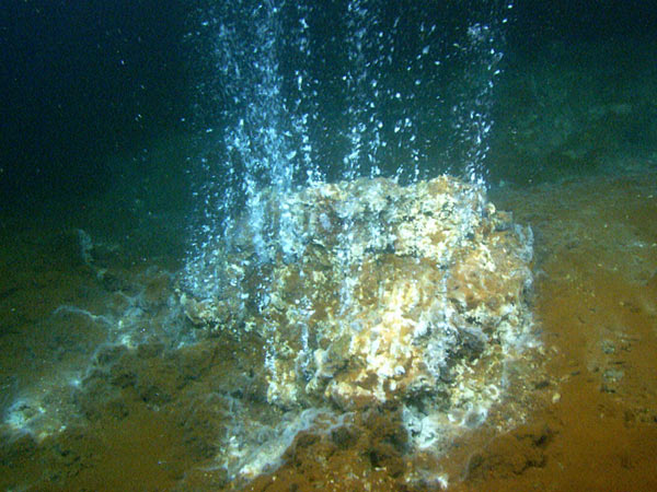
Hydrothermal vents occur when sea water enters the crust and comes in contact with the volcano's magma chamber. The hot fluid becomes enriched with minerals and then emerges through the vent; when it comes in contact with the colder seawater, its minerals are deposited and create mounds and 'chimneys'. Cyanobacteria use the hot water and minerals as an energy source through a process called chemosynthesis; this vent is covered with red, white, and black bacterial mats. Image taken by the ROV Hercules developed by the Institute for Exploration at Kolumbo underwater volcano, located northeast of Santorini in the Aegean Sea. Image courtesy of the Institute for Exploration, the University of Rhode Island (URI) Graduate School of Oceanography (GSO), and the URI Institute for Archaeological Oceanography.
Kolumbo (or Kolumbos) volcano is an active submarine volcano located 8 km NE of Santorini Island in the Aegean Sea. The volcano forms an elliptical SW-NE elongated 3 km wide cone with a 500 m deep and 1.5 km wide crater, whose rim's highest parts rise to 18-15 m beneath sea level.
The crater floor, in particular in its northern part, contains a large and very active high-temperature fumarole field.
The crater of Kolumbo volcano is a small caldera which could have (at least in parts) formed during the volcano's only known, but very violent last eruption which occurred in 1650 AD.
[smaller] [larger]
Eruptions du volcan Kolumbo: 1650
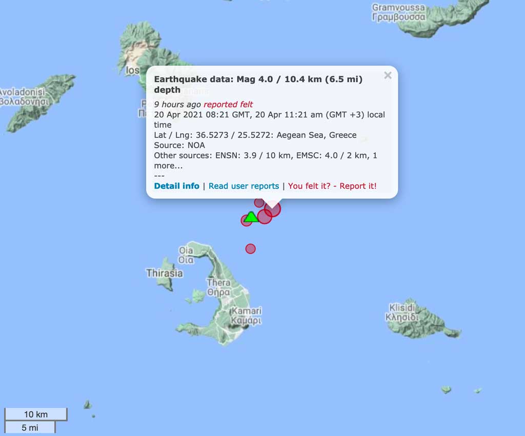
Derniers séismes proches
| Date et l'heure | Mag / Prof. | Distance / Lieux | |||
|---|---|---|---|---|---|
| 22 mai 12:14 (Temps Universel) | 1.7 10 km | 2.8 km au nord-est | Info | ||
| 22 mai 11:20 (Temps Universel) | 1.7 10 km | 19 km à l'est | Info | ||
| 22 mai 13:42 (GMT +3) | 1.2 8 km | 22 km au nord-est | Info | ||
| 22 mai 13:38 (GMT +3) | 1.9 7.9 km | 30 km au nord-est | Info | ||
| 22 mai 13:10 (GMT +3) | 2.0 10.4 km | 18 km au nord-est | Info | ||
| 22 mai 12:17 (GMT +3) | 1.9 4.7 km | 20 km au nord-est | Info | ||
| 22 mai 08:15 (Temps Universel) | 1.7 10.8 km | 24 km au nord-est | Info | ||
| mardi, 20 mai 2025 GMT (1 séisme) | |||||
| 20 mai 16:51 (Athens) | 3.4 12 km | 29 km au nord-est | Info | ||
| dimanche, 18 mai 2025 GMT (1 séisme) | |||||
| 18 mai 06:28 (Athens) | 3.8 15 km | 28 km au nord-est | Info | ||
Introduction
The large hydrothermal field in the northern part of the caldera at about 500 m depth contains a massive Kuroko-style sulfide deposit. Only few such deposits are known world-wide and they are of great interest, especially because of the typically high content of gold and silver in the sulfides. In 2010, the exploration Vessel (E/V) Nautilus discovered steep, up to 6 m high chimneys of sulfides above one of the vents.1650 eruption of Kolumbo volcano
The 1650 eruption was a very explosive event and ejected pumice and ash as far as Turkey, and produced pyroclastic flows that killed about 70 people on Santorini. During the eruption, it constructed a temporary island (hence it's name Kolumbo, in Greece "swimming"). A tsunami occurred as well, probably during the collapse of the cone. It caused damage on nearby islands up to 150 km and invaded the flat coastal areas especially on the eastern side of Santorini, where ruins from Roman times were uncovered. The eruption also caused damage killed a great number of livestock because of poisonous gasses, mainly H2S.
Links:
- Thera 2006 Expedition Summary (NOAA Ocean Explorer)
- Special Volume of Oceanography(pdf)
- Follow Dr. Robert Ballard and his team as they explore the ocean on the E/V Nautilus
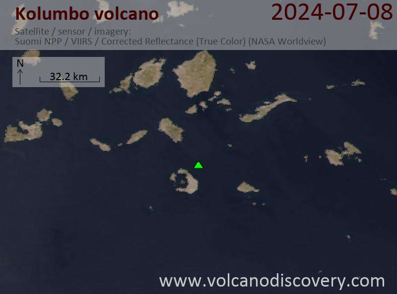
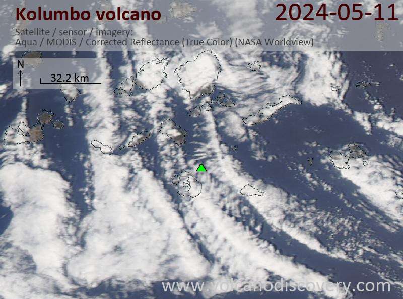
Dernières images satellite
Kolumbo Volcan Cartes
Below is a selection of maps showing the location and surroundings of the volcano at various resolutions based on aerial-imagery / terrain maps. Feel free to use them for non-commercial purposes on your blog or website as long as you credit them with a link back to this page (click to copy it).

Satellite/aerial-type map of Kolumbo volcano (world scale)

Terrain-type map of Kolumbo volcano (world scale)

Satellite/aerial-type map of Kolumbo volcano (region scale large)

Terrain-type map of Kolumbo volcano (region scale large)

Satellite/aerial-type map of Kolumbo volcano (region scale medium)

Terrain-type map of Kolumbo volcano (region scale medium)

Satellite/aerial-type map of Kolumbo volcano (region scale small)

Terrain-type map of Kolumbo volcano (region scale small)

Satellite/aerial-type map of Kolumbo volcano (local scale large)

Terrain-type map of Kolumbo volcano (local scale large)

Satellite/aerial-type map of Kolumbo volcano (local scale medium)

Terrain-type map of Kolumbo volcano (local scale medium)

Satellite/aerial-type map of Kolumbo volcano (local scale small)

Terrain-type map of Kolumbo volcano (local scale small)

Satellite/aerial-type map of Kolumbo volcano (scale of 10s of km)

Terrain-type map of Kolumbo volcano (scale of 10s of km)

Satellite/aerial-type map of Kolumbo volcano (scale of 20-40 km)

Terrain-type map of Kolumbo volcano (scale of 20-40 km)

Satellite/aerial-type map of Kolumbo volcano (scale of approx. 10-20 km)

Terrain-type map of Kolumbo volcano (scale of approx. 10-20 km)

Satellite/aerial-type map of Kolumbo volcano (scale of 5-10 km)

Satellite/aerial-type map of Kolumbo volcano (scale of few kilometers)


