Kontakt | RSS | EN | DE | EL | ES | FR | IT | RU

Akan Volcano

Updated: 13. Mai 2024 21:33 GMT -
caldera 1499 m / 4,918 ft
Hokkaido (Japan), 43.38°N / 144.01°E
Aktueller Status: normal / ruhend (1 von 5)
Last update: 13 Dez 2021 (Smithsonian / USGS Weekly Volcanic Activity Report)

Akan volcano (阿寒岳, Akan-dake) is one of Hokkaido's most active volcanoes. Akan consists of a large 24 x 13 km diameter caldera and a group of younger partly Holocene andesite cones. The highest point of the complex is the Mount Meakan (1499 m) stratovolcano.
The frequent historic eruptions occurred all from the Me-Akan group, east of Lake Akan. Me-Akan volcano (雌阿寒岳 Meakan-dake) consists of 9 overlapping cones. Its summit has 3 craters.
Me-Akan has had at least 17 small phreatic eruptions since the beginning of the 19th century and from geologic studies it is known that there were at least 4 major magmatic eruptions with pyroclastic flows have occurred in prehistoric time during the past 10,000 years.

Lake Akan is part of the Akan National Park. It is known for a rare green algae (marimo) which can grow to about the size of a soccer ball. The only town around the lake is the resort of Akankohan known for its hot springs and the "bokke", bubbling mud pools found at the lakeshore.

[smaller] [larger]
Typische Aktivität: explosive
Ausbrüche des Akan: 2008, 2006, 1988, 1966, 1965, 1964, 1962, 1960, 1959, 1958, 1957, 1956, 1955, 1954, 1951(?)-52, 1927 (?), 1808 (?), 1800

Letzte Erdbeben in der Nähe

UhrzeitMag. / TiefeEntfernung / Ort
13. Mai. 06:09 (GMT +9)
2.6

135 km
26 km südwestlich Japan: TOKACHI REGION
Info

Beschreibung

The Akan caldera is located immediately SW of Kutcharo caldera and has an elonogated, irregular shape due to several caldera-forming explosive eruptions between the early and mid Pleistocene.
Growth of 3 post-caldera stratovolcanoes, 3 at the SW end of the caldera and the other at the NE side, has reduced the size of the caldera lake. The conical O-Akan volcano was frequently active during the Holocene. The 1-km-wide Nakamachineshiri crater of Me-Akan volcano was formed during a major pumice-and-scoria eruption about 13,500 years ago.

Akan Volcano Photos

Ausbrüche des Vulkans Akan


2008 eruption
Tremor was recorded on 17 November 2008. A small ash eruption occurred on 18 November, and was later detected by a fresh deposit of ash on snow in up to 400 m distance from the Ponmachineshiri crater. Another ash eruption occurred on 28 November, producing a small ash plume reaching 2 km altitude.
(Source: Smithsonian / GVP monthly reports)

2006 eruption
A small eruption occurred from a vent on the NE flank of Meakan on 21 March 2006. Ashfall was observed 10 km SE of the volcano.

1998 eruption
A small ash eruption occurred from Meakan volcano on 9 November 1998.

1996 eruption
A small phreatic eruption occurred on 21 November 1996.

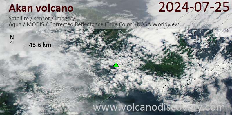
Latest satellite images

Akan satellite image sat1Akan satellite image sat2
Mi, 28. Nov 2018, 06:00

Akan volcano (Hokkaido, Japan) - Smithsonian / USGS Weekly Volcanic Activity Report for 28 November-4 December 2018 (New Activity / Unrest)

JMA reported that the number of earthquakes with shallow hypocenters and epicenters near Ponmachineshiri Crater, a summit crater of Me-Akan (also known as Meakan-dake, which means Meakan Peak) of the Akan volcanic complex, increased at 1800 on 20 November. Another seismic increase occurred on 23 November, in number and amplitude of events, prompting JMA to raise the Alert Level to 2 (the second lowest level on a 5-level scale). ... Read all
Fr, 23. Nov 2018, 05:42

Akan volcano (Hokkaido, Japan) activity update: Alert level raised

A new earthquake swarm is occurring at the Meakandake cone so JMA has raised the alert level to 2. A similar event occurred 3 years ago. The last eruption was in 2008. ... Read all

Auf dieser Seite:

App herunterladen
Volcanoes & Earthquakes - new app for Android
Android | iOS-Version

Mehr auf VolcanoDiscovery

Warum gibt es Werbung auf dieser Seite?

Unterstützen Sie unsere Arbeit!

Diese Webseite und die dazugehörigen Apps und Tools instandzuhalten und kostenlos Nachrichten zu Vulkanen, Erdbeben und anderen Themen bereitzustellen, verschlingt enorm viel Zeit und auch Geld.
Wenn Sie die Infos mögen und uns in der Arbeit dazu unterstützen wollen, würden wir uns über eine Spende (über PayPal oder mit Kreditkarte) sehr freuen.
Online Zahlung (Kreditkarte)
Damit können wir Ihnen auch in Zukunft neue Features entwickeln und Bestehende laufend verbessern.Vielen Dank!
Sources: VolcanoDiscovery / VolcanoAdventures and other sources as noted.
Use of material: Most text and images on our websites are owned by us. Re-use is generally not permitted without authorization. Contact us for licensing rights.
Volcanoes & Earthquakes
VolcanoDiscovery Home
Vulkane | Erdbeben | Fotos | News | App
Adventure & Study Travel
Reisen zu Vulkanen und Vulkangebieten: Wanderreisen, Studienreisen, Fotoreisen
Tours & Dates | FAQ | About us
Get our newsletter!
Company info
Kontakt | Impressum | AGB
Follow us
Follow us on facebook Follow us on Instagram Follow us on Twitter Visit our Youtube channel
EN | DE | EL | ES | FR | IT | RU
VolcanoDiscovery GmbH, Germany, Reg. nr.: HRB 103744, EU Tax Id: DE 297 465 123 owned and created by
Dr. Tom Pfeiffer, volcanologist, volcano photographer, tour organizer member of
IAVCEI
IAVCEI
Vulkanologische Gesellschaft
Volcanological Society
Ecotourism Greece
Ecotourism Greece
RUV insurance
Insured by R+V
VolcanoDiscovery © 2004- All Rights Reserved | Datenschutz - Cookie Einstellungen