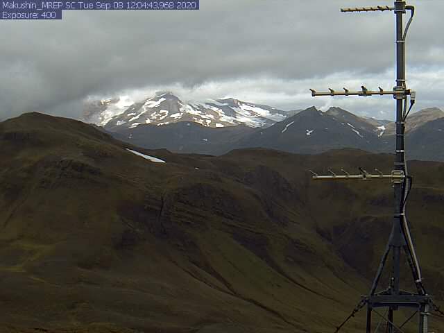
Kontakt | RSS | EN | DE | EL | ES | FR | IT | RU
Mi, 9. Sep 2020, 06:23

Makushin volcano (Aleutian Islands): Volcanic Alert Level lowered to Green

Makushin volcano yesterday (image: AVO)
The Alaska Volcano Observatory (AVO) reported that the seismicity at the volcano has been steadily declining for months, following an earthquake sequence that began on 15 June. ... Read all

Makushin Volcano

Updated: 30. Apr. 2024 05:59 GMT -
Stratovolcano 1800 m / 5,905 ft
Aleutian Islands, 53.89°N / -166.92°W
Aktueller Status: normal / ruhend (1 von 5)
Last update: 12 Oct 2023 (Volcanic Ash Advisory)

Makushin volcano is an ice-covered 1800-m-high stratovolcano on northern Unalaska Island west of the town of Dutch Harbor. The volcano contains a 2.5-km-wide caldera. Its broad, domical shape contrasts with the usual steep-sided profile of most other volcanoes in the Aleutians.

[smaller] [larger]
Typische Aktivität: unspecified
Ausbrüche des Makushin: 1995

Letzte Erdbeben in der Nähe

UhrzeitMag. / TiefeEntfernung / Ort
17. Apr. 23:28 (Anchorage)
0.1

8.8 km
14 km östlich 11 km W of Dutch Harbor, Alaska
Info

Beschreibung

Much of the volcano was formed during the Pleistocene, but the caldera (which formed about 8000 years ago), Sugarloaf cone on the ENE flank, and a cluster of about a dozen explosion pits and cinder cones at Point Kadin on the WNW flank, are of Holocene age. A broad band of NE-SW-trending satellitic vents cuts across the volcano. The composite Pakushin cone, with multiple summit craters, lies 8 km to the SW of Makushin. Frequent explosive eruptions have occurred during the past 4000 years, sometimes accompanied by pyroclastic flows and surges. Geothermal areas are found in the summit caldera of Makushin and on the SE and eastern flanks of the volcano. They represent the largest and most investigated high-temperature geothermal resources in Alaska. Small-to-moderate explosive eruptions have been recorded at Makushin since 1786.
---
Smithsonian / GVP volcano information

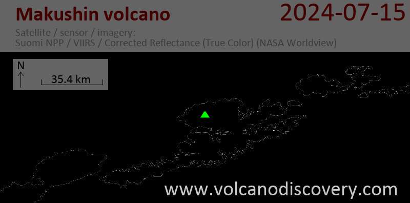
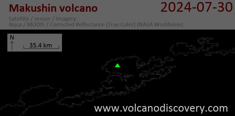
Latest satellite images

makushin satellite image sat1makushin satellite image sat2

Auf dieser Seite:

App herunterladen
Volcanoes & Earthquakes - new app for Android
Android | iOS-Version

Mehr auf VolcanoDiscovery

Warum gibt es Werbung auf dieser Seite?

Unterstützen Sie unsere Arbeit!

Diese Webseite und die dazugehörigen Apps und Tools instandzuhalten und kostenlos Nachrichten zu Vulkanen, Erdbeben und anderen Themen bereitzustellen, verschlingt enorm viel Zeit und auch Geld.
Wenn Sie die Infos mögen und uns in der Arbeit dazu unterstützen wollen, würden wir uns über eine Spende (über PayPal oder mit Kreditkarte) sehr freuen.
Online Zahlung (Kreditkarte)
Damit können wir Ihnen auch in Zukunft neue Features entwickeln und Bestehende laufend verbessern.Vielen Dank!
Sources: VolcanoDiscovery / VolcanoAdventures and other sources as noted.
Use of material: Most text and images on our websites are owned by us. Re-use is generally not permitted without authorization. Contact us for licensing rights.
Volcanoes & Earthquakes
VolcanoDiscovery Home
Vulkane | Erdbeben | Fotos | News | App
Adventure & Study Travel
Reisen zu Vulkanen und Vulkangebieten: Wanderreisen, Studienreisen, Fotoreisen
Tours & Dates | FAQ | About us
Get our newsletter!
Company info
Kontakt | Impressum | AGB
Follow us
Follow us on facebook Follow us on Instagram Follow us on Twitter Visit our Youtube channel
EN | DE | EL | ES | FR | IT | RU
VolcanoDiscovery GmbH, Germany, Reg. nr.: HRB 103744, EU Tax Id: DE 297 465 123 owned and created by
Dr. Tom Pfeiffer, volcanologist, volcano photographer, tour organizer member of
IAVCEI
IAVCEI
Vulkanologische Gesellschaft
Volcanological Society
Ecotourism Greece
Ecotourism Greece
RUV insurance
Insured by R+V
VolcanoDiscovery © 2004- All Rights Reserved | Datenschutz - Cookie Einstellungen