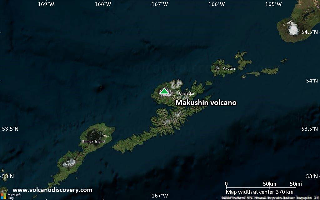
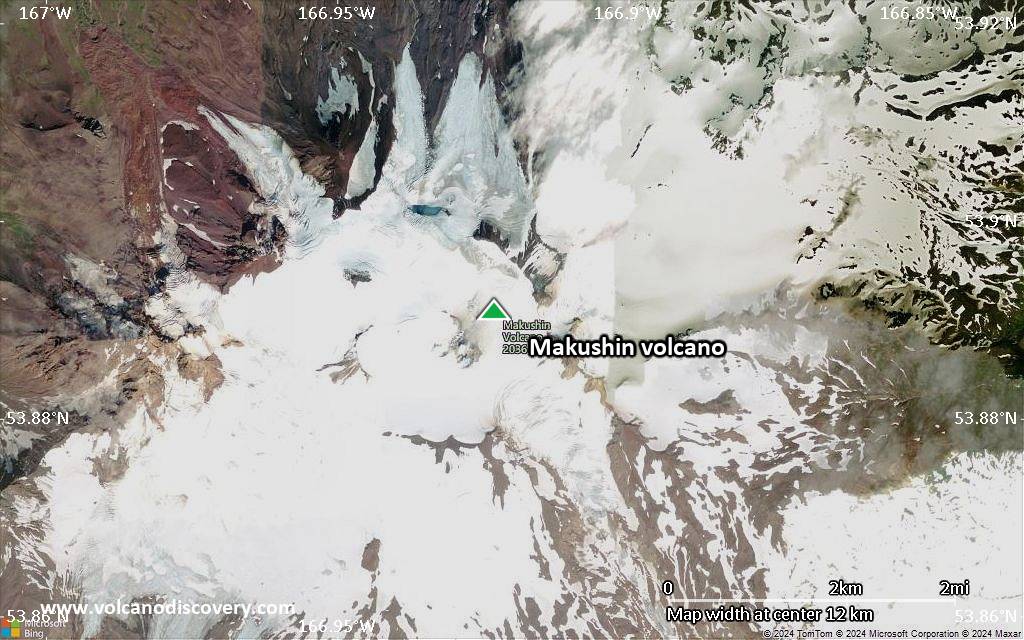
| RSS | EN | DE | EL | ES | FR | IT | RU
Wed, 9 Sep 2020, 06:23

Makushin volcano (Aleutian Islands): Volcanic Alert Level lowered to Green

Makushin volcano yesterday (image: AVO)
The Alaska Volcano Observatory (AVO) reported that the seismicity at the volcano has been steadily declining for months, following an earthquake sequence that began on 15 June. ... Read all

Makushin Volcano

Updated: Sep 2, 2025 07:27 GMT -
Stratovolcano
Aleutian Islands, 53.89°N / -166.92°W
Summit height: 1800 m / 5,905 ft
Current status: normal or dormant (1 out of 5)
Last update: 12 Oct 2023 (Volcanic Ash Advisory)

Makushin volcano is an ice-covered 1800-m-high stratovolcano on northern Unalaska Island west of the town of Dutch Harbor. The volcano contains a 2.5-km-wide caldera. Its broad, domical shape contrasts with the usual steep-sided profile of most other volcanoes in the Aleutians.

[smaller] [larger]
Typical eruption style: unspecified
Makushin volcano eruptions: 1995

Latest nearby earthquakes

Date and TimeMag / DepthDistance / Location
Aug 28, 10:41 pm (Universal Time)
0.5

5.6 km
1.1 km (0.7 mi) to the SE 16 mi west of Unalaska, Aleutians West Census Area, Alaska, United States Info
Sunday, August 24, 2025 GMT (1 quake)
Aug 24, 01:29 am (Universal Time)
0.2

12 km
22 km (14 mi) to the S Bering Sea, 8.5 mi west of Unalaska Island, Aleutians West Census Area, Alaska, United States Info
Saturday, August 23, 2025 GMT (1 quake)
Aug 23, 03:08 pm (GMT -8)
0.5

5.2 km
4.9 km (3 mi) to the S 16 mi west of Unalaska, Aleutians West Census Area, Alaska, United States Info
Thursday, August 21, 2025 GMT (4 quakes)
Aug 21, 06:53 pm (Universal Time)
0.1

6.4 km
7 km (4.3 mi) to the SE 13 mi west of Unalaska, Aleutians West Census Area, Alaska, United States Info
Aug 21, 05:06 pm (Universal Time)
0.4

6.8 km
7.2 km (4.5 mi) to the SE 13 mi west of Unalaska, Aleutians West Census Area, Alaska, United States Info
Aug 21, 04:43 pm (Universal Time)
0.0

4.6 km
6.2 km (3.9 mi) to the SE 13 mi west of Unalaska, Aleutians West Census Area, Alaska, United States Info
Aug 21, 06:56 am (Universal Time)
0.9

7.5 km
8 km (5 mi) to the SE 13 mi west of Unalaska, Aleutians West Census Area, Alaska, United States Info
Wednesday, August 20, 2025 GMT (1 quake)
Aug 20, 05:25 am (Universal Time)
0.3

36 km
7.1 km (4.4 mi) to the SW 19 mi west of Unalaska, Aleutians West Census Area, Alaska, United States Info

Background

Much of the volcano was formed during the Pleistocene, but the caldera (which formed about 8000 years ago), Sugarloaf cone on the ENE flank, and a cluster of about a dozen explosion pits and cinder cones at Point Kadin on the WNW flank, are of Holocene age. A broad band of NE-SW-trending satellitic vents cuts across the volcano. The composite Pakushin cone, with multiple summit craters, lies 8 km to the SW of Makushin. Frequent explosive eruptions have occurred during the past 4000 years, sometimes accompanied by pyroclastic flows and surges. Geothermal areas are found in the summit caldera of Makushin and on the SE and eastern flanks of the volcano. They represent the largest and most investigated high-temperature geothermal resources in Alaska. Small-to-moderate explosive eruptions have been recorded at Makushin since 1786.
---
Smithsonian / GVP volcano information

Significant volcanic eruptions: Makushin volcano

In the past 10,000 years, Makushin has had at least 19 confirmed volcanic eruptions, out of which 13 are documented by historical records, while the others can be inferred from geological evidence.
Additionally, there are 9 uncertain or discredited eruptions from Makushin volcano.
The table below lists all known eruptions (date in bold face) of Makushin volcano since around 1700. Updates on the most recent volcanic activity of Makushin can be found on the news page of Makushin volcano.
DateNoteVEIDeathsDamage
1995 Jan 30
Historical obs./docs.
1
1993 Aug 16 ±15 d. - 1994 Jan 19 ?
Historical obs./docs.
1
1987 Mar 2
Historical obs./docs.
1
1986 Apr 28
Discredited Eruption
1980 May 1 ±75 d.SE side of summit
Historical obs./docs.
1
?? 1952 Jul 2 ±182 d.
Uncertain Eruption
?
1951 Dec 20
Historical obs./docs.
1
1938 Oct
Historical obs./docs.
2
1926 Dec 30
Historical obs./docs.
2
?? 1912
Uncertain Eruption
?
1907
Historical obs./docs.
?
1883
Historical obs./docs.
2
?? 1867
Uncertain Eruption
?
1865
Historical obs./docs.
?
?? 1844 ±1 y.
Uncertain Eruption
?
?? 1827 - 1838
Uncertain Eruption
2?
1826 Jun
Historical obs./docs.
3
?? 1818
Uncertain Eruption
?
1802
Historical obs./docs.
3
?? 1792 Feb 14
Uncertain Eruption
?
?? 1790 Jun 7
Uncertain Eruption
?
1768 - 1769
Historical obs./docs.
3
Remark:
Our list of volcanic eruptions closely follows the database of eruptions of the Smithsonian's Global Volcanism Project (GVP), the internationally most recognized data source for volcanic eruptions, but also includes significant eruptive episodes or related volcano events. "Volcanic eruptions" are usually to be understood as sequences of individual eruptive episodes that can follow each other, or even overlap (if several vents are involved), and can last many years, decades or even longer. For example, the current activity of Stromboli volcano is understood as a single eruption that has been ongoing since 1934.
Sources: NOAA National Centers for Environmental Information (NCEI), Global Significant Volcanic Eruptions Database. doi:10.7289/V5TD9V7K | Global Volcanism Project / Smithsonian Institution

Makushin Volcano FAQ

+When was the last eruption of Makushin volcano?

+How often does Makushin volcano erupt?

+How active is Makushin volcano at present?

+When was the largest eruption of Makushin volcano?

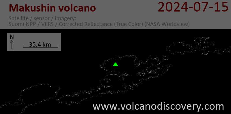
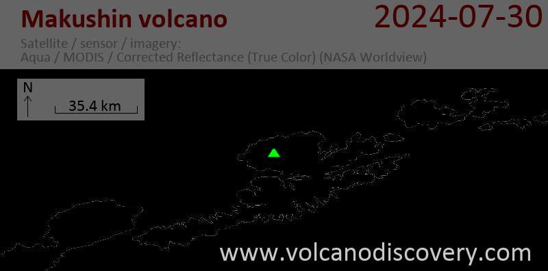
Latest satellite images

makushin satellite image sat1makushin satellite image sat2

Makushin Volcano Maps

Below is a selection of maps showing the location and surroundings of the volcano at various resolutions based on aerial-imagery / terrain maps. Feel free to use them for non-commercial purposes on your blog or website as long as you credit them with a link back to this page (click to copy it).
Satellite/aerial-type map of Makushin volcano (world scale)
Terrain-type map of Makushin volcano (world scale)
Satellite/aerial-type map of Makushin volcano (region scale large)
Terrain-type map of Makushin volcano (region scale large)
Satellite/aerial-type map of Makushin volcano (region scale medium)
Terrain-type map of Makushin volcano (region scale medium)
Satellite/aerial-type map of Makushin volcano (region scale small)
Terrain-type map of Makushin volcano (region scale small)
Satellite/aerial-type map of Makushin volcano (local scale large)
Terrain-type map of Makushin volcano (local scale large)
Satellite/aerial-type map of Makushin volcano (local scale medium)
Terrain-type map of Makushin volcano (local scale medium)
Satellite/aerial-type map of Makushin volcano (local scale small)
Terrain-type map of Makushin volcano (local scale small)
Satellite/aerial-type map of Makushin volcano (scale of 10s of km)
Terrain-type map of Makushin volcano (scale of 10s of km)
Satellite/aerial-type map of Makushin volcano (scale of 20-40 km)
Terrain-type map of Makushin volcano (scale of 20-40 km)
Satellite/aerial-type map of Makushin volcano (scale of approx. 10-20 km)
Terrain-type map of Makushin volcano (scale of approx. 10-20 km)
Satellite/aerial-type map of Makushin volcano (scale of 5-10 km)
Satellite/aerial-type map of Makushin volcano (scale of few kilometers)
Volcanoes & Earthquakes - new app for Android
Guaranteed tours
6-21 Oct 2025: From Krakatau to Bali - Java (Indonesia)
3-19 Nov 2025: Volcanoes and Spices - Sulawesi/Halmahera (Indonesia)
9-19 Nov 2025: Guatemala Volcano Special - Guatemala
20 Nov - 3 Dec 2025: Desert, salt and volcanoes - Danakil desert (Ethiopia)
2-10 May 2026: From Stromboli to Etna - Sicily and Eolian Islands (Italy)
= spaces available   = guaranteed   = few spaces left   = booked out

On this page:

Try our free app!
Volcanoes & Earthquakes - new app for Android
Android | iOS version

More on VolcanoDiscovery

Why is there advertising on this site?

Support Us – Help Us Enhance Our Services!

We’re passionate about delivering the latest volcano and earthquake data from around the globe — just for you. However, maintaining our website and free apps requires significant time, effort, and resources.
Your support helps us expand our hardware and software capabilities and empowers our dedicated editorial team. Our mission is to provide uninterrupted, real-time updates whenever an earthquake strikes or a volcano erupts — and your donations make this possible. Every contribution, big or small, is deeply appreciated. If you find our information valuable and want to help us add new features, create compelling content, and improve our technology, please consider making a donation:

Donate with Card or Apple/Google Pay:

Send €5 payment link to support VolcanoDiscovery with 5 EUR
€10 payment link to support VolcanoDiscovery with 10 EUR
€25 payment link to support VolcanoDiscovery with 25 EUR
€50 payment link to support VolcanoDiscovery with 50 EUR
€100 payment link to support VolcanoDiscovery with 100 EUR
€250 payment link to support VolcanoDiscovery with 250 EUR

Donate with PayPal:

Planned Features:

Thanks to your past donations, we have recently added:
Download the Volcanoes & Earthquakes app to stay among the first to receive the fastest seismic and volcano alerts online:
Android | iOS
Thank you for being part of our mission!
Sources: VolcanoDiscovery / VolcanoAdventures and other sources as noted.
Use of material: Most text and images on our websites are owned by us. Re-use is generally not permitted without authorization. Contact us for licensing rights.
Volcanoes & Earthquakes
VolcanoDiscovery Home
Volcanoes | Earthquakes | Photos | Volcano News | | Shop | App
Adventure & Study Travel
Tours to Volcanoes and Volcanic Areas: walking tours, photo tours, study tours
Tours & Dates | FAQ | About us
Get our newsletter!
Company info
Contact | Legal info | Terms & conditions
Follow us
Follow us on facebook Follow us on Instagram Follow us on Bluesky Follow us on Twitter Visit our Youtube channel
EN | DE | EL | ES | FR | IT | RU
VolcanoDiscovery GmbH, Germany, Reg. nr.: HRB 103744, EU Tax Id: DE 297 465 123 owned and created by
Dr. Tom Pfeiffer, volcanologist, volcano photographer, tour organizer member of
IAVCEI
IAVCEI
Vulkanologische Gesellschaft
Volcanological Society
Ecotourism Greece
Ecotourism Greece
RUV insurance
Insured by R+V
VolcanoDiscovery © 2004- All Rights Reserved | Privacy - Cookie Settings