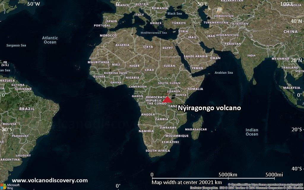
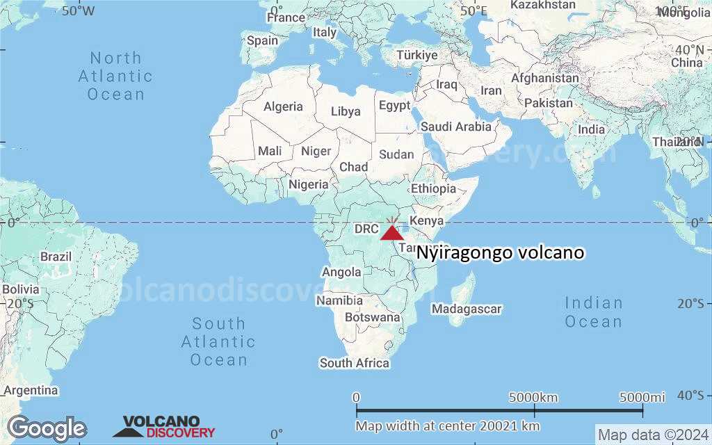
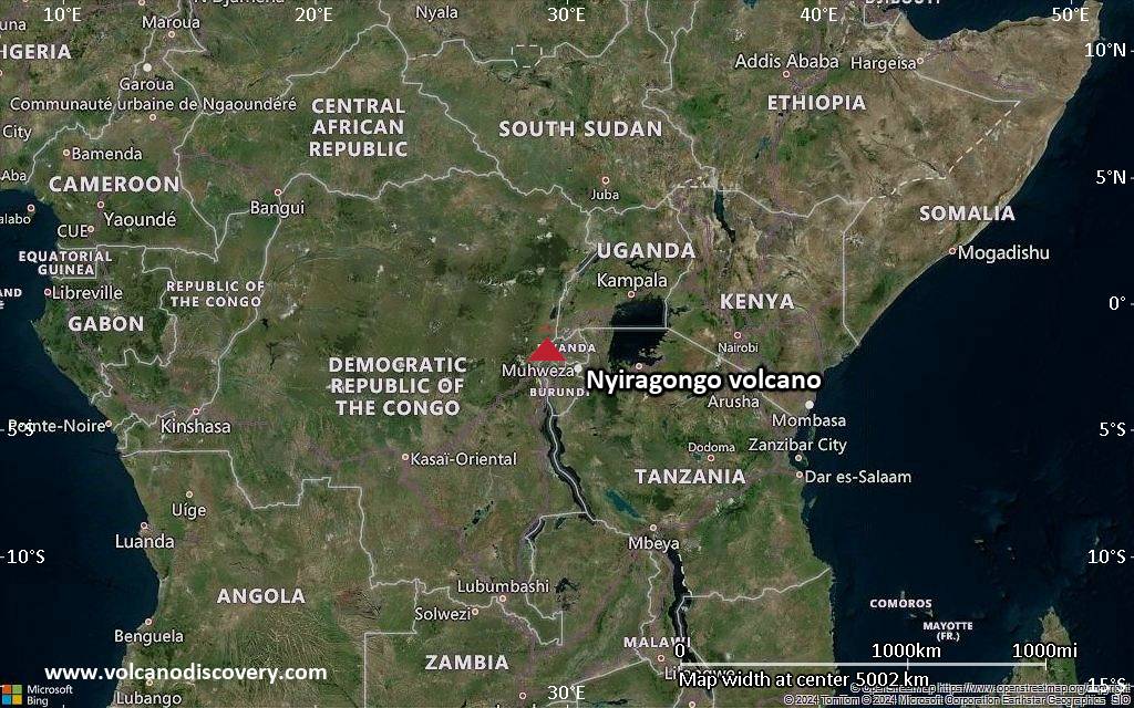
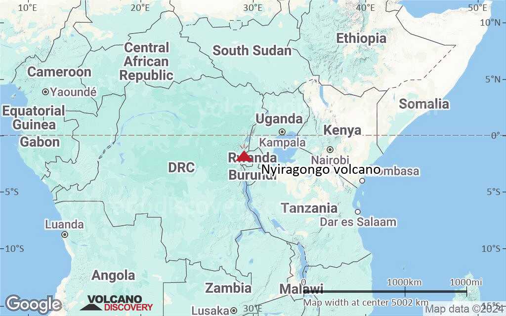
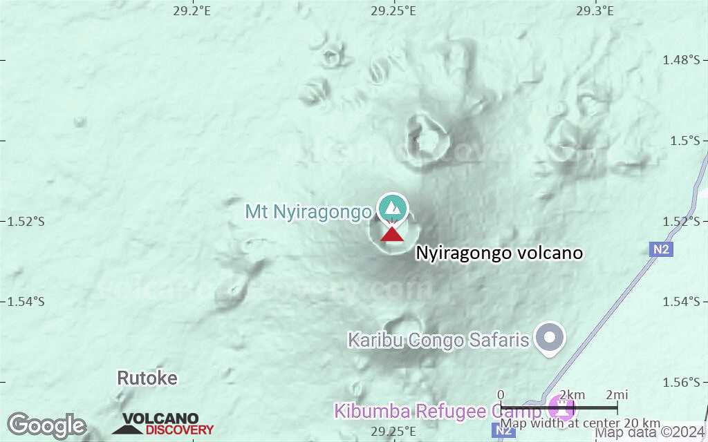
| RSS | EN | DE | EL | ES | FR | IT | RU

Nyiragongo Volcano

Updated: Aug 3, 2025 04:07 GMT -
Stratovolcano
DRCongo, -1.52°S / 29.25°E
Summit height: 3470 m / 11,384 ft
Current status: erupting (4 out of 5)
Last update: 10 Jul 2024 (Smithsonian / USGS Weekly Volcanic Activity Report)
The lava lake of Nyiragongo volcano

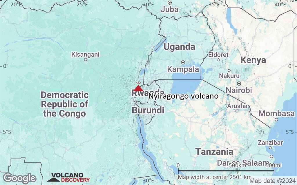
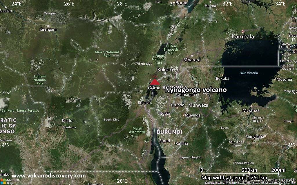
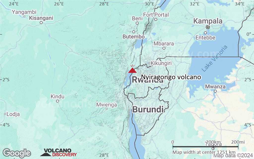
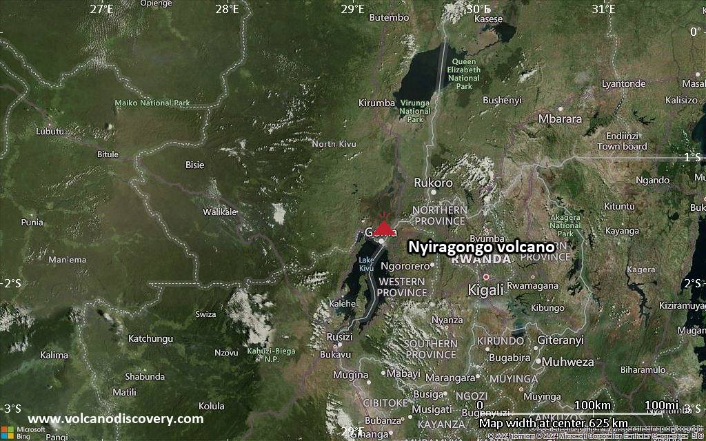
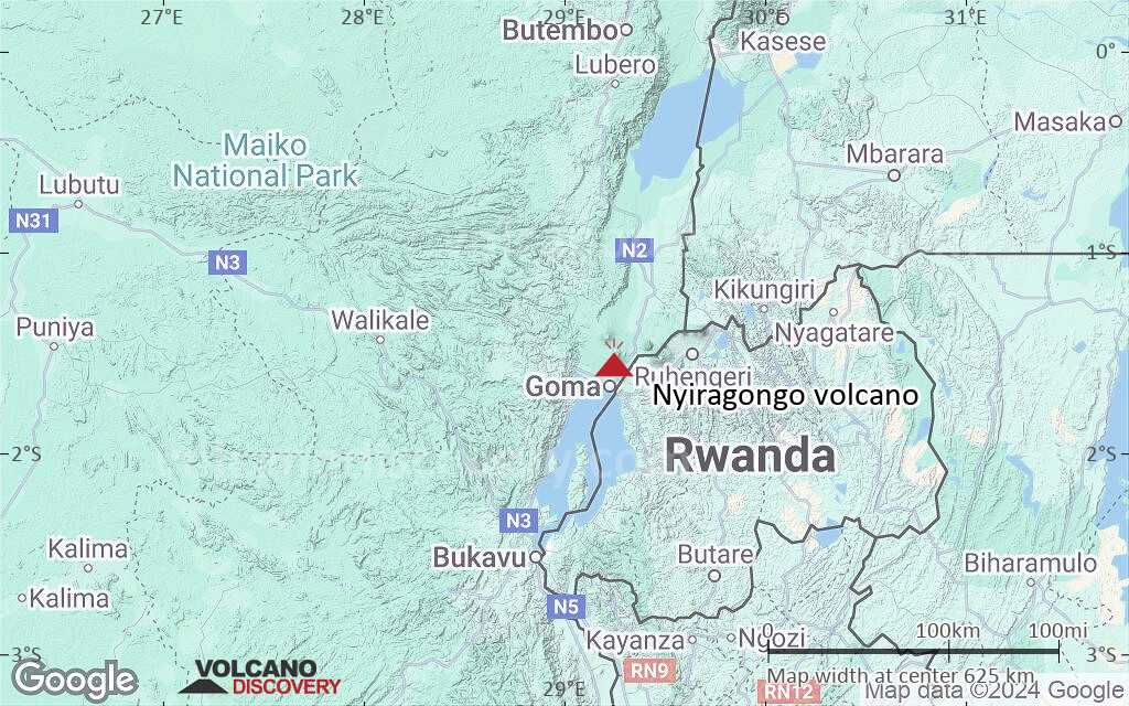
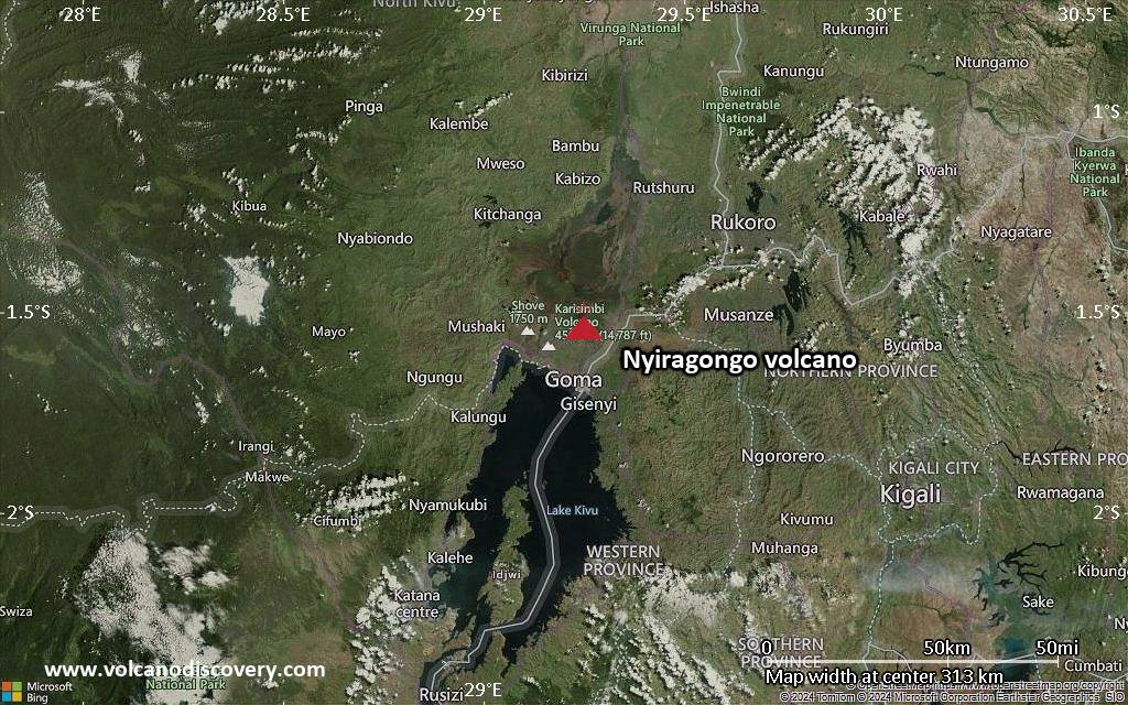
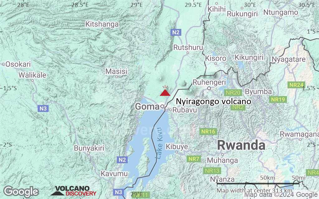
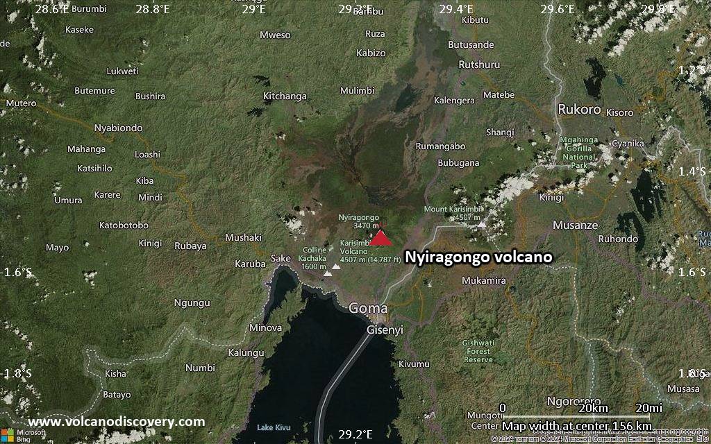
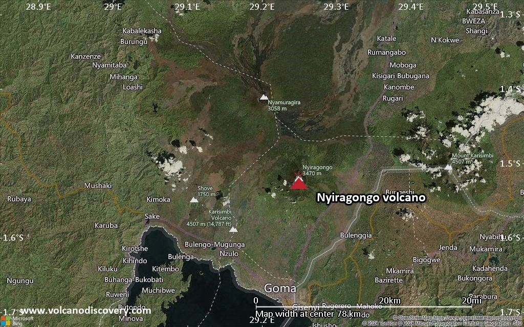
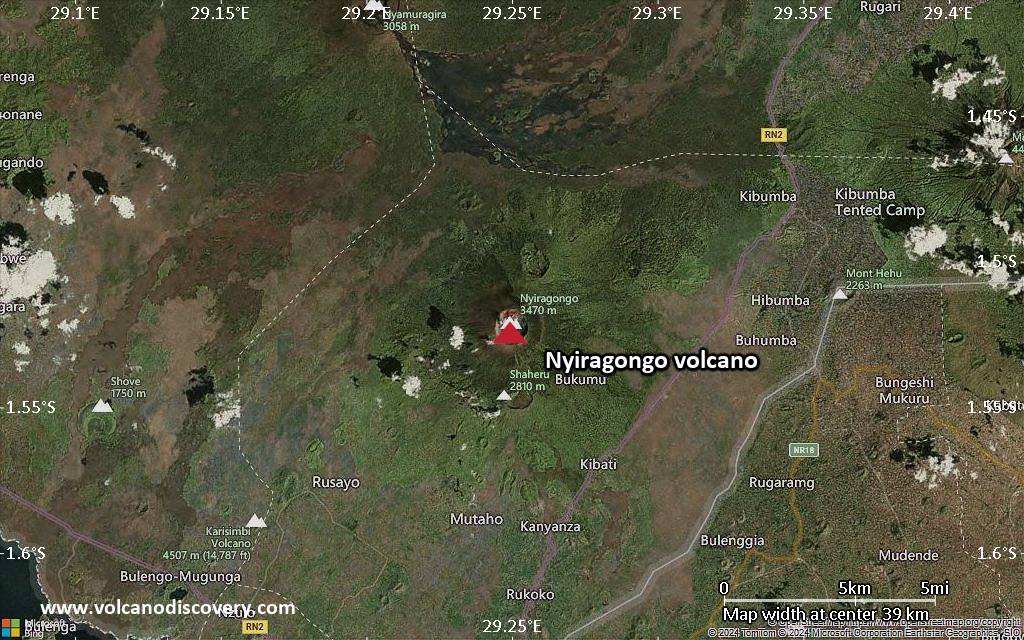
Nyiragongo (also spelled Niragongo), one of the world's most beautiful and active volcanoes, is a large stratovolcano near Lake Kivu at the eastern border of DRCongo with Rwanda in the Virunga National Park.
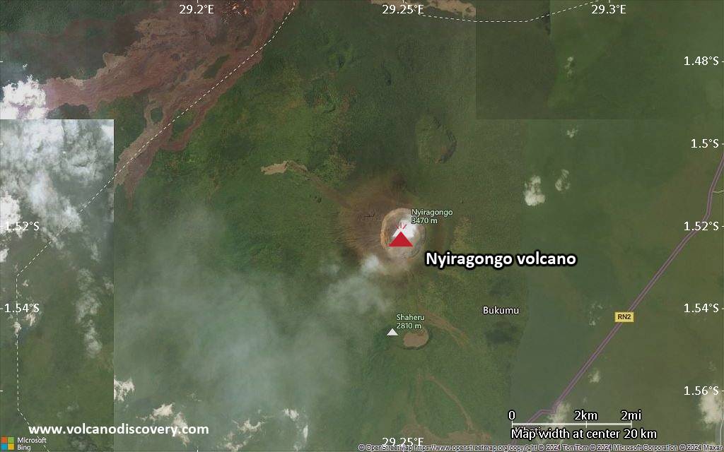
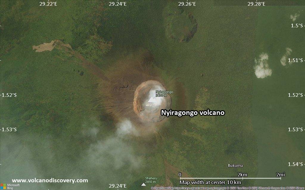
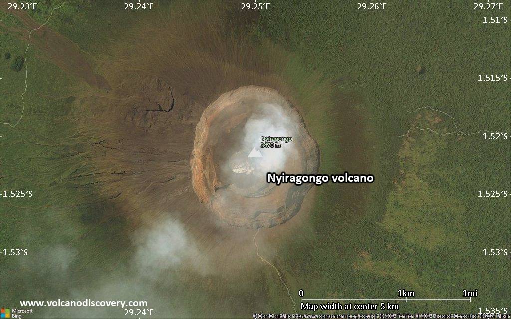
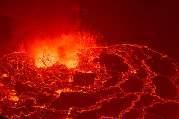
It has a 1.2 km diameter summit caldera containing the world's most active and largest lava lake.
Nyiragongo is infamous for its extremely fluid lava that runs as water when the lava lake drains. On January 17, 2002, Nyiragongo erupted and the lava lake drained from fissures on its western flanks. The city centre of the Goma town, the capital of the East Virunga province, had been destroyed by voluninous lava flows. 200,000 people were left homeless, adding to the human desaster caused by frequent civil wars.

[smaller] [larger]
Typical eruption style: Large effusive eruptions; persistant lava lake in the summit crater.
Nyiragongo volcano eruptions: 1884, 1894, 1898, 1899, 1900, 1901, 1902, 1905, 1906, 1908(?), 1911, 1918, 1920-21, 1927-77, 1977, 1982, 1994-96, 2002 (17 Jan-3 Feb, south flank), 2002-2021 (lava lake), 2021 (22-23 May, flank eruption)

Latest nearby earthquakes

Date and TimeMag / DepthDistance / Location

Background

Nyiragongo, located in the Western branch of the Rift Valley near Lake Kivu and the Congolese-Rwandese border, is one of the world's most active volcanoes. It is notorious for its lava lake and producing lateral eruptions with extremely fluid, fast-moving lava flows that repeatedly devastated areas around the volcano, such as the Goma desaster on January 2002, when a lava flow destroyed much of the city's commercial center and promted 200,000 people to flee.

The large lava lake contained in its deep summit crater, now active again, became famous in the 1960's and 70's when volcanologists such as the Kraffts and Tazieff studied it. It had been active for half a century before it drained in one of the volcano's recent most catastrophic eruptions in 1977: through openings in its outer flanks in 1977, a huge lava flow poured out and killed hundreds of people. A similar event happened again in January 2002, when lava flows from flank vents drained the lake and cut through Goma, reaching Lake Kivu.
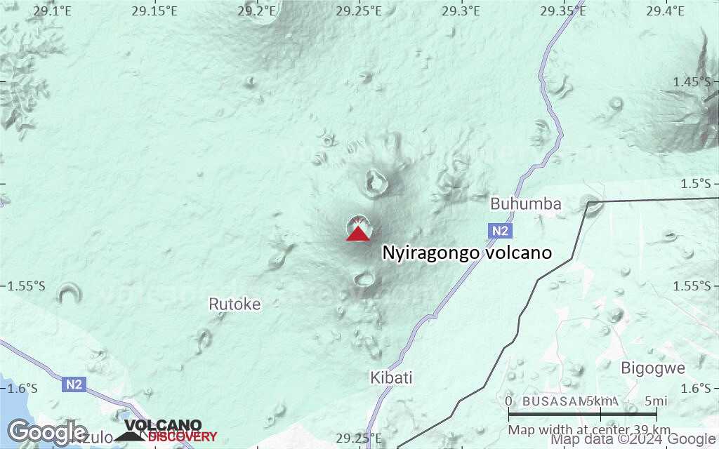
In contrast to its neighbor volcano, Nyamuragira,- a typical, and very active shield volcano comparable with Mauna Loa,- the 3470-m-high Nyiragongo displays the steep slopes of a stratovolcano. Terraces inside the steep-walled, 1.2-km-wide summit crater mark levels of former lava lakes, which have been observed since the late-19th century.
Two older volcanoes, Baruta and Shaheru, are partially overlapped by Nyiragongo on the north and south and look like lateral cones. About 100 parasitic cones are located primarily along radial fissures south of Shaheru, east of the summit, and along a NE-SW zone extending as far as Lake Kivu. Many cones are buried by voluminous lava flows that extend long distances down the flanks of the volcano.

Nyiragongo Volcano Photos

Significant volcanic eruptions: Nyiragongo volcano

In the past 10,000 years, Nyiragongo has had at least 19 confirmed volcanic eruptions, out of which 18 are documented by historical records, while the others can be inferred from geological evidence.
There is one uncertain or discredited eruption in 1908 from Nyiragongo volcano.
The table below lists all known eruptions (date in bold face) of Nyiragongo volcano since around 1800. Updates on the most recent volcanic activity of Nyiragongo can be found on the news page of Nyiragongo volcano.
DateNoteVEIDeathsDamage
2002 May 17 ? - ongoing
Historical obs./docs.
2
2021 May 22
(eruption 2002 May 17 ? - ongoing)
Historical obs./docs.
232
heavy
Info
2002 Jan 17 - Feb 3 or laterSouth flank (2800-1570 m), summit crater
Historical obs./docs.
1
2002 Jan 17
(eruption 2002 Jan 17 - Feb 3 or later)
Historical obs./docs.
1100
heavy
Info
1994 Jun 23 - 1996 Mar 16 ±15 d.
Historical obs./docs.
1
1990 Nov 21
(eruptive episode 1990 Nov 21)
Historical obs./docs.
01
Info
1982 Jun 21 - Oct 17 ±15 d.
Historical obs./docs.
1
1927 Mar 16 ±15 d. - 1977 Jan 10
Historical obs./docs.
1
1977 Jan 10North, south, and west flanks
Historical obs./docs.
1
1977 Jan 10
Historical obs./docs.
150-100 (*)
heavy
Info
1920 - 1921
Historical obs./docs.
1
1918
Historical obs./docs.
1
1911 Aug - OctSouthern pit
Historical obs./docs.
1
?? 1908 Dec 1 ±30 d.
Uncertain Eruption
?
1906
Historical obs./docs.
1
1905
Historical obs./docs.
1
1902
Historical obs./docs.
1
1901
Historical obs./docs.
1
1900
Historical obs./docs.
1
1899
Historical obs./docs.
1
1898
Historical obs./docs.
1
1894
Historical obs./docs.
1
1891 or beforeVolcano Uncertain: probably Nyiragongo?
1884Southern pit
Historical obs./docs.
1
(*) Estimated numbers
Remark:
Our list of volcanic eruptions closely follows the database of eruptions of the Smithsonian's Global Volcanism Project (GVP), the internationally most recognized data source for volcanic eruptions, but also includes significant eruptive episodes or related volcano events. "Volcanic eruptions" are usually to be understood as sequences of individual eruptive episodes that can follow each other, or even overlap (if several vents are involved), and can last many years, decades or even longer. For example, the current activity of Stromboli volcano is understood as a single eruption that has been ongoing since 1934.
Sources: NOAA National Centers for Environmental Information (NCEI), Global Significant Volcanic Eruptions Database. doi:10.7289/V5TD9V7K | Global Volcanism Project / Smithsonian Institution

Nyiragongo Volcano FAQ

+When was the last eruption of Nyiragongo volcano?

+How often does Nyiragongo volcano erupt?

+How active is Nyiragongo volcano at present?

+When was the largest eruption of Nyiragongo volcano?

Latest satellite images

Nyiragongo satellite image sat1Nyiragongo satellite image sat2
Nyiragongo Volcano Tours
8-days expedition to Nyiragongo volcano & mountain gorillas in Virunga National Park
8 days / 7 nights - Moderate to Challenging
Price $ 3950
no scheduled dates at present

Nyiragongo Volcano Maps

Below is a selection of maps showing the location and surroundings of the volcano at various resolutions based on aerial-imagery / terrain maps. Feel free to use them for non-commercial purposes on your blog or website as long as you credit them with a link back to this page (click to copy it).
Satellite/aerial-type map of Nyiragongo volcano (world scale)
Terrain-type map of Nyiragongo volcano (world scale)
Satellite/aerial-type map of Nyiragongo volcano (region scale large)
Terrain-type map of Nyiragongo volcano (region scale large)
Satellite/aerial-type map of Nyiragongo volcano (region scale medium)
Terrain-type map of Nyiragongo volcano (region scale medium)
Satellite/aerial-type map of Nyiragongo volcano (region scale small)
Terrain-type map of Nyiragongo volcano (region scale small)
Satellite/aerial-type map of Nyiragongo volcano (local scale large)
Terrain-type map of Nyiragongo volcano (local scale large)
Satellite/aerial-type map of Nyiragongo volcano (local scale medium)
Terrain-type map of Nyiragongo volcano (local scale medium)
Satellite/aerial-type map of Nyiragongo volcano (local scale small)
Terrain-type map of Nyiragongo volcano (local scale small)
Satellite/aerial-type map of Nyiragongo volcano (scale of 10s of km)
Terrain-type map of Nyiragongo volcano (scale of 10s of km)
Satellite/aerial-type map of Nyiragongo volcano (scale of 20-40 km)
Terrain-type map of Nyiragongo volcano (scale of 20-40 km)
Satellite/aerial-type map of Nyiragongo volcano (scale of approx. 10-20 km)
Terrain-type map of Nyiragongo volcano (scale of approx. 10-20 km)
Satellite/aerial-type map of Nyiragongo volcano (scale of 5-10 km)
Satellite/aerial-type map of Nyiragongo volcano (scale of few kilometers)
Volcanoes & Earthquakes - new app for Android
Guaranteed tours
1-14 Oct 2025: Desert, salt and volcanoes - Danakil desert (Ethiopia)
4-12 Oct 2025: From Stromboli to Etna - Sicily and Eolian Islands (Italy)
6-21 Oct 2025: From Krakatau to Bali - Java (Indonesia)
3-19 Nov 2025: Volcanoes and Spices - Sulawesi/Halmahera (Indonesia)
9-19 Nov 2025: Guatemala Volcano Special - Guatemala
= spaces available   = guaranteed   = few spaces left   = booked out
Wed, 10 Jul 2024, 14:00

Nyiragongo volcano - Smithsonian / USGS Weekly Volcanic Activity Report for 3 July-9 July 2024 (Continuing Activity)

A 5 July satellite image showed a dark elliptical area of lava on Nyiragongo's crater floor. Gas-and-steam plumes appeared to be rising from two central vents. Thermal anomalies identified in SWIR images corresponded to the location of the lava area along with a small brighter area at the center. ... Read all
Wed, 26 Jun 2024, 14:00

Nyiragongo volcano - Smithsonian / USGS Weekly Volcanic Activity Report for 19 June-25 June 2024 (Continuing Activity)

A 25 June satellite image showed a dark elliptical area of lava on Nyiragongo's crater floor. A central vent produced a gas-and-steam plume the drifted WNW. The lava area was about 560 m E-W and about 690 m N-S. ... Read all

On this page:

Try our free app!
Volcanoes & Earthquakes - new app for Android
Android | iOS version

More on VolcanoDiscovery

Why is there advertising on this site?

Support us - Help us upgrade our services!

We truly love working to bring you the latest volcano and earthquake data from around the world. Maintaining our website and our free apps does require, however, considerable time and resources.
We need financing to increase hard- and software capacity as well as support our editor team. We're aiming to achieve uninterrupted service wherever an earthquake or volcano eruption unfolds, and your donations can make it happen! Every donation will be highly appreciated. If you find the information useful and would like to support our team in integrating further features, write great content, and in upgrading our soft- and hardware, please make a donation (PayPal).

Planned features:Thanks to your past donations, these features have been added recently:
Download and Upgrade the Volcanoes & Earthquakes app to get one of the fastest seismic and volcano alerts online:
Android | IOS
Thank you!
Sources: VolcanoDiscovery / VolcanoAdventures and other sources as noted.
Use of material: Most text and images on our websites are owned by us. Re-use is generally not permitted without authorization. Contact us for licensing rights.
Volcanoes & Earthquakes
VolcanoDiscovery Home
Volcanoes | Earthquakes | Photos | Volcano News | | Shop | App
Adventure & Study Travel
Tours to Volcanoes and Volcanic Areas: walking tours, photo tours, study tours
Tours & Dates | FAQ | About us
Get our newsletter!
Company info
Contact | Legal info | Terms & conditions
Follow us
Follow us on facebook Follow us on Instagram Follow us on Bluesky Follow us on Twitter Visit our Youtube channel
EN | DE | EL | ES | FR | IT | RU
VolcanoDiscovery GmbH, Germany, Reg. nr.: HRB 103744, EU Tax Id: DE 297 465 123 owned and created by
Dr. Tom Pfeiffer, volcanologist, volcano photographer, tour organizer member of
IAVCEI
IAVCEI
Vulkanologische Gesellschaft
Volcanological Society
Ecotourism Greece
Ecotourism Greece
RUV insurance
Insured by R+V
VolcanoDiscovery © 2004- All Rights Reserved | Privacy - Cookie Settings