| RSS | EN | DE | EL | ES | FR | IT | RU

Papandayan Volcano

Updated: Sep 18, 2025 06:27 GMT -
stratovolcano
West Java (Indonesia), -7.32°S / 107.73°E
Summit height: 2665 m / 8,743 ft.
Current status: normal or dormant (1 out of 5)
Last update: 11 Sep 2025 (Smithsonian Daily Volcanic Activity Report)

Papandayan is a complex stratovolcano with four large summit craters, the youngest of which was breached to the NE by collapse during a brief eruption in 1772 and contains active fumarole fields.

[smaller] [larger]
Typical eruption style:

Explosive. At present strong fumarolic activity.


Papandayan volcano eruptions: 1772 (moderate eruption followed by a devastating debris avalanche), 1923, 1942, 2002

Latest nearby earthquakes

Date and TimeMag / DepthDistance / Location

Background

The broad 1.1-km-wide, flat-floored Alun-Alun crater truncates the summit of Papandayan, and Gunung Puntang to the north gives the volcano a twin-peaked appearance. Several episodes of collapse have given the volcano an irregular profile and produced debris avalanches that have impacted lowland areas beyond the volcano. A sulfur-encrusted fumarole field occupies historically active Kawah Mas ("Golden Crater").
After its first historical eruption in 1772, in which collapse of the NE flank produced a catastrophic debris avalanche that destroyed 40 villages and killed nearly 3000 persons, only small phreatic eruptions had occurred prior to an explosive eruption that began in November 2002.
(Source: GVP)

Papandayan Volcano Photos

Significant volcanic eruptions: Papandayan volcano

In the past 10,000 years, Papandayan has had at least 4 confirmed eruptions, all documented by historical records or observations.
The table below lists all known eruptions (date in bold face) of Papandayan volcano in historic times and during the past 10,000 years. Updates on the most recent volcanic activity of Papandayan can be found on the news page of Papandayan volcano.
DateNoteVEIDeathsDamage
2002 Nov 11 - Dec 19 ±3 d.Kawah Baru, Kawah Nangklak
Historical obs./docs.
2
1942 Aug 15 - Aug 16
Historical obs./docs.
1?
1923 Mar 11 - 1925 Mar 9Kawah Baru, Kawah Nangklak
Historical obs./docs.
1
1923 Mar 11
(eruption 1923 Mar 11 - 1925 Mar 9)
Historical obs./docs.
11
Info
1772 Aug 12
Historical obs./docs.
3
1772 Aug 12
Historical obs./docs.
32,957
Info
Remark:
Our list of volcanic eruptions closely follows the database of eruptions of the Smithsonian's Global Volcanism Project (GVP), the internationally most recognized data source for volcanic eruptions, but also includes significant eruptive episodes or related volcano events. "Volcanic eruptions" are usually to be understood as sequences of individual eruptive episodes that can follow each other, or even overlap (if several vents are involved), and can last many years, decades or even longer. For example, the current activity of Stromboli volcano is understood as a single eruption that has been ongoing since 1934.
Sources: NOAA National Centers for Environmental Information (NCEI), Global Significant Volcanic Eruptions Database. doi:10.7289/V5TD9V7K | Global Volcanism Project / Smithsonian Institution

Papandayan Volcano FAQ

+When was the last eruption of Papandayan volcano?

+How often does Papandayan volcano erupt?

+How active is Papandayan volcano at present?

+When was the largest eruption of Papandayan volcano?

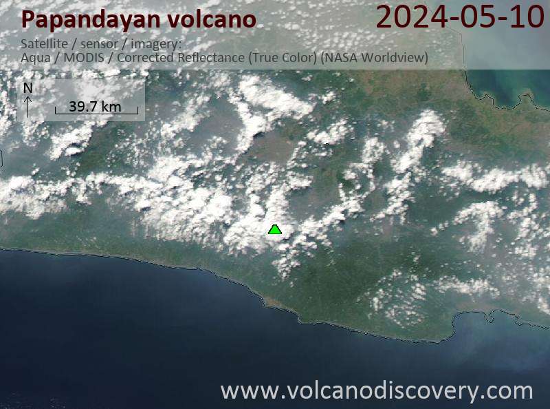
Latest satellite images

Papandayan satellite image sat1Papandayan satellite image sat2
Papandayan Volcano Tours
Java (Indonesia)
Volcanoes of Java
17-day walking and trekking tour on Java
17 days / 16 nights - Moderate to Challenging
Price 3120 €
6-22 Oct 2025
Java (Indonesia)
From Krakatau to Bali
17-day study and photo tour to Java, Indonesia
17 days / 16 nights - Easy to Moderate
Price 3180 €
Custom and group dates
6-21 Oct 2025
3-19 Nov 2025
4-20 May 2026

Papandayan Volcano Maps

Below is a selection of maps showing the location and surroundings of the volcano at various resolutions based on aerial-imagery / terrain maps. Feel free to use them for non-commercial purposes on your blog or website as long as you credit them with a link back to this page (click to copy it).
Satellite/aerial-type map of Papandayan volcano (world scale)
Terrain-type map of Papandayan volcano (world scale)
Satellite/aerial-type map of Papandayan volcano (region scale large)
Terrain-type map of Papandayan volcano (region scale large)
Satellite/aerial-type map of Papandayan volcano (region scale medium)
Terrain-type map of Papandayan volcano (region scale medium)
Satellite/aerial-type map of Papandayan volcano (region scale small)
Terrain-type map of Papandayan volcano (region scale small)
Satellite/aerial-type map of Papandayan volcano (local scale large)
Terrain-type map of Papandayan volcano (local scale large)
Satellite/aerial-type map of Papandayan volcano (local scale medium)
Terrain-type map of Papandayan volcano (local scale medium)
Satellite/aerial-type map of Papandayan volcano (local scale small)
Terrain-type map of Papandayan volcano (local scale small)
Satellite/aerial-type map of Papandayan volcano (scale of 10s of km)
Terrain-type map of Papandayan volcano (scale of 10s of km)
Satellite/aerial-type map of Papandayan volcano (scale of 20-40 km)
Terrain-type map of Papandayan volcano (scale of 20-40 km)
Satellite/aerial-type map of Papandayan volcano (scale of approx. 10-20 km)
Terrain-type map of Papandayan volcano (scale of approx. 10-20 km)
Satellite/aerial-type map of Papandayan volcano (scale of 5-10 km)
Satellite/aerial-type map of Papandayan volcano (scale of few kilometers)
Fumaroles at Papandayan volcano
Unrooted tree (2002 eruption of Papandayan volcano)
Colorful water pools
A small pond filled with boiling mud (Papandayan volcano)
Volcanoes & Earthquakes - new app for Android
Guaranteed tours
6-21 Oct 2025: From Krakatau to Bali - Java (Indonesia)
3-19 Nov 2025: Volcanoes and Spices - Sulawesi/Halmahera (Indonesia)
3-19 Nov 2025: From Krakatau to Bali - Java (Indonesia)
9-19 Nov 2025: Guatemala Volcano Special - Guatemala
20 Nov - 3 Dec 2025: Desert, salt and volcanoes - Danakil desert (Ethiopia)
2-10 May 2026: From Stromboli to Etna - Sicily and Eolian Islands (Italy)
= spaces available   = guaranteed   = few spaces left   = booked out
Thu, 11 Sep 2025, 10:15

Papandayan Volcano (Indonesia) activity update Sep 10, 2025 - Unrest

The Center for Volcanology and Geological Hazard/Pusat Vulkanologi dan Mitigasi Bencana Geologi (CVGHM/PVMBG) reported that unrest continued at Papandayan on 10 September 2025 (local). The alert level at Papandayan remained at "Level 1 - Normal" (on a 4-level scale). Plumes rose to a maximum of 15 meters (49 feet) above the vent. ... Read all
Wed, 10 Sep 2025, 06:44

Papandayan Volcano (Indonesia) activity update Sep 9, 2025 - Unrest

The Center for Volcanology and Geological Hazard/Pusat Vulkanologi dan Mitigasi Bencana Geologi (CVGHM/PVMBG) reported that unrest continued at Papandayan on 9 September 2025 (local). The alert level at Papandayan remained at "Level 1 - Normal" (on a 4-level scale). ... Read all

On this page:

Try our free app!
Volcanoes & Earthquakes - new app for Android
Android | iOS version

More on VolcanoDiscovery

Why is there advertising on this site?

Support Us – Help Us Enhance Our Services!

We’re passionate about delivering the latest volcano and earthquake data from around the globe — just for you. However, maintaining our website and free apps requires significant time, effort, and resources.
Your support helps us expand our hardware and software capabilities and empowers our dedicated editorial team. Our mission is to provide uninterrupted, real-time updates whenever an earthquake strikes or a volcano erupts — and your donations make this possible. Every contribution, big or small, is deeply appreciated. If you find our information valuable and want to help us add new features, create compelling content, and improve our technology, please consider making a donation:

Donate with Card or Apple/Google Pay:

Send €5 payment link to support VolcanoDiscovery with 5 EUR
€10 payment link to support VolcanoDiscovery with 10 EUR
€25 payment link to support VolcanoDiscovery with 25 EUR
€50 payment link to support VolcanoDiscovery with 50 EUR
€100 payment link to support VolcanoDiscovery with 100 EUR
€250 payment link to support VolcanoDiscovery with 250 EUR

Donate with PayPal:

Planned Features:

Thanks to your past donations, we have recently added:
Download the Volcanoes & Earthquakes app to stay among the first to receive the fastest seismic and volcano alerts online:
Android | iOS
Thank you for being part of our mission!
Sources: VolcanoDiscovery / VolcanoAdventures and other sources as noted.
Use of material: Most text and images on our websites are owned by us. Re-use is generally not permitted without authorization. Contact us for licensing rights.
Volcanoes & Earthquakes
VolcanoDiscovery Home
Volcanoes | Earthquakes | Photos | Volcano News | | Shop | App
Adventure & Study Travel
Tours to Volcanoes and Volcanic Areas: walking tours, photo tours, study tours
Tours & Dates | FAQ | About us
Get our newsletter!
Company info
Contact | Legal info | Terms & conditions
Follow us
Follow us on facebook Follow us on Instagram Follow us on Bluesky Follow us on Twitter Visit our Youtube channel
EN | DE | EL | ES | FR | IT | RU
VolcanoDiscovery GmbH, Germany, Reg. nr.: HRB 103744, EU Tax Id: DE 297 465 123 owned and created by
Dr. Tom Pfeiffer, volcanologist, volcano photographer, tour organizer member of
IAVCEI
IAVCEI
Vulkanologische Gesellschaft
Volcanological Society
Ecotourism Greece
Ecotourism Greece
RUV insurance
Insured by R+V
VolcanoDiscovery © 2004- All Rights Reserved | Privacy - Cookie Settings