| RSS | EN | DE | EL | ES | FR | IT | RU

Hautere Vulkan

Updated: 18. Nov. 2025 06:21 GMT -
Stratovolcano
New Zealand, -46.55°S / 166.9°E
Summit height: 330 m / 1083 ft
Aktueller Status: (wahrscheinlich) erloschen (0 von 5)

[smaller] [larger]
Typische Aktivität: unspecified
Ausbrüche des Hautere: None during the past 10,000 years
Less than 2.58 million years ago (Pleistocene)

Letzte Erdbeben in der Nähe

Datum und UhrzeitMag / TiefeDistanz / Ort

Beschreibung

Hautere (Solander Island) is an eroded volcano lying 40 km south of the tip of South Island, NW of Steward Island. Argon/Argon dates as young as about 400-150 ka were obtained by Mortimer et al. (2008).
---
Source: Smithsonian / GVP volcano information

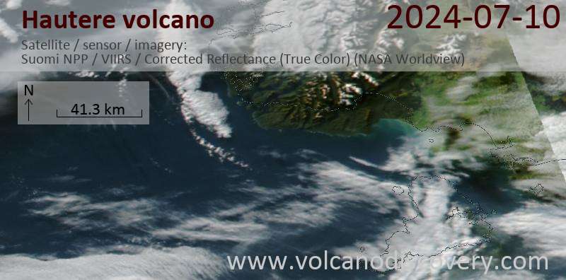
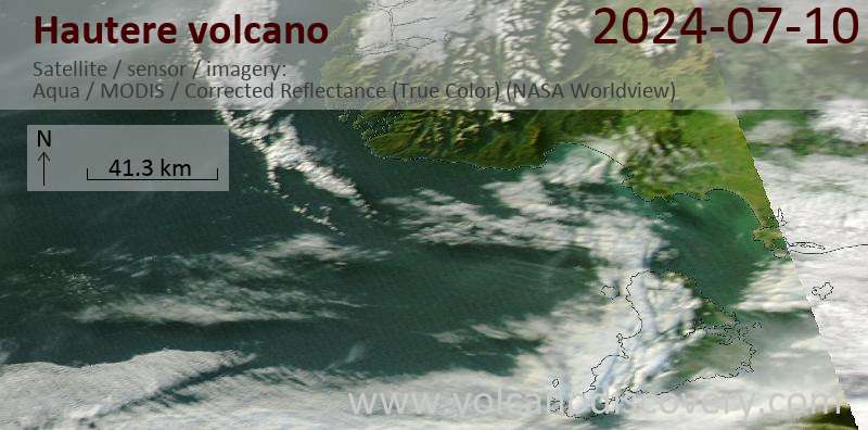
Neueste Satellitenbilder

hautere Satellitenbild sat1hautere Satellitenbild sat2

Hautere Vulkan Karten

Below is a selection of maps showing the location and surroundings of the volcano at various resolutions based on aerial-imagery / terrain maps. Feel free to use them for non-commercial purposes on your blog or website as long as you credit them with a link back to this page (click to copy it).
Satellite/aerial-type map of Hautere volcano (world scale)
Terrain-type map of Hautere volcano (world scale)
Satellite/aerial-type map of Hautere volcano (region scale large)
Terrain-type map of Hautere volcano (region scale large)
Satellite/aerial-type map of Hautere volcano (region scale medium)
Terrain-type map of Hautere volcano (region scale medium)
Satellite/aerial-type map of Hautere volcano (region scale small)
Terrain-type map of Hautere volcano (region scale small)
Satellite/aerial-type map of Hautere volcano (local scale large)
Terrain-type map of Hautere volcano (local scale large)
Satellite/aerial-type map of Hautere volcano (local scale medium)
Terrain-type map of Hautere volcano (local scale medium)
Satellite/aerial-type map of Hautere volcano (local scale small)
Terrain-type map of Hautere volcano (local scale small)
Satellite/aerial-type map of Hautere volcano (scale of 10s of km)
Terrain-type map of Hautere volcano (scale of 10s of km)
Satellite/aerial-type map of Hautere volcano (scale of 20-40 km)
Terrain-type map of Hautere volcano (scale of 20-40 km)
Satellite/aerial-type map of Hautere volcano (scale of approx. 10-20 km)
Terrain-type map of Hautere volcano (scale of approx. 10-20 km)
Satellite/aerial-type map of Hautere volcano (scale of 5-10 km)
Satellite/aerial-type map of Hautere volcano (scale of few kilometers)
Volcanoes & Earthquakes - new app for Android
News

No news in this list.

Auf dieser Seite:

Try our free app!
Volcanoes & Earthquakes - new app for Android
Android | iOS version

More on VolcanoDiscovery

Warum gibt es Werbung auf dieser Seite?

Gemeinsam VolcanoDiscovery weiterentwickeln!

Tag für Tag arbeiten wir mit Leidenschaft daran, Ihnen die neuesten Daten zu Vulkanen und Erdbeben in aller Welt in Echtzeit bereitzustellen. Die Pflege unserer Website und unserer kostenlosen Apps erfordert jedoch erheblichen Zeitaufwand, Engagement und technische Ressourcen.
Mit Ihrer Unterstützung können wir unsere Hard- und Softwarekapazitäten ausbauen, unser Redaktionsteam stärken und sicherstellen, dass wir Sie weiterhin informieren können. Unser Ziel: ein unterbrechungsfreier und möglichst vollständiger Service, sobald sich ein Erdbeben oder Vulkanausbruch ereignet. Ihre Unterstützung macht dies möglich – jeder Beitrag zählt! Wenn Sie unsere Dienste und Infos hilfreich finden und sich an dieser Mission beteiligen möchten, unterstützen Sie uns noch heute:

Spenden mit PayPal:

Geplante Verbesserungen:

Dank Ihrer bisherigen Spenden konnten wir bereits umsetzen:
Laden Sie die App „Vulkane & Erdbeben“ herunter, um bei Vulkanen und Erdbeben immer auf dem aktuellsten Stand zu sein und neueste Nachrichten zu erhalten!
Android | iOS
Vielen Dank, dass Sie Teil dieser Mission sind!
Sources: VolcanoDiscovery / VolcanoAdventures and other sources as noted.
Use of material: Most text and images on our websites are owned by us. Re-use is generally not permitted without authorization. Contact us for licensing rights.
Volcanoes & Earthquakes
VolcanoDiscovery Home
Vulkane | Erdbeben | Fotos | News | | Shop | App
Adventure & Study Travel
Reisen zu Vulkanen und Vulkangebieten: Wanderreisen, Studienreisen, Fotoreisen
Tours & Dates | FAQ | About us
Get our newsletter!
Company info
Kontakt | Impressum | AGB
Follow us
Follow us on facebook Follow us on Instagram Follow us on Bluesky Follow us on Twitter Visit our Youtube channel
EN | DE | EL | ES | FR | IT | RU
VolcanoDiscovery GmbH, Germany, Reg. nr.: HRB 103744, EU Tax Id: DE 297 465 123 owned and created by
Dr. Tom Pfeiffer, volcanologist, volcano photographer, tour organizer member of
IAVCEI
IAVCEI
Vulkanologische Gesellschaft
Volcanological Society
Ecotourism Greece
Ecotourism Greece
RUV insurance
Insured by R+V
VolcanoDiscovery © 2004- All Rights Reserved | Datenschutz - Cookie Einstellungen