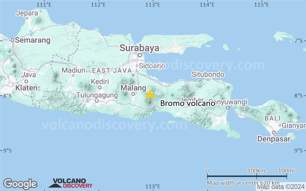
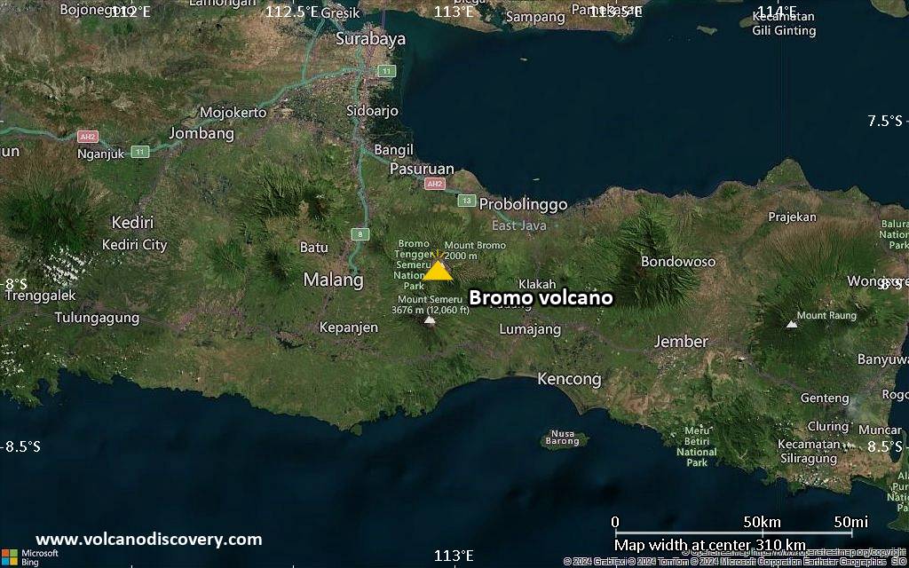
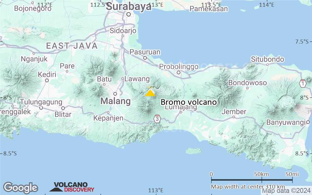
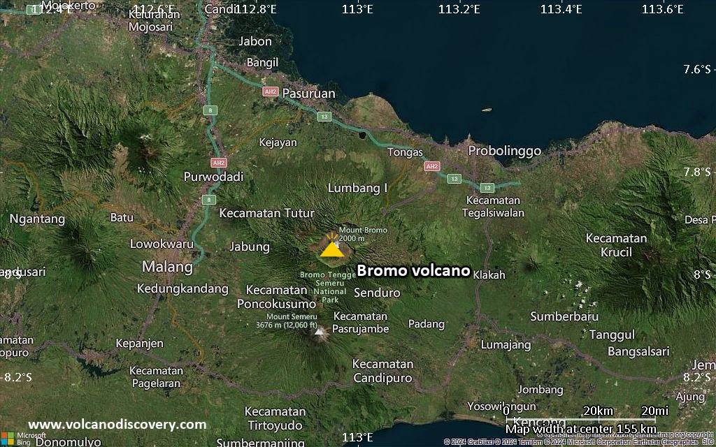
| RSS | EN | DE | EL | ES | FR | IT | RU

Bromo Volcan

Updated: 15 mai 2025 12:10 GMT -
Stratovolcano
East Java, Indonesia, -7.94°S / 112.95°E
Summit height: 2329 m / 7,641 ft
Condition actuelle: en vigilance - niveau agité (2 sur 5)
Last update: 20 déc. 2023 (Smithsonian / USGS Weekly Volcanic Activity Report)

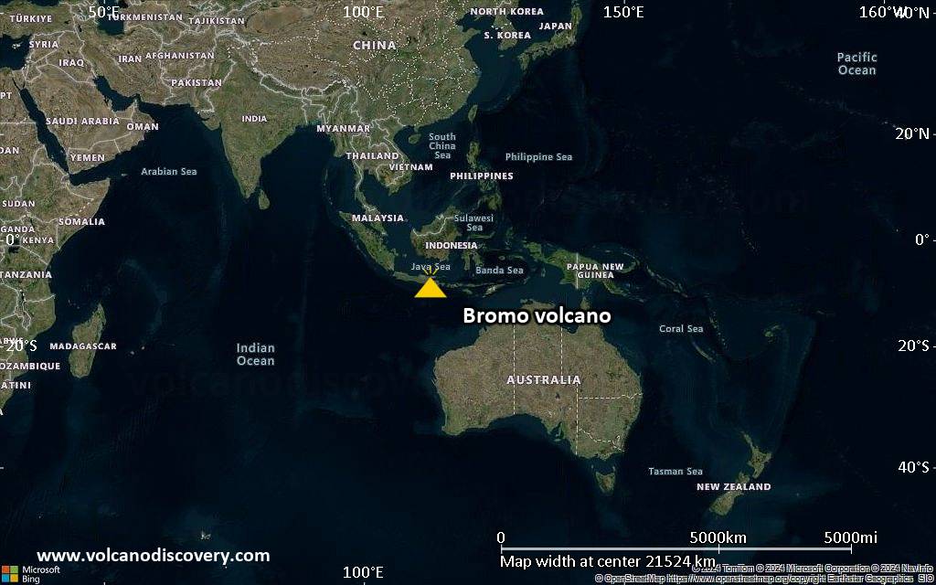
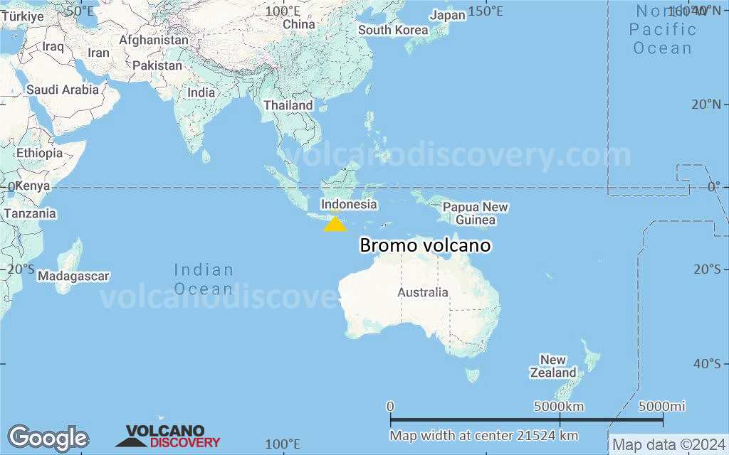
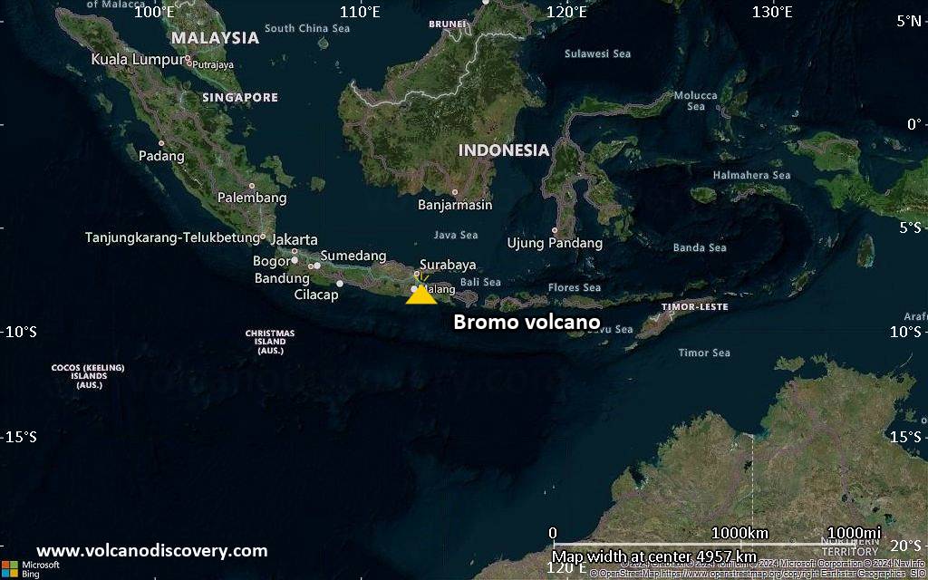
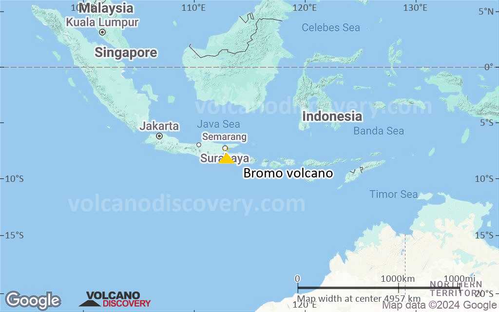
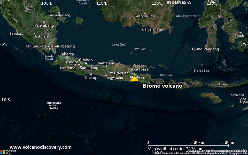
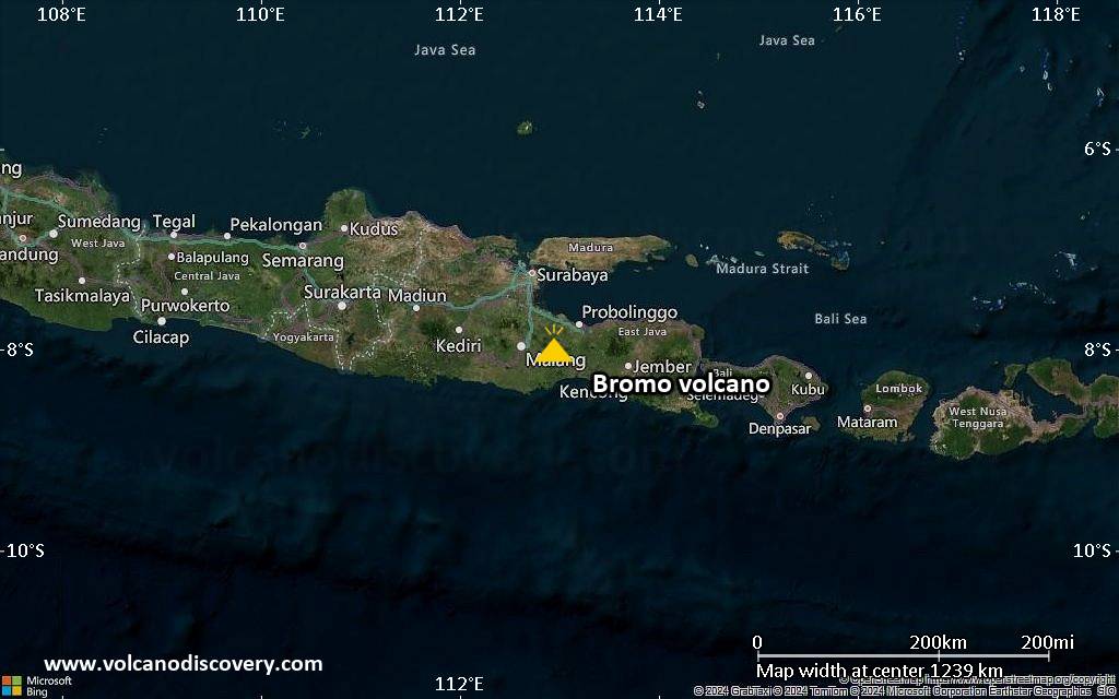
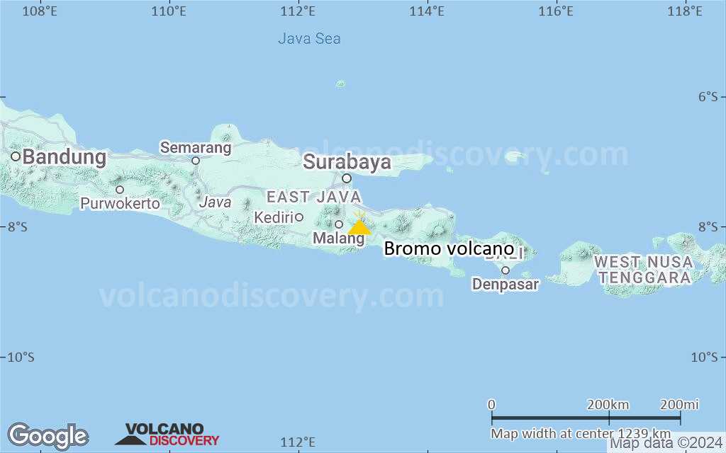
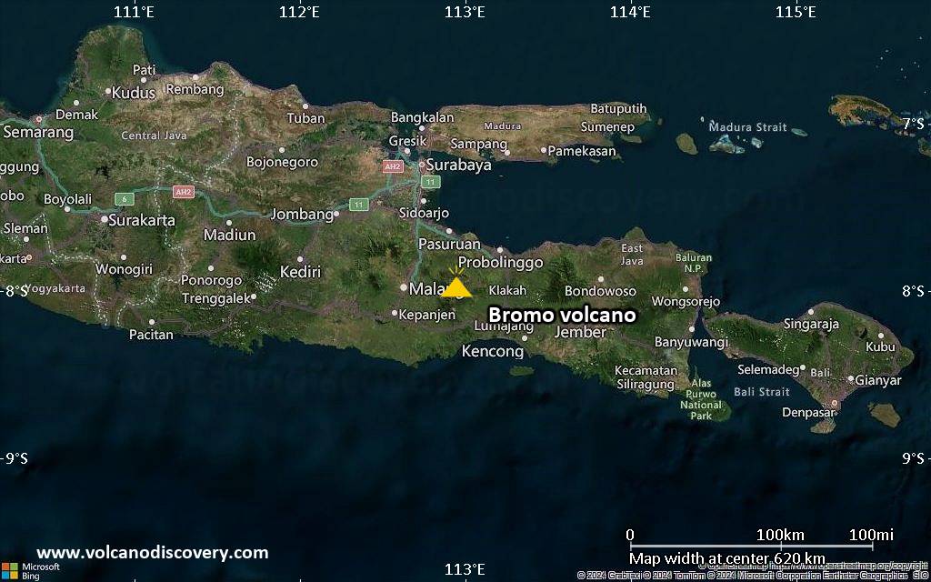
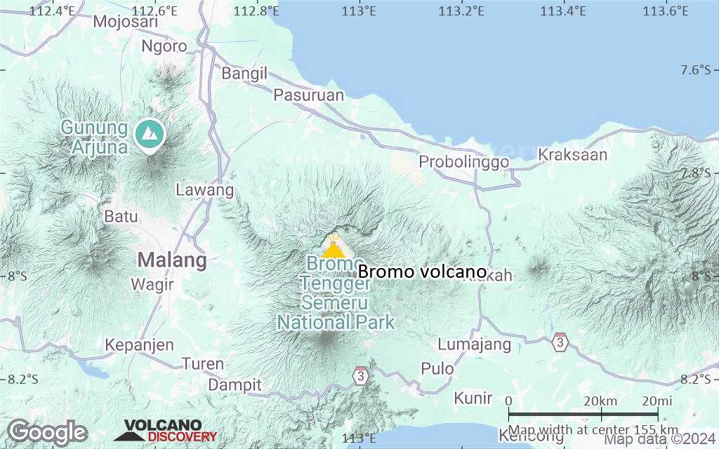
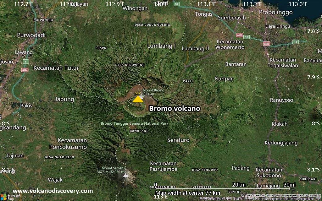
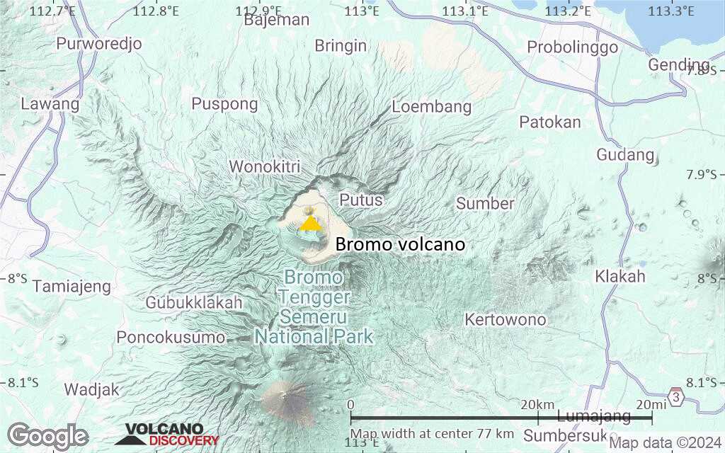
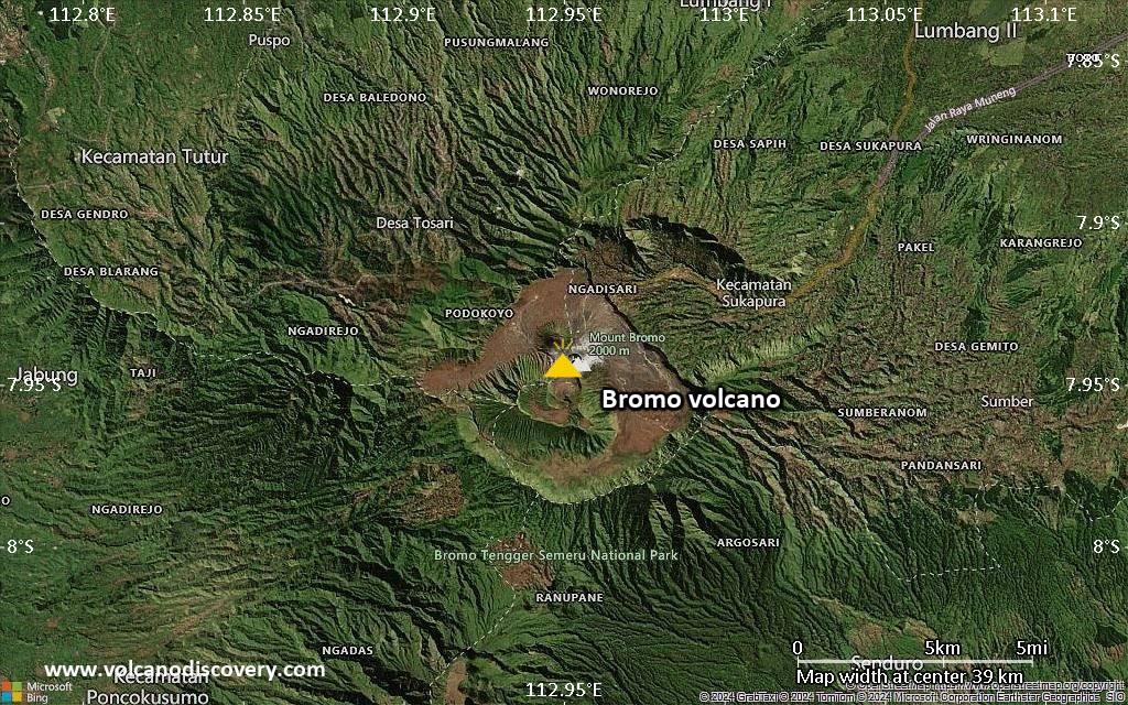
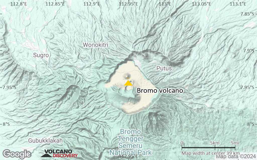
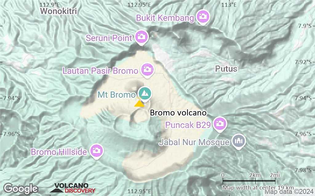
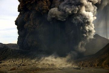
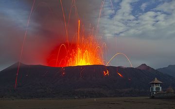
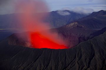
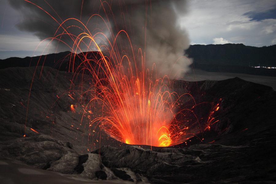
Mt. Bromo volcano in East Java is the active cone inside the giant Tengger caldera, one of Indonesia's most scenic locations destination in East Java, famous for its magnificient sunrise views and the panorama over the caldera with Semeru volcano in the background.

[smaller] [larger]
Style éruptif tipique: Explosive. Frequent small, phreatic eruptions at Bromo cinder cone on the bottom of the caldera.
Eruptions du volcan Bromo: 1804, 1815, 1820, 1822, 1825, 1829, 1830, 1835, 1842, 1843, 1844, 1856, 1857, 1858, 1858, 1859, 1860, 1865, 1865, 1866, 1867-68, 1877, 1885, 1885-86, 1886, 1886-87, 1888(?), 1890, 1893, 1896, 1906-07, 1907, 1907-08, 1909, 1910, 1915-16, 1921, 1922, 1928, 1930, 1935, 1939, 1940, 1948, 1950, 1955, 1956, 1972, 1980, 1983(?), 1983, 1984, 1995 (March-May), 1995 (Sep-Dec), 2000 (Nov)-2001 (Jan), 2004 (June), 2010 (Nov)-2011 (Jun) , 2015 (Nov)- 2016 (Nov), 2019 (Mar-Jul), 2020 (Dec), 2021 (Apr-Oct)

Derniers séismes proches

Date et l'heureMag / Prof.Distance / Lieux
2 mai 16:27 (Temps Universel)
2.2

10 km
19 km au sud-ouest Java, Indonesia Info
2 mai 21:09 (GMT +7)
3.0

10 km
20 km au sud-est Java, Indonesia Info

Introduction

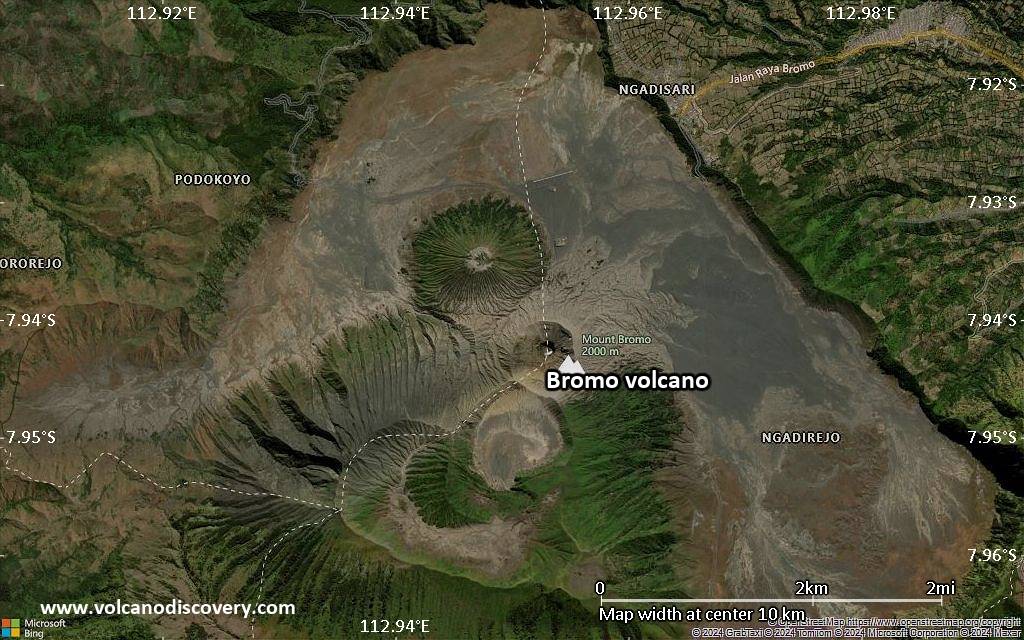
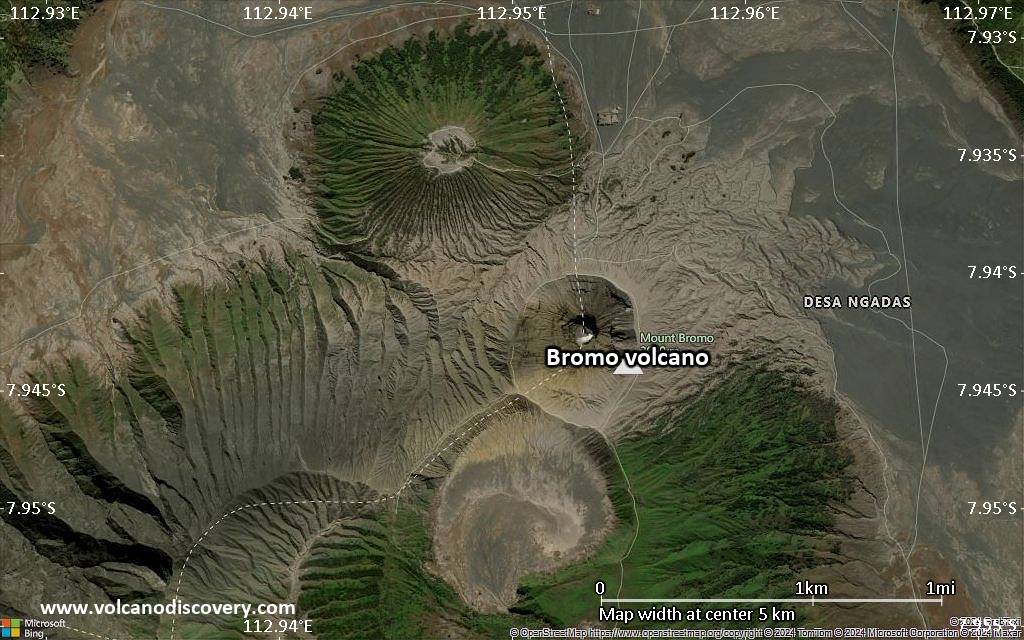
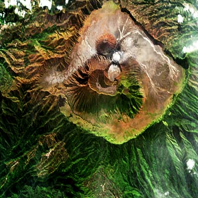
The 16-km-wide Tengger caldera is located at the northern end of a volcanic massif extending from Semeru volcano. The massive Tengger volcanic complex dates back to about 820,000 years ago and consists of five overlapping stratovolcanoes, each truncated by a caldera. Lava domes, pyroclastic cones, and a maar occupy the flanks of the massif. The Ngadisari caldera at the NE end of the complex formed about 150,000 years ago and is now drained through the Sapikerep Valley. The most recent of the Tengger calderas is the 9 x 10 km wide Sandsea Caldera at the SW end of the complex, which formed incrementally during the late Pleistocene and early Holocene. An overlapping cluster of post-caldera cones was constructed on the floor of the Sandsea Caldera within the last several thousand years. The youngest of these is Bromo, one of Java's most active and most frequently visited volcanoes.

Bromo Volcano Photos

Éruptions volcaniques importantes: volcano Bromo

In the past 10,000 years, Bromo has had at least 67 confirmed volcanic eruptions, out of which 61 are documented by historical records, while the others can be inferred from geological evidence.
Additionally, there are 5 uncertain or discredited eruptions from Bromo volcano.
The table below lists all known eruptions (date in bold face) of Bromo volcano since around 1900. Updates on the most recent volcanic activity of Bromo can be found on the news page of Bromo volcano.
DateNoteVEIMortsDommages
2023 Déc 13
Obs./docs historiques
1
inconnu
?? 2021 Avr 15 - Oct 22
Éruption incertaine
Obs./docs historiques
?
inconnu
2020 Déc 26 - Déc 28
Obs./docs historiques
1
inconnu
2019 Fév 18 - Jul 28Bromo
Obs./docs historiques
2
inconnu
2015 Nov 12 - 2016 Nov 12Bromo cone
Obs./docs historiques
2
inconnu
2010 Nov 26 - 2011 Jun 13Bromo
Obs./docs historiques
3?
inconnu
2010 Déc 28
(éruption 2010 Nov 26 - 2011 Jun 13)
Obs./docs historiques
0
léger
Infos
2004 Jun 8 - Jun 24 ±3 d.Bromo
Obs./docs historiques
2
inconnu
2004 Jun 8
(éruption 2004 Jun 8 - Jun 24 ±3 d.)
Obs./docs historiques
22
inconnu
Infos
2000 Nov 29 - 2001 Jan 15 ou plus tardBromo
Obs./docs historiques
2
inconnu
1995 Sep 9 - Déc 16 ±15 d.Bromo
Obs./docs historiques
1
inconnu
1995 Mar 3 - Mai 26 ±5 d.Bromo
Obs./docs historiques
1
inconnu
1984 Mai 12 - Mai 31Bromo
Obs./docs historiques
1
inconnu
1983 Déc 21Bromo
Obs./docs historiques
1
inconnu
?? 1983 Avr 15 ±5 d. - Jun 28 ±1 d.
Éruption incertaine
1
inconnu
1980 Jun 5 ±1 d. - Sep 20Bromo
Obs./docs historiques
2
inconnu
1972 Jan 26 - Mar 16 ±15 d.Bromo
Obs./docs historiques
2
inconnu
1956 Jun 16 ±15 d. - Jul 16 ±15 d.Bromo
Obs./docs historiques
2
inconnu
1955 Déc 29 - Déc 30Bromo
Obs./docs historiques
2
inconnu
1950 Mai 27 - Août 16 ±15 d.Bromo
Obs./docs historiques
2
inconnu
1948 Fév 15 - Avr 25Bromo
Obs./docs historiques
3
inconnu
1940 Avr 25 - Jul 3 ou plus tardBromo
Obs./docs historiques
2
inconnu
1939 Jun 24 - JulBromo
Obs./docs historiques
2
inconnu
1935 JulBromo
Obs./docs historiques
2
inconnu
1930 Mai 30 - JulBromo
Obs./docs historiques
2
inconnu
1929 Août 7 - Sep 8Bromo
Obs./docs historiques
2
inconnu
1928 Déc 16Bromo
Obs./docs historiques
2
inconnu
1928 Mar 15 ±5 d. - JulBromo
Obs./docs historiques
2
inconnu
1922 Fév 5 - Jun 20Bromo
Obs./docs historiques
2
inconnu
1921 Jun - Oct 17Bromo
Obs./docs historiques
2
inconnu
1915 Nov - 1916 JunBromo
Obs./docs historiques
3
inconnu
1910 Jan 18 - Jan 21Bromo
Obs./docs historiques
2
inconnu
1909 Jan 12 - Jan 14Bromo
Obs./docs historiques
2
inconnu
1907 Déc 14 - 1908 Fév 13Bromo
Obs./docs historiques
2
inconnu
1907 Août 28Bromo
Obs./docs historiques
2
inconnu
1906 Sep 25 - 1907 Mai 18Bromo
Obs./docs historiques
2
inconnu
Remark:
Our list of volcanic eruptions closely follows the database of eruptions of the Smithsonian's Global Volcanism Project (GVP), the internationally most recognized data source for volcanic eruptions, but also includes significant eruptive episodes or related volcano events. "Volcanic eruptions" are usually to be understood as sequences of individual eruptive episodes that can follow each other, or even overlap (if several vents are involved), and can last many years, decades or even longer. For example, the current activity of Stromboli volcano is understood as a single eruption that has been ongoing since 1934.
Sources: NOAA National Centers for Environmental Information (NCEI), Global Significant Volcanic Eruptions Database. doi:10.7289/V5TD9V7K | Global Volcanism Project / Smithsonian Institution

Bromo Volcano FAQ

+When was the last eruption of Bromo volcano?

+How often does Bromo volcano erupt?

+How active is Bromo volcano at present?

+When was the largest eruption of Bromo volcano?

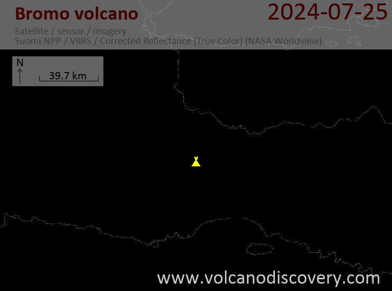
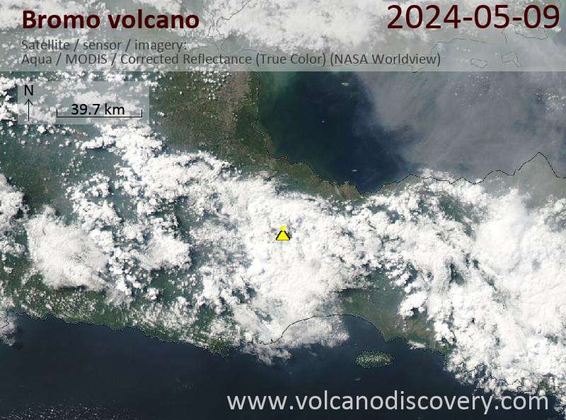
Dernières images satellite

Bromo image satellite sat1Bromo image satellite sat2
Bromo Voyages aux Volcans
Java (Indonésie)
Du Krakatau à Bali
16-jours d'étude à la découverte des volcans de Java, Indonésie
16 Jours - Facile-Modérée
Prix 3180 €
Départs sur commande possibles
9-24 juin 2025
7-22 juil. 2025
3-18 août 2025
Java (Indonésie)
Les volcans actifs de Java
17 jours de voyage et de trekking sur les volcans actifs de Java
17 jours (16 nuits) - Modérée-Soutenu
Prix 3120 €
9-25 juin 2025
7-23 juil. 2025
1-17 août 2025
Est de Java (Indonésie)
Volcans de l'Est-Java
4 à 6 jours de randonnées à la découverte des volcans Bromo, Semeru et Ijen
4-6 jours - Variable (dépendant de l'itinéraire choisi et vos préférences)
Prix depending on nr of people and program
Départs sur commande possibles
Est de Java (Indonésie)
Bromo, Semeru, Ijen
Voyage trekking sur les volcans Semeru, Bromo et Ijen (Est-Java)
7-9 jours - Modérée-Soutenu
Prix foncion du no. de personnes / programme
Départs sur commande possibles

Bromo Volcan Cartes

Below is a selection of maps showing the location and surroundings of the volcano at various resolutions based on aerial-imagery / terrain maps. Feel free to use them for non-commercial purposes on your blog or website as long as you credit them with a link back to this page (click to copy it).
Satellite/aerial-type map of Bromo volcano (world scale)
Terrain-type map of Bromo volcano (world scale)
Satellite/aerial-type map of Bromo volcano (region scale large)
Terrain-type map of Bromo volcano (region scale large)
Satellite/aerial-type map of Bromo volcano (region scale medium)
Terrain-type map of Bromo volcano (region scale medium)
Satellite/aerial-type map of Bromo volcano (region scale small)
Terrain-type map of Bromo volcano (region scale small)
Satellite/aerial-type map of Bromo volcano (local scale large)
Terrain-type map of Bromo volcano (local scale large)
Satellite/aerial-type map of Bromo volcano (local scale medium)
Terrain-type map of Bromo volcano (local scale medium)
Satellite/aerial-type map of Bromo volcano (local scale small)
Terrain-type map of Bromo volcano (local scale small)
Satellite/aerial-type map of Bromo volcano (scale of 10s of km)
Terrain-type map of Bromo volcano (scale of 10s of km)
Satellite/aerial-type map of Bromo volcano (scale of 20-40 km)
Terrain-type map of Bromo volcano (scale of 20-40 km)
Satellite/aerial-type map of Bromo volcano (scale of approx. 10-20 km)
Terrain-type map of Bromo volcano (scale of approx. 10-20 km)
Satellite/aerial-type map of Bromo volcano (scale of 5-10 km)
Satellite/aerial-type map of Bromo volcano (scale of few kilometers)
Volcanoes & Earthquakes - new app for Android
Départs garantis:
9-25 juin 2025: Volcans et Épices - Mer des Moluques (Sulawesi, Indonésie)
7-22 juil. 2025: Du Krakatau à Bali - Java (Indonésie)
7-23 juil. 2025: Volcans et Épices - Mer des Moluques (Sulawesi, Indonésie)
1-17 août 2025: Volcans et Épices - Mer des Moluques (Sulawesi, Indonésie)
1-14 oct. 2025: Désert, sels et volcans - Désert de Danakil (Éthiopie)
4-12 oct. 2025: Montagnes de Feu - du Stromboli à l'Etna - Eoliennes + Etna
6-21 oct. 2025: Du Krakatau à Bali - Java (Indonésie)
3-19 nov. 2025: Volcans et Épices - Mer des Moluques (Sulawesi, Indonésie)
= Places libres   = Départ garanti   = Quelques places disponibles   = Groupe fermé
mer., 20 déc. 2023, 15:00

Tengger Caldera volcano (Eastern Java) - Smithsonian / USGS Weekly Volcanic Activity Report for 13 December-19 December 2023 (New Activity / Unrest)

PVMBG reported increased activity at Tengger Caldera's Bromo cone in a 13 December press release. Emissions that day were white, gray, and brown, had variable densities, and rose as high as 900 m above the summit. The plumes drifted in multiple directions. ... Tout lire
jeu., 14 déc. 2023, 05:27

Bromo volcano (East Java, Indonesia): increased activity, ash emissions from crater

Ash emissions dissipated from Bromo volcano yesterday morning (image: PVMBG)
A heightened activity at the volcano has been detected at 06:00 AM yesterday. ... Tout lire
Eruption of Bromo on 8 June, 2004 (1).
Eruption of Bromo on 8 June, 2004 (2).

Satellite image of Bromo

Saltellite image of the Tengger caldera with smoking Bromo in the upper center (white crater floor). (Photo courtesy: ESA Earth Observation)
Zoom onto the cone of Bromo volcano (from the satellite image to the left).
NASA space image of Bromo volcano, located inside the Tengger caldera.

Sur cette page:

Try our free app!
Volcanoes & Earthquakes - new app for Android
Android | iOS version

More on VolcanoDiscovery

Why is there advertising on this site?

Support us - Help us upgrade our services!

We truly love working to bring you the latest volcano and earthquake data from around the world. Maintaining our website and our free apps does require, however, considerable time and resources.
We need financing to increase hard- and software capacity as well as support our editor team. We're aiming to achieve uninterrupted service wherever an earthquake or volcano eruption unfolds, and your donations can make it happen! Every donation will be highly appreciated. If you find the information useful and would like to support our team in integrating further features, write great content, and in upgrading our soft- and hardware, please make a donation (PayPal).

Planned features:Thanks to your past donations, these features have been added recently:
Download and Upgrade the Volcanoes & Earthquakes app to get one of the fastest seismic and volcano alerts online:
Android | IOS
Thank you!
Copyright: VolcanoDiscovery ou autres sources indiquées.
Utilisation des documents: Les textes, les images et les vidéos de ce site internet sont protégées par copyright. Toute reproduction et tout usage sans accord préalable ne sont pas autorisés. Si vous désirez acquérir pour certains documents (photos, vidéos, textes ou autres) le droit de reproduction, d'édition et, plus généralement, de toute utilisation destinée à un usage public, qu'elle soit commerciale ou pas, vous êtes priés de nous contacter.
Volcanoes & Earthquakes
VolcanoDiscovery Home
Volcans | Séismes | Photos | Actualités | | Shop | App
Adventure & Study Travel
Tours to Volcanoes and Volcanic Areas: walking tours, photo tours, study tours
Voyages |
Get our newsletter!
Company info
Contact | Mentions légales | Terms & conditions
Follow us
Follow us on facebook Follow us on Instagram Follow us on Bluesky Follow us on Twitter Visit our Youtube channel
EN | DE | EL | ES | FR | IT | RU
VolcanoDiscovery GmbH, Germany, Reg. nr.: HRB 103744, EU Tax Id: DE 297 465 123 owned and created by
Dr. Tom Pfeiffer, volcanologist, volcano photographer, tour organizer member of
IAVCEI
IAVCEI
Vulkanologische Gesellschaft
Volcanological Society
Ecotourism Greece
Ecotourism Greece
RUV insurance
Insured by R+V
VolcanoDiscovery © 2004- All Rights Reserved | Privacy - Changer Préférences