Korovin Volcan
Updated: 2 juil.. 2025 23:32 GMT -
Stratovolcano
Andreanof Islands, Aleutian Islands, 52.38°N / -174.17°W 
Summit height: 1533 m / 5030 ft
Condition actuelle: Activité petite ou avertissement éruption imminente (3 sur 5)
Last update: 25 avril 2025 (Volcanic Ash Advisory)
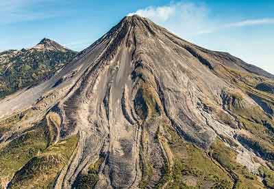
Korovin is a 1533 m high stratovolcano in the central Aleutian Islands and one of the most active volcanoes in Alaska. On average, it has been active every 10-15 years, its last eruption being in Nov-Dec 2006 with ash emissions.
[smaller] [larger]
Eruptions du volcan Korovin: 1829(?), 1844(?), 1907(?), 1951(?), 1953(?), 1973, 1976(?), 1986(?), 1987, 1998, 2005, 2006
Derniers séismes proches
| Date et l'heure | Mag / Prof. | Distance / Lieux | |||
|---|---|---|---|---|---|
| 20 juin 07:42 (Temps Universel) | 1.0 13 km | 8.7 km au sud-est | Info | ||
Introduction
Geologically, Korovin belongs to the Atka volcanic complex on northern Atka Island. The Atka complex comprises a broad ancient central shield volcano, upon which a larger stratovolcano had been built destroyed by caldera formation about 300,000 to 500,000 years ago.Korovin has two summit vents 0.6 km apart. The northwestern summit vent is a symmetric cone with a small crater. The southeastern summit vent is on the remnant of a cone with a steep-walled crater, about 1 km wide at the rim and at least several hundred meters deep with vertical crater walls. It contains a turquoise green lake with solfataric activity.
Dernières images satellite
Korovin Volcan Cartes
Below is a selection of maps showing the location and surroundings of the volcano at various resolutions based on aerial-imagery / terrain maps. Feel free to use them for non-commercial purposes on your blog or website as long as you credit them with a link back to this page (click to copy it).

Satellite/aerial-type map of Korovin volcano (world scale)

Terrain-type map of Korovin volcano (world scale)

Satellite/aerial-type map of Korovin volcano (region scale large)

Terrain-type map of Korovin volcano (region scale large)

Satellite/aerial-type map of Korovin volcano (region scale medium)

Terrain-type map of Korovin volcano (region scale medium)

Satellite/aerial-type map of Korovin volcano (region scale small)

Terrain-type map of Korovin volcano (region scale small)

Satellite/aerial-type map of Korovin volcano (local scale large)

Terrain-type map of Korovin volcano (local scale large)

Satellite/aerial-type map of Korovin volcano (local scale medium)

Terrain-type map of Korovin volcano (local scale medium)

Satellite/aerial-type map of Korovin volcano (local scale small)

Terrain-type map of Korovin volcano (local scale small)

Satellite/aerial-type map of Korovin volcano (scale of 10s of km)

Terrain-type map of Korovin volcano (scale of 10s of km)

Satellite/aerial-type map of Korovin volcano (scale of 20-40 km)

Terrain-type map of Korovin volcano (scale of 20-40 km)

Satellite/aerial-type map of Korovin volcano (scale of approx. 10-20 km)

Terrain-type map of Korovin volcano (scale of approx. 10-20 km)

Satellite/aerial-type map of Korovin volcano (scale of 5-10 km)

Satellite/aerial-type map of Korovin volcano (scale of few kilometers)


