Contact | RSS | EN | DE | EL | ES | FR | IT | RU

Kolumbo Volcano

Updated: 18 mai 2024 08:27 GMT -
submarine volcano -18 m / -60 ft
Grèce, 36.52°N / 25.49°E
Condition actuelle: normal / en sommeil (1 sur 5)
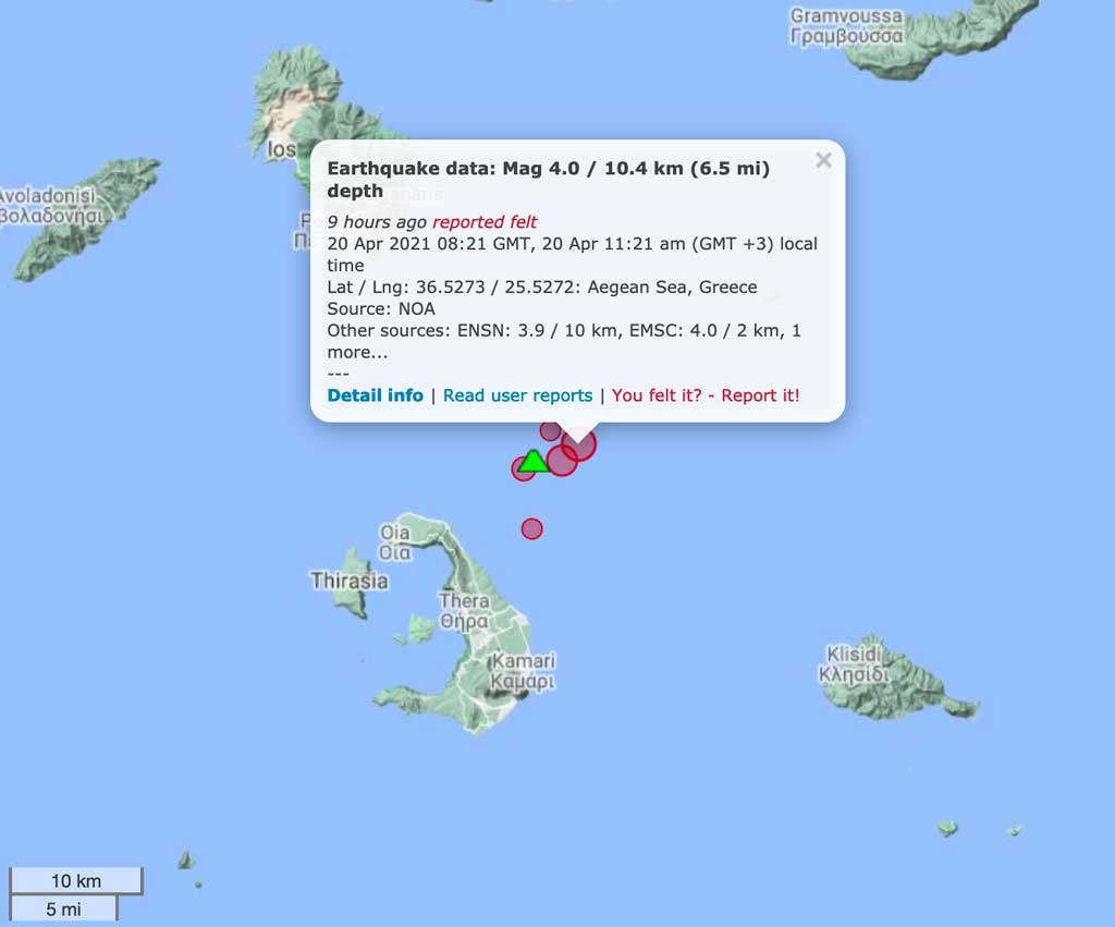
Last update: 20 avril 2021
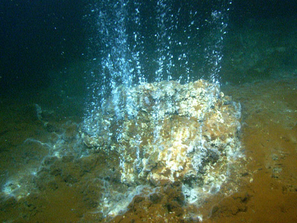
Hydrothermal vents occur when sea water enters the crust and comes in contact with the volcano's magma chamber. The hot fluid becomes enriched with minerals and then emerges through the vent; when it comes in contact with the colder seawater, its minerals are deposited and create mounds and 'chimneys'. Cyanobacteria use the hot water and minerals as an energy source through a process called chemosynthesis; this vent is covered with red, white, and black bacterial mats. Image taken by the ROV Hercules developed by the Institute for Exploration at Kolumbo underwater volcano, located northeast of Santorini in the Aegean Sea. Image courtesy of the Institute for Exploration, the University of Rhode Island (URI) Graduate School of Oceanography (GSO), and the URI Institute for Archaeological Oceanography.

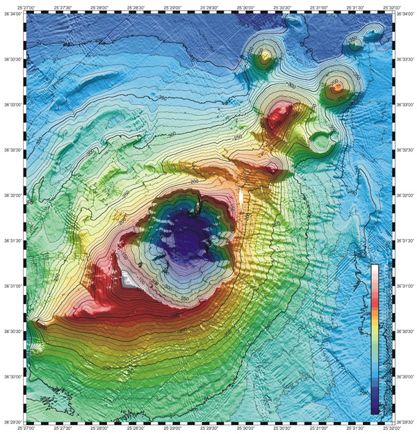
Kolumbo (or Kolumbos) volcano is an active submarine volcano located 8 km NE of Santorini Island in the Aegean Sea. The volcano forms an elliptical SW-NE elongated 3 km wide cone with a 500 m deep and 1.5 km wide crater, whose rim's highest parts rise to 18-15 m beneath sea level.
The crater floor, in particular in its northern part, contains a large and very active high-temperature fumarole field.
The crater of Kolumbo volcano is a small caldera which could have (at least in parts) formed during the volcano's only known, but very violent last eruption which occurred in 1650 AD.

[smaller] [larger]
Style éruptif tipique: explosive
Eruptions du volcan Kolumbo: 1650

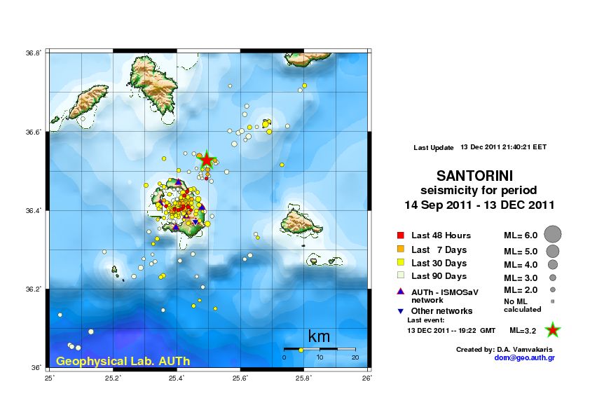
Derniers séismes proches

HeureMag. / ProfondeurDistance / Lieu
12 mai 16:56 (Athens)
2.1

13 km
1.6 km à l'est 13 Km ENE from Oia
Info
lundi, 6 mai 2024 GMT (1 séisme)
6 mai 08:37 (Athens)
2.0

10 km
18 km au nord Dodecanese Islands, Greece
Info

Introduction

The large hydrothermal field in the northern part of the caldera at about 500 m depth contains a massive Kuroko-style sulfide deposit. Only few such deposits are known world-wide and they are of great interest, especially because of the typically high content of gold and silver in the sulfides. In 2010, the exploration Vessel (E/V) Nautilus discovered steep, up to 6 m high chimneys of sulfides above one of the vents.
1650 eruption of Kolumbo volcano
The 1650 eruption was a very explosive event and ejected pumice and ash as far as Turkey, and produced pyroclastic flows that killed about 70 people on Santorini. During the eruption, it constructed a temporary island (hence it's name Kolumbo, in Greece "swimming"). A tsunami occurred as well, probably during the collapse of the cone. It caused damage on nearby islands up to 150 km and invaded the flat coastal areas especially on the eastern side of Santorini, where ruins from Roman times were uncovered. The eruption also caused damage killed a great number of livestock because of poisonous gasses, mainly H2S.

Links:
- Thera 2006 Expedition Summary (NOAA Ocean Explorer)
- Special Volume of Oceanography(pdf)
- Follow Dr. Robert Ballard and his team as they explore the ocean on the E/V Nautilus

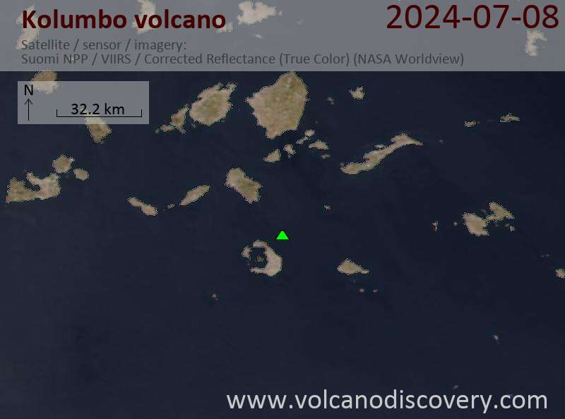
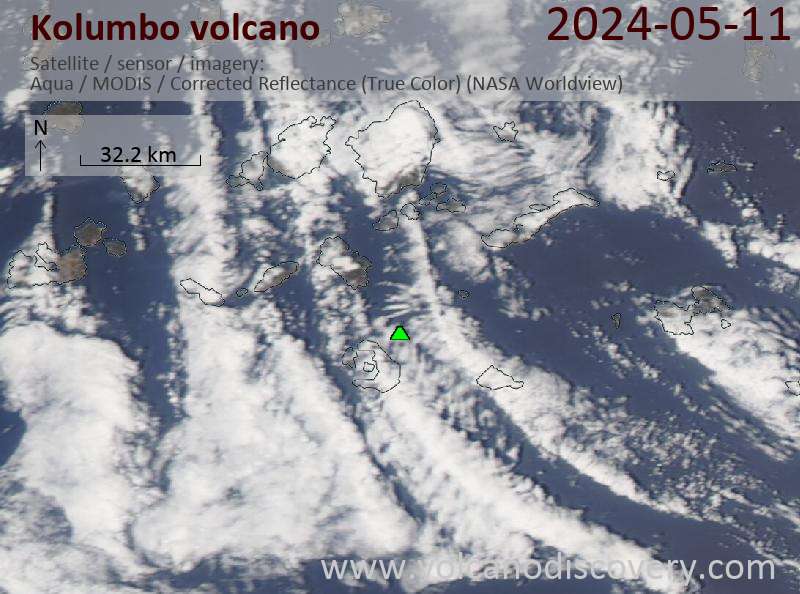
Latest satellite images

Kolumbo satellite image sat1Kolumbo satellite image sat2
mar., 20 avril 2021, 18:13

Moderate earthquake near undersea volcano beside Santorini, Greece. Should we worry?

This morning's earthquake near Kolumbo volcano offshore Santorini
This morning, a magnitude 4.0 earthquake occurred 10 km northeast of Santorini Island. The quake hit at 11.21 am local time. It was felt by many people on Santorini, especially in the northern part of the island in the town of Oia, mostly as weak shaking that lasted a few seconds. ... Read all
mar., 13 déc. 2011, 22:20

Volcan sous-marin Kolumbos (Santorin, Grèce): séisme de magnitude 3,2

Carte des séismes récents dessous de Santorin, en montrant l'événement 3,2 à Kolumbos volcan de Santorin NE
A 19h22 GMT (21h22 heure locale), un séisme de 3,2 survenu au sous-marin peu connu du volcan Kolumbos ca. 8 km NE de Santorin, l'île, en Grèce. Ceci marque l'un des plus grands événements de ces derniers mois. ... Read all
Map of the Kolumbo submarine crater and other submarine cones on the north-east trending Kolumbo volcano-tectonic rift. Figure courtesy of Haraldur Sigurdsson, Steven Carey, Matina Alexandir and Katy Croff. (from: oceanexplorer.noaa.gov/explorations/06blacksea/logs/summary_thera/summary_thera.html)

Sur cette page:

Why is there advertising on this site?
Copyright: VolcanoDiscovery ou autres sources indiquées.
Utilisation des documents: Les textes, les images et les vidéos de ce site internet sont protégées par copyright. Toute reproduction et tout usage sans accord préalable ne sont pas autorisés. Si vous désirez acquérir pour certains documents (photos, vidéos, textes ou autres) le droit de reproduction, d'édition et, plus généralement, de toute utilisation destinée à un usage public, qu'elle soit commerciale ou pas, vous êtes priés de nous contacter.
Volcanoes & Earthquakes
VolcanoDiscovery Home
Volcans | Séismes | Photos | Actualités | App
Adventure & Study Travel
Tours to Volcanoes and Volcanic Areas: walking tours, photo tours, study tours
Voyages |
Get our newsletter!
Company info
Contact | Mentions légales | Terms & conditions
Follow us
Follow us on facebook Follow us on Instagram Follow us on Twitter Visit our Youtube channel
EN | DE | EL | ES | FR | IT | RU
VolcanoDiscovery GmbH, Germany, Reg. nr.: HRB 103744, EU Tax Id: DE 297 465 123 owned and created by
Dr. Tom Pfeiffer, volcanologist, volcano photographer, tour organizer member of
IAVCEI
IAVCEI
Vulkanologische Gesellschaft
Volcanological Society
Ecotourism Greece
Ecotourism Greece
RUV insurance
Insured by R+V
VolcanoDiscovery © 2004- All Rights Reserved | Privacy - Changer Préférences
Cookie-free, privacy-friendly web stats