Amukta Volcano
Updated: 1. Mai 2024 06:28 GMT -
Stratovolcano 1066 m / 3,497 ft
United States, Aleutian Islands, 52.5°N / -171.25°W
Aktueller Status: normal / ruhend (1 von 5)
United States, Aleutian Islands, 52.5°N / -171.25°W
Aktueller Status: normal / ruhend (1 von 5)
[smaller] [larger]
Ausbrüche des Amukta: 1997
Letzte Erdbeben in der Nähe
| Uhrzeit | Mag. / Tiefe | Entfernung / Ort | |||
| 19. Apr. 07:25 (Adak) | 4.0 10 km | 29 km östlich | Info | ||
Beschreibung
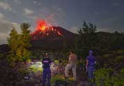
The symmetrical Amukta stratovolcano lies in the central Aleutians SW of Chagulak Island and is the westernmost of the Islands of the Four Mountains group. Amukta was constructed at the northern side of an arcuate caldera-like feature that is open to the sea along the southern coast of the 8-km-wide Amukta Island. The 1066-m-high stratovolcano overlies a broad shield volcano and is topped by a 400-m-wide crater. A cinder cone is located near the NE coast. Amukta has had several eruptions in historical time from both summit and flank vents.---
Smithsonian / GVP volcano information
Latest satellite images