| Datum und Uhrzeit | Mag / Tiefe | Nächster Vulkan / Ort | |||
|---|---|---|---|---|---|
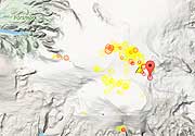
| 30. Jul. 01:48 (GMT -6) | 3.0 155 km | 33 km S von | Near Coast of Nicaragua I FELT IT | Info | |
| Dienstag, 29. Juli 2025 GMT (5 Beben) | |||||
| 29. Jul. 17:05 (Guatemala) | 5.4 10 km | 17 km W von | 0 km W of Zapotitlán, Guatemala I FELT IT - 8 Berichte | Info | |
| 29. Jul. 16:15 (GMT -6) | 3.3 5 km | 13 km SO von | Guatemala I FELT IT - 3 Berichte | Info | |
| 29. Jul. 15:42 (Guatemala) | 4.8 10 km | 21 km O von | 3 km S of Comapa, Guatemala I FELT IT - 12 Berichte | Info | |
| 29. Jul. 15:25 (Guatemala) | 5.7 10 km | 22 km W von | 22 km südlich von Jutiapa, Departamento de Jutiapa, Guatemala I FELT IT - 37 Berichte | Info | |
| 29. Jul. 15:21 (Guatemala) | 5.6 10.6 km | 15 km NW von | 3 km NW of Jerez, Guatemala I FELT IT - 143 Berichte | Info | |
| Sonntag, 27. Juli 2025 GMT (1 Beben) | |||||
| 26. Jul. 18:23 (GMT -6) | 3.2 3 km | 68 km NW von | Honduras I FELT IT | Info | |
| Freitag, 25. Juli 2025 GMT (3 Beben) | |||||
| 24. Jul. 22:12 (GMT -6) | 3.8 4 km | 76 km NO von | 42 km östlich von El Progreso, Departamento Yoro, Honduras I FELT IT - 1 Bericht | Info | |
| 24. Jul. 21:12 (GMT -6) | 3.5 5.4 km | 6 km W von | Golfo DE Fonseca, Honduras I FELT IT - 1 Bericht | Info | |
| Datum | Mag | Region | Todesopfer | Schaden | |
|---|---|---|---|---|---|
| 2018 Jan 10 | 7.5 | Honduras | 0 | leicht | Info |
| 2013 Apr 10 | 5.4 | Atlantida | 0 | leicht | Info |
| 2009 May 28 | 7.3 | Northern; Belize | 7 | mittel | Info |
| 1982 Sep 29 | 5.1 | Honduras-guatemala-el Salvador | 3 | mittel | Info |
| 1982 Jan 12 | 6.0 | Ampala, Masaya | 0 | mittel | Info |
| 1947 Jan 26 | ? | El Salvador: La Union | 0 | mittel | Info |
| 1934 Dec 3 | ? | San Jorge, La Encarnacion, San Fernando | 0 | mittel | Info |
| 1915 Dec 29 | 6.6 | El Salvador; Honduras: Gracias | 1-50 (*) | mittel | Info |
Das tödlichste Erdbeben in Honduras seit 1900 war das Erdbeben der Stärke 6.6 in ![]() Honduras, Departamento Lempira am 29. Dezember 1915. Es forderte between 1-50 fatalities und eine unbekannte Anzahl an Verletzte. Dies war das 8.-schwerste je aufgezeichnete Erdbeben in Honduras.
Honduras, Departamento Lempira am 29. Dezember 1915. Es forderte between 1-50 fatalities und eine unbekannte Anzahl an Verletzte. Dies war das 8.-schwerste je aufgezeichnete Erdbeben in Honduras.
Das Erdbeben, das den größten wirtschaftlichen Schaden verursachte, war das Erdbeben der Stärke 7.3 in ![]() Honduras am 28. Mai 2009. Es forderte 7 Todesopfer und verursachte geschätzt $1-5 million USD (heutiges Äquivalent) an wirtschaftlichem Gesamtschaden. Auch ein Tsunami wurde durch das Beben ausgelöst und trug zu dessen zerstörerischen Auswirkungen bei. Der Tsunami erreichte Wasserhöhen von 4 m. Dies war das verheerendste je aufgezeichnete Erdbeben in Honduras..
Honduras am 28. Mai 2009. Es forderte 7 Todesopfer und verursachte geschätzt $1-5 million USD (heutiges Äquivalent) an wirtschaftlichem Gesamtschaden. Auch ein Tsunami wurde durch das Beben ausgelöst und trug zu dessen zerstörerischen Auswirkungen bei. Der Tsunami erreichte Wasserhöhen von 4 m. Dies war das verheerendste je aufgezeichnete Erdbeben in Honduras..
Insgesamt forderten Erdbeben seit 1900 eine geschätzte Zahl von 35 Todesopfern; es sind mindestens 3 tödliche Beben in diesem Zeitraum bekannt.
Der gesamte wirtschaftliche Schaden, der seit 1900 von Erdbeben verursacht wurde, kann auf etwa $32 Millionen US-Dollar geschätzt werden.