


St. Paul Volcano
Updated: 12. Mai 2024 10:58 GMT -
Stratovolcano 268 m / 879 ft
France, Southern Indian Ocean, -38.72°S / 77.53°E
Aktueller Status: normal / ruhend (1 von 5)
France, Southern Indian Ocean, -38.72°S / 77.53°E
Aktueller Status: normal / ruhend (1 von 5)
[smaller] [larger]
Ausbrüche des St. Paul: 1793
Letzte Erdbeben in der Nähe
| Uhrzeit | Mag. / Tiefe | Entfernung / Ort | |||
Beschreibung
The uninhabited triangular island of St. Paul is located near the axis of the East Indian Ocean Ridge, 80 km south of Amsterdam Island. St. Paul is composed of a older tuff cone surmounted by a basaltic stratovolcano with a 1.8-km-wide caldera. The entire NE half of the volcano was submerged following collapse along a NW-trending fault. This breached the central caldera, leaving an 80-m-deep bay connected to the ocean by a narrow channel only a few meters deep. Geothermal areas are located near the 268-m-high caldera rim and along the margins of the caldera bay. The only recorded historical eruption took place in 1793 from a vent on the lower SW flank.---
Smithsonian / GVP volcano information
St. Paul Volcano Photos
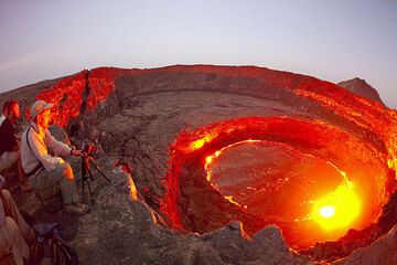
Claude, Olivier und Paul beim Betrachten des Lavasees (Photo: Tom Pfeiffer)
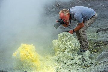
...während Paul sich nicht um die Dämpfe kümmert. (Photo: Tom Pfeiffer)
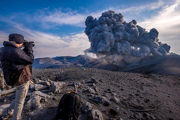
Paul fotografiert den Ausbruch (Photo: Tom Pfeiffer)
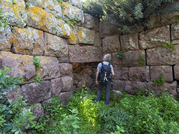
Paulus am antiken Eingang der Akropolis Paliokastro in Vathy auf der Halbinsel Methana. (Photo: Tobias Schorr)
Latest satellite images


