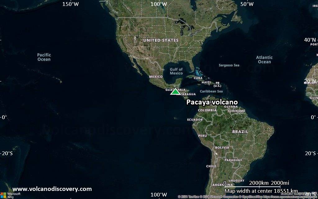
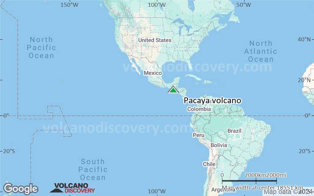
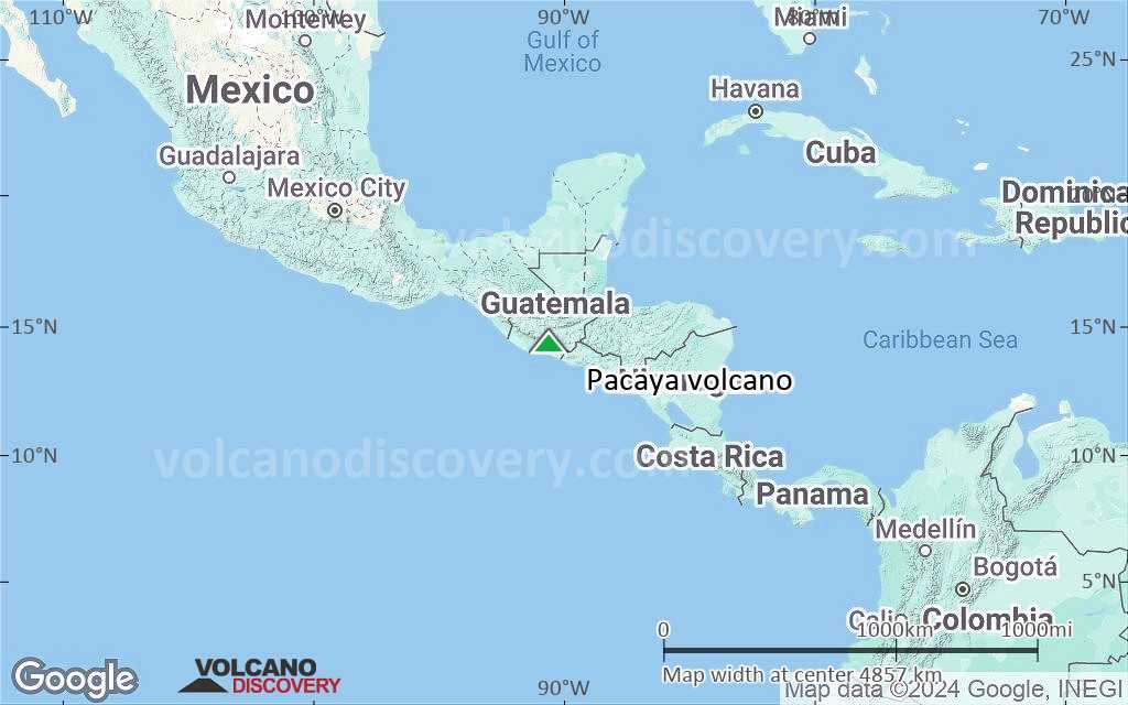
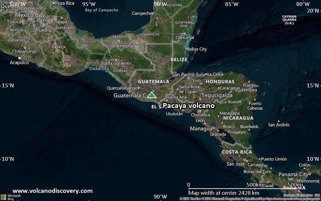
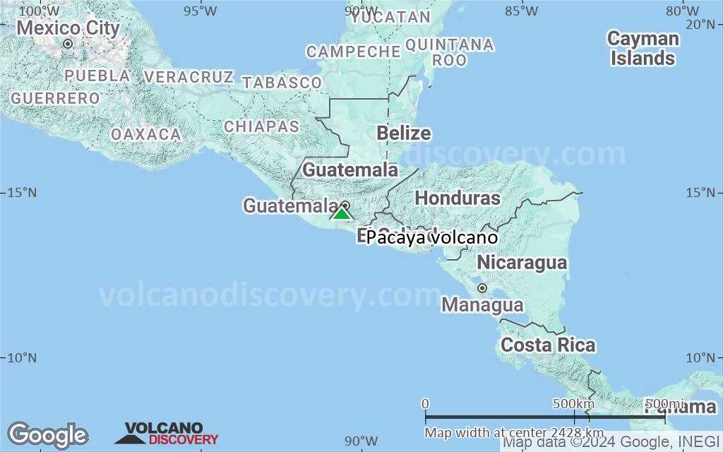
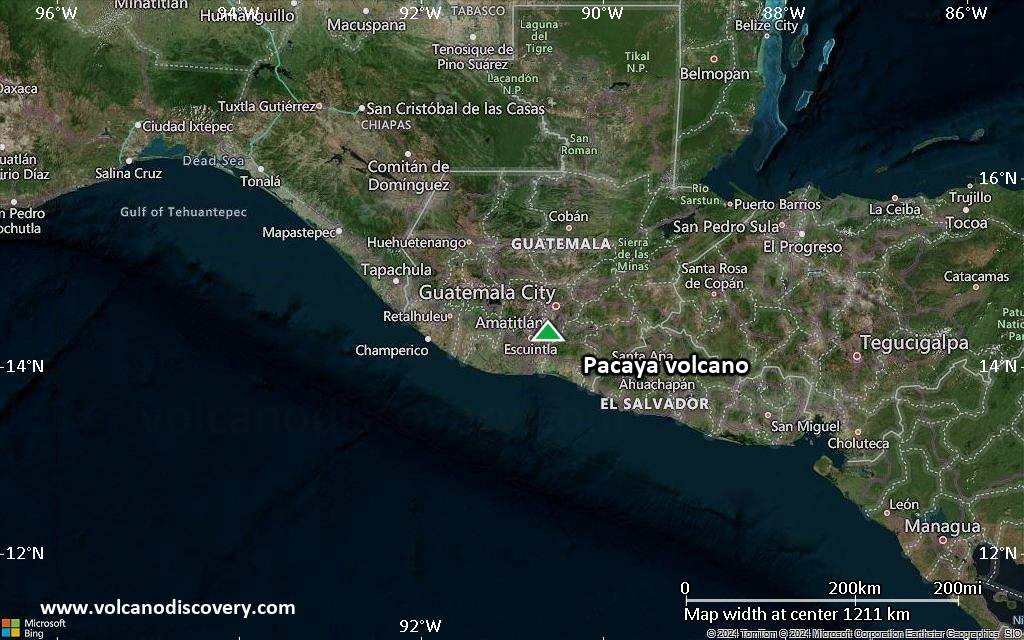
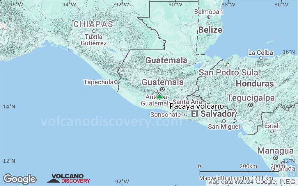
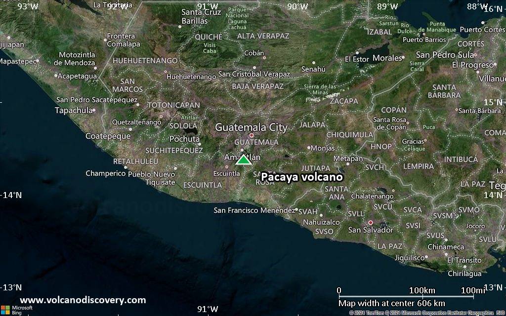
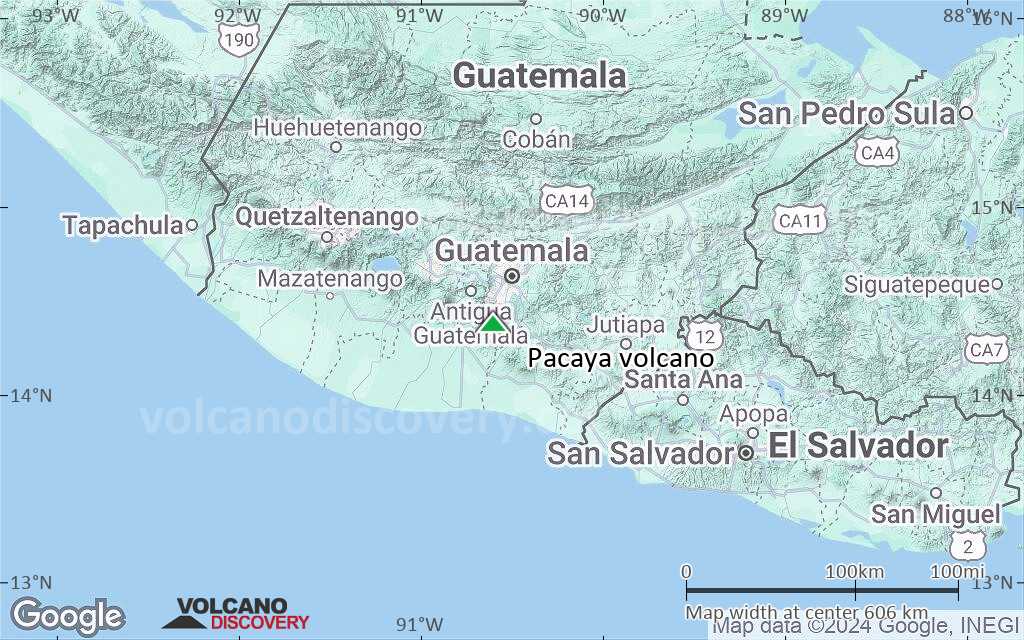
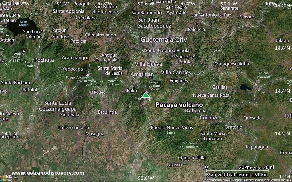
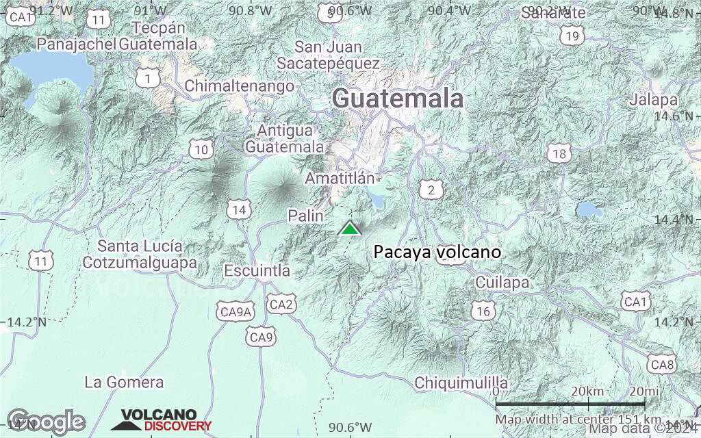
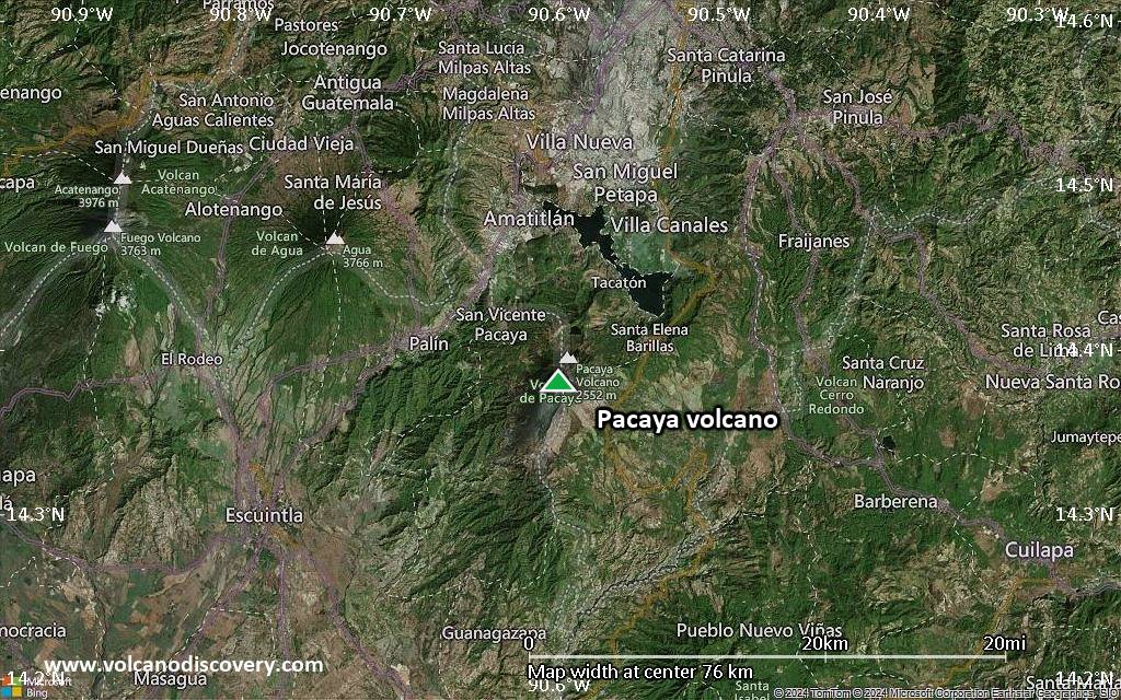
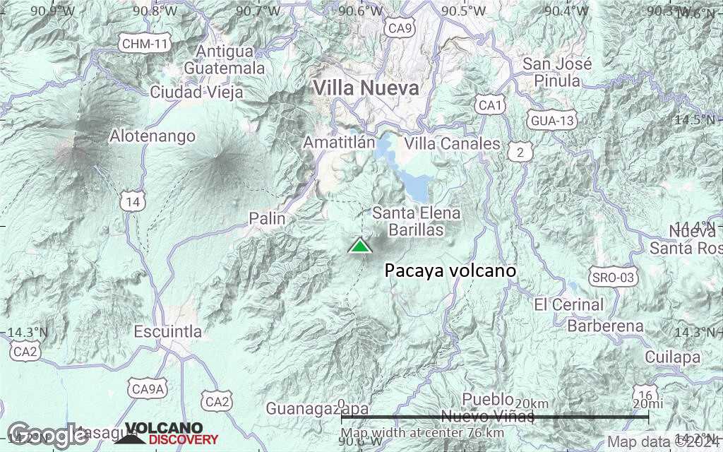
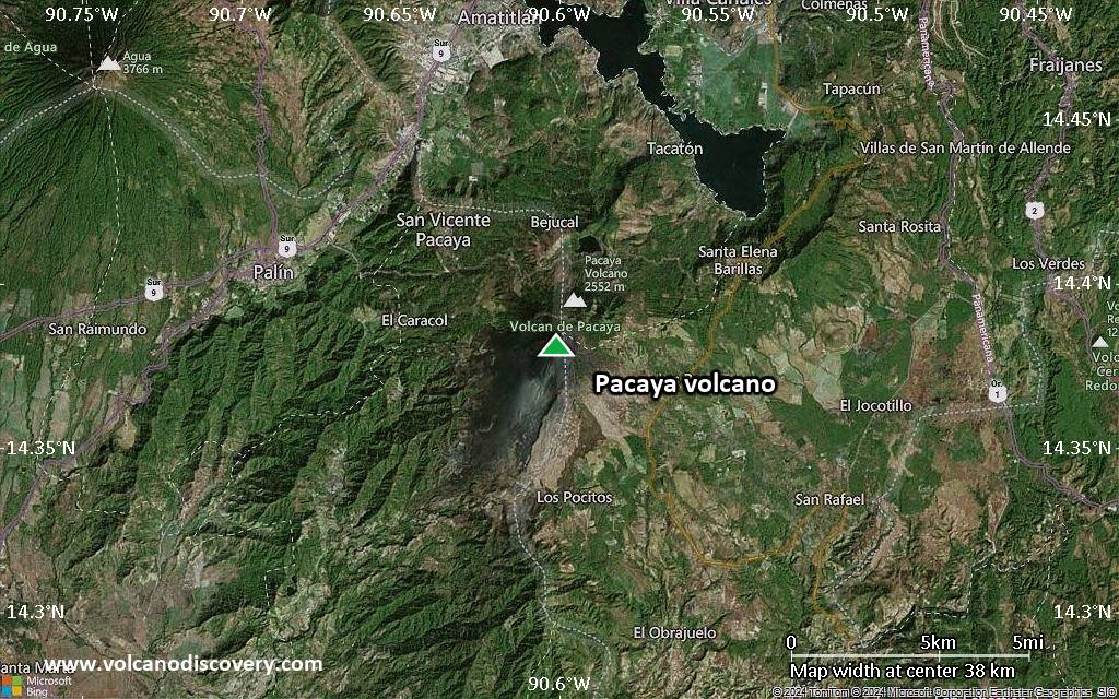
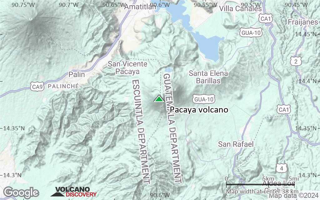
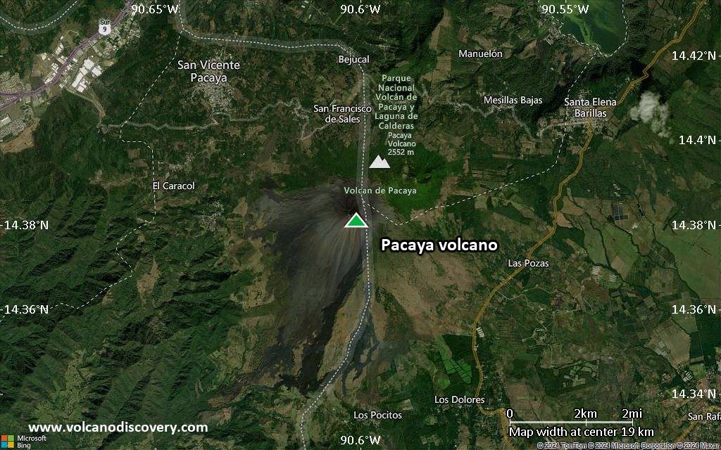
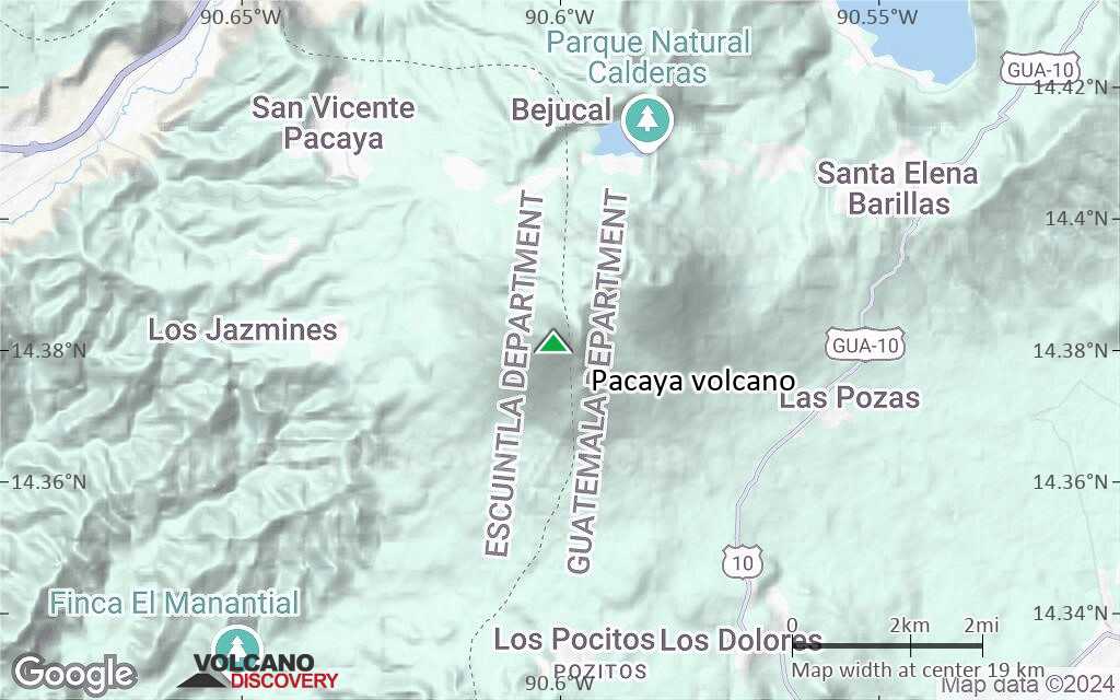
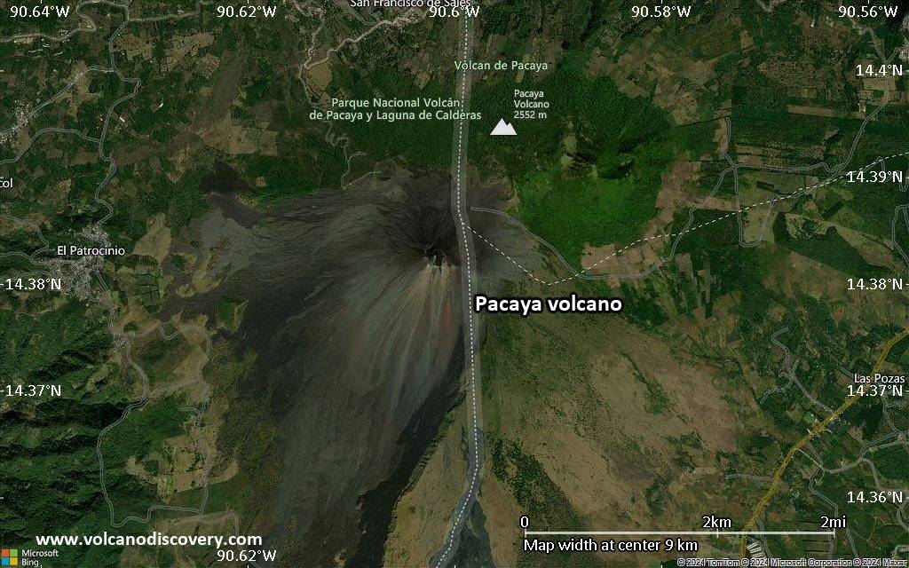
| RSS | EN | DE | EL | ES | FR | IT | RU

Pacaya Volcán

Updated: 25 mayo 2025 05:55 GMT -
Complex volcano
Guatemala, 14.38°N / -90.6°W
Summit height: 2552 m (8,373 ft)
Current status: normal or dormant (1 out of 5)
Last update: 3 ago 2024

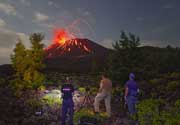
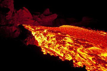
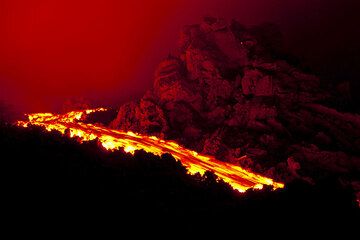
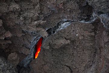
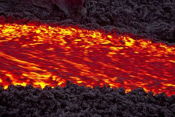
Pacaya volcano near Guatemala City is one of Guatemala's most active volcanoes, and its frequent eruptions are often visible from Guatemala City. Typical activity in recent years includes strombolian activity, lava flow emission and intermittend violent phases of lava fountaining.

[smaller] [larger]
Typical eruption style: Mildly explosive and effusive (Strombolian activity, lava fountaining, lava flows from the summit crater). Near continuously active the least during the past centuries.
Erupciones del volcán Pacaya: 1360, 1565, 1623(?), 1651, 1655, 1664, 1668, 1671, 1674, 1677(?), 1678, 1690, 1693, 1699, 1717(?), 1760(?), 1775, 1805, 1830(?), 1846, 1885, 1961, 1965, 1970, 1972, 1973, 1976, 1977, 1978, 1980 - May 1998 (intense period of summit activity), 1999-2003, 2004-2010, 2012, 2013, 2014

Latest nearby earthquakes

Fecha y horaMag / Prof.Distancia / Ubicación
23 may 01:04 (GMT -6)
1.7

10 km
21 km al noreste 10 km Al Sureste De Guatemala, Guatemala Más

Background

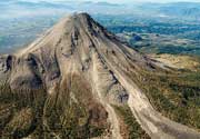
Pacaya is a complex basaltic volcano constructed just outside the southern topographic rim of the 14 x 16 km Pleistocene Amatitlán caldera. A cluster of dacitic lava domes occupies the southern caldera floor. The post-caldera Pacaya massif includes the Cerro Grande lava dome and a younger volcano to the SW. Collapse of Pacaya volcano about 1100 years ago produced a debris-avalanche deposit that extends 25 km onto the Pacific coastal plain and left an arcuate somma rim inside which the modern Pacaya volcano (MacKenney cone) grew. A subsidiary crater, Cerro Chino, was constructed on the NW somma rim and was last active in the 19th century.
During the past several decades, activity at Pacaya has consisted of frequent strombolian eruptions with intermittent lava flow extrusion that has partially filled in the caldera moat and armored the flanks of MacKenney cone, punctuated by occasional larger explosive eruptions that partially destroy the summit of the cone.
Source: GVP

Pacaya Volcano Photos

Erupciones volcánicas significativas: Pacaya volcano

In the past 10,000 years, Pacaya has had at least 32 confirmed volcanic eruptions, out of which 28 are documented by historical records, while the others can be inferred from geological evidence.
Additionally, there are 4 uncertain or discredited eruptions from Pacaya volcano.
The table below lists all known eruptions (date in bold face) of Pacaya volcano since around 1700. Updates on the most recent volcanic activity of Pacaya can be found on the news page of Pacaya volcano.
FechaNotaVEIFallecidosDaños
2015 jun 7 ±1 d. - 2021 ago 13MacKenney Crater
Obs. históricas/documentos
1
desconocido
2021 mar
(erupción 2015 jun 7 ±1 d. - 2021 ago 13)
Obs. históricas/documentos
1
ligero
Información
2014 ago 25 - 2015 feb 17MacKenney Crater
Obs. históricas/documentos
1
desconocido
2013 mar 5 - 2014 abr 10MacKenney Crater
Obs. históricas/documentos
2
desconocido
2006 mar 9 - 2010 oct 26MacKenney Cone
Obs. históricas/documentos
3
desconocido
2010 may 27
(episodio eruptivo 2010 may 27)
Obs. históricas/documentos
11
ligero
Información
2004 jul 19 ? - 2005 sep 11MacKenney Cone and lower S flank
Obs. históricas/documentos
3?
desconocido
2002 may 30 - jun 17 ?MacKenney Crater
Obs. históricas/documentos
1?
desconocido
2001 oct 31MacKenney Crater
Obs. históricas/documentos
1
desconocido
2000 ago 16 ±15 d. - 2001 jul 5 ?MacKenney Crater
Obs. históricas/documentos
1
desconocido
1990 ene 4 ? - 2000 mar 1MacKenney Crater and flank vents
Obs. históricas/documentos
3
desconocido
1995 abr 7
(erupción 1990 ene 4 ? - 2000 mar 1)
Obs. históricas/documentos
31
ligero
Información
1965 jul 4 - 1989 mar 10MacKenney Crater and flank vents
Obs. históricas/documentos
3
desconocido
1987 ene 25
(erupción 1965 jul 4 - 1989 mar 10)
Obs. históricas/documentos
3
ligero
Información
1961 mar 11 - abr 15 ?Cachajinas vent (South flank, 1860 m)
Obs. históricas/documentos
2
desconocido
1885 dic
Obs. históricas/documentos
2
desconocido
1846 febCerro Chino
Obs. históricas/documentos
2
desconocido
?? 1830
Erupción incierta
?
desconocido
1805
Obs. históricas/documentos
2
desconocido
1775 jul 1 - jul 23 o despuésCerro Chino (SW flank and summit)
Obs. históricas/documentos
3
desconocido
?? 1760
Erupción incierta
?
desconocido
?? 1717
Erupción incierta
?
desconocido
Remark:
Our list of volcanic eruptions closely follows the database of eruptions of the Smithsonian's Global Volcanism Project (GVP), the internationally most recognized data source for volcanic eruptions, but also includes significant eruptive episodes or related volcano events. "Volcanic eruptions" are usually to be understood as sequences of individual eruptive episodes that can follow each other, or even overlap (if several vents are involved), and can last many years, decades or even longer. For example, the current activity of Stromboli volcano is understood as a single eruption that has been ongoing since 1934.
Fuentes: NOAA National Centers for Environmental Information (NCEI), Global Significant Volcanic Eruptions Database. doi:10.7289/V5TD9V7K | Global Volcanism Project / Smithsonian Institution

Pacaya Volcano FAQ

+When was the last eruption of Pacaya volcano?

+How often does Pacaya volcano erupt?

+How active is Pacaya volcano at present?

+When was the largest eruption of Pacaya volcano?

Últimas imágenes satelitales

Pacaya imagen satelital sat1Pacaya imagen satelital sat2
Pacaya Tours de volcanes
11-day volcano tour to Pacaya and Fuego, Guatemala
8-12 days - Moderate to Challenging
Price $ 3590
25 nov - 5 dic 2025

Pacaya Volcán Mapas

Below is a selection of maps showing the location and surroundings of the volcano at various resolutions based on aerial-imagery / terrain maps. Feel free to use them for non-commercial purposes on your blog or website as long as you credit them with a link back to this page (click to copy it).
Satellite/aerial-type map of Pacaya volcano (world scale)
Terrain-type map of Pacaya volcano (world scale)
Satellite/aerial-type map of Pacaya volcano (region scale large)
Terrain-type map of Pacaya volcano (region scale large)
Satellite/aerial-type map of Pacaya volcano (region scale medium)
Terrain-type map of Pacaya volcano (region scale medium)
Satellite/aerial-type map of Pacaya volcano (region scale small)
Terrain-type map of Pacaya volcano (region scale small)
Satellite/aerial-type map of Pacaya volcano (local scale large)
Terrain-type map of Pacaya volcano (local scale large)
Satellite/aerial-type map of Pacaya volcano (local scale medium)
Terrain-type map of Pacaya volcano (local scale medium)
Satellite/aerial-type map of Pacaya volcano (local scale small)
Terrain-type map of Pacaya volcano (local scale small)
Satellite/aerial-type map of Pacaya volcano (scale of 10s of km)
Terrain-type map of Pacaya volcano (scale of 10s of km)
Satellite/aerial-type map of Pacaya volcano (scale of 20-40 km)
Terrain-type map of Pacaya volcano (scale of 20-40 km)
Satellite/aerial-type map of Pacaya volcano (scale of approx. 10-20 km)
Terrain-type map of Pacaya volcano (scale of approx. 10-20 km)
Satellite/aerial-type map of Pacaya volcano (scale of 5-10 km)
Satellite/aerial-type map of Pacaya volcano (scale of few kilometers)
Volcanoes & Earthquakes - new app for Android
Guaranteed tours
9-25 jun 2025: Volcanoes and Spices - Halmahera N-Sulawesi (Indonesia)
7-22 jul 2025: From Krakatau to Bali - Java (Indonesia)
7-23 jul 2025: Volcanoes and Spices - Halmahera N-Sulawesi (Indonesia)
1-17 ago 2025: Volcanoes and Spices - Halmahera N-Sulawesi (Indonesia)
1-14 oct 2025: Desert, salt and volcanoes - Danakil desert (Ethiopia)
4-12 oct 2025: From Stromboli to Etna - Sicily and Eolian Islands (Italy)
6-21 oct 2025: From Krakatau to Bali - Java (Indonesia)
3-19 nov 2025: Volcanoes and Spices - Halmahera N-Sulawesi (Indonesia)
= spaces available   = guaranteed   = few spaces left   = booked out
Pacaya volcano satellite image by (c) Google Earth View
sáb, 3 ago 2024, 14:43

Pacaya volcano (Guatemala) continues its slumber

The volcano continues to be quiet. Only a degassing plume rising 50-100 m from the Mackenney crater can be observed. ... Leer todo
mié, 18 ago 2021, 06:00

Pacaya volcano (Guatemala) - Smithsonian / USGS Weekly Volcanic Activity Report for 18 August-24 August 2021 (Continuing Activity)

INSIVUMEH reported that white-to-blue gas-and-steam emissions rose as high as 600 m above Pacaya's Mackenney crater and drifted as far as 2 km S, SW, and N during 18-25 August. Seismic stations recorded some weak explosion and degassing events on 18 August. ... Leer todo

En esta página:

Try our free app!
Volcanoes & Earthquakes - new app for Android
Android | iOS version

More on VolcanoDiscovery

Why is there advertising on this site?

Support us - Help us upgrade our services!

We truly love working to bring you the latest volcano and earthquake data from around the world. Maintaining our website and our free apps does require, however, considerable time and resources.
We need financing to increase hard- and software capacity as well as support our editor team. We're aiming to achieve uninterrupted service wherever an earthquake or volcano eruption unfolds, and your donations can make it happen! Every donation will be highly appreciated. If you find the information useful and would like to support our team in integrating further features, write great content, and in upgrading our soft- and hardware, please make a donation (PayPal).

Planned features:Thanks to your past donations, these features have been added recently:
Download and Upgrade the Volcanoes & Earthquakes app to get one of the fastest seismic and volcano alerts online:
Android | IOS
Thank you!
Sources: VolcanoDiscovery / VolcanoAdventures and other sources as noted.
Use of material: Most text and images on our websites are owned by us. Re-use is generally not permitted without authorization. Contact us for licensing rights.
Volcanoes & Earthquakes
VolcanoDiscovery Home
Volcanes | Sismos | Fotos | News | | Shop | App
Adventure & Study Travel
Tours to Volcanoes and Volcanic Areas: walking tours, photo tours, study tours
Tours & Dates | FAQ | About us
Get our newsletter!
Company info
Contact | Legal info | Terms & conditions
Follow us
Follow us on facebook Follow us on Instagram Follow us on Bluesky Follow us on Twitter Visit our Youtube channel
EN | DE | EL | ES | FR | IT | RU
VolcanoDiscovery GmbH, Germany, Reg. nr.: HRB 103744, EU Tax Id: DE 297 465 123 owned and created by
Dr. Tom Pfeiffer, volcanologist, volcano photographer, tour organizer member of
IAVCEI
IAVCEI
Vulkanologische Gesellschaft
Volcanological Society
Ecotourism Greece
Ecotourism Greece
RUV insurance
Insured by R+V
VolcanoDiscovery © 2004- All Rights Reserved | Privacy - Cookie Settings