Akutan Volcano
Updated: Apr 29, 2024 18:26 GMT -
Stratovolcano 1303 m / 4,275 ft
Aleutian Islands, USA, 54.13°N / -165.99°W
Current status: normal or dormant (1 out of 5)
Aleutian Islands, USA, 54.13°N / -165.99°W
Current status: normal or dormant (1 out of 5)
Last update: 24 Feb 2022 (small earthquake swarms)
Akutan volcano is one of the most active stratovolcanoes of the Aleutian arc. The volcano has a 2-km-wide caldera with an active intracaldera cone.
[smaller] [larger]
Akutan volcano eruptions: 1992
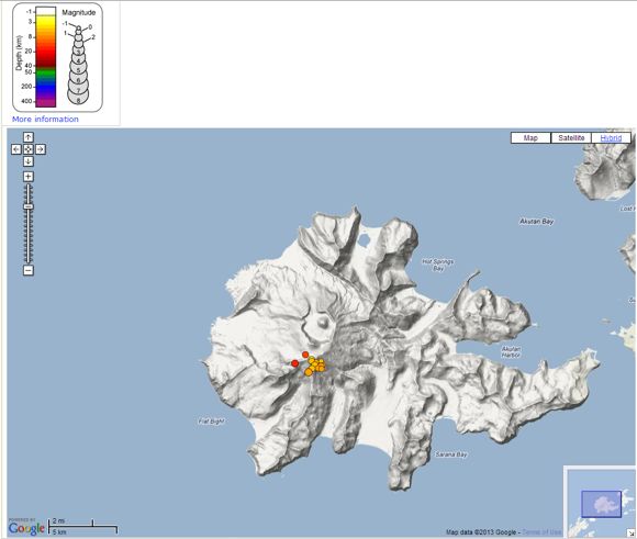
Latest nearby earthquakes
| Time | Mag. / Depth | Distance / Location | |||
| Apr 27, 06:15 am (Anchorage) | 0.6 3.2 km | Info | |||
| Saturday, April 20, 2024 GMT (2 quakes) | |||||
| Apr 20, 03:23 am (Anchorage) | 2.1 6.8 km | 1.8 km (1.1 mi) to the SE | Info | ||
| Apr 19, 05:43 pm (Anchorage) | 3.4 3.4 km | 4.4 km (2.7 mi) to the NE | Info | ||
| Friday, April 19, 2024 GMT (1 quake) | |||||
| Apr 19, 01:14 pm (Universal Time) | 0.9 4.8 km | Info | |||
Background
An older, largely buried caldera was formed during the late Pleistocene or early Holocene. Two volcanic centers are located on the NW flank. Lava Peak is of Pleistocene age, and a cinder cone lower on the flank produced a lava flow in 1852 that extended the shoreline of the island and forms Lava Point. The 60-365 m deep younger caldera was formed during a major explosive eruption about 1600 years ago and contains at least three lakes. The currently active large cinder cone in the NE part of the caldera has been the source of frequent explosive eruptions with occasional lava effusion that blankets the caldera floor. A lava flow in 1978 traveled through a narrow breach in the north caldera rim almost to the coast. Fumaroles occur at the base of the caldera cinder cone, and hot springs are located NE of the caldera at the head of Hot Springs Bay valley and along the shores of Hot Springs Bay.---
Smithsonian / GVP volcano information
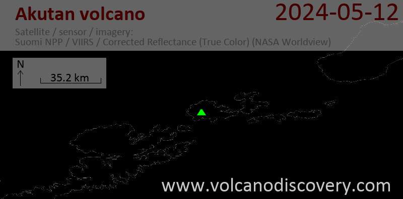
Latest satellite images