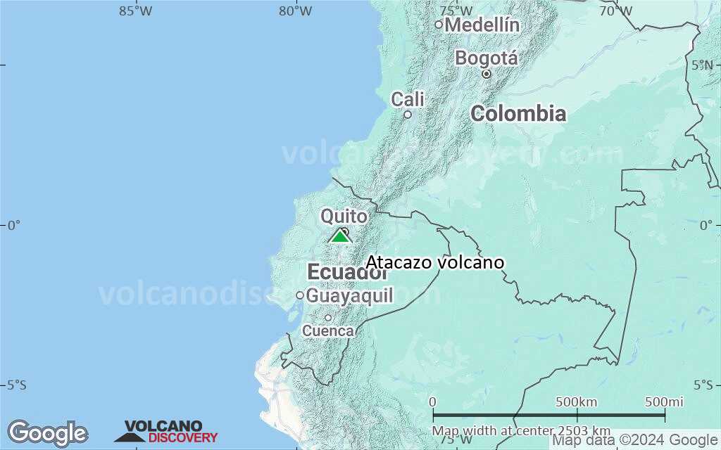
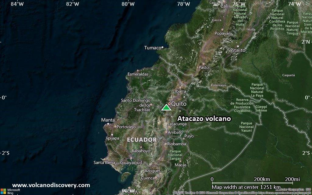
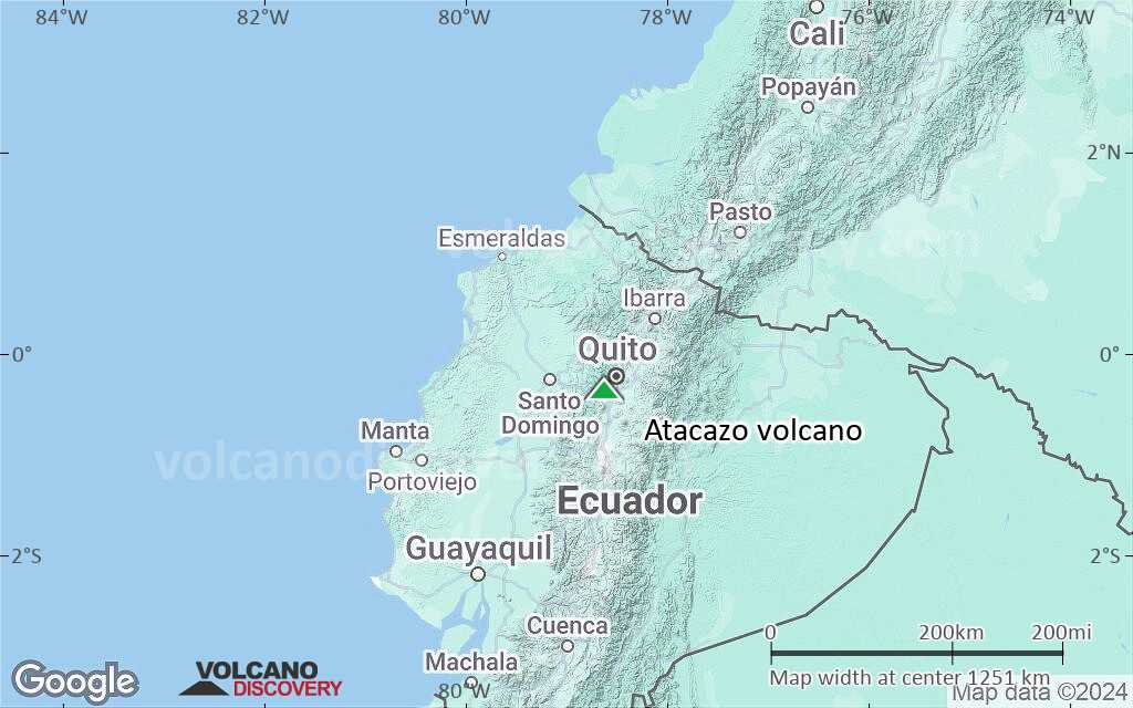
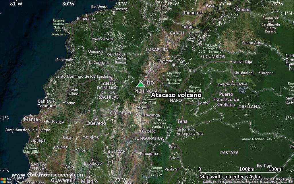
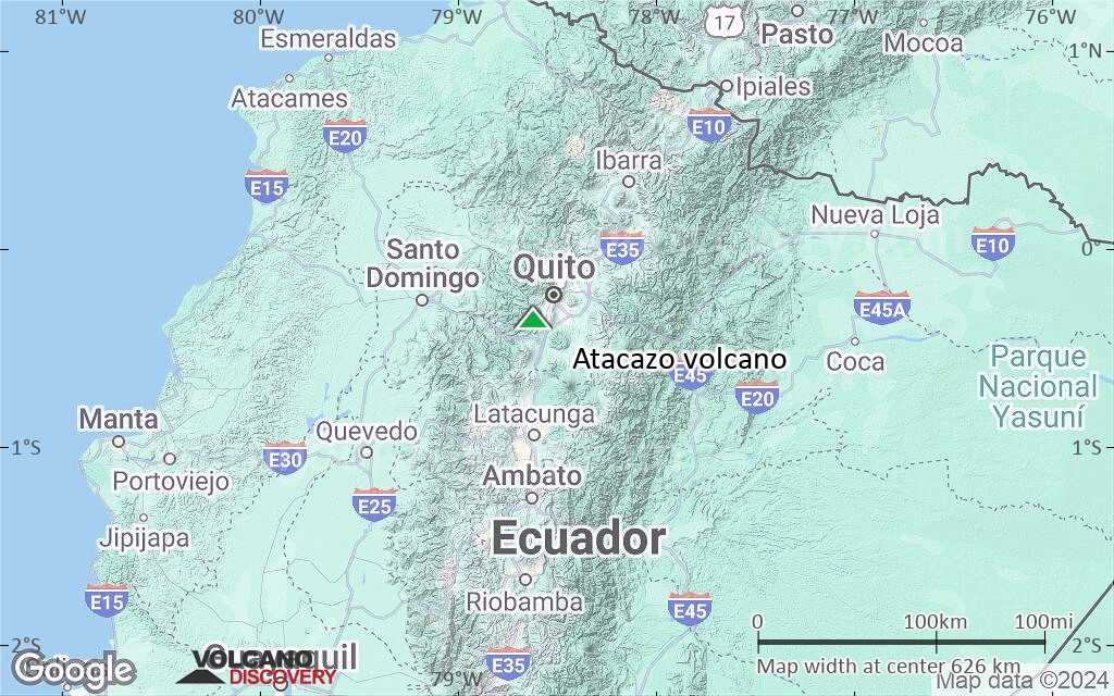
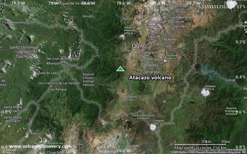
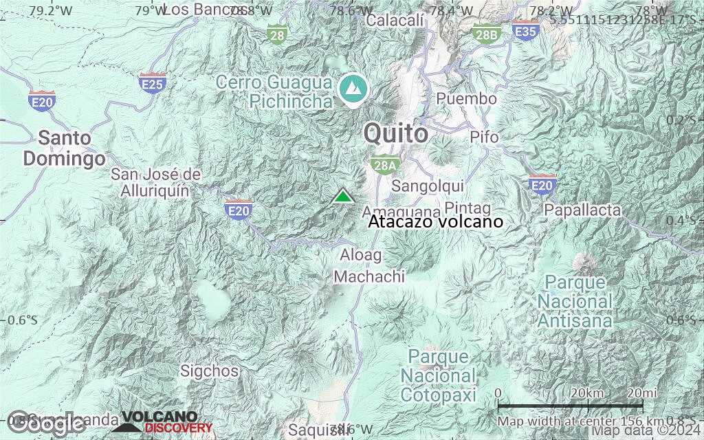
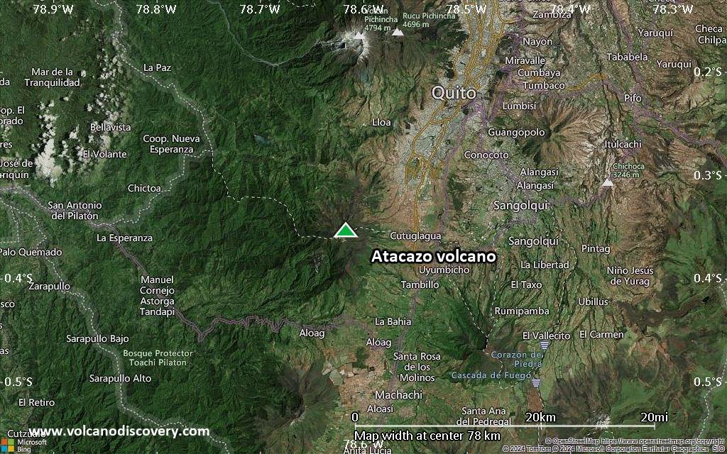
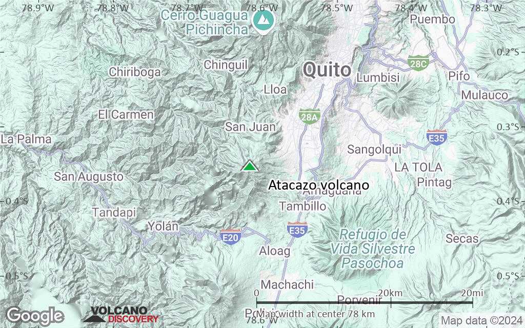
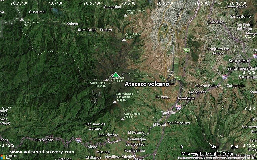
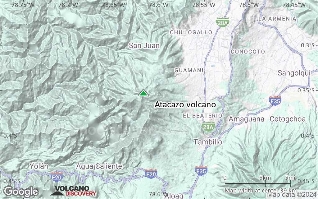
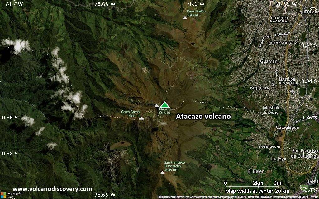
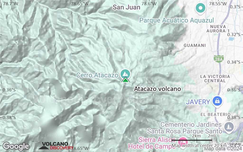
| RSS | EN | DE | EL | ES | FR | IT | RU

Atacazo Volcano

Updated: Jul 8, 2025 19:32 GMT -
stratovolcano
Ecuador, -0.35°S / -78.62°W
Summit height: 4463 m / 14,642 ft
Current status: normal or dormant (1 out of 5)

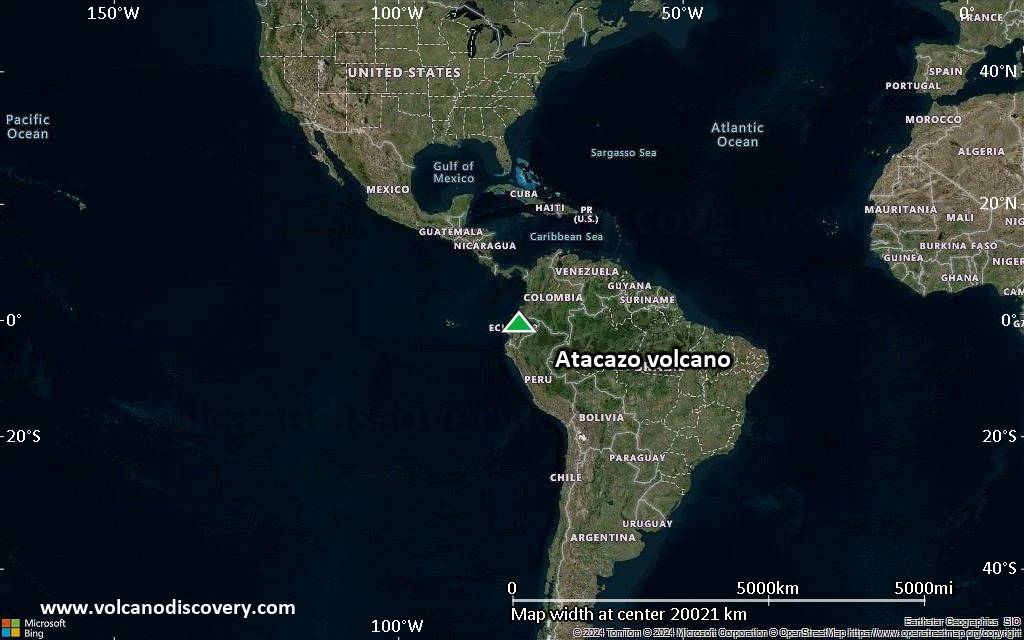
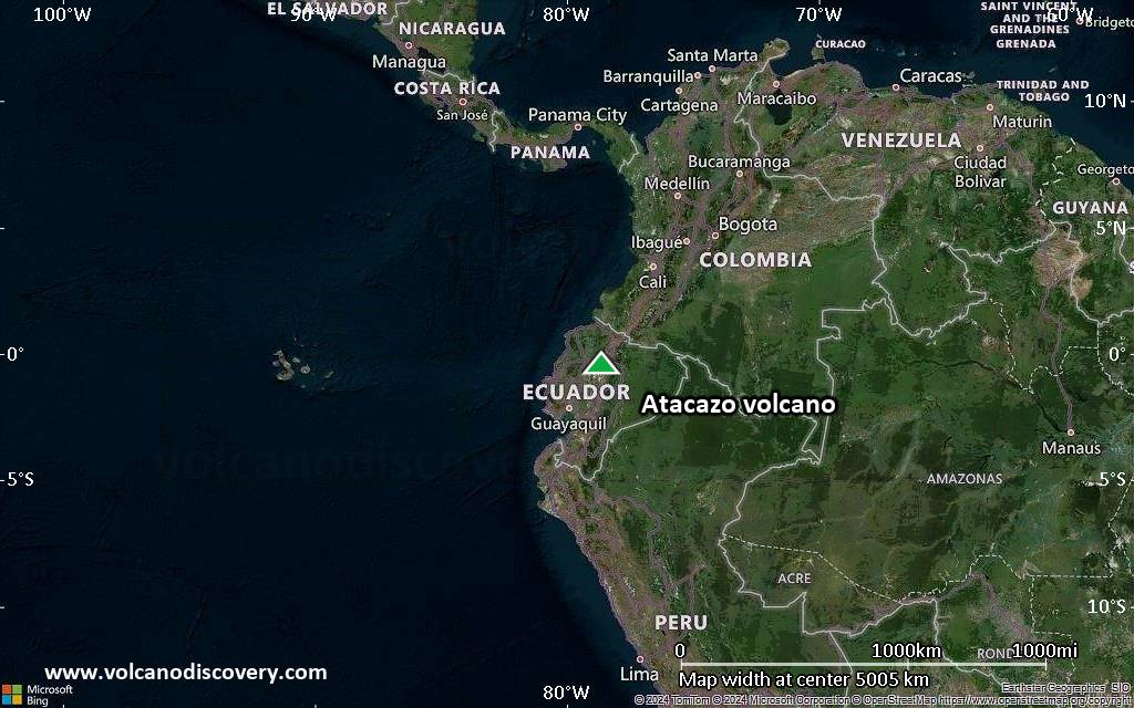
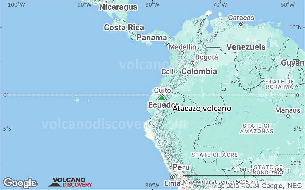
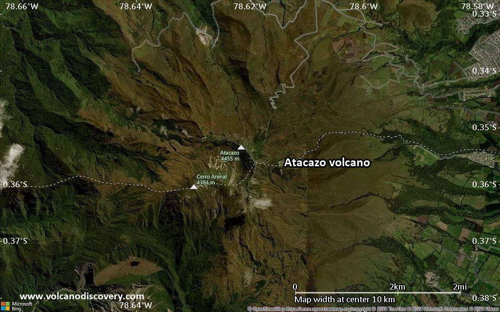
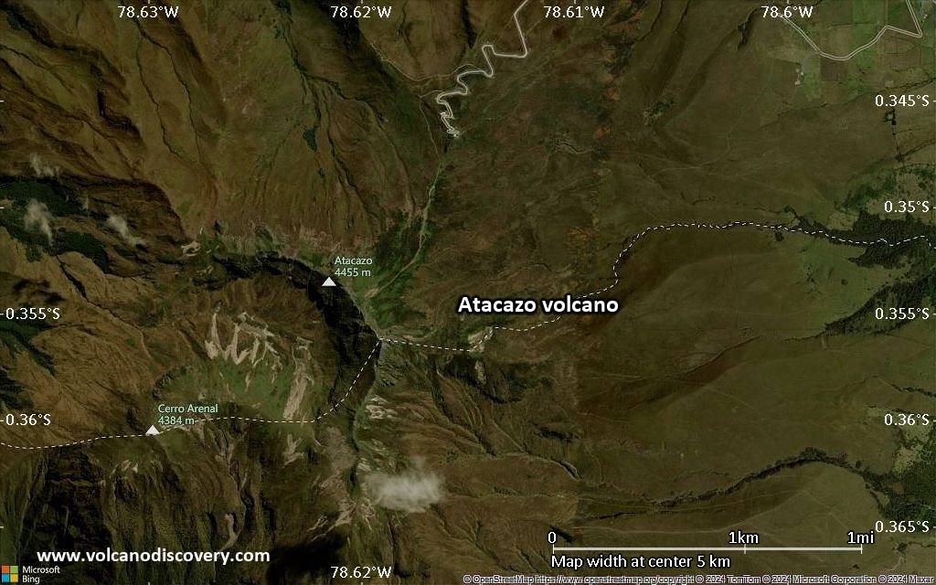
Atacazo volcano is part of the Atacazo–Ninahuilca Volcanic Complex in the Western Cordillera of Ecuador and located 10 km southwest of the capital of Ecuarod, Quito.
The andesitic Atacazo stratovolcano is a successor of the older La Carcacha stratovolcano. It was built above a 6 km wide and 900 m deep caldera. The caldera is breached to the SW and contains 3 Holocene dacitic domes. The youngest lava dome, Ninahuilca, erupted about 2300 years ago. 2 andesitic lava domes are also found on the SE flank.
Several large Plinian eruptions have occurred at the volcano during the past 10,000 years and accompanied the growth of the lava domes. The formation of the most recent dome, Ninahuilca Chico, was accompanied by explosive eruptos that produced pyroclastic flows that flowed up to 35 km distance through valleys towards the west.

[smaller] [larger]
Typical eruption style: explosive
Atacazo volcano eruptions: 320 BC ± 16 years, 4400±35 years ago

Latest nearby earthquakes

Date and TimeMag / DepthDistance / Location

Background

Several towns built on the deposits of past eruptions and are considered to be at high risk areas in case of a new major explosive eruption. These include the towns and villages of Tambillo, Uyumbicho, Aloag, Tandapi, Canchacoto.
A stretch of the main Panamerican highway, crossing the highlands from north to south, as well as the road from Aloag to Santo Domingo, linking the Northern highlands to the Coastal region, are also built in the high risk area.
Typical quiescence intervals of Atacazo volcano range between 1000–4000 years. Statistically, the risk of a new eruption is increasing, because the last major eruption is 2300 years back. A future eruption could affect about 70,000 people.

Significant volcanic eruptions: Atacazo volcano

No historic eruptions are known from Atacazo volcano, but evidence from at least 4 eruptions during the past 10,000 years can be found in the geological record.
The table below lists all known eruptions (date in bold face) of Atacazo volcano in historic times and during the past 10,000 years. Updates on the most recent volcanic activity of Atacazo can be found on the news page of Atacazo volcano.
DateNoteVEIDeathsDamage
320 ±16 y. BCNinahuilca Chico II dome5
2490 ±40 y. BCNinahuilca Chico I dome 5
3490 ±100 y. BCArenal II dome4P
6910 or before BCLa Cocha II dome4P
Remark:
Our list of volcanic eruptions closely follows the database of eruptions of the Smithsonian's Global Volcanism Project (GVP), the internationally most recognized data source for volcanic eruptions, but also includes significant eruptive episodes or related volcano events. "Volcanic eruptions" are usually to be understood as sequences of individual eruptive episodes that can follow each other, or even overlap (if several vents are involved), and can last many years, decades or even longer. For example, the current activity of Stromboli volcano is understood as a single eruption that has been ongoing since 1934.
Sources: NOAA National Centers for Environmental Information (NCEI), Global Significant Volcanic Eruptions Database. doi:10.7289/V5TD9V7K | Global Volcanism Project / Smithsonian Institution

Atacazo Volcano FAQ

+When was the last eruption of Atacazo volcano?

+When was the largest eruption of Atacazo volcano?

Latest satellite images

Atacazo satellite image sat1Atacazo satellite image sat2

Atacazo Volcano Maps

Below is a selection of maps showing the location and surroundings of the volcano at various resolutions based on aerial-imagery / terrain maps. Feel free to use them for non-commercial purposes on your blog or website as long as you credit them with a link back to this page (click to copy it).
Satellite/aerial-type map of Atacazo volcano (world scale)
Terrain-type map of Atacazo volcano (world scale)
Satellite/aerial-type map of Atacazo volcano (region scale large)
Terrain-type map of Atacazo volcano (region scale large)
Satellite/aerial-type map of Atacazo volcano (region scale medium)
Terrain-type map of Atacazo volcano (region scale medium)
Satellite/aerial-type map of Atacazo volcano (region scale small)
Terrain-type map of Atacazo volcano (region scale small)
Satellite/aerial-type map of Atacazo volcano (local scale large)
Terrain-type map of Atacazo volcano (local scale large)
Satellite/aerial-type map of Atacazo volcano (local scale medium)
Terrain-type map of Atacazo volcano (local scale medium)
Satellite/aerial-type map of Atacazo volcano (local scale small)
Terrain-type map of Atacazo volcano (local scale small)
Satellite/aerial-type map of Atacazo volcano (scale of 10s of km)
Terrain-type map of Atacazo volcano (scale of 10s of km)
Satellite/aerial-type map of Atacazo volcano (scale of 20-40 km)
Terrain-type map of Atacazo volcano (scale of 20-40 km)
Satellite/aerial-type map of Atacazo volcano (scale of approx. 10-20 km)
Terrain-type map of Atacazo volcano (scale of approx. 10-20 km)
Satellite/aerial-type map of Atacazo volcano (scale of 5-10 km)
Satellite/aerial-type map of Atacazo volcano (scale of few kilometers)
Volcanoes & Earthquakes - new app for Android
Guaranteed tours
1-17 Aug 2025: Volcanoes and Spices - Sulawesi/Halmahera (Indonesia)
1-14 Oct 2025: Desert, salt and volcanoes - Danakil desert (Ethiopia)
4-12 Oct 2025: From Stromboli to Etna - Sicily and Eolian Islands (Italy)
6-21 Oct 2025: From Krakatau to Bali - Java (Indonesia)
3-19 Nov 2025: Volcanoes and Spices - Sulawesi/Halmahera (Indonesia)
= spaces available   = guaranteed   = few spaces left   = booked out

No news in this list.

On this page:

Try our free app!
Volcanoes & Earthquakes - new app for Android
Android | iOS version

More on VolcanoDiscovery

Why is there advertising on this site?

Support us - Help us upgrade our services!

We truly love working to bring you the latest volcano and earthquake data from around the world. Maintaining our website and our free apps does require, however, considerable time and resources.
We need financing to increase hard- and software capacity as well as support our editor team. We're aiming to achieve uninterrupted service wherever an earthquake or volcano eruption unfolds, and your donations can make it happen! Every donation will be highly appreciated. If you find the information useful and would like to support our team in integrating further features, write great content, and in upgrading our soft- and hardware, please make a donation (PayPal).

Planned features:Thanks to your past donations, these features have been added recently:
Download and Upgrade the Volcanoes & Earthquakes app to get one of the fastest seismic and volcano alerts online:
Android | IOS
Thank you!
Sources: VolcanoDiscovery / VolcanoAdventures and other sources as noted.
Use of material: Most text and images on our websites are owned by us. Re-use is generally not permitted without authorization. Contact us for licensing rights.
Volcanoes & Earthquakes
VolcanoDiscovery Home
Volcanoes | Earthquakes | Photos | Volcano News | | Shop | App
Adventure & Study Travel
Tours to Volcanoes and Volcanic Areas: walking tours, photo tours, study tours
Tours & Dates | FAQ | About us
Get our newsletter!
Company info
Contact | Legal info | Terms & conditions
Follow us
Follow us on facebook Follow us on Instagram Follow us on Bluesky Follow us on Twitter Visit our Youtube channel
EN | DE | EL | ES | FR | IT | RU
VolcanoDiscovery GmbH, Germany, Reg. nr.: HRB 103744, EU Tax Id: DE 297 465 123 owned and created by
Dr. Tom Pfeiffer, volcanologist, volcano photographer, tour organizer member of
IAVCEI
IAVCEI
Vulkanologische Gesellschaft
Volcanological Society
Ecotourism Greece
Ecotourism Greece
RUV insurance
Insured by R+V
VolcanoDiscovery © 2004- All Rights Reserved | Privacy - Cookie Settings